 Location:
 Length:
 Surface:
 Start / End:
 Suitable for:
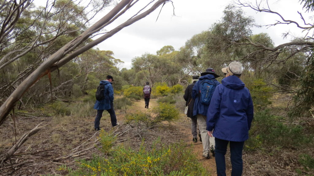
The Stockade Rail Trail is a pleasant ride or walk through a linear park in or near the railway reserve. It has easy grades and is ideal for children and novice riders, but the Dry Creek section is rougher, with some steep slopes.
Nearby Attractions
- Unity Park features numerous paths, wetlands, parking, picnic facilities and toilets.
- Stockade Botanic Park features gardens, barbecues, picnic areas and toilets.
- Adelaide Super-Drome is the headquarters of the Australian Institute of Sport’s track cycling program.
- Quarry and prison history
- Dry Creek Trail
- The Levels–City Bikeway
Last updated: 2 May 2025
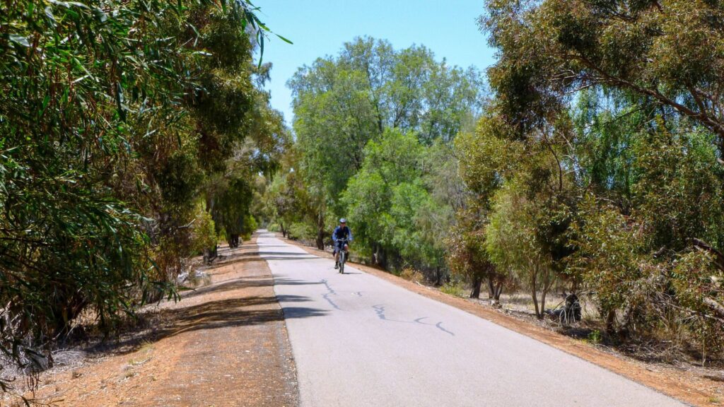
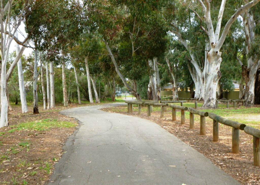
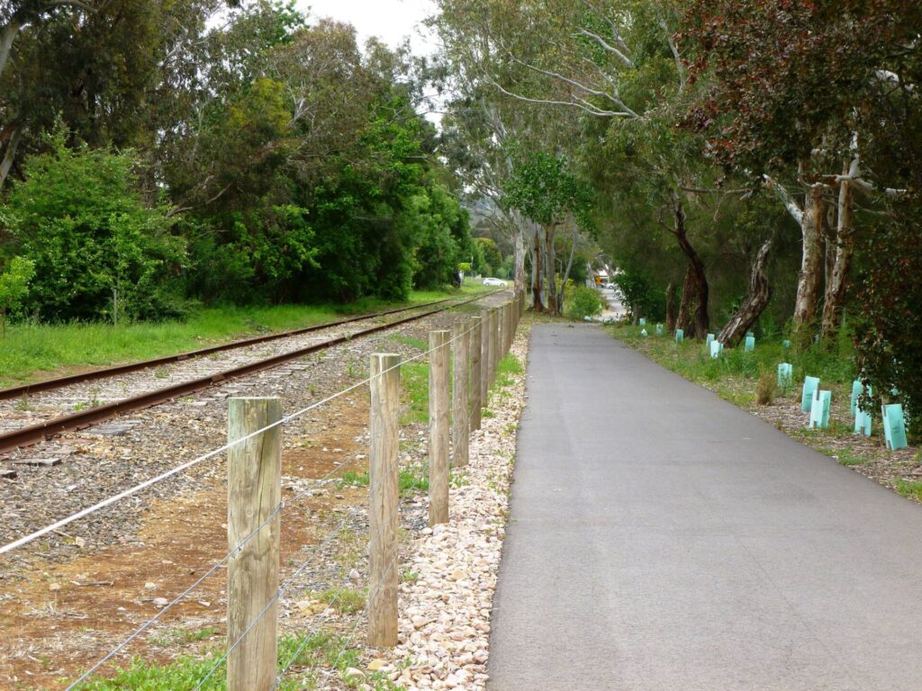
The Stockade Rail Trail features a wide gravel surface, with fine gravel through Unity Park and coarser gravel sections along Dry Creek. The transition to the Dry Creek Trail to get around government buildings in the railway corridor should be treated with caution.
Section Guides
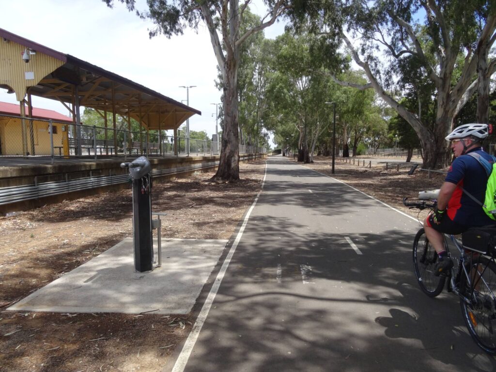
Pooraka to Northfield (1.5 km)
- The trail starts on the eastern side of Main North Rd. There is parking at the tennis courts slightly north and at the Gepps Cross Homemaker Centre off Matthews Rd. It is some distance from Dry Creek Station on the Gawler Line.
- Pooraka Station was on the western side of Main North Rd.
- There are no rail trail signs but the railway reserve is still clearly visible, flanked by rows of tall gums, and some railway remnants can be seen adjacent to the path.
- There is a pleasant park with Winds of Change sculptures immediately north of the trailhead.
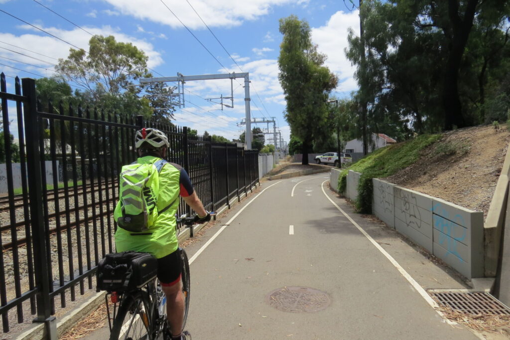
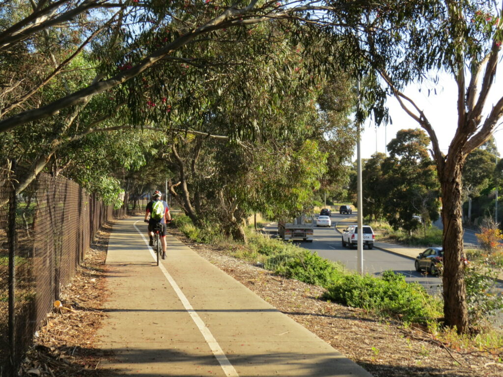
- Head east along the trail, bypassing the vehicle control gates if closed. Cross Levels–City Bikeway as you enter Unity Park, where there are a number of path options if you want to explore.
- Toilets and facilities are located close to South Tce.
- Northfield Station was located where the Cross Keys BMX Club and Pooraka Skate Park now are.
Northfield to Stockade (1.1 km)
- Cross Bridge/Briens Rd at the traffic lights.
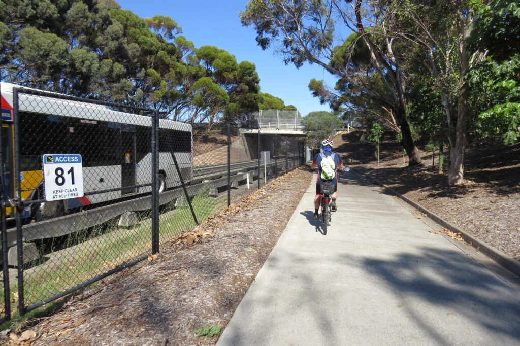
- Turn left onto the eastern Briens Rd footpath, passing a works depot for the Department of Infrastructure and Transport which prevents access to the railway reserve.
- After 200 m, with the Bridgeway Hotel to your left, you reach the Dry Creek Trail. Take care as this detour has a steep descent and climb on a loose surface.
- After you get around the depot, the trail rejoins the railway reserve and there are several paths to choose from. The lower one near the creek, with a dark gravel surface, is on the railway alignment.
- Alternatively, turn right at the eastern Briens Rd footpath and go 100 m south to Howard Rd. Follow Howard Rd uphill and enter Stockade Botanical Park. Turn into the car park and take the path near the toilet block. To rejoin the rail reserve, turn left and proceed east onto a gravel path which drops steeply. The steep section should be approached with caution.
- Records are vague as to how far the railway went, but it is believed it ended somewhere near the first quarry, where there is an unusual steel gantry. This is Yatala Guard Tower 1, from where guards supervised prisoners working in the quarry. There are a number of historical sites nearby and Yatala Prison sits atop the hill to the southeast.
CONNECTING PATHS
Dry Creek Trail (21.4 km): This follows Dry Creek from the Tapa Martinthi Trail in the west to Wynn Vale Dam in the east. Mostly gentle grades make it an easy ride for most abilities.
Levels–City Bikeway (18 km): Extends from Mawson Lakes to the CBD, but the outer section from Mawson Lakes to Pooraka uses busy roads and is not recommended. The Pooraka to city section is sealed and uses a combination of quiet back streets and sealed shared-user paths.
![Rail trail access off Main North Rd is not well marked [2023]](jpg/s27-050-001-stockade-rt-trail-start-main-north-rd-pooraka-nov-23-300x216.jpg)
Rail trail access off Main North Rd is not well marked [2023]
![The gravel path is shaded by the large eucalypts on the sides of the rail corridor [2023]](jpg/s27-050-002-stockade-rt-trail-pooraka-nov-23-300x225.jpg)
The gravel path is shaded by the large eucalypts on the sides of the rail corridor [2023]
![Pretty trail adjacent to the Unity Park wetlands [2023]](jpg/s27-050-006-stockade-rt-trail-thru-unity-park-northfield-nov-23-300x169.jpg)
Pretty trail adjacent to the Unity Park wetlands [2023]
![The Northfield Railway Station site is now a BMX track [2023]](jpg/s27-050-017-stockade-rt-old-station-site-northfield-nov-23-300x225.jpg)
The Northfield Railway Station site is now a BMX track [2023]
![The Stockade Botanic Park entrance [2023]](jpg/s27-050-019-stockade-rt-stockade-park-entrance-northfield-nov-23-300x225.jpg)
The Stockade Botanic Park entrance [2023]
![Junction of the Stockade Rail Trail and Dry Creek Trail [2023]](jpg/s27-050-022-stockade-rt-dry-creek-trail-northfield-nov-23-300x169.jpg)
Junction of the Stockade Rail Trail and Dry Creek Trail [2023]
![The trail with the grim Yatala Guard Tower 1 above it [2023]](jpg/s27-050-033-stockade-rt-guard-gantry-dry-creek-trail-northfield-nov-23-e1742373006365-300x88.jpg)
The trail with the grim Yatala Guard Tower 1 above it [2023]
![The Dry Creek Trail below the old rail corridor [2023]](jpg/s27-050-023-stockade-rt-dry-creek-trail-northfield-nov-23-300x225.jpg)
The Dry Creek Trail below the old rail corridor [2023]
![Dry Creek Trail upper level [2023]](jpg/s27-050-025-stockade-rt-dry-creek-trail-upper-level-northfield-nov-23-300x224.jpg)
Dry Creek Trail upper level [2023]
Adelaide Metro trains take bikes, with restrictions. Gawler Line timetable here
Do you know of a bike hire or transportation service on this rail trail that should appear here? If so, let us know at admin@railtrails.org.au.
Information and Links
The trail is managed by The City of Salisbury and The City of Port Adelaide Enfield (the railway reserve is the council boundary). To report any issues or problems:
City of Salisbury – North of railway easement
Ph: 08 8406 8222 or ci**@**************ov.au
City of Port Adelaide Enfield – South of railway easement
Ph: 08 8405 6600 or se*****@**************ov.au
For further information go to:
YouTube video of Dry Creek to Stockade Railway here
Information about Dry Creek Linear Park here
Information about Unity Park here
Information about Stockade Botanics Park here
Information about Adelaide Super-drome here
Rail timetables at Adelaide Metro
Contact Rail Trails Australia
To contact us about this rail trail, email sa@railtrails.org.au
Background Information
Traditional Owners
We acknowledge the Kaurna people, the traditional custodians of the land and waterways on which the rail trail is constructed.
Development and Future of the Rail Trail
Whilst informal trails have existed within the railway reserve for decades, it is only since the line’s closure and removal of the tracks that the opportunity has existed for the establishment of an attractive park and rail trail.
Rail Line History
The Stockade (later Northfield) Line in northern Adelaide ran between Dry Creek Station and Stockade. The tracks branched east from the main line in the railyards just north of Dry Creek Station. The branch, which terminated at Stockade Station (somewhere near the first quarry) opened on 1 June, 1857, making it one of South Australia’s oldest. It was built to carry stone from the quarries behind Yatala Labour Prison. There was one, possibly two, train turntables in the vicinity of Stockade Station. Originally intended only for freight, it later catered for passengers. In 1961, Stockade Station was relocated to the western side of Briens Rd as a passenger service and renamed Northfield, which consisted of a single platform and shelter. The last passenger trains ran in 1987 but livestock continued to be delivered by rail to the Gepps Cross Abattoirs and Livestock Markets until 1995. The three stations were subsequently demolished and the track lifted. The remains of Cavan and Pooraka Stations and the rail corridor between them may yet become part of the Stockade Rail Trail, simplifying rail commuter travel to Dry Creek.
Nearby Trails
Gawler Greenway railside trail
Adelaide CBD
14 km


Parafield railside trail
15 km north of Adelaide CBD
3 km

O-Bahn Bikeway trail
Adelaide CBD
16 km
Outer Harbor Greenway railside trail
Adelaide CBD
23 km
Penfield railside trail
20 km north of Adelaide CBD
7 km
Semaphore Rail Trail
16 km north-west of Adelaide CBD
4.2 km
Westside Bikeway rail trail
2 km west of Adelaide CBD
9 km
Mike Turtur Bikeway railside trail
Adelaide CBD
9 km
Coast Park Path Rail Trail
12km north-west of Adelaide CBD
25 km
Smithfield Magazine Rail Trail
33 km north of Adelaide CBD
3.5 km
Marino Rocks Greenway rail trail
Adelaide CBD
16 km
Amy Gillett Bikeway rail trail
Adelaide Hills, 49 km east of CBD
23 km

Mount Barker Rail Trail
Adelaide Hills, 33km south-east of CBD
5 km
Coast to Vines Rail Trail
20 km south of Adelaide CBD
37 km
Barossa Rail Trail
Barossa Valley, 50 km north-east of Adelaide
43 km
Kapunda Rail Trail
78 km north of Adelaide
1 km
Nurragi Conservation Reserve rail trail
Fleurieu Peninsula, 70 km south-east of Adelaide
13 km
Encounter Bikeway railside trail
Fleurieu Peninsula, 85 km south of Adelaide
28 km
Eudunda Rail Trail
112 km north of Adelaide
1 km
Riesling and Rattler Trails
Clare Valley, 130 km north of Adelaide
53 km
Shamus Liptrot Rail Trail
Adelaide Plains, 100 km north of Adelaide
11 km

Copper Rail Trail
Adelaide Plains, 100 km north of Adelaide
39 km
Wool Rail Trail
130 kms north of Adealide
2.2 km
Nearby Trails
Gawler Greenway railside trail
Adelaide CBD
14 km
Parafield railside trail
15 km north of Adelaide CBD
3 km
O-Bahn Bikeway trail
Adelaide CBD
16 km
Outer Harbor Greenway railside trail
Adelaide CBD
23 km
Penfield railside trail
20 km north of Adelaide CBD
7 km
Semaphore Rail Trail
16 km north-west of Adelaide CBD
4.2 km
Westside Bikeway rail trail
2 km west of Adelaide CBD
9 km
Mike Turtur Bikeway railside trail
Adelaide CBD
9 km
Coast Park Path Rail Trail
12km north-west of Adelaide CBD
25 km
Smithfield Magazine Rail Trail
33 km north of Adelaide CBD
3.5 km
Marino Rocks Greenway rail trail
Adelaide CBD
16 km
Amy Gillett Bikeway rail trail
Adelaide Hills, 49 km east of CBD
23 km
Mount Barker Rail Trail
Adelaide Hills, 33km south-east of CBD
5 km
Coast to Vines Rail Trail
20 km south of Adelaide CBD
37 km
Barossa Rail Trail
Barossa Valley, 50 km north-east of Adelaide
43 km
Kapunda Rail Trail
78 km north of Adelaide
1 km
Nurragi Conservation Reserve rail trail
Fleurieu Peninsula, 70 km south-east of Adelaide
13 km
Encounter Bikeway railside trail
Fleurieu Peninsula, 85 km south of Adelaide
28 km
Eudunda Rail Trail
112 km north of Adelaide
1 km
Riesling and Rattler Trails
Clare Valley, 130 km north of Adelaide
53 km
Shamus Liptrot Rail Trail
Adelaide Plains, 100 km north of Adelaide
11 km
Copper Rail Trail
Adelaide Plains, 100 km north of Adelaide
39 km
Wool Rail Trail
130 kms north of Adealide
2.2 km
One review of “Stockade Rail Trail”
21/70 The Stockade Line was a branch off the Gawler one, from near Dry Creek Station, but only a fragment remains eastwards from Main North Rd. Pooraka Station was on the other side, but that's fenced off. No signs, no off-street parking except at the tennis courts that I could see, apart from at the BMX track, near Briens Rd, and that's fenced as well. Unity Park is nice enough, but it looks like The Levels–City Bikeway that runs north-south through there has got more attention.