 Location:
 Length:
 Surface:
 Start / End:
 Suitable for:
An intriguing trail steeped in colonial and maritime history, the Outer Harbor Greenway rail trail lets you experience an amazing period in Adelaide's development

- It’s a great way to get to the Coast Park Path, a stunning trip along a continuous sandy-beach coastline
- This rail and railside trail links with several shared user paths around the Port Dock precinct and the coastal area of Semaphore
- It is suitable for all the family
Nearby Attractions
- Three quality museums in one street, the National Railway Museum, SA Aviation Museum and SA Maritime Museum
- Port Dock historic precinct
- Coast Park Path and beach facilities
- Inner Harbour/Anne Rennie Loop Trail
Last updated: 20 July 2025
This ride uses quiet roads and paths adjacent to an operational railway line starting from the Adelaide Parklands and following the rail corridor to the Port Dock precinct and then on to Outer Harbor.
The main sections of the trail are:
- Adelaide Parklands to Woodville (8 km): Follows quiet suburban streets adjacent to the Outer Harbor Line through to Woodville Station. Park at Lot 104 Montefiore Rd off Festival Dr, with the trail starting slightly to the north, or catch the train to Adelaide Station and ride south along the Karrwirra Parri/River Torrens shared path to join the rail trail.
- Woodville to Port Dock (6 km): Continues on either quiet streets or shared-use paths but there are several points where it crosses main roads controlled by traffic lights.
- Port Dock to Outer Harbor (9.5 km): Travels through what was once a chaotic port, with huge exports of copper and wool and myriad ways of transporting it. To ride or walk from this direction, park near the Outer Harbor Lookout, off Lady Ruthven Dr, or catch the train to Outer Harbor Station and ride southwest to join the rail trail.
Section Guides
Adelaide Parklands to Woodville (8 km)
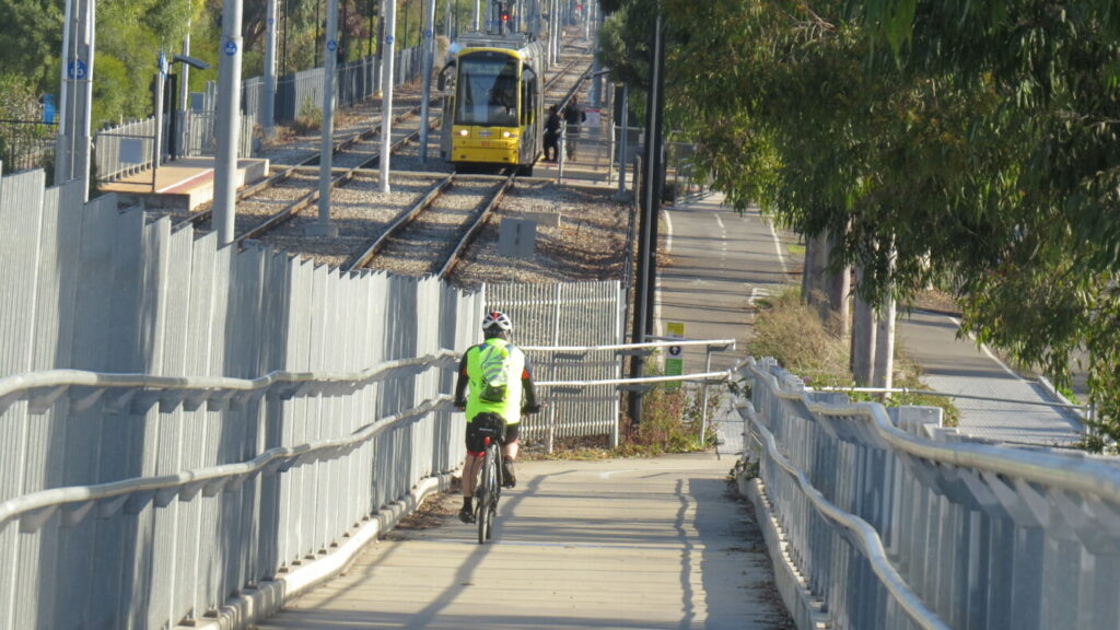
- The trail starts on the shared path near the Morphett St Bridge and Adelaide Railway Station. Follow the River Torrens and numerous railway lines westward past the Torrens Weir and then go under the lines into Bonython Park. Follow the river to the first bridge and cross it.
- Continue to the edge of Adelaide Parklands where the path turns right and crosses the railway line again. Follow the line under the road.
- From this point the trail is clearly marked
- It progresses along Day Tce and Belmore Tce, next to the Bowden Brompton housing development, and uses bridges to cross main roads.
- If you need a rest, stop at the M.J. McInerney Reserve in West Croydon, where there are toilets.
Woodville to Port Dock (6 km)
- From Woodville Station continue straight on.
- There is a railside trail on the other side of the tracks called the Grange Greenway, which follows a branch line to Grange.
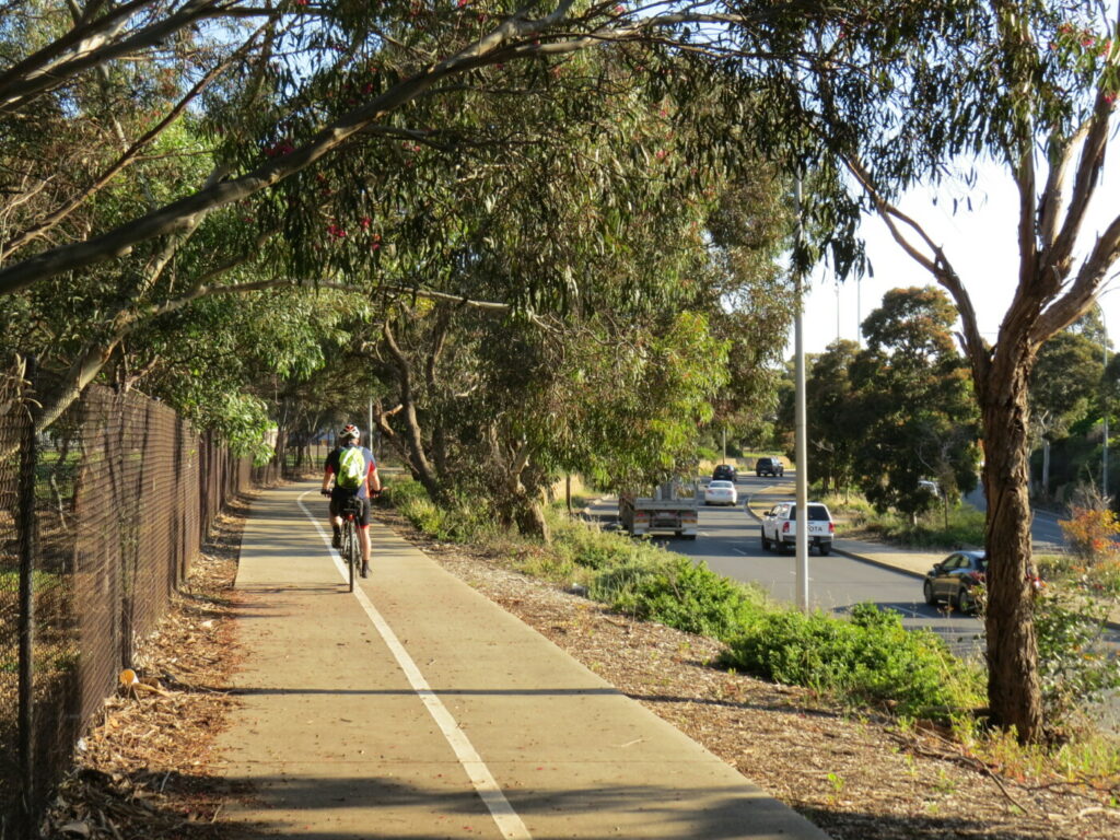
- The trail continues on either quiet streets or shared-use paths but there are several points where it crosses main roads. Fortunately, these spots are controlled by traffic lights.
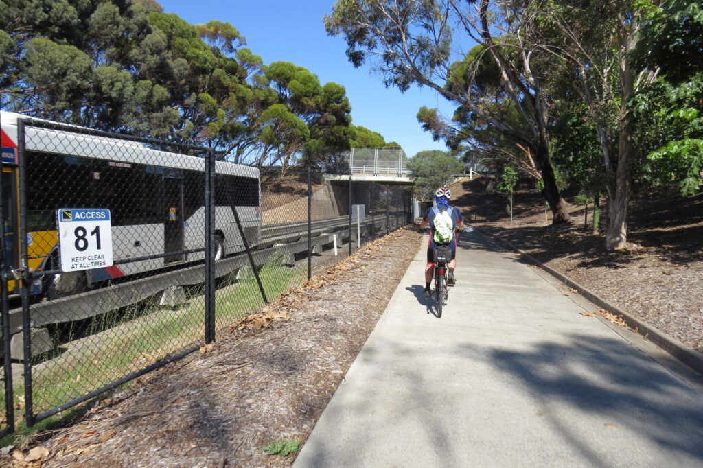
- The path passes under Grand Junction Rd and winds through suburban streets until it enters the old Port Dock railyards. The trail passes the aviation museum on the right and then turns left into Barlow St. When the trail turns left into Baker St, the Port Dock Station can be seen on the left and the car park for the National Railway Museum in Lipson St.
- At the end of Baker St, the trail turns left into St Vincent St and immediately right into Todd St. Pedestrian and cycle crossing points are provided. Follow Todd St to the Divett St roundabout and continue on into McLaren Pde until you see a carpark on the right. You can either ride through this carpark or use the small path next to it to access the Port River Dock. This section is well signposted but the roads can be busy. Once at the Port River Dock, the Tom ‘Diver’ Derrick Bridge can be seen in the distance and Dock One on the right. Turn left and follow the path along the river toward the Birkenhead Bridge.
- You may notice some interesting paving along the wharf which indicates where some of the railway lines were. This area had numerous train, tram and trolley bus tracks, along wharfs and streets and over bridges. There is an interesting shared-use path (the Anna Rennie Loop Trail) that circles the Port Dock area. See CONNECTING PATHS below.
Port Dock to Outer Harbour (9.5 km)
- Use the Birkenhead Bridge to cross the Port River and then cross Semaphore Rd
- The trail follows the railway line along Mead St and then weaves its way through suburbia until finally crossing the line into Lady Ruthven Dr. The trail crosses Lady Ruthven Dr and then continues for a short distance to a large roundabout.
- Follow the shared-use path to the left until you get to Lady Ruthven Reserve and the Outer Harbor Lookout.
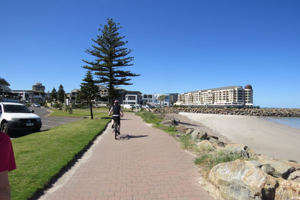
- This is the end of the rail trail, but you can make a look by taking the Coast Park Path south to Semaphore and then returning to Port Dock via the Semaphore Rail Trail. See GET AROUND below for train options
CONNECTING PATHS
- Inner Harbour/Anna Rennie Loop Path (3.5 km): Overlaps the Outer Harbor Greenway as it crosses the Port River’s Birkenhead Bridge, follows Jenkins St and a short section of Semaphore Rd. It circles the Port Dock precinct, also known as the New Port. The trail has many interactive maps that allow visitors to superimpose historical photographs from a century ago over today’s view of the same areas. Hart’s Mill Playground is a convenient place to rest while the kids burn-off some energy. Further details and maps can be found in the FURTHER INFORMATION section below
- Coast Park Path (34 km): Follows the shore from Outer Harbor to Seacliff, south of Adelaide. A 5 km section currently follows Military Rd from Third Ave, Semaphore Park, to the Grange Jetty. This section is expected to be converted into a shared-use path over the next few years. The path connects with the Mike Turtur Bikeway, River Torrens Linear Park and Coast to Vines trails. See Trails SA for details.
- Semaphore Rail Trail (4 km): This branch line started near Glanville Station and headed towards the beach. The trail starts on the corner of Panama Dr and follows Semaphore Rd using on-road bike lanes
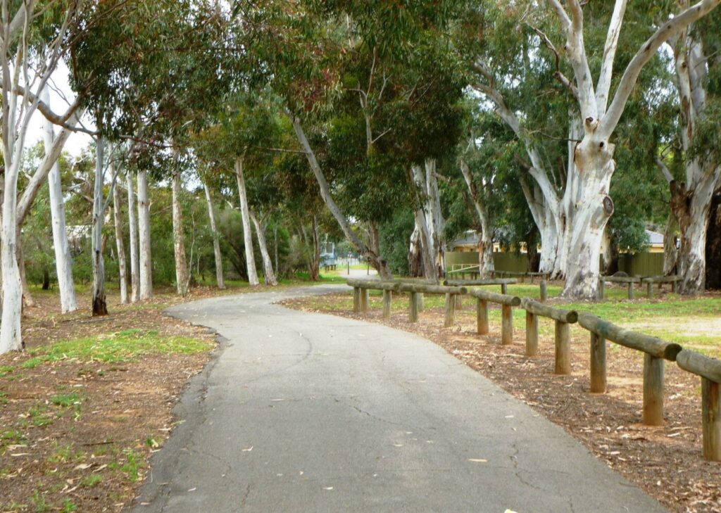
![Torrens Weir is one of first things to look at on the Outer Harbor trail [2025]](jpg/s02-050-torrens-weir-on-the-outer-harbor-trail-2025-img_5754-225x300.jpg)
Torrens Weir is one of first things to look at on the Outer Harbor trail [2025]
![Trail goes over Rosetta St underpass at the West Croydon Station [2021]](jpg/s02-105-2-west-croydon-rail-line-on-the-left-and-bridge-overpass-for-cyclists-ahead-aug-2021-300x225.jpg)
Trail goes over Rosetta St underpass at the West Croydon Station [2021]
![It passes through M.J. McInerney Reserve leaving West Croydon [2021]](jpg/s02-105-3-the-trail-passes-through-mj-mcinerney-reserve-aug-2021-300x225.jpg)
It passes through M.J. McInerney Reserve leaving West Croydon [2021]
![Too early to stop at the Mia Piatto cafe in Woodville Park [2021]](jpg/s02-105-4-belmore-tce-woodville-aug-2021-300x225.jpg)
Too early to stop at the Mia Piatto cafe in Woodville Park [2021]
![Outer Harbor train coming up the line next to the trail on Belmore Tce [2021]](jpg/s02-130-port-train-coming-up-the-line-next-to-outer-harbor-trail-along-belmore-tce-woodville-park-2021-300x225.jpg)
Outer Harbor train coming up the line next to the trail on Belmore Tce [2021]
![Bike repair station next to the trail at Woodville Railway Station [2021]](jpg/s02-105-6-bike-repair-station-adjacent-to-woodville-station-aug-2021-300x225.jpg)
Bike repair station next to the trail at Woodville Railway Station [2021]
![Locals enjoy a break on the shared path through St Clair [2021]](jpg/s02-105-7-shared-use-trail-section-through-st-clair-aug-2021-300x225.jpg)
Locals enjoy a break on the shared path through St Clair [2021]
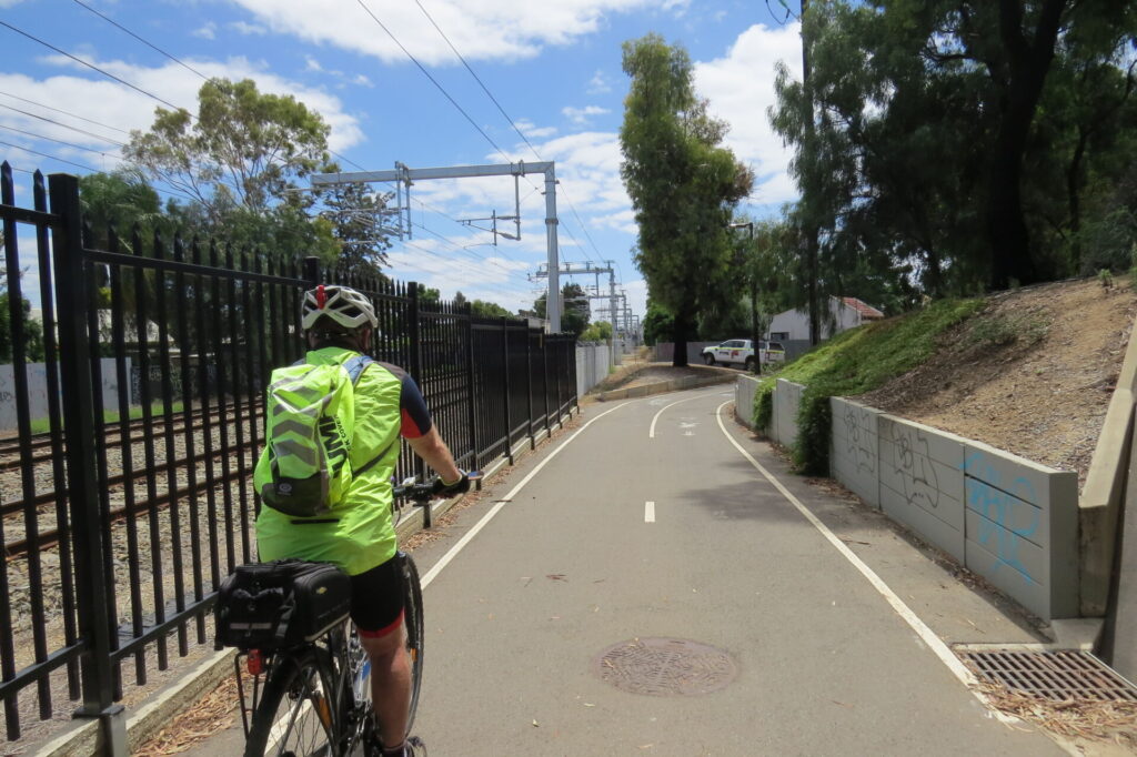
![Into light from Grand Junction Rd underpass near Port Adelaide [2021]](jpg/s02-155-8-grand-junction-rd-underpass-rosewater-aug-2021-300x225.jpg)
Into light from Grand Junction Rd underpass near Port Adelaide [2021]

SA Aviation Museum is close to the trail at 16 Bedford St, Port Adelaide
![National Railway Museum at 76 Lipson St runs a miniature train [2021]](jpg/s02-205-10-railway-museum-aug-2021-300x225.jpg)
National Railway Museum at 76 Lipson St runs a miniature train [2021]
![SA Maritime Museum at 126 Lipson St, Port Adelaide [2021]](jpg/s02-205-11-maritime-museum-aug-2021-300x225.jpg)
SA Maritime Museum at 126 Lipson St, Port Adelaide [2021]
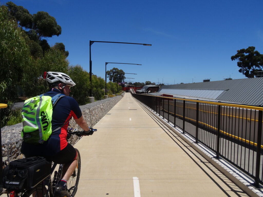
![Bridge will give Port Dock residents direct access to Outer Harbor trail [2024]](jpg/s02-250-jetty-style-bridge-for-outer-harbor-rail-trail-adelaide-2024-300x169.jpg)
Bridge will give Port Dock residents direct access to Outer Harbor trail [2024]
![Port Dock's fancy paving includes a "shadow" of the old railway tracks [2023]](jpg/s02-205-12-port-dock-paving-showing-the-old-rail-lines-aug-2021-300x225.jpg)
Port Dock's fancy paving includes a "shadow" of the old railway tracks [2023]

The 1869 Port River Lighthouse on Queens Wharf

Crossing Birkenhead Bridge over the Port Adelaide River
The area is served by the Outer Harbor Line. Metro Adelaide trains carry bikes, subject to certain restrictions. Details and timetable here
The Port Adelaide Visitor Information Centre runs a free bike hire program which makes it easy to go for a ride. It’s at 66 Commercial Rd, Port Adelaide.
Do you know of a bike hire or transportation service on this rail trail that should appear here? If so, let us know at admin@railtrails.org.au.
Information and Links
Further information links:
- Adelaide Metro’s Outer Harbor Line timetable here
- Outer Harbor Greenway here
- Adelaide Parklands Trail here
- SA Maritime Museum here
- National Railway Museum here
- SA Aviation Museum here
- Inner Harbour Loop Trail here
- Anna Rennie information here
- Coast Park Path here
The trail is managed by three councils.
The City of Adelaide: CBD to outer edge of Parklands (Park Tce, Bowden). Ph: 8230 7203
The City of Charles Sturt: Park Tce, Bowden, to Durham Tce, Cheltenham. Ph: 8405 6600
The City of Port Adelaide Enfield: Durham Tce, Cheltenham, to Outer Harbor. Ph: 8408 1111
Contact Rail Trails Australia
To contact us about this rail trail, email sa@railtrails.org.au
Background Information
Traditional owners
We acknowledge the Kaurna people, the traditional custodians of the land and waterways on which this trail was built.
Development and future of the rail trail
Work has started on a bridge over Port Adelaide’s Dock 1. It will be for bicycle and pedestrian traffic and will link a residential development with the Port Adelaide Precinct. On completion of the residential development, a shared-use path will be established along the edge of the Port River for 500 m to Dock 2. The yet-to-be-named trail will follow the alignment of old wharf-side railway lines and will therefore be a rail trail.
The Rosewater Loop is a potential rail trail that would connect the Outer Harbor Rail Trail with the Port River Bikeway via Eastern Pde. The loop was constructed in 1915 to alleviate congestion in the Port Dock railyards and is no longer in use (see map).
Rail line history
The railway between Adelaide and Port Dock Station was opened in 1856 and was the second one in SA. It is believed to have been the first government-owned line in the British Empire. The line was extended to Outer Harbor when a deeper seaport was required. The Port Dock area was incredibly busy, bringing immigrants and produce from abroad and exporting copper and farm produce. All of this movement needed an efficient transport system. Port Rd, which runs parallel to the existing railway line, has an extraordinary width of more that 60 m and is relatively flat.
It was proposed by Colonel William Light in 1836 that a canal should be constructed between Adelaide and the Port Dock precinct. The proposal was imaginative but did not stack up against the cost-effective and efficient rail transport that was appearing. The Port Dock area became a maze of small railway lines, mostly privately owned, connected to the wharf area and smelters. There were horse-drawn trams, trains and trolley buses, steam trains and electric trams. Confusion reigned as no one knew who had right of way and no one cared because the private transport operators had to make money to survive. Eventually the port activity declined, the small private operators closed and the state government railway and bus services were all that remained.
Australia’s Oldest Operating Station to be Restored
Posted: 20/07/25
Australia's oldest operating railway station building is undergoing a massive restoration to return it to ...
More...McLaren Pde Plaza to link with Outer Harbor Rail Trail
Posted: 30/05/24
The Port Dock Line extension in Adelaide will result in a change to the Outer ...
More...Port Dock Railway Line extension is well underway
Posted: 14/04/24
The Adelaide to Port Dock railway line was constructed in 1856 to service the passenger and ...
More...Line to Port Dock makes comeback
Posted: 22/07/23
The Adelaide to Port Dock railway line was constructed in 1856 to cater for passenger and ...
More...Rosewater Rail Loop to be redeveloped as a rail trail
Posted: 21/11/21
Gillman Rail Yards The Rosewater Rail Loop in ...
More...Nearby Trails
Semaphore Rail Trail
16 km north-west of Adelaide CBD
4.2 km


Stockade Rail Trail
11 km north of Adelaide CBD
2.6 km
Gawler Greenway railside trail
Adelaide CBD
14 km

Parafield railside trail
15 km north of Adelaide CBD
3 km

O-Bahn Bikeway trail
Adelaide CBD
16 km
Westside Bikeway rail trail
2 km west of Adelaide CBD
9 km
Coast Park Path Rail Trail
12km north-west of Adelaide CBD
25 km
Mike Turtur Bikeway railside trail
Adelaide CBD
9 km
Penfield railside trail
20 km north of Adelaide CBD
7 km
Marino Rocks Greenway rail trail
Adelaide CBD
16 km
Smithfield Magazine Rail Trail
33 km north of Adelaide CBD
3.5 km
Coast to Vines Rail Trail
20 km south of Adelaide CBD
37 km

Amy Gillett Bikeway rail trail
Adelaide Hills, 49 km east of CBD
23 km
Mount Barker Rail Trail
Adelaide Hills, 33km south-east of CBD
5 km
Barossa Rail Trail
Barossa Valley, 50 km north-east of Adelaide
43 km
Kapunda Rail Trail
78 km north of Adelaide
1 km
Nurragi Conservation Reserve rail trail
Fleurieu Peninsula, 70 km south-east of Adelaide
13 km
Encounter Bikeway railside trail
Fleurieu Peninsula, 85 km south of Adelaide
28 km
Eudunda Rail Trail
112 km north of Adelaide
1 km
Riesling and Rattler Trails
Clare Valley, 130 km north of Adelaide
53 km
Shamus Liptrot Rail Trail
Adelaide Plains, 100 km north of Adelaide
11 km

Copper Rail Trail
Adelaide Plains, 100 km north of Adelaide
39 km
Wool Rail Trail
130 kms north of Adealide
2.2 km
Nearby Trails
Semaphore Rail Trail
16 km north-west of Adelaide CBD
4.2 km
Stockade Rail Trail
11 km north of Adelaide CBD
2.6 km
Gawler Greenway railside trail
Adelaide CBD
14 km
Parafield railside trail
15 km north of Adelaide CBD
3 km
O-Bahn Bikeway trail
Adelaide CBD
16 km
Westside Bikeway rail trail
2 km west of Adelaide CBD
9 km
Coast Park Path Rail Trail
12km north-west of Adelaide CBD
25 km
Mike Turtur Bikeway railside trail
Adelaide CBD
9 km
Penfield railside trail
20 km north of Adelaide CBD
7 km
Marino Rocks Greenway rail trail
Adelaide CBD
16 km
Smithfield Magazine Rail Trail
33 km north of Adelaide CBD
3.5 km
Coast to Vines Rail Trail
20 km south of Adelaide CBD
37 km
Amy Gillett Bikeway rail trail
Adelaide Hills, 49 km east of CBD
23 km
Mount Barker Rail Trail
Adelaide Hills, 33km south-east of CBD
5 km
Barossa Rail Trail
Barossa Valley, 50 km north-east of Adelaide
43 km
Kapunda Rail Trail
78 km north of Adelaide
1 km
Nurragi Conservation Reserve rail trail
Fleurieu Peninsula, 70 km south-east of Adelaide
13 km
Encounter Bikeway railside trail
Fleurieu Peninsula, 85 km south of Adelaide
28 km
Eudunda Rail Trail
112 km north of Adelaide
1 km
Riesling and Rattler Trails
Clare Valley, 130 km north of Adelaide
53 km
Shamus Liptrot Rail Trail
Adelaide Plains, 100 km north of Adelaide
11 km
Copper Rail Trail
Adelaide Plains, 100 km north of Adelaide
39 km
Wool Rail Trail
130 kms north of Adealide
2.2 km
2 reviews of “Outer Harbor Greenway railside trail”
18/70 Was this yesterday? I rode the Outer Harbor from Woodville because I already knew where this was from riding the Coast Park Trail before my "rest" day. Enjoyable ride through the 'burbs and lot happening in the Outer Harbor. New shared bridge is coming along well. Did the Semaphore Rail Trail from Panama Drive on the way back.
This is a very pleasant ride alongside an active suburban railway line. A mix of dedicated paths and quiet back streets. Aviation, railway and maritime museums in Port Adelaide are well worth a visit.