 Location:
 Length:
 Surface:
 Start / End:
 Suitable for:
Imagine being able to ride or walk 70 km along Adelaide's sandy shoreline. That's the plan for the Coast Park Path, and you can do much of it already.

- This is an excellent trail that joins three railway lines that never quite managed it themselves
- It runs alongside sandy beaches
- The trail is enjoyable to ride, with many locations to stop and relax
- It is a treat for all the family
- When finished, the Coast Park Path could extend 70 km along the coast, from Outer Harbor south to Sellicks Beach
Nearby Attractions
- There are excellent reserves and recreation areas as well as kiosks, cafes and hotels.
- The trail passes four jetties which are accessible for walkers.
- Grange Jetty precinct, Henley Square, Glenelg’s Jetty Rd and Brighton’s Jetty Rd have excellent dining precincts
- River Torrens Linear Park and several other shared paths that lead back to Adelaide
- The Bay Discovery Centre museum and information centre at Jetty Rd, Glenelg.
- Fort Glanville open days
Last updated: 19 December 2025
The Santos Tour Down Under will take place in and around Adelaide, the Adelaide Hills, Barossa Valley, McLaren Vale and South Coast regions during January 2026. This rail trail may be impacted to varying degrees by the Tour.
Fri 23rd January 26: Men’s Stage 3 starts at Henley Square at Henley Beach. Expect increased cycle and pedestrian traffic on the Coast Park Rail Trail in the vicinity of Henley Square.
Sat 24th January 26: Men’s Stage 4 starts on The Esplanade at Brighton and travels south along the Esplanade. Expect increased cycle and pedestrian traffic on the Coast Park Rail Trail in the vicinity of Brighton and spectators on the path south of Jetty Road.
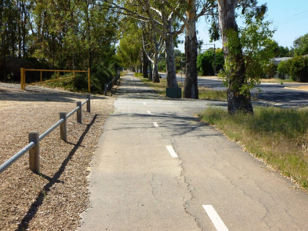
The Coast Park Path is a great day or weekend destination on the coastal beaches of Adelaide. It has a sealed surface that is mostly concrete or paving and is very flat. Numerous railways and tramways were built in Adelaide in the 1870s and ’80s and this shared path features three that were never connected as planned. Access from Adelaide to the coast was a significant problem during settlement due to ‘low, swampy reed country’. While it was a beautiful wetland, the colonists managed to drain it within a few decades and, in doing so, created sand drifts that proceeded to destroy two of the three railways.
The three sections are:
- Woodville to Grange (7km): A railside trail that shadows the operational Grange Line and the former Grange Tramway through suburbia to the coast. Our guide for this section is lengthy because the signage is poor. The issue has been raised with the trail manager.
- Grange to Glenelg (10km): Travels along the coast about 100 m west of the alignment of the Grange to Glenelg Railway. The trail is paved and sits on the edge of an embankment, providing excellent views of the coast.
- Glenelg to Marino (8km): Travels south along the coast and through sand hill sections on which Glenelg to Marino passenger railway was built
Section Guides
Woodville to Grange (6.5km)
- This section starts at Woodville Station on Woodville Rd and is also known as the Grange Greenway. If travelling by car, park at the station or, if that’s full, there’s plenty of parking in nearby Port Rd.
- If coming on the Outer Harbor Greenway railside trail, cross the tracks at Woodville Rd towards the station carpark.
- Follow curving Rowley Tce as it moves away from the Outer Harbor Line until you reach Port Rd. Use the pedestrian-actuated crossing to get you over Port Rd. Once over it, ride a few metres toward the railway line and then turn left and follow the shared path adjacent to the tracks.
- Follow the path until you reach May St where you will need to turn left. Continue following May St, turning right into Alma Tce and follow it until it stops at Todville St.
- Cross Todville St using the pedestrian crossing and follow the trail through the housing development until Alma Tce resumes. Just before the roundabout at the junction of Alma Tce and Levistone St, take the path on the right and follow it to the railway pedestrian crossing on the right. Once over the railway line, turn left and follow the Clark Tce path to the junction of Trimmer Pde and Tapleys Hill Rd
- At the traffic lights, cross Trimmer Pde and then Tapleys Hill Rd. Turn left away from the Grange Line, follow the shared path beside the Royal Adelaide Golf Course and then right into Meakin Tce. Cross Frederick Rd and then proceed along Westmoreland Rd to Beach St.
- Turn right onto Beach St and use the footpath on the right hand side to cross the creek. Just over the creek, turn right into Napier Dr and follow the Grange Lakes Corridor along the creek, passing the Charles Sturt Museum, until you come back to the railway line..
- Before the railway line, turn left into Terminus St and continue to the end.
- Turn left onto Charles Sturt Ave and then right onto Baker St. Take the service lane on the right at the bend and follow it past the Grange Station until you reach Military Rd.
- Turn right on the Military Rd footpath, passing a former station platform disguised as a retaining wall on the other side, and follow it to the pedestrian crossing near the service station. Cross Military Rd there and turn right and, using the footpath, go along Military Rd a short distance until you come to Terminus St. Ride over the rise (once the coastal dune), past Seaview Rd (believed to be on the alignment of the Grange to Glenelg Railway) until you come to the coast. Turn left onto the Coast Park Path (on the sea side of the Esplanade) and follow it to the Grange Jetty, which is the beginning of the Grange to Glenelg section.
Grange to Glenelg (10km)
- This section starts at Jetty St, where there are toilets, a hotel and cafe. If arriving by train, walk up Terminus St from Grange Station and join the Coast Park Path at Esplanade. There’s parking at the end of Jetty St after you cross Military Rd.
- The railway was constructed in 1882 to help with building a difficult part of Military Rd, which was intended to link four forts along the coast. Nearly half the railway was removed after completion of the road the following year. The remaining 6 km was left but gradually disappeared under the dunes and was often referred to as “the mystery railway” or “the railway that never was”.
- Follow the shared use path along the foreshore, but note that it can be very busy on weekends.
- You’ll quickly reach Henley Beach Jetty and numerous eateries,
- At the mouth of the River Torrens, you’ll see the start of the River Torrens Linear Park Path that runs eastward for 12 km to the CBD and then a further 20 to the Adelaide Hills.
- Immediately south of the West Beach Boat Ramp there is a 700m section of the path cut through a sand dune (there is often sand over the path). Behind the dune is a waste water treatment plant on the site of the temporary Fort Glenelg. In 1956, during construction of the treatment plants, the original railway line was uncovered.
- At the Patawalonga River, the Glenelg Wier provides a crossing point. Please walk your bike across. Once over the weir, turn left and then right and proceed toward the open reserve in the distance. Ride between Colley Reserve and the apartment building and then turn left to return along the coast to Mosley Square.
- Glenelg is a major suburb with all facilities.
Glenelg to Marino (8km)
- The trail starts at Mosley Square but the Glenelg trams that stop there do not take bikes but it’s an easy ride from the CBD via the Mike Turtur or Westside shared paths, subject to 2025 construction activity. If arriving by car, there’s more parking in Maxwell Tce.
- The Glenelg to Marino Tramway started out as a private cargo and passenger service but it was never connected to the others due to political and financial issues, not to mention feuds between residents and the owners and the monumental difficulties of running trains through sand dunes.
- Before you set off, walk out on the Glenelg Jetty to warm up.
- After you pass the Somerton Surf Lifesaving Club the trail goes through a small section of sand dunes in the Minda Coastal Park.
- Just beyond the Brighton Beachfront Holiday Park near the end of the trail, there’s a café, toilets and the remains of Tjilbruke Spring. The spring, which still flows slowly today, once fed a substantial freshwater pond nearr the coast. This site forms part of the Kaurna people’s Tjilbruke Dreaming Story.
CONNECTING PATHS
- Semaphore Rail Trail (4km): Further north, the Coast Park Path forms a rail trail for the Semaphore tourist railway, which we feature separately.
- Grange Lakes Corridor Shared Use Path (3km): Competition was king in the early days of the colony and there was money to be made from railways/tramways but, more often than not, money was lost. While the above three privately owned railways were being constructed, a privately owned tramway was being built from Adelaide to Henley Beach in 1882. While there’s nothing left of the tramway which closed in 1957, its corridor runs next to the Port River and intersects with the Woodville to Grange shared path at Beach St. This trail runs 3 km from Trimmer Pde and will extend south to Marlborough St and beyond, providing excellent, safe cycling with plenty to see.
- Outer Harbor Greenway (23km) : It is possible to cycle from the Adelaide CBD along the Outer Harbor Greenway and then follow the Coast Park Path from Woodville.
- Mike Turtur Bikeway (9km): Connects Glenelg with the Adelaide CBD and it also connects to the Westside Bikeway and Sturt Linear Park shared path.
- Coast to Vines Rail Trail connection (1.4km): At the end of the Coast Park Path at Marino, you can ride up the hill using Burnham Rd and Strickland Rd and then turn right onto Bandon Tce. Follow Bandon Tce, turn right into Jervois Tce then left into The Cove Rd which can be followed until, opposite Emma St, the Coast to Vines starts on the left. The distance might be short but there’s a 40m climb in the first 400m. Sometimes it’s better to walk.
![Trail passes through housing development splitting Alma Tce in Woodville West [2023]](jpg/1-woodville-to-grange-section-trail-passes-through-a-new-housing-estate-oct-2023-300x225.jpg)
Trail passes through housing development splitting Alma Tce in Woodville West [2023]
![The Meakin Tce footpath has been widened to serve as a shared path [2023]](jpg/4-meakin-terrace-footpath-has-been-widened-to-become-a-shared-use-path-oct-23-300x225.jpg)
The Meakin Tce footpath has been widened to serve as a shared path [2023]
![The Charles Sturt Museum on the Grange Lakes Corridor [2025]](jpg/s05-100-the-charles-sturt-museum-on-the-grange-corridor-2025-img_5727-300x225.jpg)
The Charles Sturt Museum on the Grange Lakes Corridor [2025]
![The original Grange Station platform is now part of the Military Rd footpath [2023]](jpg/5-grange-station-platform-which-is-now-part-of-the-military-road-footpath-oct-23-300x225.jpg)
The original Grange Station platform is now part of the Military Rd footpath [2023]
![Grange Jetty, looking out from the Coast Park Path [2023]](jpg/6-grange-jetty.-photo-taken-standing-on-the-trail-oct-23-300x225.jpg)
Grange Jetty, looking out from the Coast Park Path [2023]
![Heading toward the Henley Beach Jetty [2023]](jpg/7-heading-toward-the-henley-beach-jetty-oct-23-300x225.jpg)
Heading toward the Henley Beach Jetty [2023]
![Approaching the major suburban centre of Glenelg [2023]](jpg/8-approaching-glenelg-oct-23-300x200.jpg)
Approaching the major suburban centre of Glenelg [2023]
![Crossing the Patawalonga River weir at Glenelg [2023]](jpg/9-crossing-the-patawalonga-weir-glenelg-oct-23-300x200.jpg)
Crossing the Patawalonga River weir at Glenelg [2023]
![Glenelg foreshore showing separated path for cyclists on left [2023]](jpg/10-glenelg-forshore-showing-a-sensible-path-design-with-cyclists-on-the-left-path-and-walkers-on-the-seaside-path-oct-23-300x200.jpg)
Glenelg foreshore showing separated path for cyclists on left [2023]
![Approaching Brighton Jetty after a hard day on the beach [2023]](jpg/11-approaching-brighton-jetty-oct-23-e1745561270904-300x72.jpg)
Approaching Brighton Jetty after a hard day on the beach [2023]
![Current southern trailhead, near where Glenelg to Marino Line ended [2025]](jpg/for-web-s05-300-current-southern-end-of-the-coast-park-path-near-where-the-glenelg-to-marino-line-stopped-2025-img_5696-1-300x225.jpg)
Current southern trailhead, near where Glenelg to Marino Line ended [2025]
Tram and train timetables at Adelaide Metro
Do you know of a bike hire or transportation service on this rail trail that should appear here? If so, let us know at admin@railtrails.org.au.
Information and Links
Adelaide Metro’s Grange Line (Woodville) train timetable here
Seaford Line (Marino Rocks) train timetable here
Bay Discovery Centre information here
For further information, or to report any problems, please see contacts below:
City of Holdfast Bay, Ph: 08 8229 9999, or browse here
City of Charles Sturt, Ph: 08 08 8408 1111 or browse here
Glenelg to Marino section information here
Walking SA Coastal Park information on Coast Park Path
Contact Rail Trails Australia
To contact us about this rail trail, email sa@railtrails.org.au
Background Information
Traditional owners
We acknowledge the Kaurna meyunna people, the traditional custodians of the land and waterways on which the Coast Park Path rail trail is constructed. Witongga is the Kaurna meyunna people’s name for the reed beds that once existed along the Adelaide coast for 8 km from Glenelg to the Port River estuary. Water from creeks and rivers collected in these wetlands and provided a fertile and bountiful feeding ground for the Kaurna meyunna people.
Rail line history
For the colonists, the reed beds prevented easy access from the coast to Adelaide. Private companies were formed to construct tramways to the coast. Two tramways (only government lines could be called railways) and a government line were constructed along the coast between 1879 to 1883 and, while they ended within metres of each other, they were never connected.
Woodville to Grange Tramway (1882-present)
The 6.5 km Grange Line was constructed as a branch line from the Outer Harbor Railway by a private company to encourage people to buy land in that area. The line was built away from the reed beds and crossed the Port River estuary, linking Adelaide to Grange and two coastal forts, Glanville and Largs. It was in financial trouble by 1891 and was taken over by South Australian Railways, which extended it south to Henley Beach. It still operates, but only as far as Grange.
Grange to Glenelg Railway (1882-1883)
As a result of community concern relating to a possible invasion by the Russian Navy, the South Australian Government commissioned several studies on the best options for protecting the colony. The favoured one was the construction of four coastal forts. This plan was slowly implemented, after years of procrastination. Fort Glanville was constructed in 1880 and Fort Largs in 1884. Fort Glenelg only amounted to some guns placed among sand bags while the plan for one at Marino was abandoned. It was always believed that the forts would be connect by a railway along the coast. The government finally acted in 1882 and ordered the construction of 10 km Military Rd from Grange to Glenelg, with a railway constructed to assist with its construction.
The project was completed by 1883 and removal of the railway began. The Glenelg community implored the government to retain the railway for passenger, freight and security services. After all, it was intended that it would service the forts. The government stopped the removal, leaving 6 km intact but it was never used and slowly disappeared under sand drifts. The fort at Glenelg remained a temporary structure and was never used. The road was often blocked by sand drifts or flooded during winter but it remains in use. In 1956, workers unearthed a section of the railway at Glenelg and it became known locally as the Mystery Railway.
Glenelg to Marino Tramway (1880-1882)
This 7 km line was constructed to transport construction materials from quarries to Adelaide and to provide public transport for the southern beaches. This was a period of frenetic railway construction, with six tram and train lines to the coast or along it built in 1879-80. Political interference and complaints from Glenelg residents meant that the only available route for this one was along the sand dunes. The service was stopped after 16 months due to poor patronage, damage caused by sand drifts and the death of three passengers in two accidents. The tracks were removed and the rolling stock sold.
Development and future of the rail trail
The Grange Lakes Corridor is being continually improved and it is hoped that it will be extended south past Henley Beach to the River Torrens Linear Park Path
The Coast Park Path extends north as far as Outer Harbor but there is a 2km gap from Grange to Tennyson. On completion of this bit, the continuous part of the Coast Park Path will be 32 km, of which 23 are rail trail or railside trail.
Nearby Trails
Westside Bikeway rail trail
2 km west of Adelaide CBD
9 km


Mike Turtur Bikeway railside trail
Adelaide CBD
9 km
Marino Rocks Greenway rail trail
Adelaide CBD
16 km
Outer Harbor Greenway railside trail
Adelaide CBD
23 km
Semaphore Rail Trail
16 km north-west of Adelaide CBD
4.2 km
O-Bahn Bikeway trail
Adelaide CBD
16 km
Stockade Rail Trail
11 km north of Adelaide CBD
2.6 km
Coast to Vines Rail Trail
20 km south of Adelaide CBD
37 km

Gawler Greenway railside trail
Adelaide CBD
14 km
Parafield railside trail
15 km north of Adelaide CBD
3 km
Penfield railside trail
20 km north of Adelaide CBD
7 km
Mount Barker Rail Trail
Adelaide Hills, 33km south-east of CBD
5 km
Smithfield Magazine Rail Trail
33 km north of Adelaide CBD
3.5 km
Amy Gillett Bikeway rail trail
Adelaide Hills, 49 km east of CBD
23 km
Barossa Rail Trail
Barossa Valley, 50 km north-east of Adelaide
43 km
Nurragi Conservation Reserve rail trail
Fleurieu Peninsula, 70 km south-east of Adelaide
13 km
Encounter Bikeway railside trail
Fleurieu Peninsula, 85 km south of Adelaide
28 km
Kapunda Rail Trail
78 km north of Adelaide
1 km
Eudunda Rail Trail
112 km north of Adelaide
1 km
Riesling and Rattler Trails
Clare Valley, 130 km north of Adelaide
53 km
Shamus Liptrot Rail Trail
Adelaide Plains, 100 km north of Adelaide
11 km

Copper Rail Trail
Adelaide Plains, 100 km north of Adelaide
39 km
Nearby Trails
Westside Bikeway rail trail
2 km west of Adelaide CBD
9 km
Mike Turtur Bikeway railside trail
Adelaide CBD
9 km
Marino Rocks Greenway rail trail
Adelaide CBD
16 km
Outer Harbor Greenway railside trail
Adelaide CBD
23 km
Semaphore Rail Trail
16 km north-west of Adelaide CBD
4.2 km
O-Bahn Bikeway trail
Adelaide CBD
16 km
Stockade Rail Trail
11 km north of Adelaide CBD
2.6 km
Coast to Vines Rail Trail
20 km south of Adelaide CBD
37 km
Gawler Greenway railside trail
Adelaide CBD
14 km
Parafield railside trail
15 km north of Adelaide CBD
3 km
Penfield railside trail
20 km north of Adelaide CBD
7 km
Mount Barker Rail Trail
Adelaide Hills, 33km south-east of CBD
5 km
Smithfield Magazine Rail Trail
33 km north of Adelaide CBD
3.5 km
Amy Gillett Bikeway rail trail
Adelaide Hills, 49 km east of CBD
23 km
Barossa Rail Trail
Barossa Valley, 50 km north-east of Adelaide
43 km
Nurragi Conservation Reserve rail trail
Fleurieu Peninsula, 70 km south-east of Adelaide
13 km
Encounter Bikeway railside trail
Fleurieu Peninsula, 85 km south of Adelaide
28 km
Kapunda Rail Trail
78 km north of Adelaide
1 km
Eudunda Rail Trail
112 km north of Adelaide
1 km
Riesling and Rattler Trails
Clare Valley, 130 km north of Adelaide
53 km
Shamus Liptrot Rail Trail
Adelaide Plains, 100 km north of Adelaide
11 km
Copper Rail Trail
Adelaide Plains, 100 km north of Adelaide
39 km
2 reviews of “Coast Park Path Rail Trail”
16/70 I hope this one gets extended soon, to take some pressure off the completed sections. Great quality trail but the lovely paving bit might be an issue in a few year time
A great scenic trail along Adelaide's beaches, linking with a number of options for transit to and from the City. Most of the path is quite wide but can still be quite congested with walkers on fine days, especially near any of the jetties.