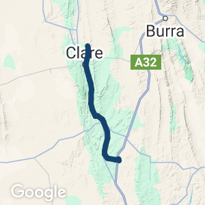
 Location:
 Length:
 Surface:
 Start / End:
 Suitable for:
A magnificent facility, the Reisling and Rattler Trails represent over 30 years of work by the local community to revive their railway corridor.
- Perhaps South Australia’s best known rail trail, located in one of Australia’s premier wine regions
- Seven townships and many cellar doors along or near this shared path
- Original railway cuttings and infrastructure form part of the trail
Nearby Attractions
- Clare Valley wineries, particularly Sevenhill
- Impressive scenery, from vineyards to open rural areas
- Vibrant tourist area with a strong focus on the wine industry and fine dining using local produce
- Historic buildings including John Horrocks’ Cottage, St Aloysius’ Church and Martindale Hall
- The 900 km Mawson Trail, the 300 km Lavender Cycling Trail (Murray Bridge to Clare) and the 20 km Clare Valley Wine and Wilderness Trail
- Old Police Station Museum, Clare
- Copper Rail Trail
Last updated: 11 May 2025
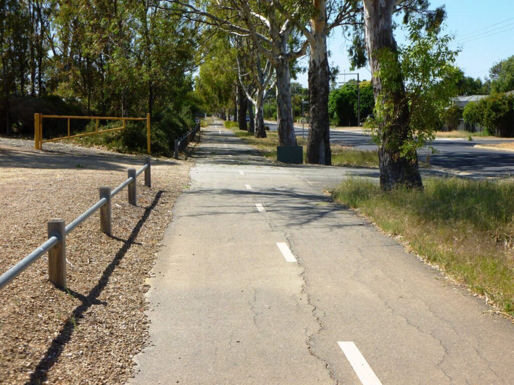
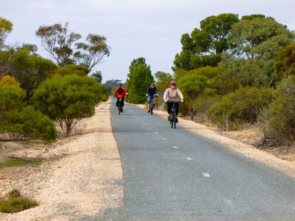
The Riesling and Rattler Rail Trails are quite different in terms of scenery and topography. Many of the road approaches are chip sealed to make stopping easier and there are marker posts every kilometre, although some are faded.
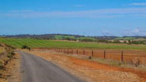
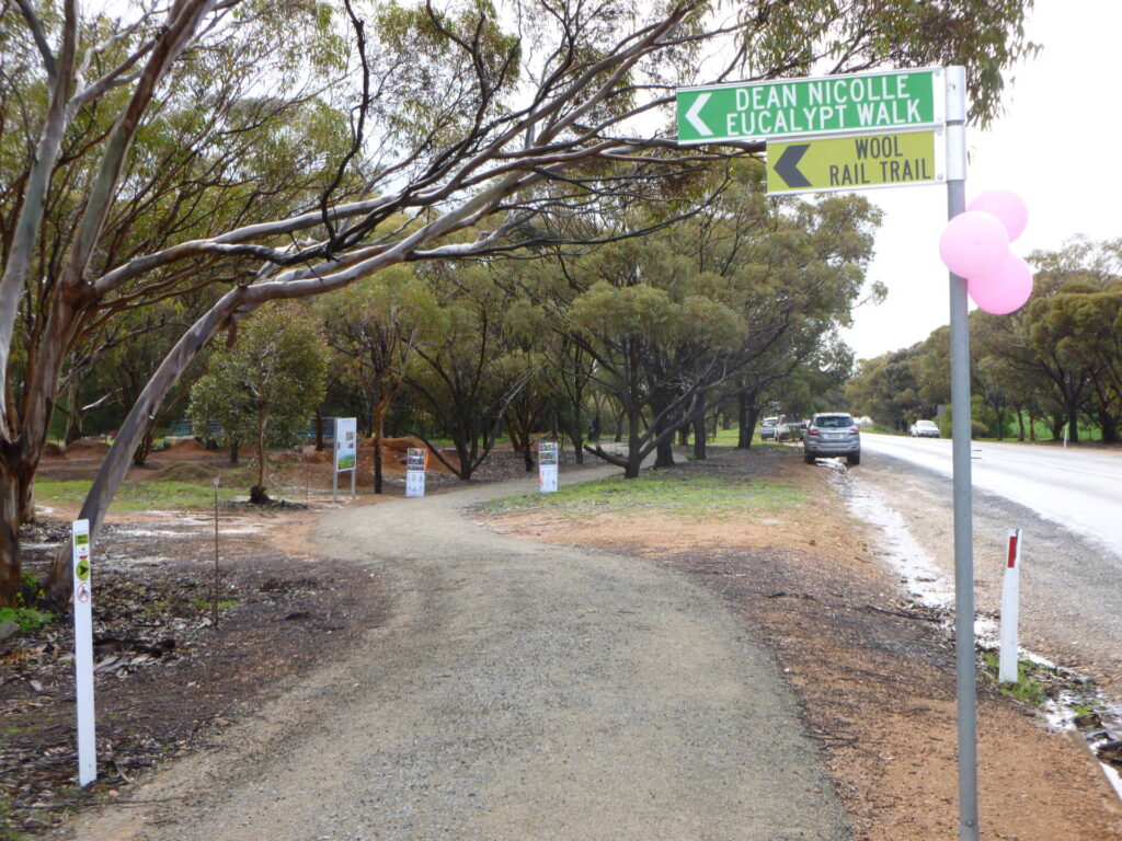
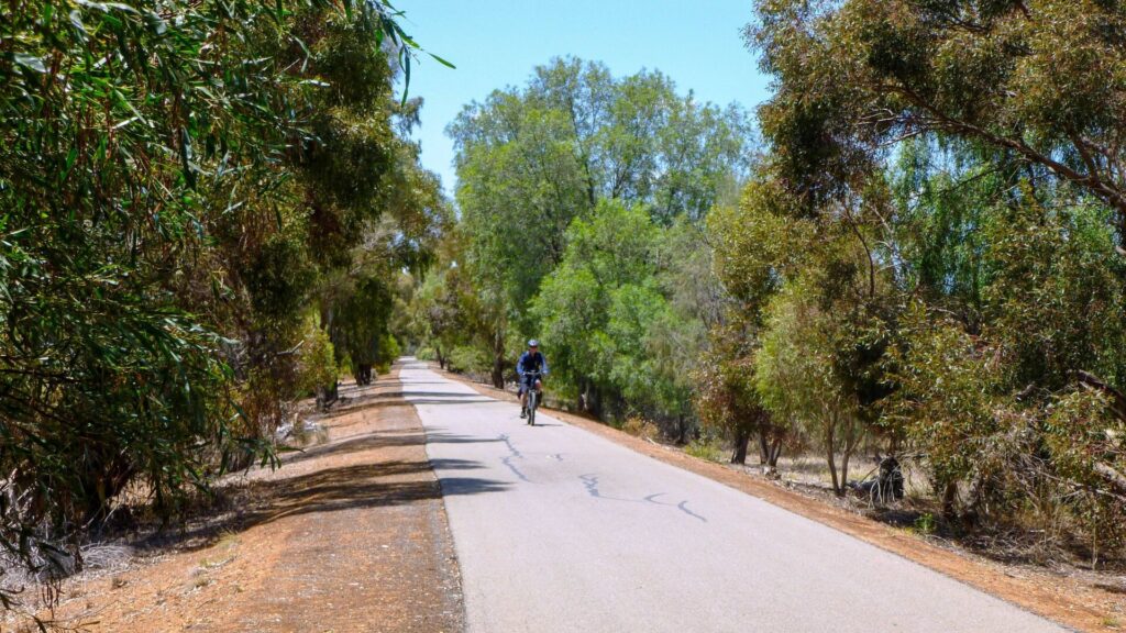
Rattler Trail (20 km): Crosses open farming country from Riverton to Auburn
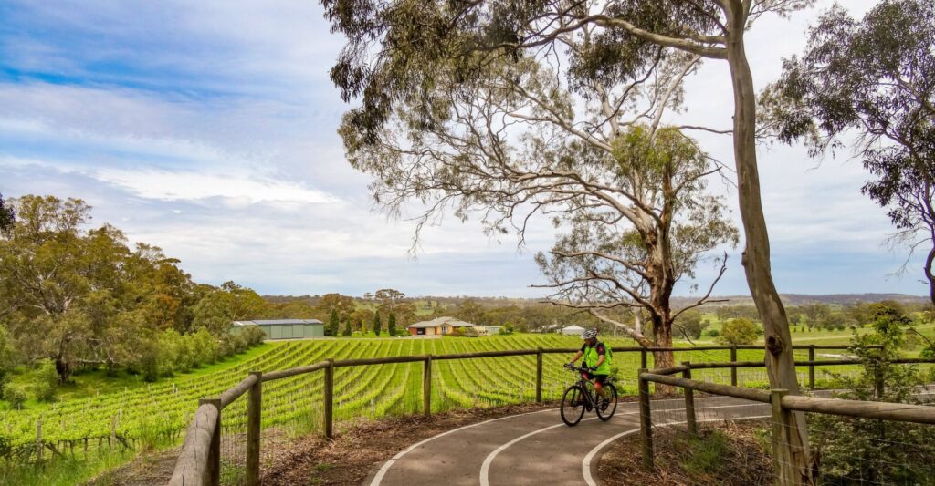
Riesling Trail south (25 km): Goes from Auburn to Clare through the Clare Valley, with its wine region and many historic towns.
Riesling Trail north (8 km): Essentially flat and an enjoyable ride through open farmland and vineyards from Clare to White Hut
Section Guides
Riverton to Rhynie (6.2 km)
- The Rattler Trail starts from the north-eastern corner of the Riverton Oval, opposite the holiday park and near the scoreboard (enter from Oxford Tce).
- Riverton’s magnificent railway station is now a private residence but there’s a bit of a view from public roads. There are some railcars and rolling stock in the former railyard. There are toilets, BBQ and picnic facilities near the budget holiday park.
- The first section has two gates to contain grazing stock. Please ensure you close them.
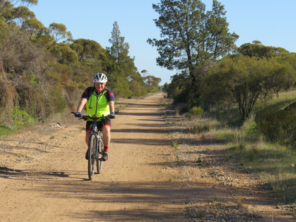
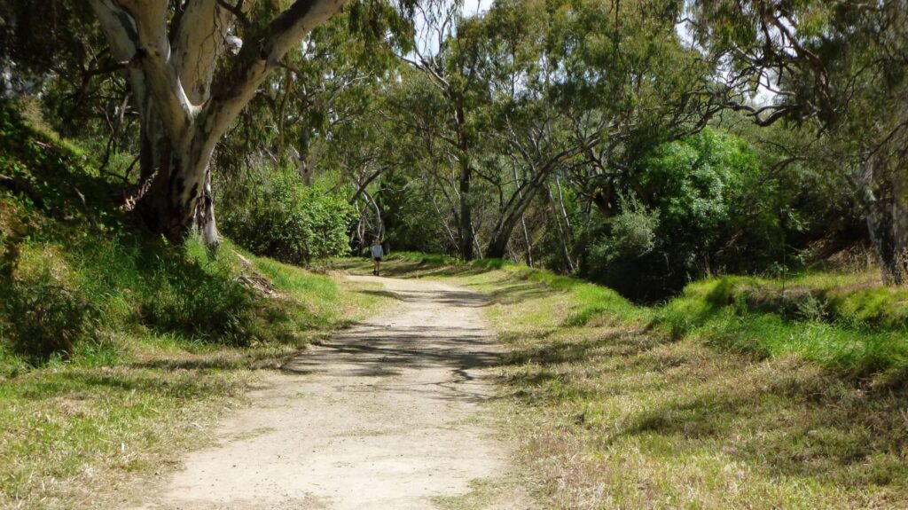
- After passing through the Riverton Golf Course, the trail enters a thick grove of swamp oaks; cool and shady on a hot day. The trail climbs gently through to Rhynie.
- At the Rhynie Station site shelter, you will find information boards with historical photos. A 650 m gravel track leads to the edge of town.
- There are no shops in Rhynie and even the historic hotel has closed, but there are toilets and picnic facilities in the park nearby.
Rhynie to Auburn (13.3 km)
- From Rhynie, the trail undulates through farming country with several steel bridges over creeks and low-level crossings for horses
- There is little evidence of Undalya siding, apart from an information board
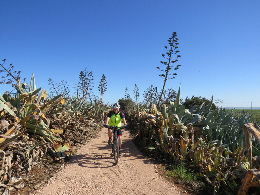
- The entrance to Auburn is across a long steel bridge over Rice Creek, through a shady corridor of pines, then past the oval, Auburn Community Caravan Park and on to the former Auburn Railway Station, predictably now a wine cellar.
- The town centre, with a number of food and beverage outlets, is to the west of the trail, easily accessed via paths and quiet streets.
- There are no steep or dangerous sections, but take care at road crossings.
Auburn to Penwortham (15 km)
- The Riesling Trail starts at Auburn Station, where there is some parking, and is maintained to a very high standard. There are interpretive signs and wineries along the way.
- Head north from the station and cross the long bridge over the Wakefield River which opened in 2019 to enable the rail trail to be entirely on the railway corridor after 25 years of work.
- Cross the highway with care and enjoy the gentle climb to Penwortham, passing Leasingham and Watervale. There are several wine cellars and food outlets along the way.
- At Penwortham, the trail goes under Horrocks Hwy and then loosely follows the railway to Clare.
- Visit historic St Mark’s Church (visible from the trail and accessible from Pawelski Rd), where district pioneer John Horrocks was buried in 1846. Horrocks’ Cottage can also be viewed on the corner of Surrey La and Horrocks Hwy.
Penwortham to Clare (10 km)
- Penwortham is the highest point on the trail and it is downhill all the way from there.
- Sevenhill is 4km further on, with St Aloysius’ Church and Sevenhill Cellars a short distance up College Rd.
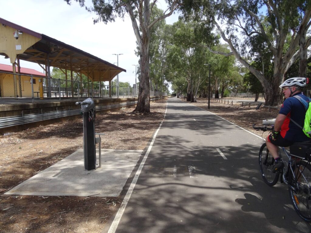
- The Clare Showgrounds siding has some artworks and is the start point of local ParkRuns. Passing along the eastern side of Clare, there is little evidence of the railway station and yards. There are a number of artworks and some relics in the station precinct and the old stationmaster’s house is now privately owned (the childhood home of internationally renowned author Monica McInerney).
- There is a carpark and shelter at the station site. A sculpture depicting Monica McInerney as a child reading books in the solitude of the roof top of the stationmaster’s house, was erected on the reserve adjacent to the station site in 2022.
- Follow the Clare town centre signs for numerous food and beverage options, toilets and shops.
- There are several options for cycle hire in Clare.
- There are no steep or dangerous sections, but take care at road crossings.
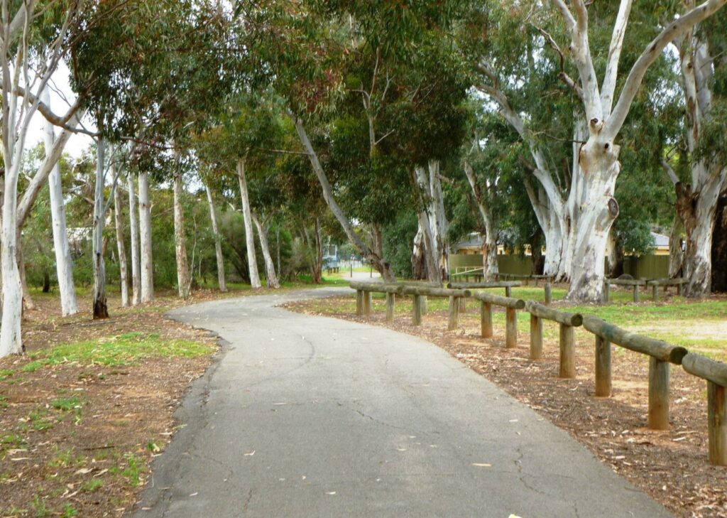
Clare to White Hut (8 km)
- This section extends north from the Clare Station precinct.
- It features a quality surface through shady cuttings and over bridges before coming out into beautiful farmland and vineyard areas.
- There are several artworks to view on the way.
- Take care crossing White Hut Rd as the gap in the pine log chicane is narrow and can be awkward.
- The trail ends at Barinia Rd, White Hut, the site of the Barinia siding. There’s a parking area and shady picnic table.
CONNECTING PATHS
- Melrose Park (500m): At the Drover and His Sheep sculpture (600 m north of the Clare Station precinct) take York Rd on the left and follow it north to Melrose Park. There are numerous trails within Melrose Park and an extensive model railway network, along with a lake, playground, toilets and picnic facilities. A further 500 m to the west are the Gleeson Wetlands with paths around an extensive planting of native shrubs and three water areas with a variety of bird species.
- Clare Valley Wine and Wilderness Trail (110km): A hiking and cycling trail designed to highlight the wine, food and natural landscapes of the Clare Valley. This trail intersects and occasionally follows the Riesling Trail. Stages 1, 2, 5 and 6 are complete and open for use. The remainder are under development. A map can be downloaded from the official site here
![The Riverton Station and surrounds are impressive, but respect that it is private hands [2015]](jpg/s20-061-p1060826-riverton-railway-station-sa-2015-05-300x200.jpg)
The Riverton Station and surrounds are impressive, but respect that it is private hands [2015]
![Discreet trailhead in Riverton behind the footy scoreboard [2025]](jpg/s20-050-replace-web-pic-2-discreet-trailhead-in-riverton-behind-the-scoreboard-2025-img_5835-300x225.jpg)
Discreet trailhead in Riverton behind the footy scoreboard [2025]
![Flimsy bridge over the trail at Riverton for members of the golf club [2015]](jpg/s20-061-p1060819-bridge-over-trail-at-riverton-golf-course-2015-05-300x200.jpg)
Flimsy bridge over the trail at Riverton for members of the golf club [2015]
A smooth surface and wide open farmland between Rhynie and Auburn (2015)
![An old telegraph pill box at Undalya siding, the railway closed long before radios made these redundant [2021]](jpg/s20-152-043-undalya-siding-remains-aug-21-300x225.jpg)
An old telegraph pill box at Undalya siding, the railway closed long before radios made these redundant [2021]
![Colourful blossoms south of Auburn in late winter [2021]](jpg/s20-152-056-cyclist-south-of-auburn-aug-21-300x213.jpg)
Colourful blossoms south of Auburn in late winter [2021]
![A significant bridge just before Auburn [2015]](jpg/s20-111-p1060809-new-bridge-on-rattler-trail-near-auburn-sa-2015-05-300x200.jpg)
A significant bridge just before Auburn [2015]
![Auburn has numerous historic buildings [2017]](jpg/s20-212-auburn-sa-rt-tour-qb-2017-qb-2017-112-of-143-300x203.jpg)
Auburn has numerous historic buildings [2017]
![Auburn Station is now a cafe and wine tasting centre. [2024]](jpg/s20-200-auburn-station-2024-03-30_165504-300x169.jpg)
Auburn Station is now a cafe and wine tasting centre. [2024]
![No mistaking where you are at Auburn! [2024]](jpg/s20-200-auburn-2024-03-30_002548356-300x169.jpg)
No mistaking where you are at Auburn! [2024]
![Impressive bridge across the Wakefield River, which opened in 2019, gets riders and walkers off the streets of Auburn [2022]](jpg/s20-215-impressive-bridge-across-the-wakefield-river-which-opened-in-2019-gets-riders-and-walkers-off-the-streets-of-auburn-2022-g_1383_crop-300x169.jpg)
Impressive bridge across the Wakefield River, which opened in 2019, gets riders and walkers off the streets of Auburn [2022]
![More of the scenery near Leasingham with wind turbines in the background [2015]](jpg/s20-211-auburn-to-leasingham-4498-2015-05-300x169.jpg)
More of the scenery near Leasingham with wind turbines in the background [2015]
![The view while resting at 'The Meeting Place' [2022]](jpg/s20-259-114-leasingham-meeting-place-view-feb-22-300x218.jpg)
The view while resting at 'The Meeting Place' [2022]
![Taking in the grape vines at Leasingham [2024]](jpg/s20-250-leasingham-2024-03-30_115246-300x169.jpg)
Taking in the grape vines at Leasingham [2024]
![Taking in the vineyards at Watervale [2024]](jpg/s20-300-watervale-2024-03-30_121458-300x169.jpg)
Taking in the vineyards at Watervale [2024]
![Typical interpretive sign along the rail trail, here at Watervale [2011]](jpg/s20-308-watervale-2011-05-0634-300x225.jpg)
Typical interpretive sign along the rail trail, here at Watervale [2011]
![At Stephen John Winery, not far from Auburn [Alex Thompson, 2014]](jpg/s20-308-watervale-stephen-john-winery-2014-11-economy-300x200.jpg)
At Stephen John Winery, not far from Auburn [Alex Thompson, 2014]
![Colourful riders near Penwortham [2017]](jpg/s20-359-penwortham-sa-rt-tour-qb-2017-2002-300x225.jpg)
Colourful riders near Penwortham [2017]
![Lots of interpretive signs to nearby attractions and businesses such as wineries [2024]](jpg/s20-350-penworthan-pawlski-rd-2024-03-30_124334-300x169.jpg)
Lots of interpretive signs to nearby attractions and businesses such as wineries [2024]
![Cruising along near Penwortham [2022]](jpg/s20-360-141-penwortham-cyclists-feb-22-300x225.jpg)
Cruising along near Penwortham [2022]
![Sevenhill Cellars is the oldest and one of the most popular wineries along the trail, with live music under the trees at times [2024]](jpg/s20-400-sevenhill-cellar-2024-03-30_135409-300x169.jpg)
Sevenhill Cellars is the oldest and one of the most popular wineries along the trail, with live music under the trees at times [2024]
![Look for lots of artwork along the rail trail, a passion of the volunteer committee of management, this one at Sevenhill [2022]](jpg/s20-413-151-sevenhill-cyclist-sculpture-feb-22-300x228.jpg)
Look for lots of artwork along the rail trail, a passion of the volunteer committee of management, this one at Sevenhill [2022]
![More vineyards at Sevenhill [2022]](jpg/s20-413-152-sevenhill-trail-view-feb-22-300x220.jpg)
More vineyards at Sevenhill [2022]
![The refurbished and widened Quarry Rd bridge between Sevenhill and Clare is a landmark [2024]](jpg/s20-410-quarry-rd-bridge-auburn-2024-03-_dsf5678-300x169.jpg)
The refurbished and widened Quarry Rd bridge between Sevenhill and Clare is a landmark [2024]
![The Clare Station area [2022]](jpg/s20-462-163-clare-station-info-shelter-feb-22-300x225.jpg)
The Clare Station area [2022]
![More artwork by Ty Manning at Clare [2015]](jpg/s20-461-clare-p1060754-2015-05-artwork-300x200.jpg)
More artwork by Ty Manning at Clare [2015]
![The drover's sheep at Clare [2022]](jpg/s20-462-167-clare-sheep-sculptures-feb-22-300x225.jpg)
The drover's sheep at Clare [2022]
![Clare also has its share of historic buildings [2006]](jpg/s20-456-clare-2006-09-118-1871_img-225x300.jpg)
Clare also has its share of historic buildings [2006]
![The corrugated iron kangaroos take off as you approach White Hut [2017]](jpg/s20-507-kangaroo-artwork-sa-rt-tour-qb-2017_-300x225.jpg)
The corrugated iron kangaroos take off as you approach White Hut [2017]
![The northern trailhead has car parking and a shady picnic table [Alex Thompson, 2014]](jpg/s20-507-barinia-2014-11-300x200.jpg)
The northern trailhead has car parking and a shady picnic table [Alex Thompson, 2014]
 Experience the best of the Riesling Trail on the only tour on this rail trail
Clare Valley Cycle Hire or call 0475 733 747
Riesling Trail Bike Hire or call 0418 777 318
Discovery Holiday Park – Cycle Hire
Do you know of a bike hire or transportation service on this rail trail that should appear here? If so, let us know at admin@railtrails.org.au.
Information and Links
The trail is managed by a voluntary committee of management with assistance from the Department of Recreation, Sport and Racing (Trails SA).
Riesling Trail Management Committee – ad***@***************om.au
Clare Valley Visitor Information Ph: 8842 2131 www.clarevalley.com.au
Clare Valley Business and Tourism Association – promotional video ‘Clare’
For bike hire, go to GET AROUND below
Clare Valley information here
24-page history of the rail trail (2022, 15MB) here
Clare Valley Wine and Wilderness Trail
Contact Rail Trails Australia
To contact us about this rail trail, email sa@railtrails.org.au
Background Information
Traditional owners
We acknowledge the Ngadjuri people, the traditional custodians of the land and waterways on which the rail trail is built.
Development and future of the rail trail
The trail is managed by a voluntary committee of management with assistance from the Department of Recreation, Sport and Racing (Trails SA). There is a proposal to extend the Riesling Trail from White Hut to Spalding along the railway reserve.
Rail line history
One of Australia’s early explorers, Edward John Eyre, made his way through the valley in 1839. His favourable reports led John Horrocks to settle there and to found Penwortham, the first settlement north of Gawler. In 1840, Edward Gleeson set up a sheep station and established Clare, named after his native county in Ireland. Copper was discovered at nearby Burra in 1845. Villages were established and roads built and, by the 1880s and ’90s, grape growing had taken hold in the region. The railway reached Riverton in 1864, but did not reach the valley and Clare itself until 1918, finally stretching to Spalding in 1922, a distance of 86 km. The line closed in 1984 and was dismantled five years later.
Riesling Rail Trail – 25 Years and still going Strong
Posted: 19/12/23
The Riesling Trail Committee celebrated its 25th anniversary on the 7 November 2023. The trail was one ...
More...Walk or Ride To Remember The Anzacs
Posted: 23/04/22
The South Australian Riverton Community will host "A Walk or Ride To Remember The Anzacs" ...
More...Riesling Trail (in South Australia) has a bridge upgrade
Posted: 04/12/20
The Riesling Trail Management Committee, with assistance from the Federal Government, SA Government Office for ...
More...Even COVID-19 has a silver lining
Posted: 02/05/20
COVID-19 has changed our lives. Social distancing and semi-lockdowns have become the norm but there ...
More...Funding for Riesling – Rattler Rail Trail upgrade
Posted: 30/05/13
The all-weather trail is located in the Gilbert Valley as a direct linkage to the ...
More...Nearby Trails
Shamus Liptrot Rail Trail
Adelaide Plains, 100 km north of Adelaide
11 km


Copper Rail Trail
Adelaide Plains, 100 km north of Adelaide
39 km

Wool Rail Trail
130 kms north of Adealide
2.2 km

Eudunda Rail Trail
112 km north of Adelaide
1 km

Kapunda Rail Trail
78 km north of Adelaide
1 km

Barossa Rail Trail
Barossa Valley, 50 km north-east of Adelaide
43 km
Smithfield Magazine Rail Trail
33 km north of Adelaide CBD
3.5 km
Penfield railside trail
20 km north of Adelaide CBD
7 km
Parafield railside trail
15 km north of Adelaide CBD
3 km
Gawler Greenway railside trail
Adelaide CBD
14 km
Copper Coast Rail Trail
Yorke Peninsula, 150 km north of Adelaide
25 km
Stockade Rail Trail
11 km north of Adelaide CBD
2.6 km
Outer Harbor Greenway railside trail
Adelaide CBD
23 km
Semaphore Rail Trail
16 km north-west of Adelaide CBD
4.2 km
O-Bahn Bikeway trail
Adelaide CBD
16 km
Amy Gillett Bikeway rail trail
Adelaide Hills, 49 km east of CBD
23 km
Westside Bikeway rail trail
2 km west of Adelaide CBD
9 km
Mike Turtur Bikeway railside trail
Adelaide CBD
9 km
Coast Park Path Rail Trail
12km north-west of Adelaide CBD
25 km
Marino Rocks Greenway rail trail
Adelaide CBD
16 km
Southern Flinders Rail Trail
Flinders Ranges, 207 km north of Adelaide
80 km
Nearby Trails
Shamus Liptrot Rail Trail
Adelaide Plains, 100 km north of Adelaide
11 km
Copper Rail Trail
Adelaide Plains, 100 km north of Adelaide
39 km
Wool Rail Trail
130 kms north of Adealide
2.2 km
Eudunda Rail Trail
112 km north of Adelaide
1 km
Kapunda Rail Trail
78 km north of Adelaide
1 km
Barossa Rail Trail
Barossa Valley, 50 km north-east of Adelaide
43 km
Smithfield Magazine Rail Trail
33 km north of Adelaide CBD
3.5 km
Penfield railside trail
20 km north of Adelaide CBD
7 km
Parafield railside trail
15 km north of Adelaide CBD
3 km
Gawler Greenway railside trail
Adelaide CBD
14 km
Copper Coast Rail Trail
Yorke Peninsula, 150 km north of Adelaide
25 km
Stockade Rail Trail
11 km north of Adelaide CBD
2.6 km
Outer Harbor Greenway railside trail
Adelaide CBD
23 km
Semaphore Rail Trail
16 km north-west of Adelaide CBD
4.2 km
O-Bahn Bikeway trail
Adelaide CBD
16 km
Amy Gillett Bikeway rail trail
Adelaide Hills, 49 km east of CBD
23 km
Westside Bikeway rail trail
2 km west of Adelaide CBD
9 km
Mike Turtur Bikeway railside trail
Adelaide CBD
9 km
Coast Park Path Rail Trail
12km north-west of Adelaide CBD
25 km
Marino Rocks Greenway rail trail
Adelaide CBD
16 km
Southern Flinders Rail Trail
Flinders Ranges, 207 km north of Adelaide
80 km
20 reviews of “Riesling and Rattler Trails”
26/70 I rode the whole thing up and back a couple of days ago and it was way too much distance to be able to enjoy all the sights. I felt like I'd cheated myself
Stayed in Penwortham (halfway and highest point) Riesling Trail was excellent and quite beautiful both ways. Winery signs on trail can be a bit misleading as almost all winery's require you to get off trail and deal with busy highway (and in some cases, hills!) Best suggestion is that you travel with the Tourist winery map to be sure you are not lost or surprised.
Meant to give it 5 stars….
I rode this trail twice recently and several times in prior years. I think it probably the best trail in SA with well maintained surfaces and great scenery. Plenty of places to stop for rest or food.
We did Auburn to Clare return. What a fabulous rail trail. Well signposted to cafes and wineries. Picnic tables and guide posts are plentiful.
It had rained the day before and the trail surface was great.
Did the Auburn to Riverton return this afternoon. Lovely trail. Caravan Parks at both ends. Coffee shops and cafes at both ends. Great surface and beautiful rolling hills scenery. Some sections well shaded but other sections a little bit exposed. Good signage and quite a few shelters and picnic benches.
My wife and I rode from Riverton to Auburn and return. Very impressed with the fine gravel surface, and smooth steel bridges. Loved the farmland and the recent tree plantings are paying dividends. Thanks to the volunteers, and all involved. Will definitely return.
Did Auburn to Sevenhill. Great and pleasant ride and the fine gravel track is in excellent condition. Great scenery.
The Reisling Trail from Auburn to Barina is an easy riding trail with a well formed fine, compacted gravel surface for its entirety. Distance markers every kilometre are helpful and there are plenty of way finding signs with directions to service providers (food, accommodation, cellar doors) along the way. The trail boasts interesting art installations, rest areas and information panels for trail users. Velvet and Willow Pantry in Auburn is a delightful cafe for refreshments. The northern end of the trail at Barina simply terminates in the countryside. It is a pleasant ride out there but it is just a turn round point to return to Clare.
The Rattler Trail from Auburn to Riverton also has an equally well formed trail surface. The countryside here is significantly different to that around the Reisling Trail being much more open grain cropping land. The trail is quite exposed to sun and wind and trail users should take this into account. Some revegetation along the trail corridor is evident but the corridor would benefit with much more tree planting. Riverton is a pretty regional town worth seeing.
Rode the trail over 2 days, firstly staring at Watervale down to Riverton and return. Great quality trail, very smooth surface. Next day started from Clare, down to Watervale, north to Barina, then back to Clare. We are on a mission to ride all the rail trails in Australia and this is one of the better ones. A great trail
We rode the Rattler Trail today from Auburn to Riverton and return.
Although this trail isn't as well known as the connecting Reisling Trail, it is just as good. The surface is a very smooth fine crushed blue metal. This trail passes through more open farmlands, but some of the rural views are expansive and spectacular.
All the creek crossings now have metal bridges, and some of the early tree plantings are thriving and well over 4 metres high.
We came across some volunteers that were doing maintenance on a section of tree plantings that were 2 years old. The trees were on average about a metre high, and looked to be thriving in the recent rains. A big thank you to all the volunteers involved with this great trail.
The town of Riverton still has a lot of railway lines intact, as well as a huge two story stone railway station. There are also 4 train carriages on site that used to be used as accommodation. It is privately owned, but you can still check it out from the distance.
Riverton has some beautiful stone buildings, and we had coffee and cake at a lovely little shop called the Riverton Deli, Bakery, take away.
There is a nice little shelter shed at the Rynie station site, with loads of information and history.
Auburn is also a great little village with more nice stone buildings and pub. So much to see and do.
Don't miss it.
Rode Rattler Trail today. Doesn't seem to get as much attention as the Reisling Trail, despite joining each other. Good surface and interpretive signs. Huge job being done by Trail volunteers planting and maintaining shrubs and trees along the trail.
Today we rode from Clare to Auburn and return. The weather was terrible, but the trail was wonderful. It has one of the smoothest and most durable surfaces I have found on a rail trail. We rode this trail 7 years ago, and have found lots of additions and improvements this time round. New artwork sculptures and bridges being the most noticeable. The new bridge on the original rail corridor at Auburn is a credit to the builders. It looks great and is a treat to ride over. Another great improvement is the gravel banks on the sides of the high embankments, a good safety feature.
It's the June long weekend, and the trail was quite crowded in places with riders and walkers. Obviously very popular with locals and visitors alike.
We rode from Clare to Barinia and return today. The weather wasn't very nice, but the trail is terrific. The surface is so smooth, and there are so many cuttings with large shady pines. It's like riding through a tunnel of trees at some places.
A couple of sculpture sites and interpretive signs make this a really great trail. Clare is a nice little town with plenty of accommodation, shops and places to eat.
The Rattler Trail is a terrific, scenic and well maintained trail. Highly recommended.
The Rattler Rail Trail is a very enjoyable mostly uphill ride from Riverton to Auburn. The track surface is now good and there are lovely coffee shops at each end. Our group usually rides this trail two or three times a year. You can see more photos and a video here: https://uncoolcyclingclub.com/rattler-rail-trail-sa/
I rode the Riesling and Rattler Trails over a weekend in September 2018.
The section Clare to Auburn is the busiest and most popular, due to the large number of wineries, eateries and art galleries close to the trail. There are also many options for side trips to lookouts and more wineries. Clare is the largest town on the trail, with good facilities and accommodation options.
The southern section known as the Rattler Trail from Auburn to Riverton is a quieter section of the overall trail, with flatter surrounds and extensive farmland views. Riverton is a small town with interesting historic features. Unfortunately the Riverton Railway Station appeared to be now privately owned and did not allow access at the time.
Clare to Whitehut at the northern end is also a quiet section of the trail, with extensive farmland views.
Overall the trail had a good gravel surface. My chain and bike was a bit dusty after a couple of days, so it would be good to have some lube. Also the weather was quite warm even in early September, and a bit windy, so make sure you have water and sunscreen and allow time for a slower ride depending on conditions.
Just finished riding the Riesling and Rattler trails on my hybrid. The surface is excellent on both trails now, and the addition of extra artworks and interpretive signs certainly enhances the experience. The new bridges on the Rattler Trail are excellent, and the new surface is very smooth. I would be happy to ride both trails on my road bike. A new trail-side cafe (The Legless Dog) near Watervale was a most welcome sight. There are also plenty of choices for a meal or snack at Auburn. Check out the Cogwebs Cafe for a unique experience.
Rode from Clare to Auburn with my young family in January 2015. Whilst it not as long as the Victorian trails, I think it is more beautiful than the Murray to the Mountains or the Great Victorian Rail trail. Excellent surface, outstanding views, heaps of informative signs and many things to see and do off the trail make for a wonderful experience. Approaching Clare, I could smell the pine trees as we rode past! I would be nice to see a few more bridges re installed, especially around Leasinghan and Auburn and a few more toilets as most were around 500m off the trail into the townships. After speaking to the locals, there is a significant push to lengthen the trail and they feel the trail brings a significant tourist attraction to the area. Looking forward to riding the whole length in the future.
I rode on both these trails on 26 February 2014. The Riesling trail has a well-maintained surface.
The Rattler trail from Auburn to Riverton and return is undergoing repairs in some places but was open to bikes on the day I was there. It is a bit rough in places with coarse gravel on the riding surface, so I would recommend a mountain bike for this section. Three of the four bridges on the Riverton section have new steel decking, great to see the work coming along.