 Location:
 Length:
 Surface:
 Start / End:
 Suitable for:
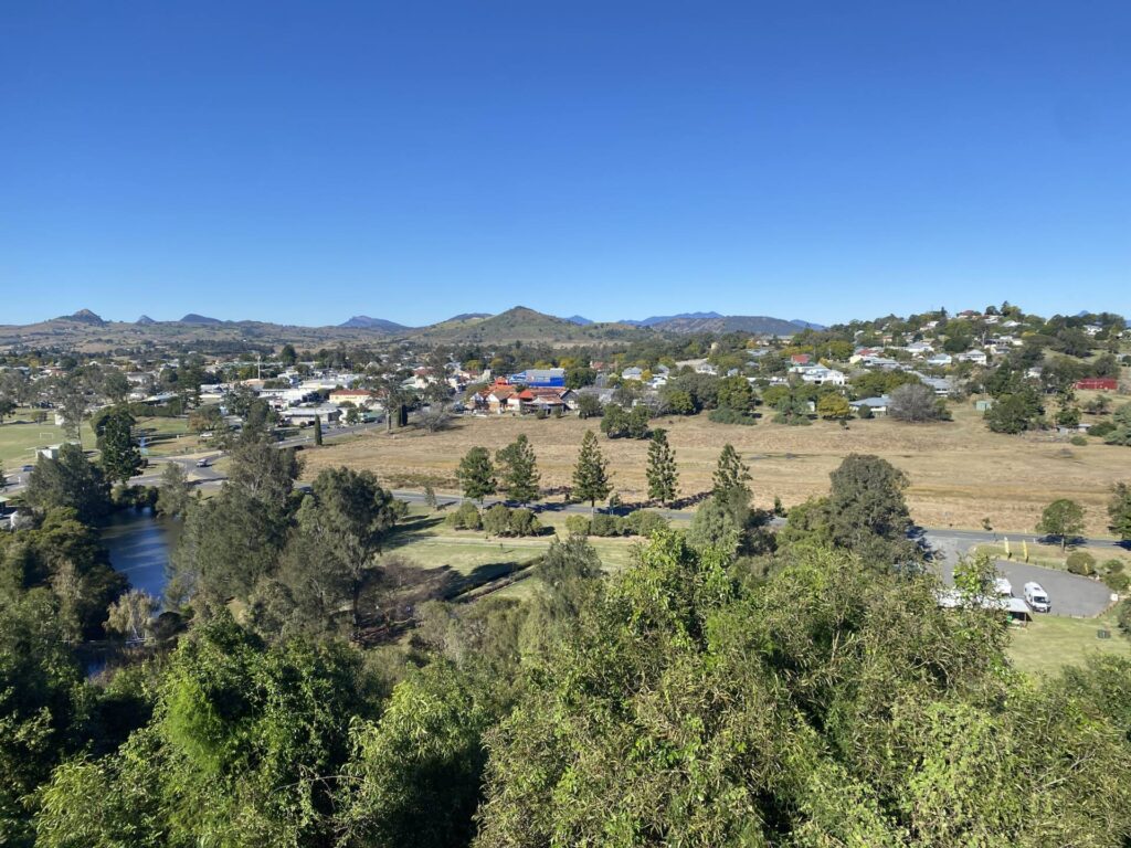
The Brisbane Valley Rail Trail, at 161km, is the longest rail trail in Australia. It commences in North Ipswich, near sea level, and tracks up the Brisbane Valley through the towns of Fernvale, Lowood, Coominya, Esk, Toogoolawah, Moore, Linville. The trail then climbs the Great Dividing Range more steeply to Blackbutt and terminates around 500m above sea level at Yarraman.
- Continuing upgrades are providing comfortable and easy riding along much of it. However, many sections can be affected by storm events and trail surfaces vary
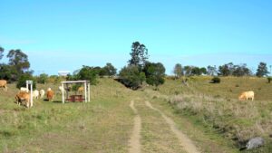
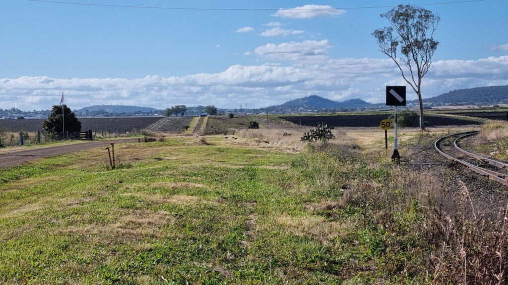
- The terrain is gently undulating through mostly farming land in the southern section, with steeper sections and bushland in the north
- Heritage-listed attractions include Lockyer Creek Bridge and Yimbun Tunnel
- Suitable for multi-day tours, with options for fully supported tours and shuttles
- Accommodation and food outlets are available in all of the towns and villages along the trail
- A bike shuttle service operates along the full length of the trail.
Nearby Attractions
- Close to Brisbane and Ipswich
- Scenic rural countryside
- Railway history and heritage
- Close to Wivenhoe and Somerset Dams
Last updated: 5 February 2026
- Access points at each town are the former station sites, which have plenty of parking
- Horses must be shod
- No drinking water or toilets available outside the towns listed
- There are many low-level crossings, where bridges are missing or have been removed
- Cattle may be grazing beside the trail
Section Guides
Ipswich to Fernvale (23km)
Note: There is drinking water located along the ‘Brassall Bikeway’ section (between Wulkuraka and Brassall), immediately south of Workshops St, and in John Murphy Park, Brassall
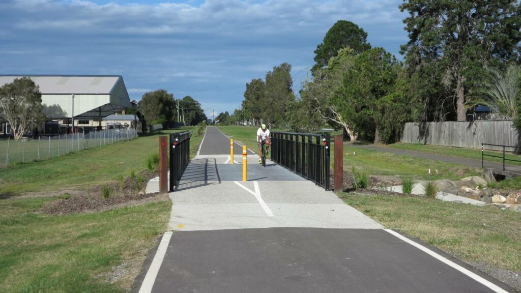
- Access: The trailhead is at 163 Grace St, Wulkuraka. It has two public toilets, one of which has disabled access. There is also a water bubbler with dog bowl and considerable parking. If arriving by train at Wulkuraka Station, follow the concrete shared path along Grace St, pass Arnold St on the right and cross to the other side of Grace St.
- The first section of the BVRT to Diamantina Boulevard at the Warrego Hwy underpass has a high quality concrete surface. The remainder is gravel and dirt suitable for hybrid and mountain bikes.
- Continue 100m and turn right on to Brassall Bikeway. After 150m, turn left at the picnic shelter and enter the BVRT connection path.
- Station sites along this section include Muirlea (5km), Pine Mountain (8.6km), Borallon (11.5km), Wanora (15km), Fairney View (18.5km) and Fernvale (22.6km). All are clearly marked.
- A carpark suitable for horse floats, with CCTV security, is at the Borallon Station site on Borallon Station Rd. There’s a horse watering trough connected to a large tank and a large shade shelter for all trail users.
- Fernvale’s facilities include the Fernvale Futures Visitor Information Centre at the station site, bakery, café, ATM and accommodation. Filtered water, WiFi and outdoor power points are available 24 hours at the front of the Information Centre. There are toilets and free electric barbeques in the park opposite the bakery.
Fernvale to Lowood (8km)
- Mainly fine compacted gravel surface, with a substantial portion of the trail now concreted between Fairney View Fernvale Road & Clive Street, Fernvale. And again, along part of the Lowood section, from the township, through part of Pete Bevan’s native gardens.
- Suitable for hybrid bikes, personal mobility vehicles or horse-drawn vehicles
- Views of the Brisbane River in this section.
- A fun run is held on the trail each July. For information click here
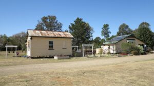
- Lowood has basic facilities and still has its station, used by the local Lions Club, off Railway St and visible from Main St. Toilets and water are located in the park in the centre of town and the northern section of the trail has an extensive native garden display, planted and maintained by locals. Lowood Flood Boat Memorial, also in the park, commemorates rescues following devastating floods in the 1890s. The showgrounds has horse accommodation facilities, overnight camping and caravan access.
Lowood to Esk (36km)
- Coarse gravel/dirt surface
- Native bushland and farmland
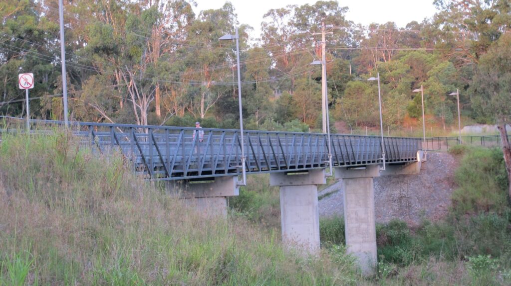
- Between Lowood and Coominya is the large 92m long Lockyer Creek Bridge, opened to rail trail users in 2019.
- A significant feature of the area is Lake Wivenhoe, the major water source for southeast Queensland and twice the capacity of Sydney Harbour.
- The intermediate town of Coominya has limited facilities. Drinking water can be bought from the supermarket, café or hotel. There are toilets and a playground in the station park, with room for horse floats to park and offload. There is a new Amenities Block on the trail opposite the former Coominya Train Station at the intersection of Main St and Bunney Road.
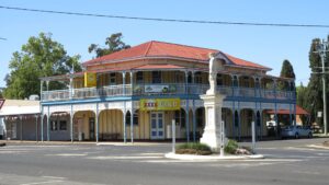
- Esk is the major regional centre and has most facilities. The station has been restored by the local Lions Club and the precinct is now a feature. There are many cafes and two pubs, a lovely main street and the trail passes through the middle of town, crossing the Brisbane Valley Highway at Lars Anderson Car Park. The trail through Esk has been significantly upgraded with a wide concrete boulevard, railway themed treatments and lighting over the trail itself. The former railway siding has been restored and there is a large picnic area with shelter beside the public amenities block just past the railway siding approaching the centre of Esk.
Esk to Toogoolawah (19km)
- Coarse gravel/dirt surface
- Undulating farmland
Both Esk and Toogoolawah have cafes that open onto the rail trail. The new cafe at Esk, Brisbane Valley Roasters, provides eight external power points for free charging of ebikes at a bespoke bike rack within the grounds of the cafe. The Grand Hotel in Esk provides 20 external power points around its outside beer garden for ebike charging.
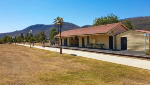
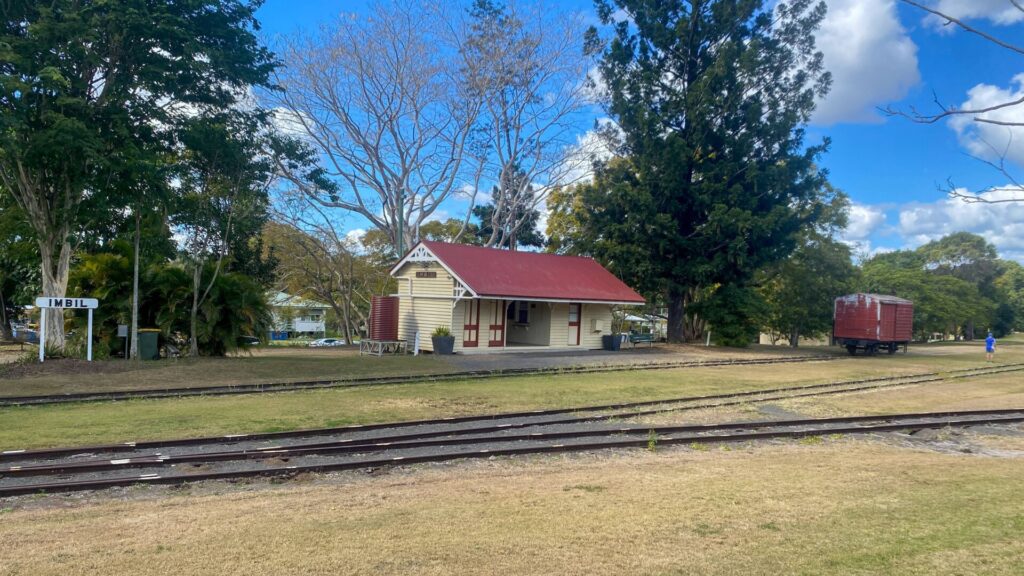
The Toogoolawah station building is a small museum and regular markets are held in the former station yards. Accommodation options include the Toogoolawah Motel, Exchange Hotel and the Pedlars’ Rest.
Toogoolawah to Moore (27km)
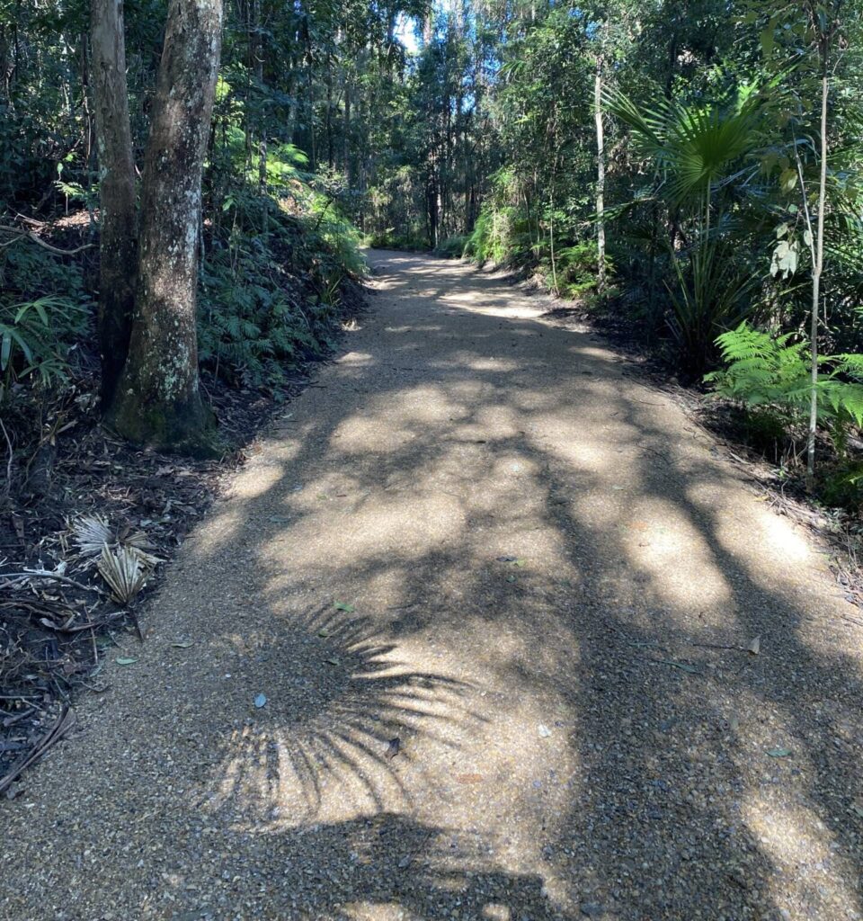
- Smooth gravel surface so suitable for hybrid bikes
- Some steep descents/ascents where railway bridges have been removed; the trail dips in and out of creek beds
- Undulating terrain
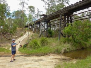
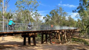
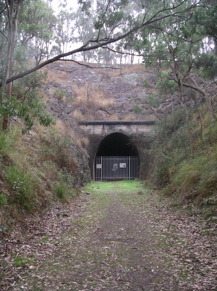
- Near Harlin is the 100m long Yimbun Tunnel, the only tunnel on the rail trail.
- A large concrete and steel bridge at Harlin was destroyed in the 2013 floods, requiring a diversion through the small town of Harlin
- There is a shelter shed at the top of the climb past Harlin State School with views out to the Brisbane River
Moore to Blackbutt (29km)
This section consists of three sub-sections listed below. It includes some steep grades where railway bridges have been removed. The trail dips in and out of creek beds.
Moore to Linville (7km )
- At the old Moore station, cross Linville Road and follow the road for 100m; rejoin the BVRT on the right.
Linville is a small village with a general store and a popular pub that has accommodation. Camping is allowed at the former railway yards. There is a new toilet and shower block at the rest area on the site of the old railway station. A new purpose-built trail users accommodation facility, Linville Rail Trail Refuge, opened in 2023.
Linville to Benarkin (18 km)
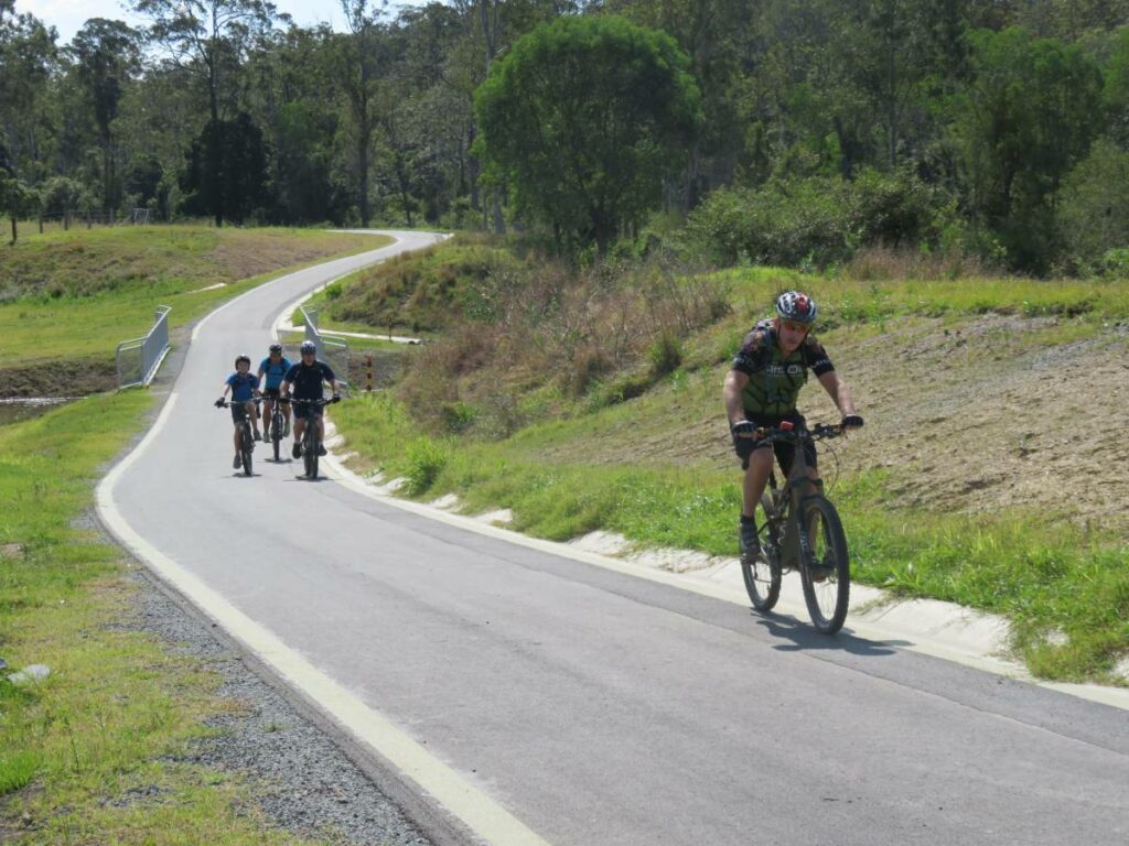
- From Linville the trail climbs the rugged and picturesque Blackbutt Range for 20km with an elevation gain of around 300m to Benarkin. It is a long steady climb, on formation, so it is at railway gradient.
- Front suspension and gloves are recommended for riders due to the rough surface.
- Linville and Benarkin are small villages, each with a general store
- Perhaps the most scenic section of the entire 161km trail
- Close to the small village of Benarkin the vegetation changes to eucalyptus and scrub. Benarkin sits at the top of the range about 500 m above sea level, as do Blackbutt and Yarraman.
Benarkin is an even smaller village with a general store. Camping is allowed at the former railway yards with free public toilets available (unfortunately the showers are closed).
Benarkin to Blackbutt (5km)
- Smooth gravel surface: can be ridden comfortably on hybrid bikes
- Steady climb to Blackbutt
- The Nukku siding station has been restored and relocated in the Blackbutt rail yards. Toilets are nearby in Les Muller Park, Coulson Street, Blackbutt.
Blackbutt is a regional centre and offers bakeries, cafes, supermarkets and a visitor information centre. Accommodation is available at the Hotel Radnor or at B&Bs close to the trail.
The trailhead continues through to Yarraman opposite the junction of Hart and Douglas streets in Blackbutt.
Water is available in the park at Blackbutt (next to the toilets).
Blackbutt to Yarraman (19km)
This is the roughest section of the BVRT. Trail users should expect a more poorly formed and maintained track, washouts, sandy and loose surface sections and water in creek crossings. Currently this is an ‘adventure trail’ section and cyclists should only attempt this section with a suitable off-road bike and the skills for riding a rougher trail.
- Steady climb to the top of the range, then descent to Yarraman
- Coarse gravel/dirt surface
- The old Pidna Station site is at Harland Park at Cooyar Creek, beside the highway
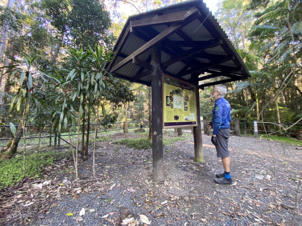
The Yarraman trailhead is a short distance out of the town. From the D’Aguilar Highway (A3), which passes through the town, turn into Browne St which then becomes Millar St. The trailhead is one kilometre along this route from the D’Aguilar Highway. It passes the Yarraman Heritage Centre which is well worth a visit. The trailhead has a number of interesting heritage installations and information panels.
Yarraman has two hotels, a motel, caravan park, supermarket, bakery and cafes. The Yarraman Heritage Centre features the re-located old rail station building.
CONNECTING PATH
There is a signposted Link Trail that connects to the Kingaroy Kilkivan Rail Trail from Yarraman (see FURTHER INFORMATION). The Link Trail follows a former stock route through to Nanango and then uses quiet roads through to Kingaroy. By car, it is a 45km drive from Yarraman to Kingaroy.
![Wulkuraka Railway Station is the nearest public transport [2022]](jpg/q02-061-wulkuraka-station-2022-06-13_104238-300x169.jpg)
Wulkuraka Railway Station is the nearest public transport [2022]
![From the station it is necessary to ride 1 km along Grace St [2022]](jpg/q02-061-wulkuraka-station-to-trail-head-2022-06-13_104529-300x169.jpg)
From the station it is necessary to ride 1 km along Grace St [2022]
![Hard to miss the trailhead facilities at Wulkuraka on Grace St [2023]](jpg/q02-050-wulkuraka-trail-head-2023-06-img-1790-300x225.jpg)
Hard to miss the trailhead facilities at Wulkuraka on Grace St [2023]
![Some of the new trailhead facilities at Grace St [2023]](jpg/q02-050-wulkuraka-trail-head-2023-06-img-1792-294x300.jpg)
Some of the new trailhead facilities at Grace St [2023]
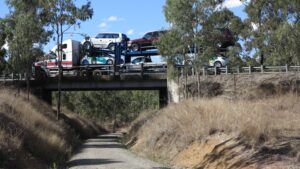
![From Wulkuraka to Dimantina Ave is constructed to a high standard [2018])](jpg/q02-058-diamantina-blvd-2018-09-9847-300x169.jpg)
From Wulkuraka to Dimantina Ave is constructed to a high standard [2018])
![The section through the Warrego Hwy underpass is now also of a high standard [Karen Davidson, 2020]](jpg/q02-060-warrego-highway-2020-07-8-7-20-9-42-01-am-300x225.jpg)
The section through the Warrego Hwy underpass is now also of a high standard [Karen Davidson, 2020]
![Borallon Station site has a shelter and horse watering and hitching facilities [2023]](jpg/q02-108-borallon14-2023-01-300x225.jpg)
Borallon Station site has a shelter and horse watering and hitching facilities [2023]
![Take care crossing the Brisbane Valley Hwy at Wanora [2017]](jpg/q02-106-bvrt-hwy-crossing-from-east-2017-300x169.jpg)
Take care crossing the Brisbane Valley Hwy at Wanora [2017]
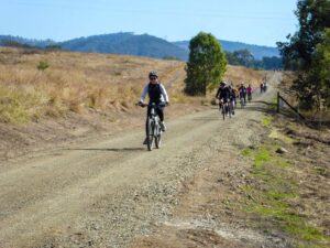
![Typical trail conditions between Wanora and Fernvale [2018]](jpg/q02-106-p1040805-between-fernvale-and-wulkuraka-july-2018-300x225.jpg)
Typical trail conditions between Wanora and Fernvale [2018]
![Fernvale Station site also has a regional information centre [2018]](jpg/q02-162-fernvale-2018-09-9859-300x169.jpg)
Fernvale Station site also has a regional information centre [2018]
![This is the impressive Fernvale information centre [2018]](jpg/q02-162-fernvale-2018-09-9864-300x169.jpg)
This is the impressive Fernvale information centre [2018]
![Views of the Brisbane River between Fernvale and Lowood [2018]](jpg/q02-162-p1040797-view-of-brisbane-river-near-lowood-july-2018-300x169.jpg)
Views of the Brisbane River between Fernvale and Lowood [2018]
![Lowood Railway Station [Paul Heymans, 2019]](jpg/q02-213-lowood-2019-02-28_104502-300x146.jpg)
Lowood Railway Station [Paul Heymans, 2019]
![The Lockyer Creek Bridge has been restored to make the Lowood to Coominya section a highlight [Paul Heymans, 2018]](jpg/q02-224-lockyer-ck-bridge-2018-12-21_100917-300x146.jpg)
The Lockyer Creek Bridge has been restored to make the Lowood to Coominya section a highlight [Paul Heymans, 2018]
![Details of the huge restoration work at the Lockyer Creek Bridge looking towards Coominya [Paul Heymans, 2019]](jpg/q02-224-lockyer-ck-bridge-2019-02-28_111027-300x146.jpg)
Details of the huge restoration work at the Lockyer Creek Bridge looking towards Coominya [Paul Heymans, 2019]
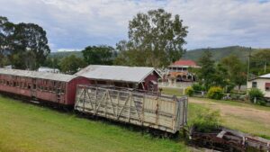
![Coominya Railway Station and parcel shed [2018]](jpg/q02-261-coominya-2018-09-9871-300x169.jpg)
Coominya Railway Station and parcel shed [2018]
Most of the bridges have low-level bypasses, providing a good look at the work of times gone by. (2018)
However another new bridge at Mt Hallen was opened in 2024
![Typical trail surface between Coominya to Toogoolawah [2018]](jpg/q02-261-coominya-to-esk-2018-11-p1090061-300x169.jpg)
Typical trail surface between Coominya to Toogoolawah [2018]
![New bridge approaching Esk [2018]](jpg/q02-314-esk-2018-09-9892-300x169.jpg)
New bridge approaching Esk [2018]
The Esk Station precinct is really well maintained with a great playground and park. (2019)
![Esk township has lots of places of interest [2007]](jpg/q02-307-esk-2007-09-3295-300x200.jpg)
Esk township has lots of places of interest [2007]
Typical scenery between Esk and Ottaba. (2012)
![Tranquillity walking between Ottaba and Toogoolawah [2020 Karen Davidson]](jpg/q02-327-toogoolawah-to-ottaba-walkers-2020-07-5-7-20-8-28-16-am-300x225.jpg)
Tranquillity walking between Ottaba and Toogoolawah [2020 Karen Davidson]
![Horses riders and walkers enjoying the trail between Ottaba and Toogoolawah [2020 Karen Davidson]](jpg/q02-327-toogoolawah-to-ottaba-walkers-horses-2020-07-5-7-20-9-36-41-am-300x225.jpg)
Horses riders and walkers enjoying the trail between Ottaba and Toogoolawah [2020 Karen Davidson]
![Bridge with a difference at Toogoolawah [2020 Karen Davidson]](jpg/q02-364-toogoolawah-walkers-2020-07-5-7-20-7-48-11-am-300x225.jpg)
Bridge with a difference at Toogoolawah [2020 Karen Davidson]
Toogoolawah Station also features many events. (2016 Mark Linnett)
The trail surface from Toogoolawah to Moore is a higher standard gravel surface. (2018)
![Cruising down from the only tunnel on the trail, between Yimbun and Harlin [2021]](jpg/q02-413-yimbun-tunnel-steven-kaye-2021-11-300x300.jpg)
Cruising down from the only tunnel on the trail, between Yimbun and Harlin [2021]
![Shelter overlooking the Brisbane River at Harlin [2018]](jpg/q02-411-harlin-2018-09-shelter-views-of-brisbane-river-300x225.jpg)
Shelter overlooking the Brisbane River at Harlin [2018]
![Low-level bridge bypass between Harlin and Moore [2018]](jpg/q02-411-nurinda-to-moore-p1040733-july-2018-300x225.jpg)
Low-level bridge bypass between Harlin and Moore [2018]
Cruising beside the Brisbane River between Harlin and Moore (2018)
There are several steep low-level crossings between Harlin and Moore. Take care when slippery. (2018)
![Each former station and other points of interest have signs painting a picture of the history [2020 Karen Davidson]](jpg/q02-463-moore-2020-07-3-7-20-12-02-27-pm-300x225.jpg)
Each former station and other points of interest have signs painting a picture of the history [2020 Karen Davidson]
The rail trail has helped spur an increase in the attractions available at Moore (2018)
![The trail between Moore and Linville [Karen Davidson, 2020]](jpg/q02-463-moore-to-linville-2020-07-3-7-20-10-34-01-am-300x225.jpg)
The trail between Moore and Linville [Karen Davidson, 2020]
Linville Station. There are plans for the deteriorating rollingstock (2019)
![Many station sites such as at Linville and Benarkin are popular with campers enjoying the rail trail [2019]](jpg/q02-515-linville-2019-05-26_134211-300x169.jpg)
Many station sites such as at Linville and Benarkin are popular with campers enjoying the rail trail [2019]
![The rail trail has helped keep Linville's businesses viable [2018]](jpg/q02-515-p1040701-linville-july-2018-300x225.jpg)
The rail trail has helped keep Linville's businesses viable [2018]
![Riding up the range from Linville to Benarkin [Bruce Glover, 2013]](jpg/q02-513-linville-to-benarkin-2013-04-dsci4973-300x169.jpg)
Riding up the range from Linville to Benarkin [Bruce Glover, 2013]
![Horse stabling area between Linville and Benarkin [2019]](jpg/q02-515-linville-to-benarkin-2019-05-26_125008-300x169.jpg)
Horse stabling area between Linville and Benarkin [2019]
![There are quite a few steep low-level crossings between Linville and Benarkin. Take care when slippery. [2019]](jpg/q02-515-linville-to-benarkin-2019-05-26_130609-300x169.jpg)
There are quite a few steep low-level crossings between Linville and Benarkin. Take care when slippery. [2019]
![Amenities at Benarkin [2019]](jpg/q02-560-benarkin-2019-05-26_121643-300x169.jpg)
Amenities at Benarkin [2019]
The Radnor Hotel is a feature of Blackbutt, which has many other facilities. (2018)
A lot of effort has been put into recreating the Blackbutt Station, including the Roy Emerson museum (2018)
Some of the locals at Nukku. (2019)
![The rail trail between Nukku and Gilla [2019]](jpg/q02-616-nukku-to-gilla-2019-05-0522-300x169.jpg)
The rail trail between Nukku and Gilla [2019]
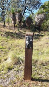
There are about 160 of these kilometre posts for users to count (2019)
![Grass trees on the approach to Yarraman [2018]](jpg/q02-657-pidna-p1040656-between-yarraman-and-blackbutt-july-2018-300x225.jpg)
Grass trees on the approach to Yarraman [2018]
![Low-level crossing at Cooyar Creek, near Yarraman, may get higher [2025]](jpg/q02-690-bridge-piers-at-cooyar-creek-near-yarraman-may-yet-resume-duty-2025-img_6389-225x300.jpg)
Low-level crossing at Cooyar Creek, near Yarraman, may get higher [2025]
![Yarraman features a comprehensive interpretive centre [2018]](jpg/q02-710-yarraman-2018-09-9972-300x169.jpg)
Yarraman features a comprehensive interpretive centre [2018]
![Well-marked turn off to the Link Track to Nanango and Kingaroy [2025]](jpg/q02-700-turn-off-to-the-link-track-to-nanango-and-kingaroy-2025-img_6363-1-300x225.jpg)
Well-marked turn off to the Link Track to Nanango and Kingaroy [2025]
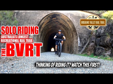
Jel Builder provides a comprehensive video guide to riding the rail trail [2023]
 Ride one of the longest rail trails in Australia and see fantastic bridges and stunning views
The Bike Hire Company offers bike hire and transport. Contact 0400 386 304 https://thebikehirecompany.com.
Do you know of a bike hire or transportation service on this rail trail that should appear here? If so, let us know at admin@railtrails.org.au.
Information and Links
The Queensland Department of Transport and Main Roads (TMR) is the state agency responsible for the day-to-day management and maintenance of the BVRT in conjunction with other organisations.
- Please report all issues to the TMR using their BVRT website.
- Urgent issues can be reported to the rail trail ranger on 0467 729 409.
Download TMR guide and map of entire rail trail (11MB)
The Link Trail joins the BVRT to the Kingaroy Kilkivan Rail Trail utilising a former stock route on a mix of gravel and sealed roads passing through Nanango to Kingaroy. The trail is well signposted with some significant hills and a challenging section of rough four-wheel drive track.
The Downs Burnett Cycle Trail is a new 440km signposted trail that circuits out from Yarraman. The trail route uses quiet country roads, both sealed and gravel, linking many small towns on the Northern Darling Downs and South Burnett. It connects to Kingaroy providing another route to the Kingaroy Kilkivan Rail Trail. Full route descriptions and downloadable GPS maps are available on the website.
For social rides and activities along the Brisbane Valley Rail Trail click HERE
Friends of the Brisbane Valley Rail Trail Inc.
Brisbane Valley Users Association
Brisbane Valley Rail Trail Ambassadors
For information on geology along the Brisbane Valley Rail Trail, click here
Contact Rail Trails Australia
To contact us about this rail trail, email qld@railtrails.org.au
Background Information
Traditional Owners
We acknowledge the Wakka Wakka and Yuggera people, the traditional custodians of the land and waterways on which the rail trail is situated.
Development and future of the rail trail
The first section of the Brisbane Valley Rail Trail was constructed by the then Esk Shire between Fernvale and Lowood in 2002. Nanango Shire followed with the Linville to Blackbutt section in 2006. The Queensland Government has gradually completed other sections in conjunction with regional councils, culminating in construction of the last 30 km between Toogoolawah and Moore in 2018 by TMR.
Railway history
The rail trail follows the former Brisbane Valley railway line, which ran north from Wulkuraka (Ipswich) 161 km to Yarraman. The railway was built in stages, reaching Esk in 1886 and Yarraman in 1913.
The bridge that crosses Lockyer Creek at Clarendon is heritage listed. It has a half-through double x 2 lattice girder spans, and is one of the oldest existing metal truss bridges, with the longest span of its type in Queensland.
At one time, Linville station was the largest loading point for cattle in southeast Queensland. Passenger services operated until 1967 and freight services were reduced from 1988, with the last section closing in 1993.
QLD Invests $3.5 Million to Upgrade 4 Rail Trails
Posted: 27/09/25
The Queensland Government announced in September 2025 that it will spend $3.5 million on 4 regional rail trails. ...
More...Linville Station Turns 100! (QLD)
Posted: 23/10/10
Linville Station Building. Photo credit: Alexander McCooke The ...
More...Nearby Trails
Caboolture – Wamuran & Loop Rail Trail
Moreton Bay, 47 km north of Brisbane
10.5 km


Ferny Grove Rail Trail
Samford Valley, 16km north-west of Brisbane
11 km

Brassall Bikeway rail trail
Ipswich, 41 km west of Brisbane
3.5 km
Muntapa Tunnel
15km south of Cooyar, north of Toowoomba, 210km from Brisbane
0.6 km
Dularcha National Park Rail Trail
Landsborough, 77 km north of Brisbane
3 km
Westbrook to Wyreema Rail Trail
Toowoomba

Mary Valley Rail Trail
Mary Valley region, 158 km north of Brisbane (via Caboolture)
5 km
Buderim Heritage Tramway Trail
Sunshine Coast, 100 km north of Brisbane
2 km
Fassifern Valley Rail Trail
Scenic Rim, 90km south-east of Brisbane
2.6 km
Bethania to Beaudesert Rail Trail
City of Logan, 40 km from Brisbane
3.5 km
Kilkivan – Kingaroy Rail Trail
225km north-west of Brisbane
89 km
Nearby Trails
Caboolture – Wamuran & Loop Rail Trail
Moreton Bay, 47 km north of Brisbane
10.5 km
Ferny Grove Rail Trail
Samford Valley, 16km north-west of Brisbane
11 km
Brassall Bikeway rail trail
Ipswich, 41 km west of Brisbane
3.5 km
Muntapa Tunnel
15km south of Cooyar, north of Toowoomba, 210km from Brisbane
0.6 km
Dularcha National Park Rail Trail
Landsborough, 77 km north of Brisbane
3 km
Westbrook to Wyreema Rail Trail
Toowoomba
Mary Valley Rail Trail
Mary Valley region, 158 km north of Brisbane (via Caboolture)
5 km
Buderim Heritage Tramway Trail
Sunshine Coast, 100 km north of Brisbane
2 km
Fassifern Valley Rail Trail
Scenic Rim, 90km south-east of Brisbane
2.6 km
Bethania to Beaudesert Rail Trail
City of Logan, 40 km from Brisbane
3.5 km
Kilkivan – Kingaroy Rail Trail
225km north-west of Brisbane
89 km
37 reviews of “Brisbane Valley Rail Trail”
It is an annual event for me to ride this trail. Either on the way to Hervey Bay or Gympie. This year 2025 an out and back.
It just keeps getting better a little less of the rough adventure bits and gladly fewer creek dips!
Lots of towns to reenergize and for me two days each way car free! What could be better.
46/70 This one just keeps getting better, with rebuilt bridges opening on a regular basis. Not happy with the Sandy Creek low-level crossing near the Borallon Station site, which might turn a few families off after only 12km of riding from Ipswich. Too steep, too narrow, too soon for newbies coming from town on hire bikes. Then there's the weird singletrack treatment around the bridge piers near Faireyview Station after 20km. Personally, I love the whole experience of the challenging riding, the towns and the people. If you're inexperienced, try Linville to Esk
Having ridden 90% of the rail trails in Western and NE Victoria, I can say that the lack of bridges and rough tracks between Yarraman and Blackbutt is disappointing. It makes for unpleasant riding and deters older and disabled riders. This section of trail is not adequately maintained and cannot be enjoyed by the family with younger children or the disabled cyclist who needs to use the hands for propulsion rather than legs. It is not inclusive of the disabled sector of cyclists. The remainder of the trail is okay but the grass between the tracks and to the sides needs to be kept slashed. The Blackbutt region is known as a tick area, so riders take note and use repellent at all times of the year in this region.
In my opinion the prettiest section of the ride was between Blackbutt and Linville with the remainder of the ride generally being through more open country. A great ride, nevertheless.
A very well maintained track with recent upgrades all along the track; including concrete paths and lighting through a number of towns as well as shelters and horse troughs. The surface however, varies from rough to fine gravel and small rocks so it is a bit jarring at speed. The last section from Blackbutt to Yarraman has sandy patches and grass.
Good signage with distance, safety markets every kilometer.
From Ipswich out there is a lot of traffic noise (& military aircraft) but the trail eventually moves away from the highway. It returns at times but not for significant distances.
Quite a bit of horse poo on the trail at times. Dog owners have to pick up their animals poop, I think horse riders should too (yes I know it is a bit harder with a horse but how about carrying a small shovel to get it off the track so we don't have to ride our bikes though it?).
Not many bridges have been restored leaving far too many gullies to ride around making the ride much more difficult.
Lots of good free camps along the route, many with toilets & showers.
Tried it on my touring bike. Fine from Ipswich to Fernvale… after that was too bumpy for comfort so that was that.
Cycled Yarraman to Wulkuraka mid week leaving our car and van at Yarraman CP. overnight at Linville Hotel and Esk Hotel plus Central Motel in Ipswich catching shuttle back to Yarraman as we plan to continue North. In Ipswich follow the Brassall cycle path into town.
A well setup trail with numerous small towns ( we stopped at all of them!).
Scored superb low 20’s weather and sunny days with no wind so very happy Southerners who don’t like the heat.
We recently rode to small sections of the BVRT basing ourselves in the great free camp at Togoolawah.
The 15 km stretch north to Harlin was more arduous than we expected, with quite course gravel making the going a bit harder, requiring us to ride in narrow ruts or risk slipping in the deeper gravel. Having said that,the ride is through some very pretty countryside, the concrete floodways are excellent and there are grids at all the fence lines. We stopped for a rewarding beer at the Harlin Pub before heading back.
We also rode from Toogoolawah to Esk. A much better riding surface, some of which looks to have had a recent upgrade. We thoroughly enjoyed the ride, had a look around Esk ( a very pretty town with an expensive caravan park) and had an excellent lunch at one of the bakeries before riding back to Toogoolawah.
I’m a 71 yo very inexperienced MTB rider, owner of an old alloy 8 speed mountain bike.
I rode solo from Yarraman to Wulkuraka with an overnight stop over in Toogoolawa.
The terrain, especially on the first day was tougher than I had been led to believe with plenty of walking up and down gullies.
The Toogoolawa Hotel at which I stayed was very old and somewhat run down however I couldn’t fault the hospitality and meals.
Beds were clean and comfortable and the shower was hot, price was reasonable. Perfect for an overnight stay.
The trip was an experience, no punctures although I came across four others who weren’t so lucky.
Did I enjoy the experience? Would I do it again? I don’t think so.
It was like running a marathon, in my opinion, (I’ve completed five) you’re glad you did it but wouldn’t say you enjoyed it!
Maybe in the future I’ll reconsider it but I’m definetly not on the market for a new MTB.
We just completed the BVRT over 4 days with my Family. It was fantastic! Congratulations to Queensland on the thoughtful infrastructure, preservation of history, planting of trees and gardens and overall upkeep and maintenance of this 160 km trail. April is a perfect time weather wise to visit the BVRT. Each day brought different vistas, vegetation and terrain. We booked an itinerary through Brisbane Valley Rail Trail Adventures who took all the hassle out of the organisation and transport, leaving us free to just enjoy the experience. I Highly Recommend the experience.
We thoroughly enjoyed cycling the BVRT recently. Being from Hobart we appreciated the companies that booked our accommodation, transported our bags each day and rented us the bikes of our choice. We found them through google and it was good to know help was always available from the friendly teams if we’d needed it. There’s also an excellent brochure filled with maps and useful information.
Our first day’s ride was from Yarraman to Linville which is 45 kms. There were many bridges missing so (being 70) we were careful and walked our bikes down the steep rocky gullies and up the other side. but I suspect younger bolder people may have enjoyed the challenge of riding them. Later the wider gullies were fun to ride.
There’s a great pub at Linville and our cottage accommodation was terrific.
Day 2 was 55 kms from Linville to Esk including the Yimbun Tunnel. We enjoyed a lunch break at Toogoolawa which had lots of shops including a pharmacy.
There are many signs along the BVRT
warning what to do when you’re passing through the magpie’s habitats. We heard and saw many magpies but most weren’t interested in us at all (14-16 August). However several people had been attacked between the tunnel and Toogoolawa so we were wary and dismounted at the worst spot. We stayed together and walked as recommended. We also sang! Only one flew over us but none attacked. The cows on the track were easily negotiated and we enjoyed the shaded rest sites along the way
Our final day was 67 kms from Esk to Wulkuraka train station.
We were glad to have good wide tyres and enjoyed the variety of surfaces along the way. We highly recommend the BVTR but I’d love to see the bridges rebuilt over the steeper gullies.
Best ride in Qld, took our time and stayed in small towns. Recomend to all.
Hi
Completed a few more sections on the 28-30th of July, 2023.
Congratulations to the track maintenance teams who have been upgrading the surface of the trail from the trail head at Wulkuraka northbound until the road crossing at the Brisbane Valley Highway on the way to Fernvale.
Also recommend the Bakery at Blackbutt.
If you're up for a climb, go for the Linville to Benarkin Section. = Great.
Happy riding.
Grat trail to do over a few days, best to start at Yarraman. Not too difficult in dry weather, the river/creek crossings might be hard when rain around. We enjoyed it. Linville Pub a highlight
My husband and I travelled from the Blue Mountains to ride the BVRT, Yarraman to Wulkuraka, over three days. What an adventure and what a blast, such a fantastic experience. It is one of the best things we have ever done. We gave our e-bikes a great workout, and couldn't have managed without them, especially for the 'down and up' bits where the rail bridges used to be. Out There Cycling were outstanding with information and helped with advice as we researched our itinerary. Leaving our car at Wulkuraka, we caught the shuttle bus to Yarraman, and off we went. First night at Moore, second night at Esk, with Out There Cycling also providing luggage transfers. What a way to travel! Everyone we met along the way was so friendly, and it was such a great vibe along the trail. We loved the whole experiencel
Thank you Heather for your 5 star review of Out There Cycling, as we only recently took over this business we are ecstatic to be doing a great job. The OTC Team are so happy yourself and your husband enjoyed your BVRT adventure.
Yarraman to Toogoolawah. Very enjoyable ride completed in 1 (very tiring) day with my 12yo daughter. Trail is well signed and predominantly rough gravel. I'd recommend investing in some gloves to take the edge of the vibration and make sure you have puncture repair kit and/or spare tubes on hand. If using standard (non-E) bike, traveling north to south will allow you to take advantage of the gradient, however once past Moore the trail is generally flat / undulating with the exception a few heartbreak hills heading into Harlin.
Trail condition was excellent with creek crossing clear and traversed via concrete paths. We particularly enjoyed the Benarkin to Linville section which was all easy downhill, through the valley and provided for some excellent photos, historic information and a couple of encounters with some friendly moo-cows.
I think I enjoyed this half of the BVRT more than the lower half (Wulkuraka – Toogoolawah). The upper half has more varied scenery and conditions however the services and amenities available in the towns south of Toogoolawah are better.
Esk to Toogoolawah. Resurfacing works appear to be complete. The former rough, stony and grassy section of the trail between Toogoolawah and the highway underpass towards Esk has now all be upgraded to a much smoother and wider hard packed unsealed surface. This makes for a much more pleasant cycling experience.
Also, there is a new cafe, Brisbane Valley Roasters, in Esk right on the trail as the trail exits Esk towards Toogoolawah. It provides a bike rack with power outlets for charging ebikes.
Fernvale to Wulkuraka: this section of the trail has a variety of track surfaces, some easy, some challenging. Coming out of Fernvale the track is generally hard packed gravel allowing easy two way passage for trail users. At the old rail bridge diversion, caution is required as there is a narrow concrete path that can be submerged after rain. The track then becomes rougher to ride for cyclists with, in places, a narrow furrowed single track and pebbly rock and grass verges. Near the highway crossing there is some loose gravel in which cyclists can lose traction. After the highway crossing there is a long section of grassy trail with a prominent single track furrow. Nearing Borallon there are the occasional sandy patches that can catch cyclists unawares. And then, approaching the highway underpass the trail becomes smooth, wide concrete.
At the date of writing the new trailhead has no sign on the rail trail to indicate its presence. The entrance is on a left hand right angle bend in the trail. There is a sign indicating Wulkuraka a further distance on. That is to the suburb, not the rail trailhead. It is easy to sail past this junction. The new trailhead really is the terminus of the rail trail and has toilets, water and shelter sheds. Continuing past this junction takes you into North Ipswich and the Brassal Cycleway.
G'day everyone. FYI the Wulkuraka Trail Head is open! 30 + car parks + toilets + shelters + filtered water bubbler. Security camera. Open for business. Brisbane Valley Rail Trail. GET ON IT !
Did a 3 day mountain bike ride. Yarraman to Wulkuraka.
Used out there cycles to drop us north. Stayed a night at the Royal Hotel. Rode to Harlin day 1. Stayed at the pub. Rode onto Coominya Bellevade Homestead. Had dinner at the pub (Fri/Sat Nights). The trail was cleaned up post wet weather event in the south east. Well done to everyone who puts into the community activity that everyone can enjoy. The townships and the countryside are beautiful
Recently completed 3 day self supported tour on this trail. Lots of improved surfaces since our last visit, and fantastic to see new bridge in place over Coal Creek out from Esk. Always enjoyable to ride this trail despite some harsh creek crossings where there are no bridges yet.
We just finished riding the BVRT on a 3 day self supported tour. Starting at Yarraman, we enjoyed the long downhill to Moore. We booked into the Montrose Manor B & B, which was really nice. Day 2 saw us ride on to Esk whete we stayed at the Rail Trail Motel, again very nice accomm. Day 3 was from Esk to Wulkuraka and on to Ipswich, where we stayed for the night. We had booked Out There Cycling shuttle service to take us back to Yarraman on day 4.
This is a great service, and we thought it was reasonably priced.
The trail has many improvements since we rode it last, with a beautiful new bridge across Coal Creek, and new surface treatments around Esk.
We had a lot of difficulty negotiating some of the deep creek crossings with missing bridges, as we had loaded panniers. The design of some crossings, means you have to get off and push your heavy bike up a steep slope
Trail surface upgrades at Coominya have transformed the previously unpleasantly rough-to-ride approaches to Coominya into a delightful smooth, wide, hard-packed trail surface. Previously I would choose to ride on the bitumen roads that run parallel to the trail. That is no longer necessary. The new surface is almost as good as smooth asphalt. And a concrete path has been installed through Coominya and in the diversion beside the low level bridge just out of Coominya.
In addition, the removal of the step-over barriers on the trail between Coominya and Esk, near the junction with the Esk-Gatton Highway, is most welcome. Riders no longer have to lift their bikes over barriers. Two of the barriers have been completely removed and a third is still in place but the stock gate across the trail beside it has been locked open.
Great to have on-going improvements for trail users.
We rode the BVRT in June 2021 on an organised supported tour. We were based in Esk and shuttled out to Yarraman for the start of the ride to Moore. Lunch was provided and we were shuttled back to Esk. The following day we were shuttled back to Moore for the ride to Esk. Again lunch was provided at Toogoolawah. The last day we were shuttled to Wulkuraka for the ride back to Esk. Lunch was provided at Coominya. Great organisation, and well worth the experience.
The trail has loads of improvements since we rode on it a couple of years ago. However there are still a lot of missing bridges and dangerous steep crossings to negotiate. The volunteers kept a watchful eye on everyone, and there was only a couple of minor incidents by some inexperienced riders.
Looking for a challenge that is both attainable and enjoyable? Look no further than the section of rail trail from Esk to Moore along the magnificent Brisbane Valley Rail Trail. Having done the section south from Esk to Coominya a few months earlier, I wanted to head north this time.
Making an early Sunday morning start, I drove from Brisbane to the Esk Caravan Park where two trail bikes had been reserved for us by the very friendly motel and park owners. We left the caravan park around 8:15am in perfect cycling conditions and headed immediately out on the BVRT towards our morning tea stop at Toogoolawah, some 19-20km away.
This section of the trail was a bit rugged and climbed gently, affording us great views across the farmlands in the area. We were required to stop several times to pass through chained gates and there were a few “bridge bypasses”. However, excellent concrete surfaced approaches and exits on either side of the bridges had recently been constructed to ensure a continuous ride along the trail.
We stopped at the delightful café at Toogoolawah for a coffee before continuing towards Moore. The trail surface improved considerably to an easier gravel surface which made cycling a lot easier. The highlight of this section was passing through the tunnel at Yimbun that was built in 1910.
After a few more steep (but not insurmountable) “bridge bypasses” we finally reached our lunch time destination at the Old Church Gallery in Moore, a distance of almost 50km from Esk. This is a beautiful old restored church building exhibiting a range of art and crafts. Adjacent to it is a restaurant with beautiful indoor and outdoor seating areas where we had lunch provided by the hospitable owner and staff.
The return trip to Esk was slightly easier in that the overall elevation was downhill. We stopped for refreshments at the Toogoolawah hotel and returned to Esk soon after 4pm.
Been going out regularly recently between Wulkuraka and Lowood (31 Km one way). Trail is now very accessable from the railway station at Wulkuraka. The station lifts make getting from the arrival side (towards Walloon) and onto the trail very easy. In general the trail is in pretty good shape and well maintained through these sections.
I recommend “Big Bens” bakery at Lowood for some refreshments before the ride back. They are just off the main street. Lowood is a very nice little town, it is not too busy and its much less chaotic than Fernvale on the weekend. The park in the area of the old railway station is well set out with seating and tables for a picnic or to eat your takeaways. Toilets are also very clean and well serviced.
For those wishing to make a weekend of it and stay in Lowood, and perhaps go further on the BVRT, there are camp sites available at the Lowood Showgrounds.
A friend and I chose to ride the Esk to Coominya section of the BVRT. We hired very good mountain bikes from the friendly and helpful people of the Esk Caravan Park – these bikes were ideal for the terrain. The ride was very pleasant and scenic, with a very good riding surface. There were 4 bridges that were boarded up to prevent cyclists travelling on them, but excellent detours had been constructed, including concrete on the steep and possibly slippery sections. There was also an abundance of bird and animal life along the way. Although there was good signage along the way showing you were on the BVRT, there were no distance markers along the way – this would enhance the experience knowing what distance you had traveled or still had to go. We stopped in Coominya for a welcome coffee and to fill our water bottles before returning to Esk on the same route. The entire trip took us 3.5 hours including the various photo opportunity stops and refreshment break.
My wife and I travelled from NSW to ride the BVRT from Yarraman to Wulkuraka recently.
The trail is progressing and has the potential to be a great trail. Dave and Josie from ‘Out There Cycling’ provide excellent transport services at reasonable prices and are happy to provide local knowledge and advice.
The trail is a real mixed bag. Having cycled trails in other states and overseas it suffers from the same issue as many rail trails- funding ! It has the key ingredients to be a great trail. There are friendly, welcoming towns evenly spaced combined with iconic Australian scenery, fauna & flora.
The need for more funding is evident with the trail surface in need of significant improvement. We had touring bikes with panniers. Most touring bikes have hybrid tyres and need to be highly inflated. Even though the trail is promoted as an ‘adventure trail’ suitable for mountain bikes, for bike tourers it is a challenge. This is mainly due to the sections that have large loose chunks of blue metal ballast exposed.
Other issues are the lack of bridges . Even though the creeks were dry at the time of our visit and most have a strip of concrete to assist traversing the quite frequent creek beds, they have potential to be unsafe. I heard from one cyclist who told us that he and his cycling partner had bad falls when they came across ice at the bottom of the dip. Beware -they can be quite steep and slippery! Many of the trestle bridges are still present and fenced off. The most difficult crossing was near Fernvale but it was made bearable to see the old bridge being rebuilt and will be great once completed!
It would be a terrific trail if the surface was consistently surfaced like the new Moore to Toogoolawah section and the bridges were able to be utilised. The final suggested improvement which would allow the trail to flow is to keep adding livestock grids to eradicate the need to open gates.
Good on Queensland for developing rail trails of significant distances. Certainly a long way ahead of my home state!
Rode my hybrid bike from Fernvale to Lockyer River and back in July. Very dry with plenty of cattle on the trail. It is tedious stopping for all the gates, but I understand the reason for them. Rough little sections over the water courses.
Would have gone further but didn’t want to get my feet wet. Looking forward to a repaired bridge
Very impressed with the Native plant garden planted outside Lowood, lots of loverly flowering plants. Thanks Pete’s Hobby Nursery made the ride.
Hope Somerset Council can secure funding to make improvements to the trail. Toilets, lunch stops, distance markers and water supply can make this a great rail trail. Looking foward to coming back to do more.
We rode from Fernvale to Esk (46kms) on Saturday, overnighted and returned the next day. It had rained during the week before but found the trail well drained. Good mountain bike cycling on coarse gravel trail. I rang Peter Kleis (Rail Trail Ranger) for advice on the trail a couple of days before our ride and he was very helpful.
Rode from Benarkin to Linville today, Rail trail is in excellent condition for mountain bike riding.
Completed Benarkin to Yarraman and return last weekend. Trail is in reasonable condition.
1 “Taranaki” style gate/fence across the trail very close to another gateway, just prior to Harland park. This was really quite annoying and it was difficult to close, not sure what purpose it actually serves. Some trail users would really struggle with this is my guess.
Some sandy patches the on the run in to Yarraman, but it was quite manageable.
Trail signage at Nukku road was confusing 1 sign indicating a turn to the right (not passing under the road bridge above trail) and then heading away up some unknown side road. I pressed straight on though following the rail trail (in spite of the sign saying advanced it was not too bad in my humble opinion, except for the aforementioned gate) and was rewarded by a couple of startled deer a little further on, and lots of surprised rabbits. All in all it was a nice quiet peaceful ride.
Crystal Café at Yarraman served up a good feed and the staff were very friendly, and keen to see rail trailers!
The Ipswich City Council are undertaking an Outdoor Recreation Plan for the City and would like your input!!
Cycling, Mountain Biking, Horse Riding and Walking are popular outdoor recreation pursuits and we want to know where you recreate, where you’d like to recreate and what can be done to improve outdoor recreation opportunities within the City of Ipswich.
There are three ways to provide your input:
Fill in a short online survey at www.ipswich.qld.gov.au or https://www.surveymonkey.com/s/PW5QG2V
Attend a user group workshop on Monday 2nd December 5.30pm, Queens Park Environmental Education Centre – Conference Room, Queens Park, Merle Finimore Avenue, Ipswich.
Or email us at in**@**************om.au
By providing your input Council will have a better understanding of the demand for outdoor recreation, as well as plan for future opportunities.
We rode the Toogoolawah to Cominya section over two days on our horses and while stony in parts the horses all handled it ok. My horse wore boots on the front feet but not the back and handled it all fine. The creek crossings were easy, as were all the gates and step overs. This section is all flat and we even managed to have a canter in some parts where there were no stones. The Showgrounds at Esk are a pleasure to stay at ( just don’t try to ride anywhere near the golf course, as the golfers are an anti horse bunch, and you will get hit by a well aimed ball) Our only gripe is that the Summerset Council don’t make it easy to ride and hire the showgrounds. Plan on looking at doing this at least 2 to 3 weeks in advance as bond for the grounds and getting it to them is an issue, and then you have to get it back. Check what you get as the showgrounds are controlled by 3 separate groups. All in all the Rail Trail do a really good job on the tracks and the water tanks and troughs for the horses are first class and it’s just the council that needs to come to the party with making it easer to camp overnight with horses. .Lastly we would like to thank Peter Kleis (Rail Trail Ranger) for making sure we knew where we were going and that all was ok with us.
We rode the Linville to Blackbutt and return last weekend. The trail is very good – there are 4 or so low level creek crossings but these are easily crossed, maybe walking down and up the slopes. One of our group rode a hybred bike but as it had narrow tires, he had two punctures with rocks pinching the tubes.
The track is in very good condition and the local councils should be congratulated and thanked in the way they have maintained the track.
We have been informed that the section from Blackbutt to Yarraman is open and in fairly good condition.
The BV rail trail is open in sections. I have ridden from Esk to Toogoolawah some months ago, and yesterday I rode from Linville to Blackbutt. Both have numerous gates and creek crossings, and the trail is pretty rough in places. Best ridden on a full mountain bike, but a hybrid will also be ok (just).
Parts of the trail are incredible, well worth the effort. Linville to Blackbutt has been the best bit so far.
Has anybody ridden parts or all of this lately? Difficult to know accurately what stage it is at and what parts are open/closed currently. Photos on the web would seem to indicate not yet open parts have been ridden?