 Location:
 Length:
 Surface:
 Start / End:
 Suitable for:
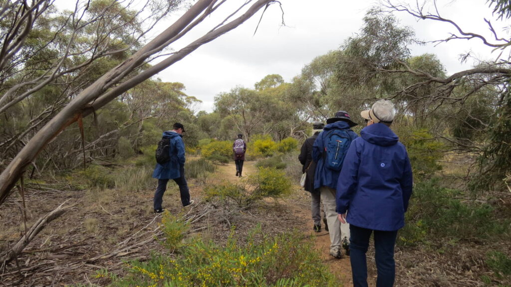
The Semaphore Rail Trail is a pleasant ride or walk through the heart of Semaphore to the beach, then south along the coastal past historic Fort Glanville travelling next to a tourist railway

- This is a pleasant ride from New Port and through the heart of Semaphore to the beach, then south along the coastal path past historic Fort Glanville
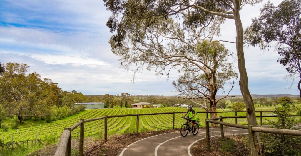
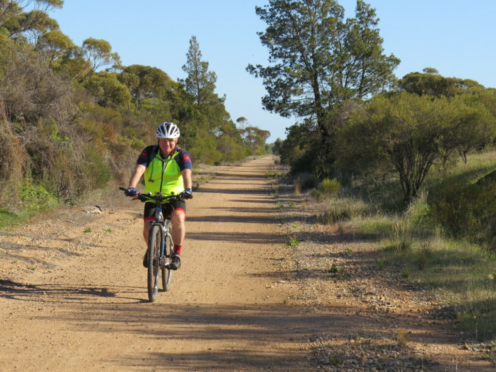
- It is mostly flat and is ideal for children and novice riders.
- There are cafes, toilets and picnic facilities along the beach section of this trail.
- It connects with the Outer Harbor Greenway, which can take you to the city or Outer Harbor.
- From Semaphore, the Coast Park Path rail trail can take you further north or south
Nearby Attractions
- Semaphore Rd for shopping, cafes, cinema
- Semaphore and Fort Glanville Tourist Railway
- New Port’s cafes and historic views
- Coast Park
- Semaphore Jetty
- Fort Glanville’s open days
- Playground and picnic areas at Semaphore Park
- Rail, aviation and maritime museums in Port Adelaide
- Tugboat Fearless
Last updated: 11 May 2025
The Semaphore Rail Trail starts at the intersection of Semaphore Rd and Panama Dr, west of Nelson St and the Birkenhead Bridge, a bascule bridge over the Port River with two lifting spans. It finishes at Semaphore Park, just south of Fort Glanville.
Section Guides
New Port to Semaphore Jetty (1.5 km)
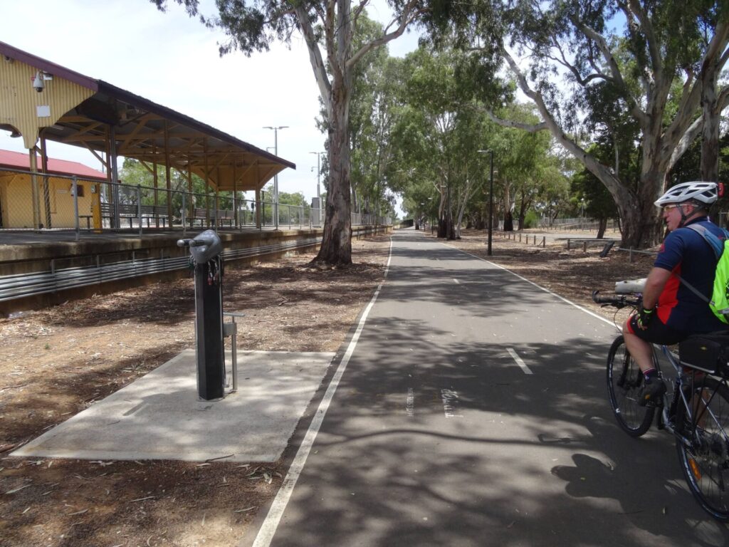
- The New Port area is undergoing major redevelopment along Semaphore Drive, so there is limited parking. You can catch the Outer Harbor train to Glanville Station, ride out on the Outer Harbor Greenway or take your chances parking in the area around Panama Dr.
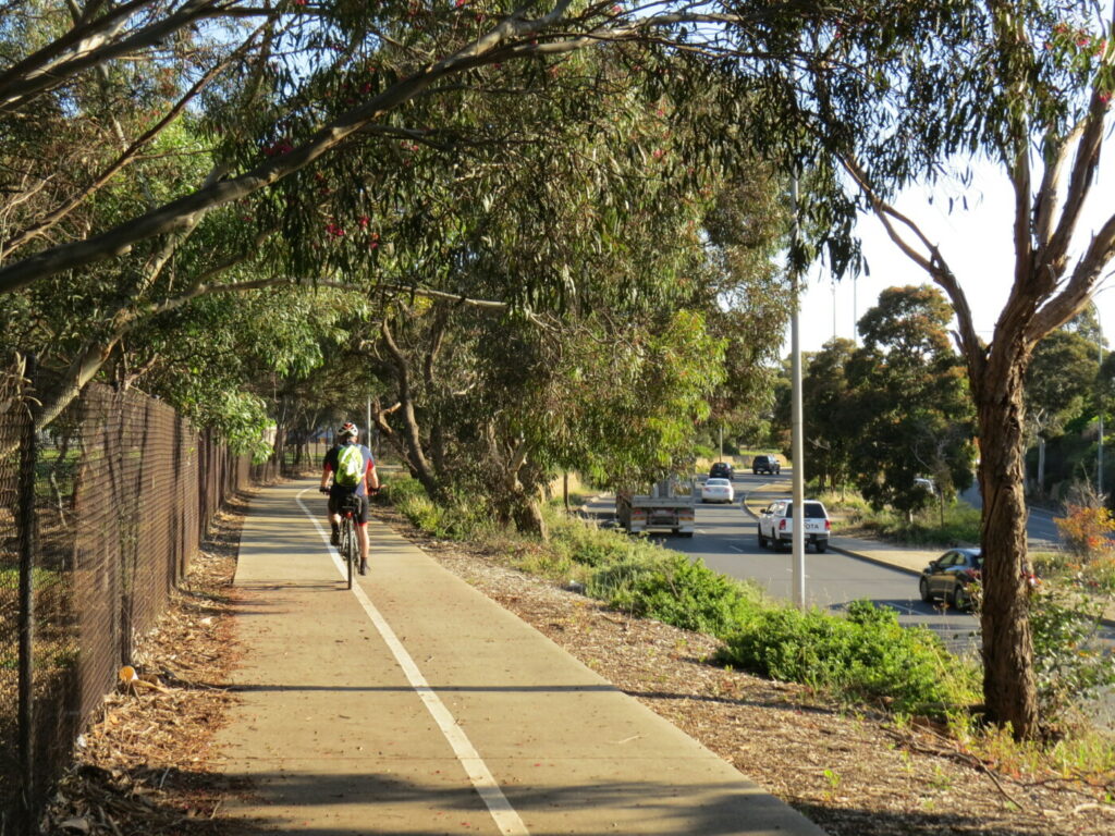
- From Panama Dr, head west on the shared path on the southern side of Semaphore Rd. Watch for Outer Harbor Greenway rail trail users, approaching along Panama Dr from the east.
- Pass the New Port residential developments on the left, with views over the old docks, as the Outer Harbor trail users turn right up Mead St.
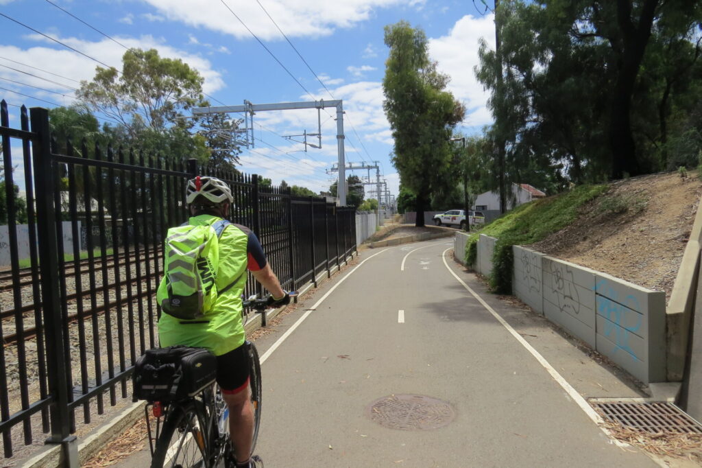
- Cross the Outer Harbor Line near Glanville Station, which was a stop on the Semaphore Railway, and then cross Causeway Rd at the lights.
- From Causeway Rd there is a choice of on-road bicycle lanes or a marked bike lane on the wide footpath.
- The next Semaphore Line station, Exeter, was on the other side of Semaphore Rd, near its junction with Woolnough St, and the train ran up the wide median
- After crossing Military Rd, the footpath bicycle lane goes onto the road for the last block to the beach.
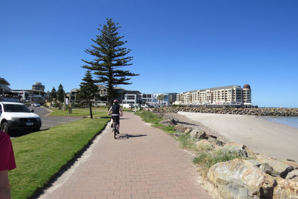
- At the point where the road descends toward Esplanade, the raised Semaphore Station stood on what is now the median strip. Cross the Esplanade at the lights and either continue straight ahead to walk the jetty or turn left to get to Semaphore Park.
Semaphore Jetty return (1 km)
- The jetty originally had a railway line on it to transport goods to and from berthed ships. Bicycles are not permitted but it is a very pleasant walk.
Semaphore Jetty to Semaphore Park (1.7 km)
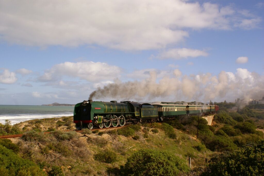
- Just south of the jetty is the Semaphore & Fort Glanville Railway tourist steam train terminus and turntable, a café and large playground.
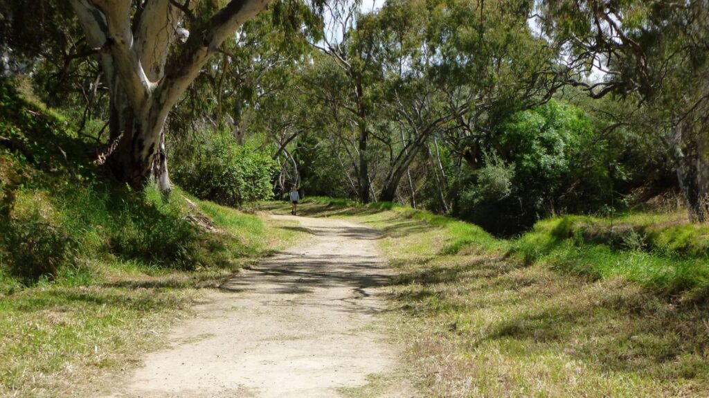
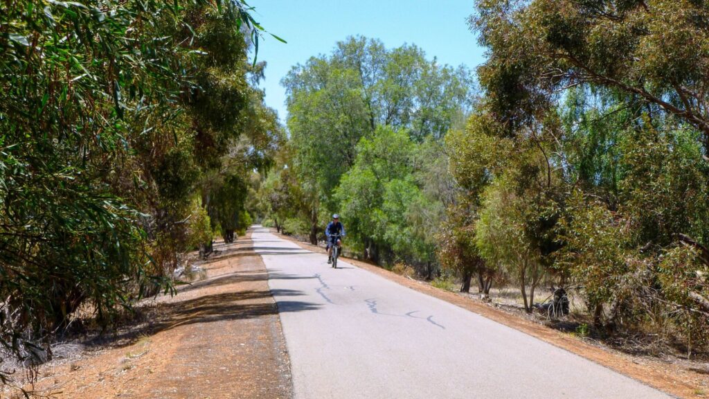
- The sealed railside trail goes south through landscaped parks, following the narrow-gauge railway line. South of Bower Rd, the trail is immediately adjacent to the railway line through sandhills.
- Access to historic Fort Glanville is from Military Rd, near the intersection with Bower Rd, which is worth a look even if it’s not an open day.
- The railside trail section finishes at the Glanville tourist railway station, although the Coast Park Path continues south to Grange.
- Just after the station is Semaphore Park, a large open space with picnic facilities, toilets and playground.
CONNECTING PATHS
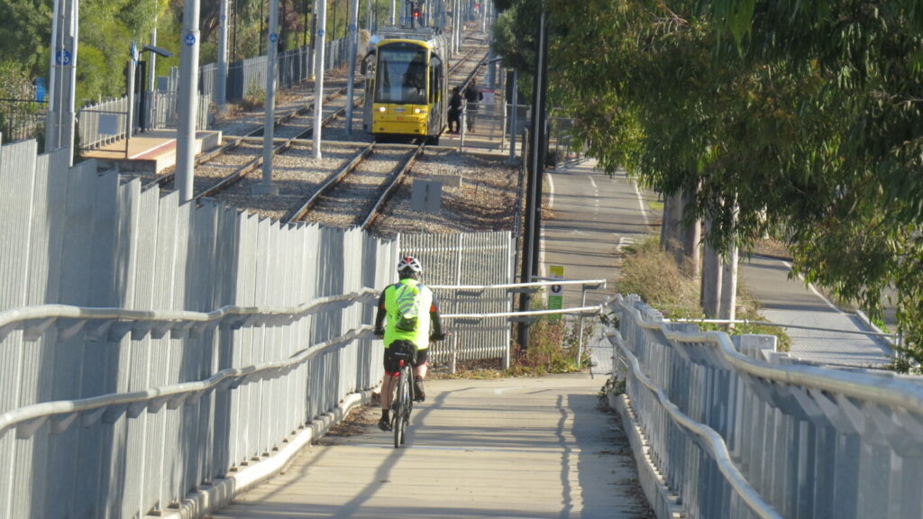
- The Outer Harbor Greenway (23 km): Comes up Semaphore Rd, crosses near Glanville Station and continues north to Outer Harbor. It also heads south over the Birkenhead Bridge (Nelson St) and through Port Dock to the CBD.
- The Coast Park Path (34 km): Follows the shore from Outer Harbor to Marino, with a 2 km gap to be filled between Semaphore Park and Grange. This requires a detour onto Military Rd, but the rest is a great scenic ride and ideal for children and novice riders.
- Inner Harbour/Anna Rennie Loop Path (3.5 km): Turns off Semaphore Rd just before the Semaphore Rail Trail. It circles the New Port precinct and there are many interactive maps that allow visitors to superimpose historical photographs from a century ago over today’s view of the same areas. Hart’s Mill Playground is a convenient place to rest while the kids burn-off some energy.
![Crossing Fletcher St on the Semaphore Rail Trail near Glanville Station [2024]](jpg/s04-001-semaphore-rt-semaphore-road-nov-24-300x169.jpg)
Crossing Fletcher St on the Semaphore Rail Trail near Glanville Station [2024]
![Elegant paved bicycle lane on the Semaphore Rd footpath [2024]](jpg/s04-005-semaphore-rt-semaphore-road-cyclepath-nov-24-300x225.jpg)
Elegant paved bicycle lane on the Semaphore Rd footpath [2024]
![Curved, "traffic calming" approach to Swan Tce on the footpath [2024]](jpg/s04-007-semaphore-rt-semaphore-road-nov-24-300x225.jpg)
Curved, "traffic calming" approach to Swan Tce on the footpath [2024]
![Semaphore Station site on median strip (left) and the 500 m jetty [2024]](jpg/s04-012-semaphore-rt-semaphore-station-site-and-jetty-nov-24-300x225.jpg)
Semaphore Station site on median strip (left) and the 500 m jetty [2024]
![The Semaphore tourist railway station has a turntable and kiosk [2024]](jpg/s04-017-semaphore-rt-semaphore-station-and-kiosk-nov-24-300x225.jpg)
The Semaphore tourist railway station has a turntable and kiosk [2024]
![You can't get much closer than this to a working steam train [2024]](jpg/s04-023-semaphore-rt-close-steam-train-nov-24-300x200.jpg)
You can't get much closer than this to a working steam train [2024]
![Shadowing the tourist line as it approaches Fort Glanville Station [2024]](jpg/s04-025-semaphore-rt-railway-approaching-fort-glanville-station-nov-24-e1741308705905-300x115.jpg)
Shadowing the tourist line as it approaches Fort Glanville Station [2024]
![Regular sand clearing is required at Fort Glanville Station [2024]](jpg/s04-027-semaphore-rt-fort-glanville-station-and-turntable-nov-24-300x225.jpg)
Regular sand clearing is required at Fort Glanville Station [2024]
![Semaphore Park's lavish facilities south of the tourist railway [2025]](jpg/s06-150-semaphore-parks-lavish-facilities-south-of-the-tourist-railway-2025-img_5736-300x225.jpg)
Semaphore Park's lavish facilities south of the tourist railway [2025]
The Port Adelaide Visitor Information Centre https://www.cityofpae.sa.gov.au/visit/visitor-information-centre offers free bike hire.
Free bike hire is also available from the Semaphore Library on Semaphore Road.
MyRide cycle shop on Semaphore Road offers sales, service and spares My Ride Semaphore
Do you know of a bike hire or transportation service on this rail trail that should appear here? If so, let us know at admin@railtrails.org.au.
Information and Links
The trail is managed by The City of Port Adelaide Enfield. To report any issues or problems:
City of Port Adelaide Enfield – Ph: 08 8405 6600 or se*****@**************ov.au
For further information go to:
Rail timetables at Adelaide Metro
Semaphore Line history
Semaphore and Osborne Lines video
Semaphore Line photos
Semaphore tourist railway information
Semaphone tramlines history
Fort Glanville Conservation Park information
Contact Rail Trails Australia
To contact us about this rail trail, email sa@railtrails.org.au
Background Information
Traditional Owners
We acknowledge the Kaurna people, the traditional custodians of the land and waterways on which the rail trail is constructed.
Development and Future of the Rail Trail
This rail trail has been built to follow several historic lines and the operational tourist railway. Further development in the Dock One precinct of Port Adelaide will allow it to connect safely with Port Dock Station and the Outer Harbor Greenway to the city.
Rail Line History
The Semaphore Line was built from Port Adelaide in 1878 to serve the new overseas shipping jetty at Semaphore and bring in supplies to be carried along Military Rd to nearby Fort Largs, to the north, and Fort Glanville, 2km south. It remained the main harbour line until the Outer Harbor one was built north from a junction at Glanville in 1908. The Semaphore Line closed after 100 years in 1978. The tracks were removed, with only the wide median strip on Semaphore Rd indicating that there had been a railway up the middle. A freight line was constructed in the 1920s from Glanville Station alongside Semaphore Rd and Port River to Osborne. It closed in 2008 when the Mary MacKillop Bridge was opened for the freight trains.
A tram line opened in 1917, running from Albert Park through Port Adelaide to Semaphore. It also used Semaphore Rd west of Military Rd and closed in 1935.
The National Railway Museum’s volunteers operate the narrow-gauge steam railway from Semaphore to Fort Glanville. It departs from the foot of the jetty and parallels the Esplanade before passing through the dunes near Fort Glanville at Point Malcolm. The locomotive is a simplified version of a 1890s concept for the coastline, when a military railway was planned to run from Glenelg along the foreshore to Fort Glanville and Fort Largs. That venture only progressed to West Beach. About 100 years later, the Port Adelaide Enfield and Charles Sturt councils financed the current narrow-gauge steam railway as a tourist attraction.
Nearby Trails
Outer Harbor Greenway railside trail
Adelaide CBD
23 km


Stockade Rail Trail
11 km north of Adelaide CBD
2.6 km
Coast Park Path Rail Trail
12km north-west of Adelaide CBD
25 km
Gawler Greenway railside trail
Adelaide CBD
14 km
Westside Bikeway rail trail
2 km west of Adelaide CBD
9 km
Parafield railside trail
15 km north of Adelaide CBD
3 km
Mike Turtur Bikeway railside trail
Adelaide CBD
9 km
O-Bahn Bikeway trail
Adelaide CBD
16 km
Marino Rocks Greenway rail trail
Adelaide CBD
16 km
Penfield railside trail
20 km north of Adelaide CBD
7 km
Smithfield Magazine Rail Trail
33 km north of Adelaide CBD
3.5 km
Coast to Vines Rail Trail
20 km south of Adelaide CBD
37 km

Amy Gillett Bikeway rail trail
Adelaide Hills, 49 km east of CBD
23 km
Mount Barker Rail Trail
Adelaide Hills, 33km south-east of CBD
5 km
Barossa Rail Trail
Barossa Valley, 50 km north-east of Adelaide
43 km
Kapunda Rail Trail
78 km north of Adelaide
1 km
Nurragi Conservation Reserve rail trail
Fleurieu Peninsula, 70 km south-east of Adelaide
13 km
Encounter Bikeway railside trail
Fleurieu Peninsula, 85 km south of Adelaide
28 km
Eudunda Rail Trail
112 km north of Adelaide
1 km
Shamus Liptrot Rail Trail
Adelaide Plains, 100 km north of Adelaide
11 km

Riesling and Rattler Trails
Clare Valley, 130 km north of Adelaide
53 km
Copper Rail Trail
Adelaide Plains, 100 km north of Adelaide
39 km
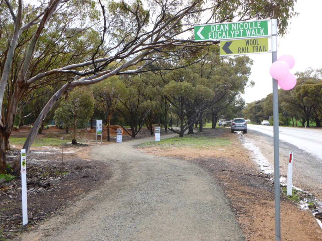
Wool Rail Trail
130 kms north of Adealide
2.2 km
Nearby Trails
Outer Harbor Greenway railside trail
Adelaide CBD
23 km
Stockade Rail Trail
11 km north of Adelaide CBD
2.6 km
Coast Park Path Rail Trail
12km north-west of Adelaide CBD
25 km
Gawler Greenway railside trail
Adelaide CBD
14 km
Westside Bikeway rail trail
2 km west of Adelaide CBD
9 km
Parafield railside trail
15 km north of Adelaide CBD
3 km
Mike Turtur Bikeway railside trail
Adelaide CBD
9 km
O-Bahn Bikeway trail
Adelaide CBD
16 km
Marino Rocks Greenway rail trail
Adelaide CBD
16 km
Penfield railside trail
20 km north of Adelaide CBD
7 km
Smithfield Magazine Rail Trail
33 km north of Adelaide CBD
3.5 km
Coast to Vines Rail Trail
20 km south of Adelaide CBD
37 km
Amy Gillett Bikeway rail trail
Adelaide Hills, 49 km east of CBD
23 km
Mount Barker Rail Trail
Adelaide Hills, 33km south-east of CBD
5 km
Barossa Rail Trail
Barossa Valley, 50 km north-east of Adelaide
43 km
Kapunda Rail Trail
78 km north of Adelaide
1 km
Nurragi Conservation Reserve rail trail
Fleurieu Peninsula, 70 km south-east of Adelaide
13 km
Encounter Bikeway railside trail
Fleurieu Peninsula, 85 km south of Adelaide
28 km
Eudunda Rail Trail
112 km north of Adelaide
1 km
Shamus Liptrot Rail Trail
Adelaide Plains, 100 km north of Adelaide
11 km
Riesling and Rattler Trails
Clare Valley, 130 km north of Adelaide
53 km
Copper Rail Trail
Adelaide Plains, 100 km north of Adelaide
39 km
Wool Rail Trail
130 kms north of Adealide
2.2 km
One review of “Semaphore Rail Trail”
19/70 Did this one after Outer Harbor. Interesting area with the shopping strip, miniature train and beautiful parks. Can't wait for it to become part of the Coast Park Path, but maybe that won't happen in my lifetime.