 Location:
 Length:
 Surface:
 Start / End:
 Suitable for:
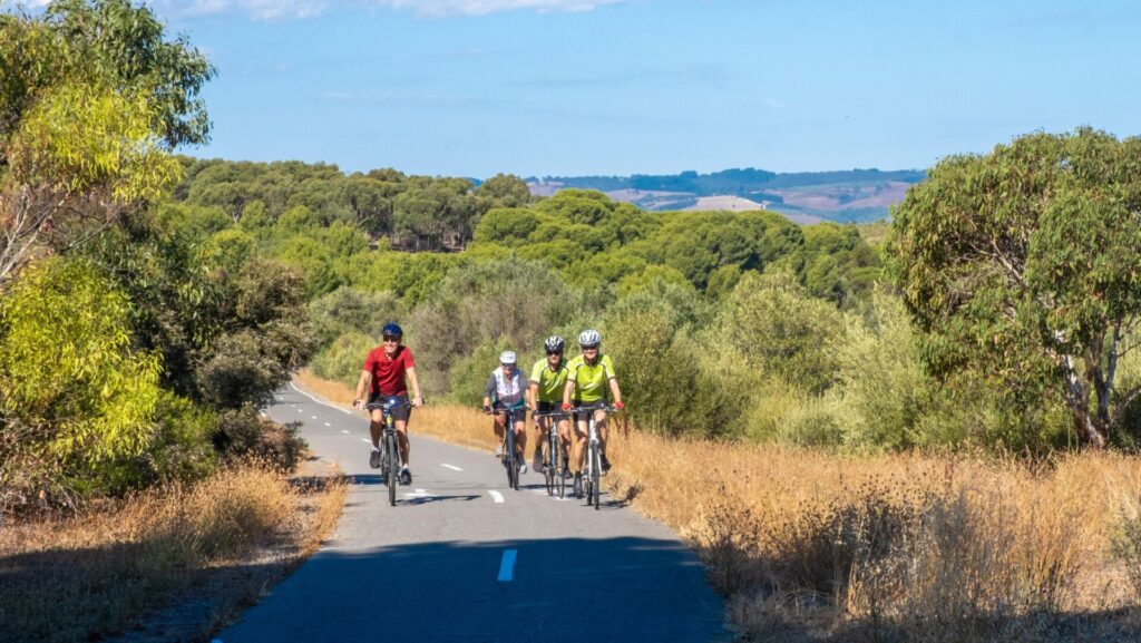
An intriguing insight into alternative public transport solutions, the trail along the O-Bahn lets you see how it works.

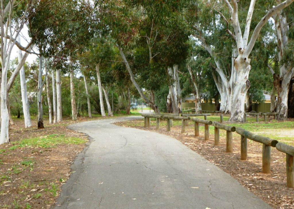
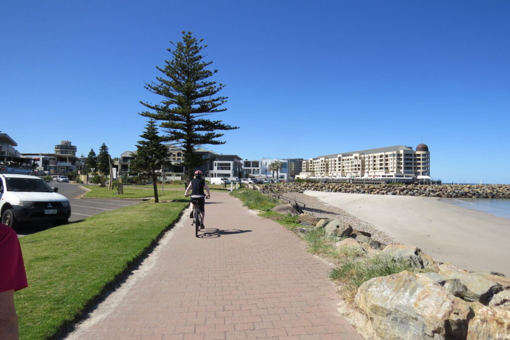
- The trail follows the river and the busway, providing a scenic linear parkland environment
- It’s an opportunity to see the concept of a railway line designed for buses
- It is one of very few in the world
- The shared path provides a strategic link in the city’s vast trail network
Nearby Attractions
- The River Torrens linear park
- The Dunstan Adventure Playground is a definite stopping point if you are riding with children
- The Gilberton Swing Bridge crossing the river from St Peters to Gilberton at the site of the Gilberton Swimming Pool
- Hope Valley Reservoir, constructed in 1873 and still in use
- Gawler Rail Trail, Outer Harbor Rail Trail, Westside Rail Trail, Mike Turtur Rail Trail and Marino Rocks Greenway
Last updated: 2 May 2025
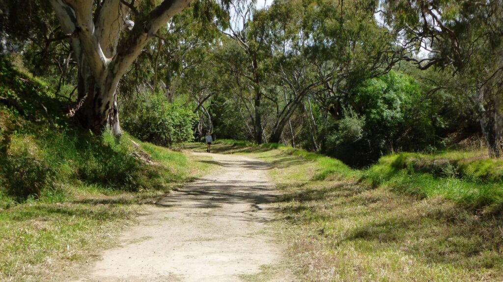
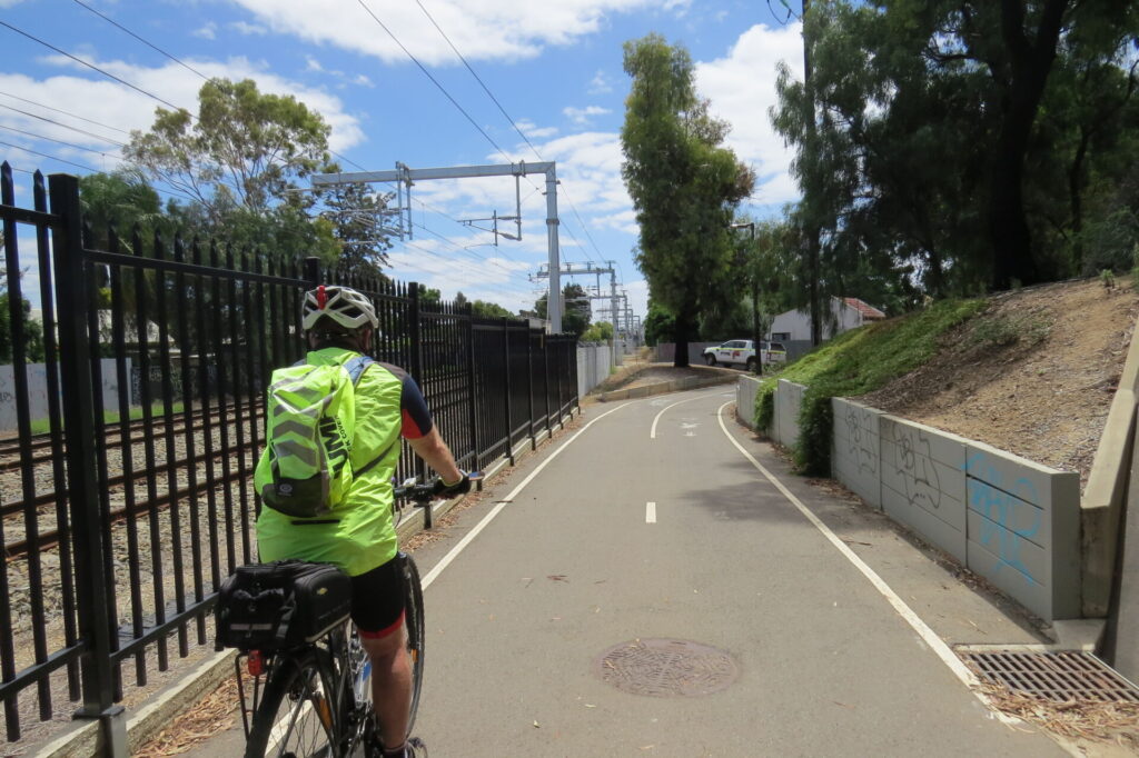
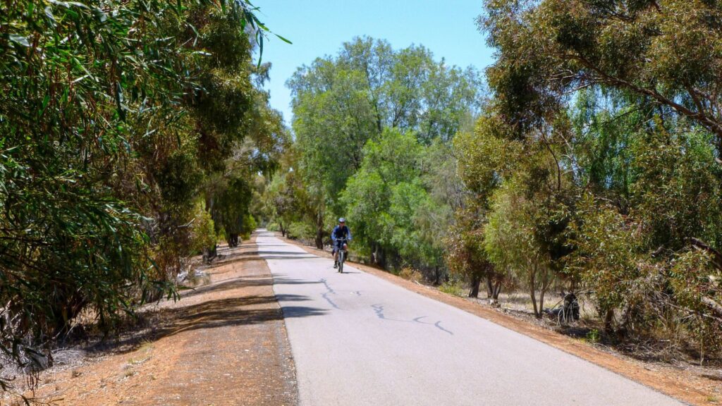
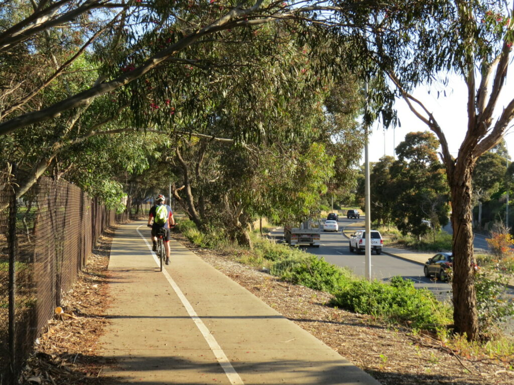
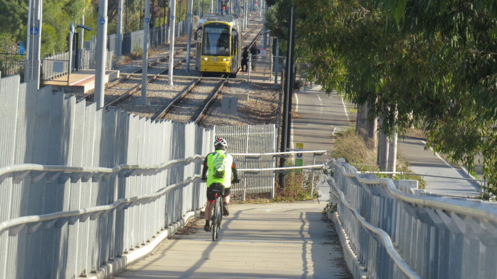
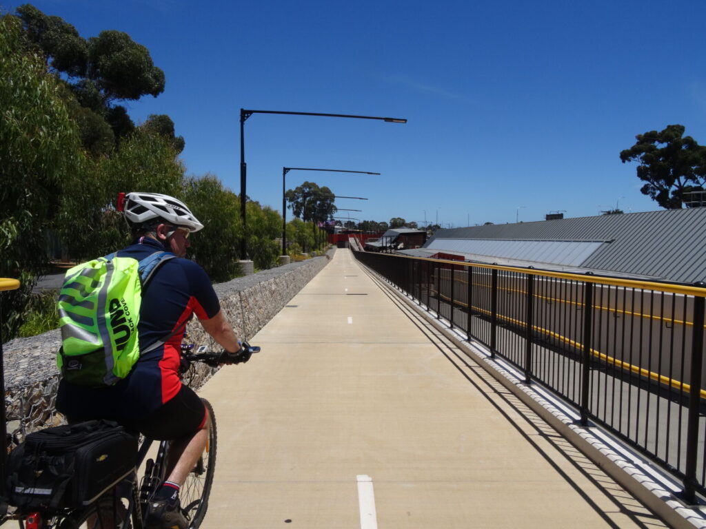
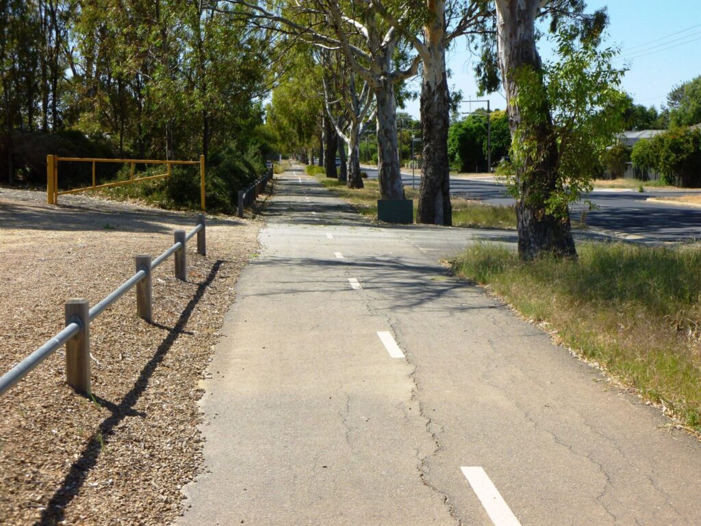
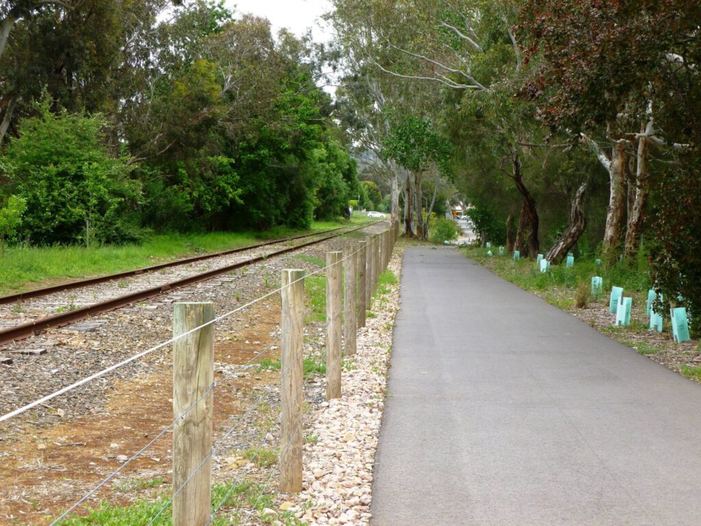
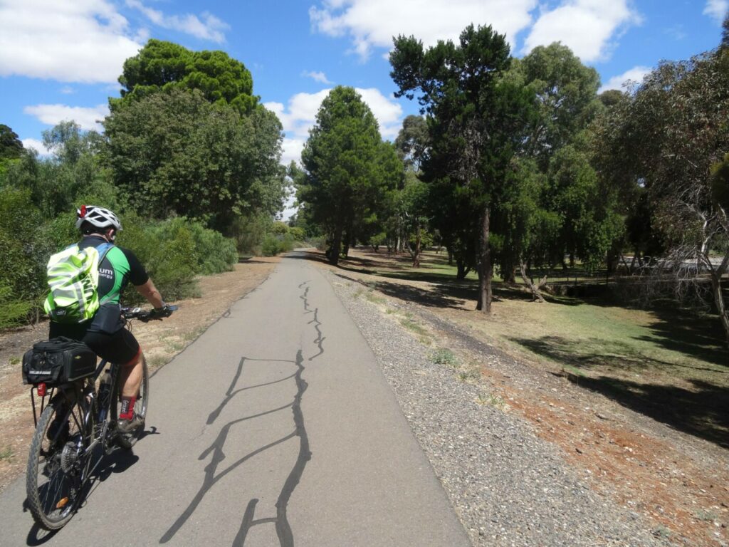
The O-Bahn is a German concept. It uses buses on a concrete-guide track instead of a conventional train and carriages. The trail follows the O-Bahn for the majority of its length and, while it is predominantly a sealed shared-use path, there are sections on quiet side roads. The trail makes use of the many O-Bahn overpasses and underpasses to provide pleasant riding. The few road crossings that you will encounter are generally quiet roads that are easy to cross. There are trails on both sides of the O-Bahn but we have described the trail that provides a more scenic and continuous journey.
Section Guides
CBD to Paradise Interchange (11 km)
- The trail starts at the eastern end of Grenfell St in the Adelaide CBD, where the O-Bahn buses enter a tunnel before re-emerging on Hackney Rd. It’s on the southern side of the portal
- Proceed past Rymill Lake and follow the Parklands Trail to the corner of Botanic Rd and Dequetteville Tce.
- Cross Botanic Rd and follow the narrow footpath which opens up into a proper shared-use path. The Wine Centre and botanic gardens are on the left and the O-Bahn tunnel ends in the middle of the road on the right.
- Continue to the River Torrens, crossing it on the shared bridge and then turn sharp left and ride under the road bridge.
- Continue heading upstream and cross the River Torrens again, using the low-level bridge. Follow the path which is adjacent to the river, past St Peters Park on the right and St Peters Weir on the left, the path will go under an O-Bahn bridge and then continue to follow the river.
- The trail crosses the O-Bahn just past the Felixstow Reserve. This bridge crossing gives a good view of the O-Bahn track. The path continues on to the river, which is crossed using a low-level bridge then continues to the right, following the river upstream.
Paradise Interchange to Modbury (5 km)
- When the trail goes under Darley Rd, the O-Bahn track can be seen ahead and the Paradise Interchange is over Darley Rd on the right. Continue on to Brookvale Rd
- There are two options for approaching the hill on Brookvale Rd. You can ride up the steep bit or cross under the O-Bahn and ride up the less-steep Willowbrook Rd. The return trip down Brookvale Rd is a lot of fun.
- At Parsons Road turn left and then turn right into the small reserve on the corner of Parsons Road and Glenwood Walk and follow the path until you come to Lyons Road. Cross Lyons Road and follow the path adjacent to the O-Bahn and then through the bridge under the O-Bahn track. Alternatively, you can take the side trail (see below) and cross Lyons Road and follow Lyons Road until you get to the entrance to the Hope Valley Reservoir. Follow the path along the top of the Reservoir head wall then up through the park to the northwestern corner of the reserve and follow the path through the gate to reconnect with the O-Bahn Rail Trail.
- The trail continues adjacent to the O-Bahn. Take the first left turn leading under the O-Bahn track and then turn right and follow the path adjacent to the O-Bahn track.
- The trail follows the O-Bahn track, going under Reservoir Road and then exiting briefly onto Meadowvale Road to the left. Follow Meadowvale Road for 100m and then rejoin the path in the reserve on the right, following it and the O-Bahn track across a creek and up to Smart Road.
- The trail can be followed into the Tea Tree Plaza shopping centre, but this is not a bike friendly area. Your best option is to return to Adelaide on the O-Bahn trail. You may want to consider returning via the Dry Creek Trail and the City to Levels Bikeway if you have the time.
CONNECTING PATHS
Adelaide Parklands Trail – 19.5 km
The Adelaide CBD is surrounded by a 600 m wide strip of parklands which contains gardens, sporting facilities, recreation facilities, art and cultural facilities. A myriad of trails have been constructed throughout the parklands however the council has developed a 19.5 km shared-use path that forms a loop around the city. The trail overlaps the O-Bahn trail and is the starting point for five rail trails (Gawler, Outer Harbor, Westside, Mike Turtur and Marino Rocks rail trails).
City to Levels Bikeway – 18 km
The City to Levels Bikeway links with the O-Bahn Rail Trail at Fuller Street, Walkerville. The trail is located on minor, low traffic roads and links with the Dry Creek Trail and Stockade Rail Trail.
Dry Creek Trail/Stockade Rail Trail – 17.5km
At Baymor Reserve, 804 North East Rd, Modbury, a 400m path, connects the O-Bahn Rail Trail with the Dry Creek Trail. The Dry Creek Trail extends 6.5 km northward to Wynn Vale Dam and 5 km west to link with the Stockade Rail Trail (it also connects with the City to Levels Bikeway at this point). Dry Creek Trail continues for a further 6 km to link with the Gawler Rail Trail.
![O-Bahn bus entering tunnel in Adelaide Parklands. Trail starts to the right [2025]](jpg/s07-050-obahn-bus-entering-tunnel.-trail-to-the-right-2025-img_5674-300x225.jpg)
O-Bahn bus entering tunnel in Adelaide Parklands. Trail starts to the right [2025]
![O-Bahn over the River Torrens and shared path at Marden [2024]](jpg/01-20-o-bahn-bridge-over-the-river-torrens-and-cycle-track-at-marden-300x200.jpg)
O-Bahn over the River Torrens and shared path at Marden [2024]
![Elevated trail above the River Torrens at Walkerville [2024]](jpg/01-30-elevated-trail-on-decking-above-the-river-torrens-at-walkerville-300x200.jpg)
Elevated trail above the River Torrens at Walkerville [2024]
![O-Bahn bus passes cyclist on the trail at Walkerville [2024]](jpg/01-40-trail-adjacent-to-the-o-bahn-at-walkerville-300x200.jpg)
O-Bahn bus passes cyclist on the trail at Walkerville [2024]
![Trail adjacent to the O-Bahn at Joslin [2024]](jpg/01-50-trail-adjacent-to-the-o-bahn-at-joslin-300x200.jpg)
Trail adjacent to the O-Bahn at Joslin [2024]
![O-Bahn bus passing under a shared bridge at Windsor Gardens [2024]](jpg/01-10-image-of-the-o-bahn-taken-from-a-cycle-path-bridge-over-the-track-at-windsor-gardens-300x200.jpg)
O-Bahn bus passing under a shared bridge at Windsor Gardens [2024]
![Gilberton Swing Bridge to the trail over the river at St Peters [2024]](jpg/01-60-suspension-bridge-over-the-river-torrens-at-st-peters.-the-photo-is-taken-from-the-edge-of-the-trail-300x200.jpg)
Gilberton Swing Bridge to the trail over the river at St Peters [2024]
![O-Bahn bus passing cyclist on the approach to the Reservoir Rd underpass at Holden Hill [2024]](jpg/02-10-o-the-trail-adjacent-to-the-o-bahn-near-tea-tree-plaza-300x200.jpg)
O-Bahn bus passing cyclist on the approach to the Reservoir Rd underpass at Holden Hill [2024]
![Cyclist crossing a creek with the O-Bahn trail in the background near Modbury [2024]](jpg/02-20-trail-crossing-a-creek-near-tea-tree-plaza.-the-o-bahn-is-in-the-background-300x200.jpg)
Cyclist crossing a creek with the O-Bahn trail in the background near Modbury [2024]
![The Hope Valley Reservoir trail at Holden Hill [2024]](jpg/02-30-side-trail-over-the-hope-valley-reservior-wall-at-holden-hill-300x200.jpg)
The Hope Valley Reservoir trail at Holden Hill [2024]
Do you know of a bike hire or transportation service on this rail trail that should appear here? If so, let us know at admin@railtrails.org.au.
Information and Links
For further information, or to report any problems, see contacts below:
City of Adelaide – City to Hackney Rd, Hackney
Ph: 08 8203 7203 or cu******@****************om.au
City of Norwood Payneham & St Peters – Hackney Rd to Wicks Ave, Felixstow
Ph: 08 8366 4555 or to******@*********ov.au
City of Port Adelaide Enfield – Fife St, Klemzig, to Riverside Grove, Windsor Gardens
Ph: 08 8405 6600 or se*****@**************ov.au
City of Tea Tree Gully – Riverside Grove, Windsor Gardens to Tea Tree Plaza
Ph: 08 8397 7444 or cu*****************@*********ov.au
Contact Rail Trails Australia
To contact us about this rail trail, email sa@railtrails.org.au
Background Information
Traditional owners
We acknowledge the Kaurna people, the traditional custodians of the land and waterways on which the Gawler Rail Trail is constructed.
Rail line history
The O-Bahn is a German designed guided busway constructed in 1986. A light-rail alternative was rejected as it was too heavy for the poor-quality alluvial soils in the river valley, was wider and would take up more space in the tight confines of the inner city.
The O-Bahn has many of the characteristics of a railway – dedicated track with unimpeded flow, rails and sleepers made of concrete, stations or interchanges along the track, no steering but, as with a train, the driver is responsible for accelerating and braking. The key difference is that the bus is able to leave the track at stations/interchanges and use conventional bus routes. The bus can travel at up to 90 kph on the track.
Development and future of the rail trail
Extension of the O-Bahn further north has been discussed but it is more likely that development of the railway from Adelaide to Gawler will provide for future northern suburbs transportation needs.
Nearby Trails
Stockade Rail Trail
11 km north of Adelaide CBD
2.6 km


Gawler Greenway railside trail
Adelaide CBD
14 km

Parafield railside trail
15 km north of Adelaide CBD
3 km

Outer Harbor Greenway railside trail
Adelaide CBD
23 km
Westside Bikeway rail trail
2 km west of Adelaide CBD
9 km
Mike Turtur Bikeway railside trail
Adelaide CBD
9 km
Penfield railside trail
20 km north of Adelaide CBD
7 km
Semaphore Rail Trail
16 km north-west of Adelaide CBD
4.2 km
Coast Park Path Rail Trail
12km north-west of Adelaide CBD
25 km
Marino Rocks Greenway rail trail
Adelaide CBD
16 km
Smithfield Magazine Rail Trail
33 km north of Adelaide CBD
3.5 km
Amy Gillett Bikeway rail trail
Adelaide Hills, 49 km east of CBD
23 km

Mount Barker Rail Trail
Adelaide Hills, 33km south-east of CBD
5 km
Coast to Vines Rail Trail
20 km south of Adelaide CBD
37 km
Barossa Rail Trail
Barossa Valley, 50 km north-east of Adelaide
43 km
Nurragi Conservation Reserve rail trail
Fleurieu Peninsula, 70 km south-east of Adelaide
13 km
Kapunda Rail Trail
78 km north of Adelaide
1 km
Encounter Bikeway railside trail
Fleurieu Peninsula, 85 km south of Adelaide
28 km
Eudunda Rail Trail
112 km north of Adelaide
1 km
Riesling and Rattler Trails
Clare Valley, 130 km north of Adelaide
53 km
Shamus Liptrot Rail Trail
Adelaide Plains, 100 km north of Adelaide
11 km

Copper Rail Trail
Adelaide Plains, 100 km north of Adelaide
39 km
Nearby Trails
Stockade Rail Trail
11 km north of Adelaide CBD
2.6 km
Gawler Greenway railside trail
Adelaide CBD
14 km
Parafield railside trail
15 km north of Adelaide CBD
3 km
Outer Harbor Greenway railside trail
Adelaide CBD
23 km
Westside Bikeway rail trail
2 km west of Adelaide CBD
9 km
Mike Turtur Bikeway railside trail
Adelaide CBD
9 km
Penfield railside trail
20 km north of Adelaide CBD
7 km
Semaphore Rail Trail
16 km north-west of Adelaide CBD
4.2 km
Coast Park Path Rail Trail
12km north-west of Adelaide CBD
25 km
Marino Rocks Greenway rail trail
Adelaide CBD
16 km
Smithfield Magazine Rail Trail
33 km north of Adelaide CBD
3.5 km
Amy Gillett Bikeway rail trail
Adelaide Hills, 49 km east of CBD
23 km
Mount Barker Rail Trail
Adelaide Hills, 33km south-east of CBD
5 km
Coast to Vines Rail Trail
20 km south of Adelaide CBD
37 km
Barossa Rail Trail
Barossa Valley, 50 km north-east of Adelaide
43 km
Nurragi Conservation Reserve rail trail
Fleurieu Peninsula, 70 km south-east of Adelaide
13 km
Kapunda Rail Trail
78 km north of Adelaide
1 km
Encounter Bikeway railside trail
Fleurieu Peninsula, 85 km south of Adelaide
28 km
Eudunda Rail Trail
112 km north of Adelaide
1 km
Riesling and Rattler Trails
Clare Valley, 130 km north of Adelaide
53 km
Shamus Liptrot Rail Trail
Adelaide Plains, 100 km north of Adelaide
11 km
Copper Rail Trail
Adelaide Plains, 100 km north of Adelaide
39 km
One review of “O-Bahn Bikeway trail”
A scenic and safe trail following Adelaide's unique guided busway system along the Torrens Valley. There are numerous trail options to explore on either side of the river or busway. A great day out for all the family with a number of parks and playgrounds along the way. There are entry and exit points all along the route and, if only going one way, it is slightly downhill from Modbury to Adelaide. Highly recommended for visitors to Adelaide. Hire a bike from a city location and follow the Torrens.