 Location:
 Length:
 Surface:
 Start / End:
 Suitable for:
A charming trip through the Adelaide Hills that is brilliant in spring and autumn but there's lots to do all year on the Amy Gillett Pathway rail trail

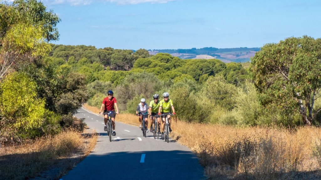
- The trail passes through several Adelaide Hills towns and beautiful rural scenery.
- The full length has been sealed, with gentle grades, and is ideal for children and novice riders.
Nearby Attractions
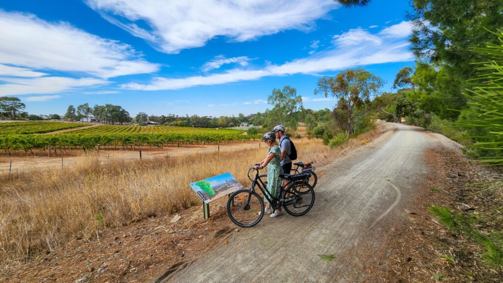
- Wine and food experiences
- Barristers Block vineyard
- National Motor Museum, Birdwood
- Hahndorf German heritage village
- Melba’s Chocolate Factory on the trail at Woodside
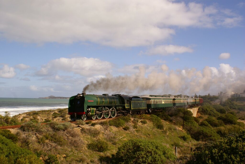
- Steamranger depot in Mt Barker for steam trains south
- Mt Torrens Heritage Walk
- Mt Barker Rail Trail
Last updated: 15 November 2025
The Santos Tour Down Under will take place in and around Adelaide, the Adelaide Hills, Barossa Valley, McLaren Vale and South Coast regions during January 2026. This rail trail may be impacted to varying degrees by the Tour.
Sun 18th January 26: Women’s Stage 2 will pass through Oakbank, Woodside and Mt Torrens. Expect increased cycle and pedestrian traffic on the Amy Gillett Trail between Oakbank and Mt Torrens.
Mon 19th January 26: Women’s Stage 3 will pass through Birdwood, Mt Torrens, Woodside and Oakbank. Expect increased cycle and pedestrian traffic on the Amy Gillett Trail between Birdwood and Oakbank.
Official opening of the Mt Torrens to Birdwood section will take place on 13 November 2025.
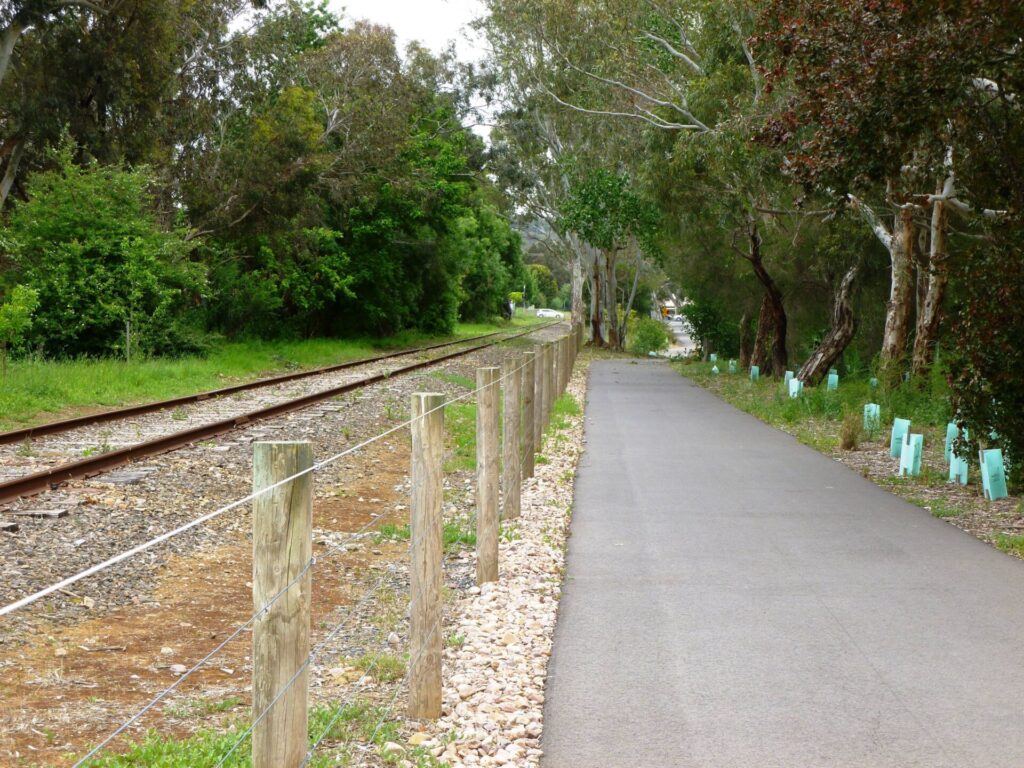
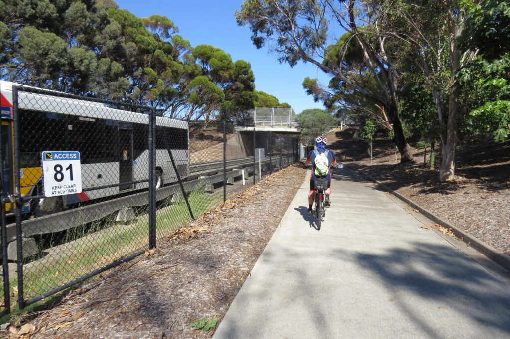
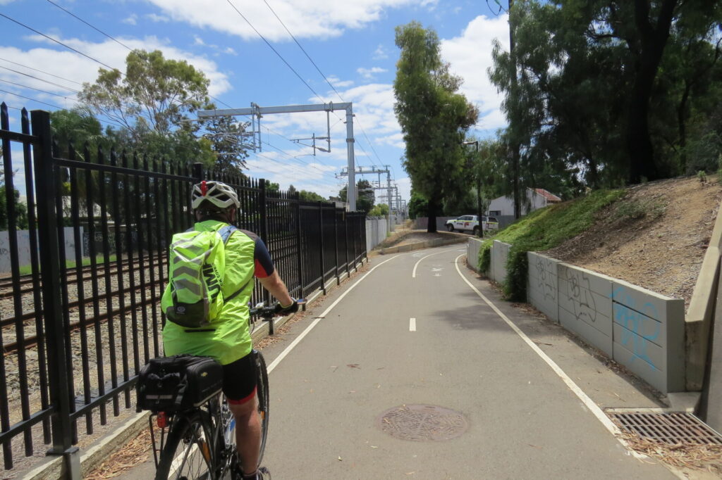
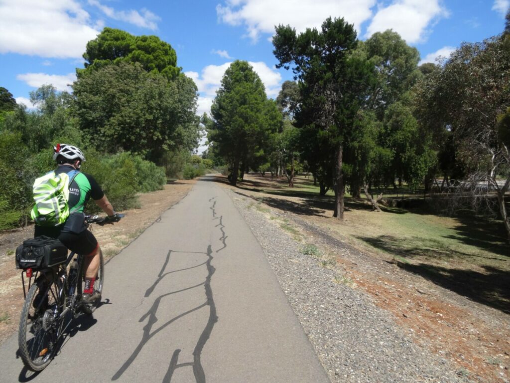
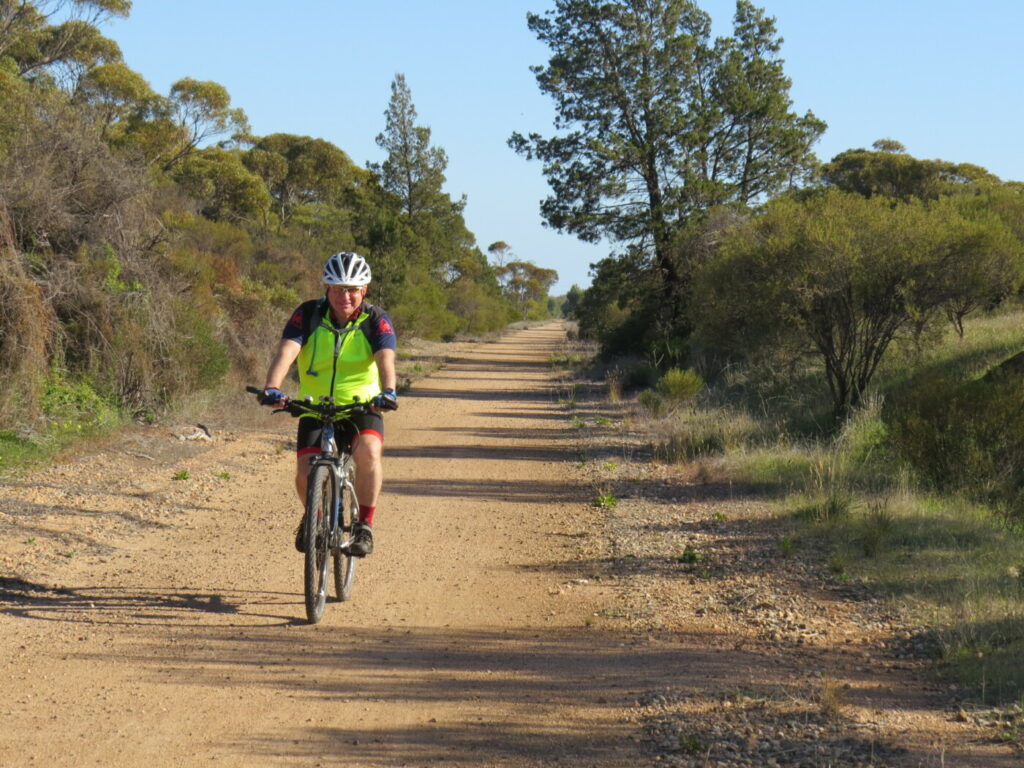
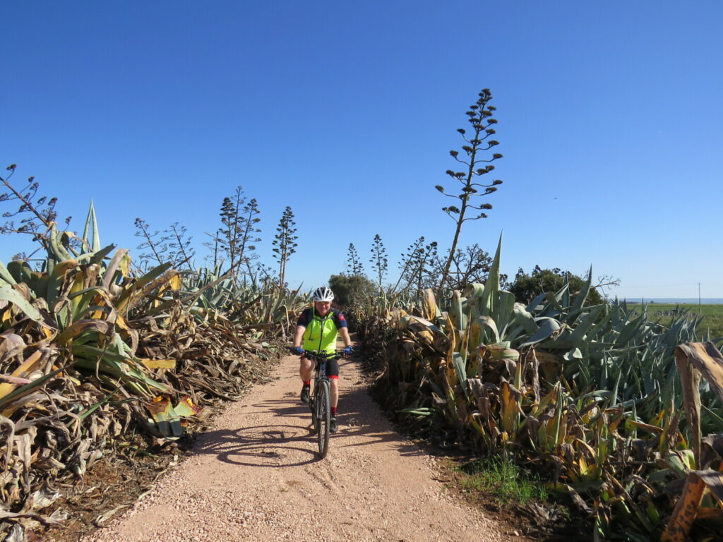
This scenic, shared use trail links the towns of Oakbank, Woodside, Charleston, Mt Torrens and Birdwood via the railway corridor, taking advantage of the topography for panoramic views. It is possible to enjoy a ride all the way from Oakbank to Birdwood almost entirely on traffic-free dedicated shared paths.
Take advantage of coffee shops, bakeries and restaurants in the larger towns. There are toilets and picnic facilities in Woodside, Charleston, Mt Torrens and Birdwood (National Motor museum).
The trail has four main sections:
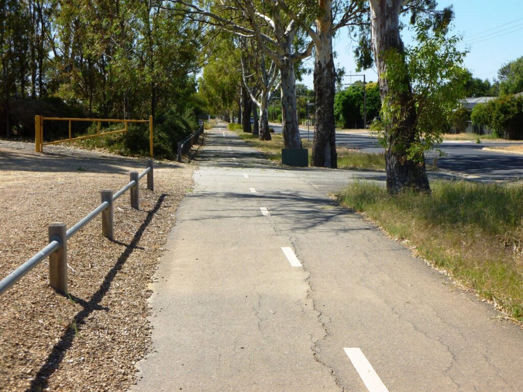
Oakbank to Woodside (5 km): Probably the busiest part of the trail, with a trail hub just out of Oakbank to get you moving.
Woodside to Charleston (5 km): Marks the transition from country town to country
Charleston to Mt Torrens (7 km): A gentle climb most of the way, with a freewheel into Mt Torrens
Mt Torrens to Birdwood (6km): A peaceful ride along a heavily wooded rail corridor
Section Guides
Oakbank to Woodside (5 km)
- The trailhead is on the corner of Onkaparinga Valley Rd and Gillman Rd, about 500m north of the Oakbank town centre. Here there’s parking, seating, water, a bike repair station and bus stops.
- Oakbank is a small town, with a pub, eateries and a racecourse, home of steeplechasing and jumping in SA, including the Great Eastern Steeplechase.
- The trail is a hot-mix asphalt surface that follows the old railway alignment northeast for 3.5 km.
- At Woodside, there are facilities at the recreation ground just before the trail crosses Onkaparinga Valley Rd and curves behind the shops.
- There are cafes and bakeries on Onkaparinga Valley Rd as well as a good bike shop (Bicycle Fix corner of Onkaparinga Valley Road and Tiers Road).
- If you’re looking for a little excitement, the Woody Trails BMX/MTB tracks is on the left at the Woodside Station site. It is landscaped and maintained by volunteers from the Love Woodside Group. The station’s well, which used to supply water to steam trains and stock, has been restored. There is ample parking on Station Rd near the tracks, picnic facilities and a bike repair station.
- You can use the streets opposite Woody Trails (Post Office Road, Station Road and Langbien Road) to access the eateries, 50m away, on Onkaparinga Valley Road.
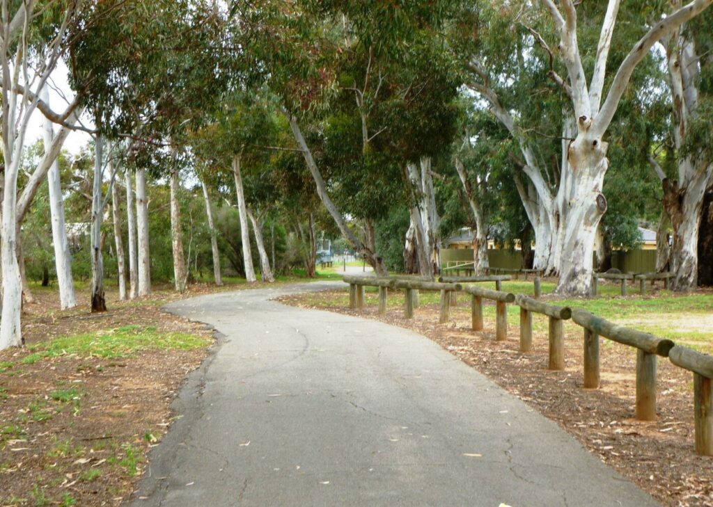
- From the end of Langbein Av, the trail returns to the railway alignment and passes through a picturesque, heavily wooded section of Woodside.
- The trail passes Barristers Block Winery on the left before it again crosses Onkaparinga Valley Rd.
- Melba’s Chocolate Factory and Woodside Cheesewrights are signposted to the right just north of the road crossing.
Woodside to Charleston (5 km)
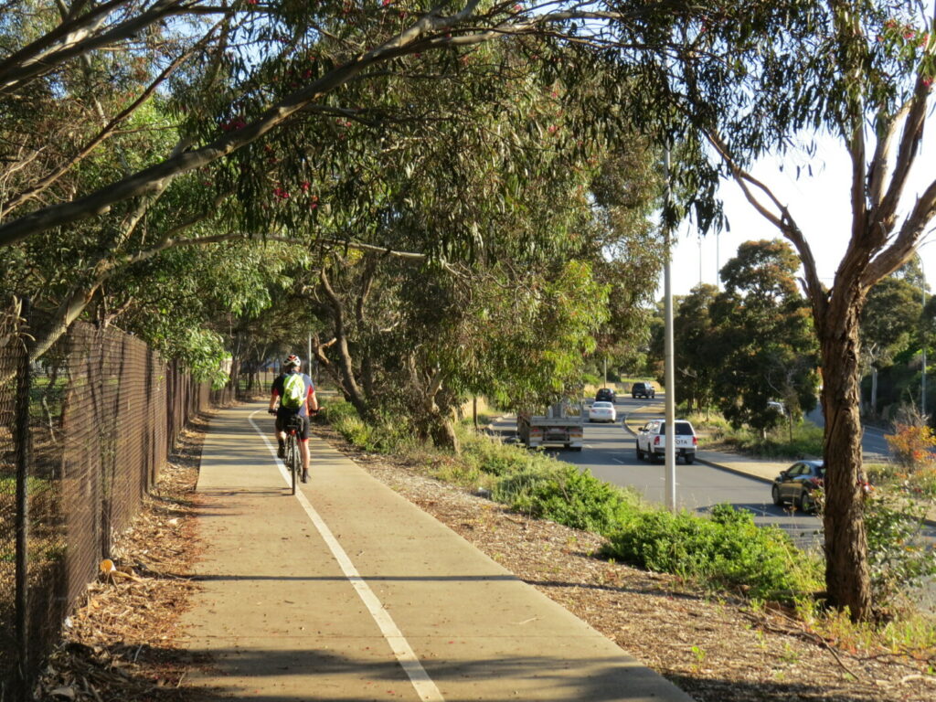
- There are several more road crossings along this section and a few more wineries.
- At Charleston, the trail does a dog-leg to the right along Newmans Rd.
- Newman Park, a shaded picnic area with ample parking, toilets, playground and free BBQ, is located on Newman Road, near its intersection with Onkaparinga Valley Rd.
- Hope Blooms Café is located on Newman Road, immediately opposite the playground. A good chance for a coffee while the kids enjoy the playground. Hope Blooms Café is open Wednesday to Saturday, 7.30am to 2.30pm.
- Charleston Hotel does lunch and dinner 7 days, and all-day meals on weekends.
Charleston to Mt Torrens (7 km)
- This section features scenic farmland and traverses deep, shady cuttings and high embankments. It is a steady climb from Charleston to the road crossing approaching Mt Torrens. There is a large rubble carpark on the northern side of the point where the trail crosses Onkaparinga Valley Road. This is the highest point of the trail. This area has a bike repair Station and the entrance to Lobethal Road Winery is located immediately opposite the carpark, on the southern side of Onkaparinga Valley Road. The cellar door is open Thursday to Monday, 11am to 5pm. Meals and platters are available. Further details are available from lobethalroad.com.
- After a short downhill run, the trail reaches Oval Rd on the northwest side of Mt Torrens; turn right on to Oval Rd for access to Mt Torrens township. Mt Torrens has a general store and hotel. Toilets and a defibrillator are located at the oval.
Mt Torrens to Birdwood (6km)
- The section of the trail commences from Oval Road and slowly descends into a lush valley. The old Mt Torrens Railway station was located adjacent to the trail at the start of this section.
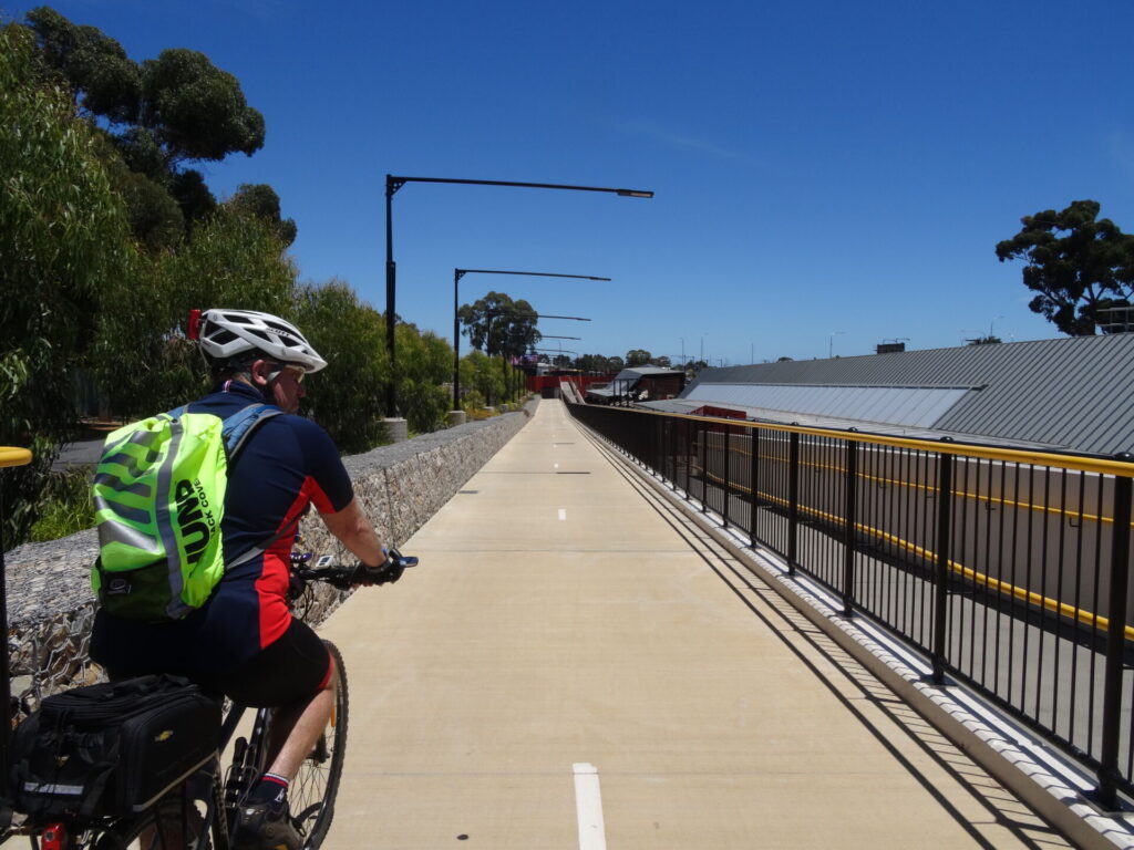
- The Burford’s Hill Railway Bridge has been restored and now carries cyclists and walkers over Burford’s Hill Road. As rubble has been removed from the northern abutment of the bridge, a new steel truss bridge connects cyclists to the continuation of the trail. The Burford’s Hill Bridge (constructed 1918) is a fine example of a reinforced concrete railway bridge which has now received a local heritage listing.
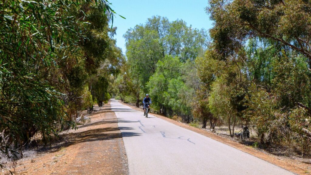
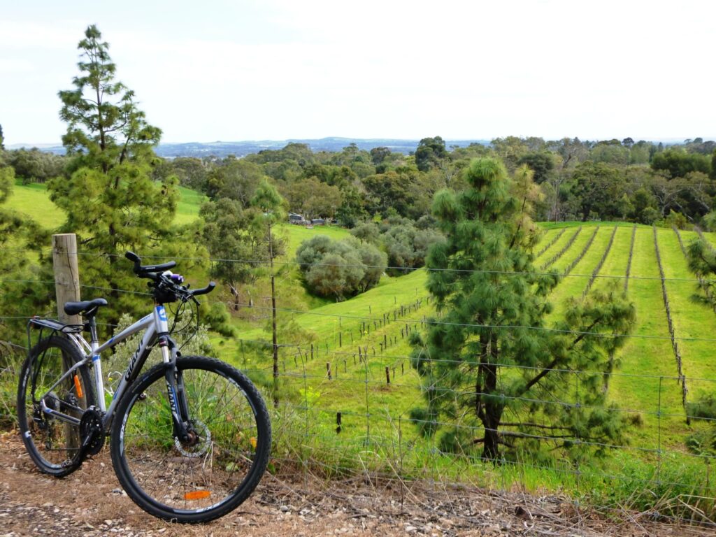
- The trail continues through dense woodland, vineyards and grazing cattle while closely following the Angas Creek on the eastern side.
- Watchout for the cow crossings which are used by local farmers to move their stock from one side of the trail to the other. The trail will be blocked occasionally while the cows cross. Please wait quietly and watch for the cows riding bikes!!
- The Angas Creek and William Creek are both crossed near Birdwood.
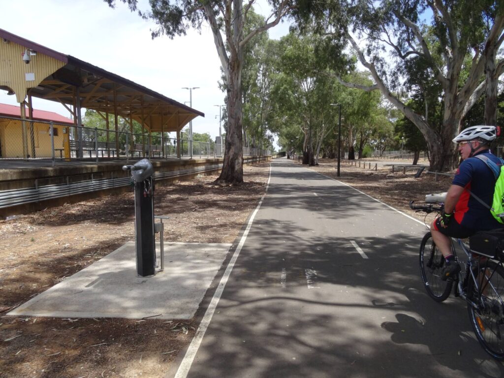
- Once in Birdwood, continue on William Street and turn left onto Torrens Road to explore the cafes in Birdwood.
![The trail hub at Gillman Rd just beyond Oakbank, has a water fountain [2023]](jpg/s12-100-oakbank-bike-repair-station-gillmans-rd-2023-04-img_2537-300x169.jpg)
The trail hub at Gillman Rd just beyond Oakbank, has a water fountain [2023]
![Riding between Oakbank and Woodside in brilliant autumn colours [2024]](jpg/s12-105-oakbank-to-woodside-2023-04-2593-300x169.jpg)
Riding between Oakbank and Woodside in brilliant autumn colours [2024]
![Walkers at Woodside travelling en masse to breakfast [2020]](jpg/s12-159-013-amy-gillett-rt-woodside-walkers-2020-10-300x225.jpg)
Walkers at Woodside travelling en masse to breakfast [2020]
![Woodside is a larger town with numerous places to eat [2024]](jpg/s12-150-woodside-2024-04-02_145210-300x169.jpg)
Woodside is a larger town with numerous places to eat [2024]
![Walkers at the Woodside to Charleston starting point [2011]](jpg/s12-158-woodside-to-charleston-start-point-6-2011-11-walker_crop-300x169.jpg)
Walkers at the Woodside to Charleston starting point [2011]
![Shady rest station on the Woodside to Charleston section [2011]](jpg/s12-158-woodside-to-charleston-rest-station-1-2011-11_crop-300x169.jpg)
Shady rest station on the Woodside to Charleston section [2011]
![Cruising through Woodside on the high-quality rail trail [2022]](jpg/s12-160-the-adelaide-hills-trail-was-built-to-a-high-standard-woodside-2022-img_1344-300x169.jpg)
Cruising through Woodside on the high-quality rail trail [2022]
![There's not a lot in Charleston, but there are public toilets [2024]](jpg/s12-200-charleston-toilet-2024-04-02_111139-300x169.jpg)
There's not a lot in Charleston, but there are public toilets [2024]
![Passing locals minding their own business near Charleston [2020]](jpg/s12-208-29-more-cows-between-hartmann-road-and-springhead-road-dsc05279-2020-10-300x225.jpg)
Passing locals minding their own business near Charleston [2020]
![Heading into the hills from Charleston up to Mt Torrens [2024]](jpg/s12-205-charleston-to-mt-torrens-2024-04-02_120336-springhead-rd-300x169.jpg)
Heading into the hills from Charleston up to Mt Torrens [2024]
![Lots of cuttings in the climb from Charleston up to Mt Torrens [2020]](jpg/s12-208-033-amy-gillett-rt-charleston-wooded-cutting-2-2020-10-300x225.jpg)
Lots of cuttings in the climb from Charleston up to Mt Torrens [2020]
![Vineyard on the approach to Onkaparinga Valley Road crossing near Mt Torrens [2020]](jpg/s12-208-34-vineyard-on-the-approach-to-onkaparinga-valley-road-crossing-dsc05284-2020-10-2-300x156.jpg)
Vineyard on the approach to Onkaparinga Valley Road crossing near Mt Torrens [2020]
![The background to the Adelaide Hills rail trail's name [2024]](jpg/s12-250-mt-torrens-sign-2024-04-02_114032-300x169.jpg)
The background to the Adelaide Hills rail trail's name [2024]
![Mount Torrens village about to be besieged by trail users [2024]](jpg/s12-250-mt-torrens-2024-04-02_144017-300x169.jpg)
Mount Torrens village about to be besieged by trail users [2024]
![The bridge over Burfords Hill Rd just out of Mt Torrens is a historic feature [2025]](jpg/s12-255-burfords-hill-rd-2025-11-and-truss-bridge-to-the-left-300x169.jpg)
The bridge over Burfords Hill Rd just out of Mt Torrens is a historic feature [2025]
![The cattle are already used to rail trail users between Mt Torrens and Birdswood [2025]](jpg/s12-255-mt-torrens-to-birdwood-2025-11-cattle-graze-peacefully-on-the-edge-of-the-trail-300x169.jpg)
The cattle are already used to rail trail users between Mt Torrens and Birdswood [2025]
![And the cattle have unique signage to warn users where they cross the rail trail! [2025]](jpg/s12-255-mt-torrens-to-birdwood-2025-11-i-didnt-know-cows-could-ride.-farmers-need-to-move-stock-over-the-trail-occasionally-300x225.jpg)
And the cattle have unique signage to warn users where they cross the rail trail! [2025]
![A winery between Mt Torrens and Birdswood [2025]](jpg/s12-255-mt-torrens-to-birdwood-2025-11-the-trail-passing-a-vineyard-300x169.jpg)
A winery between Mt Torrens and Birdswood [2025]
![Birdwood is home to the famous National Motor Museum .... [2024]](jpg/s12-300-birdwood-2024-04-02_133745-300x169.jpg)
Birdwood is home to the famous National Motor Museum .... [2024]
![... and quite a few shops [2024]](jpg/s12-300-birdwood-2024-04-02_133817-300x169.jpg)
... and quite a few shops [2024]
![The station site at Birdwood will soon become part of the rail trail [2024]](jpg/s12-300-birdwood-station-2024-04-02_135442-300x169.jpg)
The station site at Birdwood will soon become part of the rail trail [2024]
![Rail corridor beside the road between Birdwood and Mt Pleasant [2024]](jpg/s12-305-birdwood-to-mt-pleasant-2024-04-02_140419-300x169.jpg)
Rail corridor beside the road between Birdwood and Mt Pleasant [2024]
![It is hoped that the rail trail will soon be completed to Mt Pleasant [2024]](jpg/s12-350-mt-pleasant-2024-04-02_141435-300x169.jpg)
It is hoped that the rail trail will soon be completed to Mt Pleasant [2024]
Do you know of a bike hire or transportation service on this rail trail that should appear here? If so, let us know at admin@railtrails.org.au.
Information and Links
The trail is managed by Dept Planning, Transport and Infrastructure. To report any issues or problems contact www.transport.sa.gov.au or phone 1800 018 313
The section of trail between Mt Torrens and Birdwood in managed by The Adelaide Hills Council. To report any issues or problems contact the Council www.ahc.sa.gov.au or phone 8408 0400
For bus transport go to Adelaide Metro
Contact Rail Trails Australia
To contact us about this rail trail, email sa@railtrails.org.au
Background Information
Traditional owners
We acknowledge the Peramangk people, the traditional custodians of the land and waterways on which the rail trail is built.
Development and future of the rail trail
The trail is named in memory of Amy Gillett, a South Australian track cyclist and rower who represented Australia in both sports. She was killed when a driver crashed into the Australian cycling squad with which she was training in Germany in 2005.
The first stage, from Oakbank to Woodside, opened in January, 2010. The Woodside to Charleston section followed in June, 2011. Charleston to Mt Torrens was opened in May, 2014. The Mt Torrens to Birdwood section was opened in November 2025.
The fifth and final stage, Birdwood to Mt Pleasant (8.4 km), is contained within two council areas (Adelaide Hills Council and Barossa Council). The Councils are discussing the potential to seek future funding to complete stage 5. The Barossa Council has allowed funding in its 2025 / 2026 draft budget to construct a trail from Mt Pleasant to Randell Road. The Adelaide Hills Council will receive a report on the feasibility of completing their section of the trail. The report is expected to be submitted to the Council in April 2025.
Rail line history
The railway line from Balhannah to Mt Pleasant opened in 1918, following some 60 years of meetings and negotiations, and ran as a freight and passenger service. The line had six stations – Oakbank, Woodside, Charleston, Mount Torrens, Birdwood, and Mount Pleasant – and seven halts located near level crossings at Mappinga, Riverview, Kayannie, Muralappie, Milkappa Rd, Crane Rd and Narcoonah. Up to 19 trains would cover the Easter Oakbank Races and most would be parked at Woodside until required for the return trip to Adelaide. Troops were carried to and from the Woodside Army Camp’s Riverview siding.
The line was closed in March, 1963, and most of the corridor between Balhannah and Oakbank returned to private ownership.
Amy Gillett Bikeway Rail Trail Extension Officially Opened
Posted: 14/11/25
The newest 5.7 km section of the Amy Gillett Bikeway rail trail was officially opened on 13 ...
More...Council Proposes Extension of Amy Gillett Bikeway
Posted: 05/06/25
Current end of trail at Mt Torrens with construction ...
More...Amy Gillett Pathway Nears Birdwood
Posted: 05/04/25
Cracked and deteriorating walls of the original drainage culverts ...
More...Amy Gillett Bikeway extension to Birdwood underway
Posted: 21/11/24
Clearing of fire-damaged trees near a rail cutting at ...
More...Adelaide Hills Bike Infrastructure Needs Analysis
Posted: 18/09/24
The Adelaide Hills Council is interested in hearing from the Adelaide Hills Community and those ...
More...Amy Gillett Rail Trail extension project to go ahead after funding secured
Posted: 24/03/24
An extension to the Amy Gillett Rail Trail will go ahead after a funding agreement ...
More...Tour Down Under takes place soon in South Australia
Posted: 19/12/23
South Australia's iconic Tour Down Under international road cycling event is on again in January 2024 ...
More...Upgrade of directional signage and installation of bike repair stations on Amy Gillett Rail Trail
Posted: 24/10/23
A few small changes to the Amy Gillett Rail Trail in South Australia have occurred ...
More...Amy Gillett Rail Trail – extension from Mt Torrens to Birdwood
Posted: 07/09/23
In 2020 the Adelaide Hills Council was successful in securing $2.6m in funding from the Federal ...
More...Amy Gillett Rail Trail – the perfect location to stage a community event
Posted: 19/03/22
The Amy Gillett Rail Trail came alive for ‘Discover, Play, Bikeway!’ on Sunday 6 March. The ‘...
More...Amy Gillett Rail Trail – Discover, Play, Bikeway! 2022
Posted: 24/02/22
After a hugely successful inaugural event in 2021, the Adelaide Hills Council has organised Discover, Play, ...
More...Amy Gillet Rail Trail – A Koala friendly trail
Posted: 15/03/21
In December 2019 a bushfire spread through the hills and valleys around the Amy Gillett Rail ...
More...Amy Gillett Rail Trail helps to revive the Adelaide Hills
Posted: 15/03/21
In December 2019 a bushfire spread through the hills and valleys around the Amy Gillett Rail ...
More...‘Festival of the Hills’ Amy Gillet Bikeway
Posted: 07/02/21
As part of the ‘Festival of the Hills’, the Adelaide Hills Council is pleased to ...
More...$2.6m secured for Amy Gillett Bikeway Rail Trail in South Australia
Posted: 12/10/20
Adelaide Hills Council has received $2.6 million of Federal funding to complete stage 4 of the popular (...
More...Extension of Adelaide Hills Amy Gillett Rail Trail in South Australia
Posted: 29/04/20
The Adelaide Hills Council has identified an extension of the Adelaide Hills Amy Gillett Rail ...
More...Stage 3 of the Adelaide Hills Amy Gillet Rail Trail Opening
Posted: 04/05/14
The 7km Stage 3 section of the rail trail between Charleston and Mt Torrens will be ...
More...Adelaide Hills Rail Trail Link Open
Posted: 17/06/12
A 500 metre "missing link" behind the Woodside shops linking the Oakbank - Woodside and Woodside ...
More...Amy Gillett Rail Trail (Stage 1) Official Opening (SA)
Posted: 19/01/10
The official opening for Stage 1 of the Amy Gillett Rail Trail will be taking place ...
More...Funding for the Adelaide Hills Rail Trail Announced
Posted: 27/01/09
The South Australian state government has announced $1 million in funding to build the first stage ...
More...Adelaide Hills Rail Trail (SA) Committee Formation Meeting
Posted: 16/11/07
This proposed rail trail has been under consideration for many years now. An incorporated association ...
More...Nearby Trails
Mount Barker Rail Trail
Adelaide Hills, 33km south-east of CBD
5 km


O-Bahn Bikeway trail
Adelaide CBD
16 km
Stockade Rail Trail
11 km north of Adelaide CBD
2.6 km
Parafield railside trail
15 km north of Adelaide CBD
3 km
Gawler Greenway railside trail
Adelaide CBD
14 km
Penfield railside trail
20 km north of Adelaide CBD
7 km
Westside Bikeway rail trail
2 km west of Adelaide CBD
9 km
Mike Turtur Bikeway railside trail
Adelaide CBD
9 km
Smithfield Magazine Rail Trail
33 km north of Adelaide CBD
3.5 km
Marino Rocks Greenway rail trail
Adelaide CBD
16 km
Outer Harbor Greenway railside trail
Adelaide CBD
23 km
Barossa Rail Trail
Barossa Valley, 50 km north-east of Adelaide
43 km
Coast Park Path Rail Trail
12km north-west of Adelaide CBD
25 km
Semaphore Rail Trail
16 km north-west of Adelaide CBD
4.2 km
Coast to Vines Rail Trail
20 km south of Adelaide CBD
37 km

Nurragi Conservation Reserve rail trail
Fleurieu Peninsula, 70 km south-east of Adelaide
13 km
Kapunda Rail Trail
78 km north of Adelaide
1 km
Encounter Bikeway railside trail
Fleurieu Peninsula, 85 km south of Adelaide
28 km
Eudunda Rail Trail
112 km north of Adelaide
1 km
Riesling and Rattler Trails
Clare Valley, 130 km north of Adelaide
53 km
Shamus Liptrot Rail Trail
Adelaide Plains, 100 km north of Adelaide
11 km

Copper Rail Trail
Adelaide Plains, 100 km north of Adelaide
39 km
Nearby Trails
Mount Barker Rail Trail
Adelaide Hills, 33km south-east of CBD
5 km
O-Bahn Bikeway trail
Adelaide CBD
16 km
Stockade Rail Trail
11 km north of Adelaide CBD
2.6 km
Parafield railside trail
15 km north of Adelaide CBD
3 km
Gawler Greenway railside trail
Adelaide CBD
14 km
Penfield railside trail
20 km north of Adelaide CBD
7 km
Westside Bikeway rail trail
2 km west of Adelaide CBD
9 km
Mike Turtur Bikeway railside trail
Adelaide CBD
9 km
Smithfield Magazine Rail Trail
33 km north of Adelaide CBD
3.5 km
Marino Rocks Greenway rail trail
Adelaide CBD
16 km
Outer Harbor Greenway railside trail
Adelaide CBD
23 km
Barossa Rail Trail
Barossa Valley, 50 km north-east of Adelaide
43 km
Coast Park Path Rail Trail
12km north-west of Adelaide CBD
25 km
Semaphore Rail Trail
16 km north-west of Adelaide CBD
4.2 km
Coast to Vines Rail Trail
20 km south of Adelaide CBD
37 km
Nurragi Conservation Reserve rail trail
Fleurieu Peninsula, 70 km south-east of Adelaide
13 km
Kapunda Rail Trail
78 km north of Adelaide
1 km
Encounter Bikeway railside trail
Fleurieu Peninsula, 85 km south of Adelaide
28 km
Eudunda Rail Trail
112 km north of Adelaide
1 km
Riesling and Rattler Trails
Clare Valley, 130 km north of Adelaide
53 km
Shamus Liptrot Rail Trail
Adelaide Plains, 100 km north of Adelaide
11 km
Copper Rail Trail
Adelaide Plains, 100 km north of Adelaide
39 km
25 reviews of “Amy Gillett Bikeway rail trail”
We rode the new extension to Birdwood today, what a wonderful, no expenses spared trail. The trail through pretty farmland is lined with gum trees, making it nice and shady on a warm day. The bitumen surface is smooth and wide enough to ride side by side. The new bridge, which also has a bypass for horse riders, is quite magnificent. My only recommendation, don't plan on riding through Birdwood at school pick up time 😀, apart from that, there's a good variety of shops, cafes, pubs and the Motor Museum in the town.
The extension to Birdwood is beautiful
The new Mt Torrens to Birdwood section was opened yesterday in front of a large crowd. This is possibly the most scenic section of the trail, passing through delightful farming country with long avenues of shady gums. It is mostly slightly downhill all the way to Birdwood and is a wonderful ride. The trail was busy yesterday, as were the cafes in Birdwood.
Ditto to that Anthony.
Excellent
We rode the trail from Mt Torrens to Oakbank and return. We discovered a brand new Cafe and florist (Hope Blooms) in Charleston. Lovely people and great snacks and pastries. Even this late in autumn there was still plenty of autumn colour. Stopped off for some sweet treats at Melba's Chocolates with Woodside Cheesewrights right next door. Lobethal Bakery in Woodside was busy as always. On the way back we stopped off at Lobethal Road Winery where it was warm and cosy. Great views and attentive and informative owners. Snacks and meals are available as well as wine tasting. The new trail section to Birdwood is not yet open but is mostly sealed and ready to go. Just some earthworks to complete near the Burfords Hill Road bridge and line marking and signage. Currently completion is scheduled for August 2025. Overall an easy ride with great scenery and many opportunities to experience Adelaide Hills hospitality. A great day out despite the chilly winds today.
Hello Anthony. Are you aware if the extension to Birdwood is open yet. Can't find any updates. Cheers, Jac
Latest we have heard from Council is that the official opening will be 'sometime' in November.
A nice easy ride for all the family though dad might do some pushing up the last bit up mt Torrens. Nice surface suitable for all types of bikes, scenery is nice but nothing breathtaking, a few road crossings but a nice safe easy ride.
29/70 Great to see runners and cyclists out before dawn on the Adelaide Hills Rail Trail. Then the Parkrun crowd turned up in the drizzle. No toilets at the trail hub on Gillman Rd or near the start in Oakbank, but at the Balhannah Oval on the far side. Some protection from traffic on Onkaparinga Valley Rd will be necessary if it gets any more popular with the extension
I ride this trail about twice per month. They are currently expanding north to Birdwood. The surface is sealed but a bit rough in places (they can also be a bit slow to cut the grass on the path sides) but it is still a great ride overall. Plenty of eating options in Woodside.
Amy Gillett Rail Trail is a popular trail for good reason. Easy grades, beautiful hills scenery and great little towns with cafes, bakeries and wineries. The new extension to Birdwood will extend to trail through beautiful farming country to one of SA's iconic Hills towns, home of the National Motor Museum. This trail is a great day out for all the family.
The surface is great and the further north you go, the nice the trail becomes, so hopefully once it is extended further north it's an even better ride.
However there was no rail history along the trail either on display or on information boards, while the southern start of the trail is just a random location with not much information.
I also found for most of the southern half of the trail I was right beside the road so not the quietest ride. While there wasn't a lot of things to see like bridges to cross over but thankfully further north there was a nice bridge and hopefully as it extends to Birdwood the trial can go over a magnificent cement bridge.
At this stage I wouldn't specifically travel to this rail trail.
if starting from the Oatbank end, the best starting location is the Gillman st – great place to park and get organized. there is no evidence of the trail starting at Elizabeth St in Oatbank, the first actual sign on the main road is near the Gillman st corner.
We rode on this trail yesterday. We started off from Hahndorf and used the local roads to get to the start at Oakbank, about 8kms on fairly undulating roads.
Unfortunately there is little or no accommodation on the Rail Trail, so Hahndorf is the closest place to stay. Thank god for ebikes.
The trail itself is very nice, with a smooth sealed surface all the way to Mt Torrens. It is uphill all the way, albeit at railway grade. But it is a nice ride back. The trail goes out the back of Woodside, which has some shops and cafes for refreshment. There is also a cheese factory and chocolate factory on the northern end of Woodside, well worth a visit.
Unfortunately the trail finishes in the middle of nowhere, about 2km from the old pub at Mt Torrens. It would be great to see it continue on to Birdwood and Mt Pleasant where the railway terminated.
It would also be good if the trail was finished from Oakbank to Balhannah. The traffic on the road is very busy, especially on weekends.
We rode about half of this ride but began from Hahndorf and a rigorous hill or two to get to the starting point.
If riding just the trail from the Woodside end, it is recommended to use the Gillman or other cross streets to begin the ride. The actual starting point is difficult to get to from town on the shared path or busy road.
The trail starts off well enough but quickly becomes what I would label a shared path and wanders on and off streets and through parking lots and suburban developments as it makes its way. While there are advantages to having access to shops, it is unlike what many rail-trail enthusiasts might consider the peaceful rail-trail they may seek
Don't get me wrong, any rail trail is a good rail trail but some are more peaceful and rural and picturesque than others. This one is a mixed bag, great for locals but, personally, I would not go out of my way to do on a holiday.
I would also remark that motorists in the area are a lot less respectful of cyclists than we had assumed and even come to expect at home in NSW!
Hi Omar,
The ride from Hahndorf to the start of the trail just north of Oakbank is difficult as the roads are hilly and not suited to safe cycling. The best option is to start from Gillman Road where is is good parking. Once you pass through Woodside, the trail passes through open farmland all the way to Mt Torrens.
The Adelaide Hills Council is currently developing a Trails Strategy and improving the connectivity between townships will be a high priority.
Regards Mark
My partner and I did this trail in late one afternoon in September 2018. We stumbled on it after visiting Hahndorf. We managed to hire good bikes including an e-bike from the Eco Adventure Group behind the Bicycle Fix cycle store in the small town of Woodside. The picturesque scenery of the Mount Lofty Ranges and e-bike made this ride a highlight of the whole SA trip for her! There are wineries along this trail, as well as chocolatiers and historic features. The trail is also popular with locals, with many people out cycling, walking or running. There are options for side trips and we took an alternative route on return to Charleston.
Did this trail this Australia Day with our little one in tow in a trailer. Its a nice trail but is lacking in amenities/shady shelters and has a couple of annoying gaps. The trail surface is great and smooth the whole way but there are a couple of busy on road sections which get a bit scary when towing a baby in a trailer…. The trail also just ‘ends’ on the outskirts of Mount Torrens. My suggestions would be…
A nice little cafe/kiosk in Woodside next to the jumps park and rail trail – would be a little gold mine for whoever takes this on….
Some sort of sign at the end near Mount Torrens
A continuation of the trail through to Mount Pleasant!
Was a nice way to spend the day though 🙂
Found this trail while exploring the hills. As I came from NSW and had the bike in the vehicle. Asked at the local bike shop and the brochure I was given was out of date. Found it much longer than I thought had a great ride along length. Looks like it is about time this site was updated to show the current length of the ride. Some form of printed info available at shops and information centres would help those who are not locals.
Totally agree with you Greyhoundlover, I personally sound the bell on my bike when approaching other trail users regardless of what mode of transport they are using. Also looking forward to using the next section when it is complete.
I seem to be the only one offering comments, but here is a suggestion. At all access points to the trail, I would like to see a notice requesting cyclists to give some warning when approaching people on foot or horseback from behind. On that smooth surface it is impossible to hear bicycles coming. I am amazed there have been no accidents…. a startled dog or horse will swing around to face a perceived threat, could push its owner / rider into the path of bikes. Please give this some consideration.
Thanks for that, I was quite puzzled but think I have seen that sign. Will look for it next time. I’m looking forward to walking the new section when it’s finished, Great work!
The trail extension starts in Newman Road about 50 metres to the east of the existing trail. Look for a stobie pole with HANSON Lot 102 written on it. The driveway by the pole is the access road.
Love the trail! I live in Birdwood & often drive to Charleston to walk my greyhound on it. I see that work is underway for the Charleston to Mt Torrens section… lovely, I can’t wait! But I have been trying to workout where in Charleston that section starts & so far I can’t find it. Can anyone enlighten me?