 Location:
 Length:
 Surface:
 Start / End:
 Suitable for:
A great way to get a taste of Adelaide's wine heritage, the Coast to Vines Rail Trail packs in a lot of country
- A great day or weekend destination on the Fleurieu Peninsula
- High standard rail trail from the southern suburbs of Adelaide to Willunga
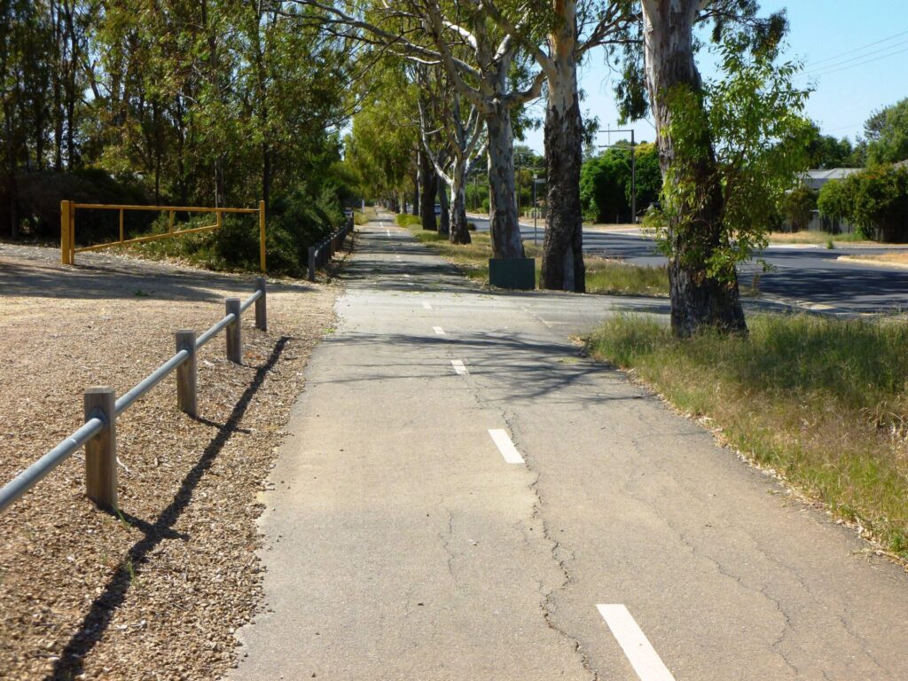
- Sealed surface and gentle gradients
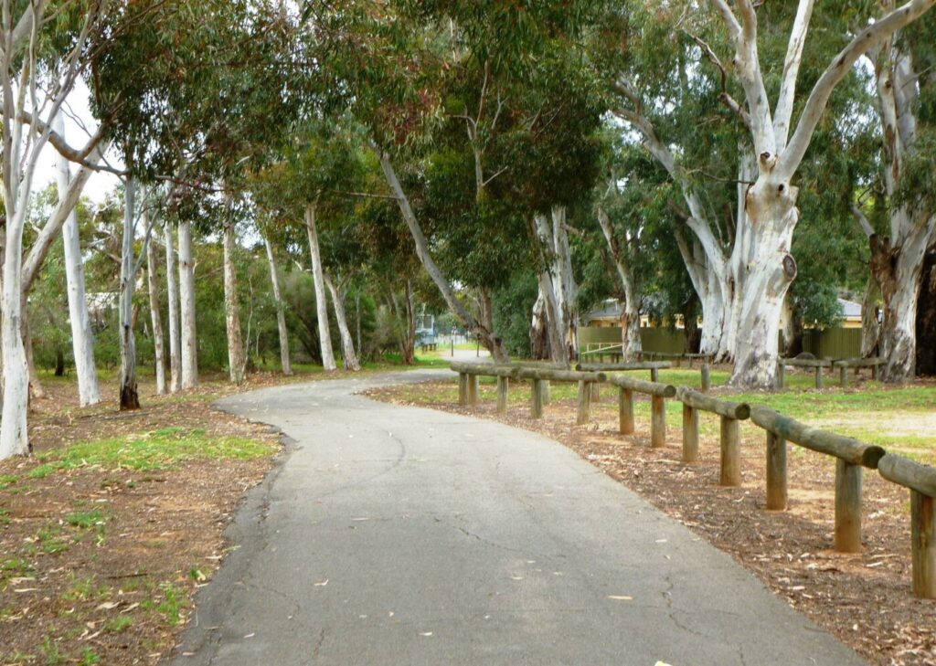
- Shady cuttings, underpasses, original embankments and bridges
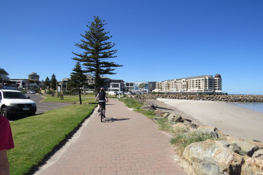
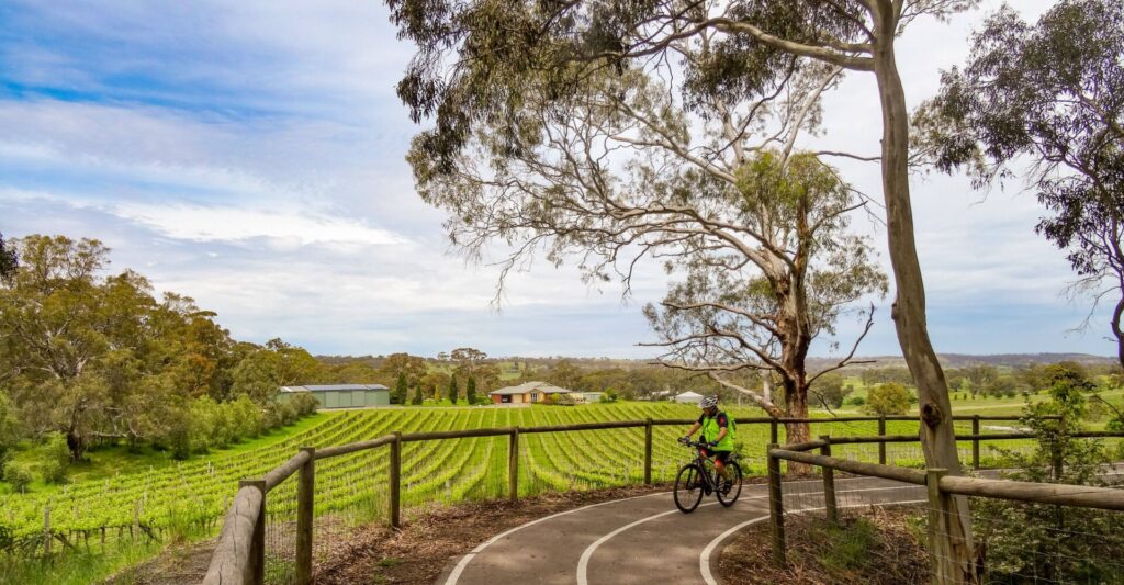
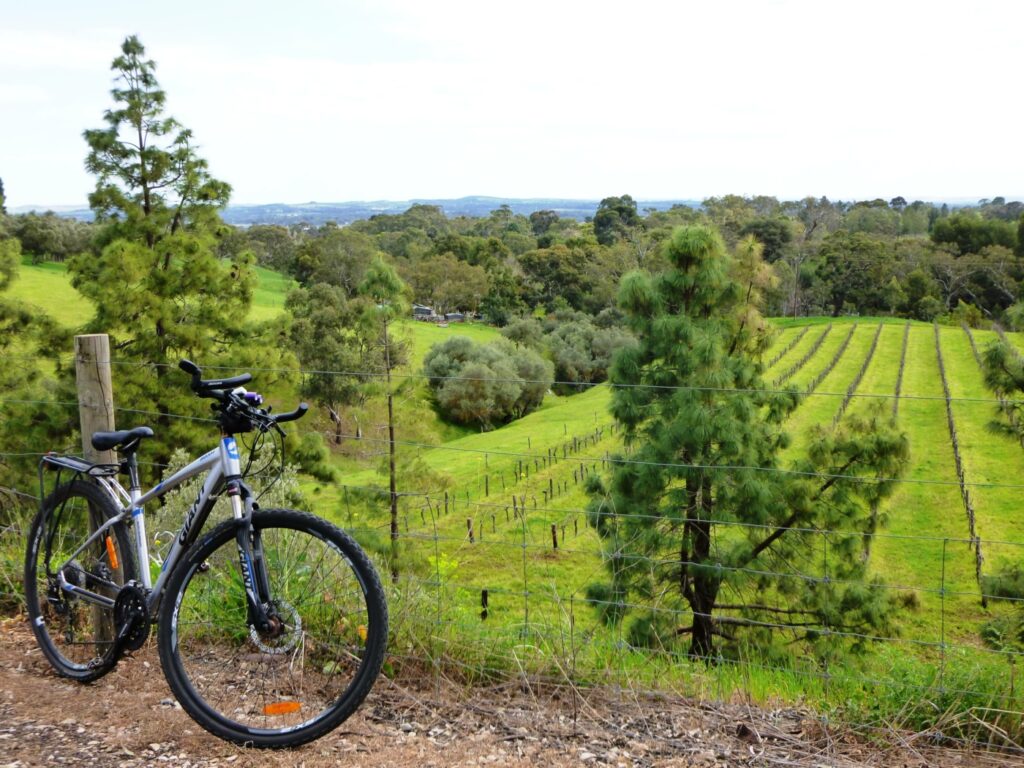
- Landscape varies from sea views to vineyards, including magnificent ocean cliffs at Hallett Cove, Onkaparinga River Recreation Reserve and the vineyards of the Southern Vales wine region
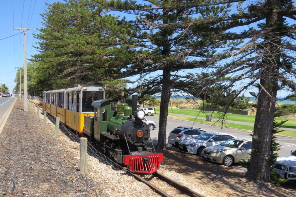
Nearby Attractions
- McLaren Vale and Willunga wineries
- Onkaparinga River National River
- Old Willunga Courthouse and Police Station Museum
- Southern Vales Loop
- Aldinga Beach
Last updated: 19 December 2025
The Santos Tour Down Under will take place in and around Adelaide, the Adelaide Hills, Barossa Valley, McLaren Vale and South Coast regions during January 2026. This rail trail may be impacted to varying degrees by the Tour.
Sat 17th January 26: Women’s Stage 1 will make several loops in the McLaren Vale – Willunga area including Start and Finish in Willunga. Expect increased cycle and pedestrian traffic on the Coast to Vines Rail Trail between McLaren Vale and Willunga and some congestion in both towns.
Sat 24th January 26: Men’s Stage 4 makes several loops in the McLaren Vale – Willunga area including Willunga Hill. Expect increased cycle and pedestrian traffic on the Coast to Vines Rail Trail between McLaren Vale and Willunga and some congestion in both towns.
McLaren Vale and Willunga combine the tourism features you would expect from a famous wine region with an un-rushed atmosphere. Both offer extensive dining and accommodation options. Visit the McLaren Vale Information Centre, on the trail as you approach McLaren Vale, for all the touring information you need.
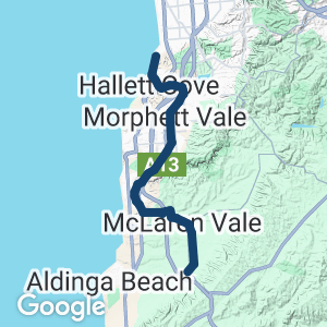
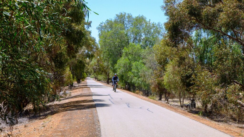
The Coast to Vines Rail Trail consists of three main sections that are quite different in terms of scenery and topography:
- Marino Rocks to Old Reynella climbs steadily from the coast for 9.4 km, heading inland along steep gullies but still within suburbia
- Old Reynella to McLaren Vale is 20 km and travels south along the old railway reserve before it crosses beneath South Rd into open farmland
- McLaren Vale to Willunga (also known as the Shiraz Trail) is 8 km and displays the best of the Southern Vales wine region, including the townships of McLaren Vale and Willunga
Section Guides
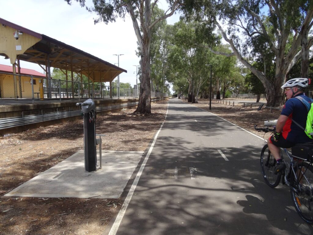
Marino Rocks to Old Reynella (9.4km)
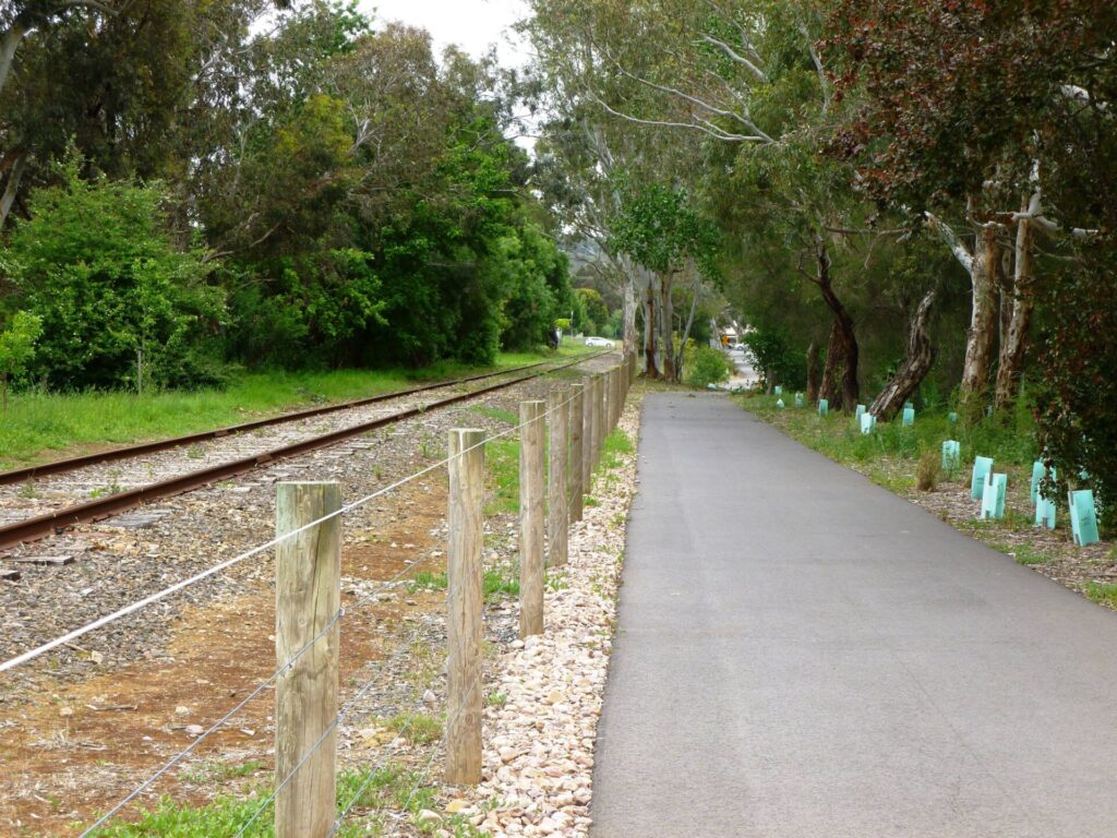
- From the railway station, the trail runs south beside the operational railway to Hallett Cove and then follows the alignment of the old Willunga Line, closed in 1969 Frequent stops will be needed to take in the ocean views
- At Hallett Cove Station, follow the signage through the area (walk your bike) to the ramp at the southern end, which leads you to a pedestrian overpass. Now the path gradually swings to the east. Follow it uphill to Gledsdale Rd, opposite Hallett Cove Mall
- The trail follows a deep gully and waterfall creek. Glade Crescent Reserve has a playground and toilets.
- Cross Lonsdale Rd at the lights, then follow the old railway line alignment through the scenic Hugh Johnson Boulevard Reserve. Just beyond the Young St crossing you reach the highest point on the trail.
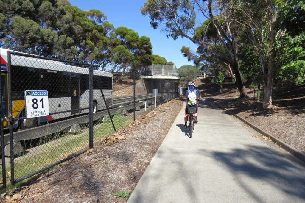
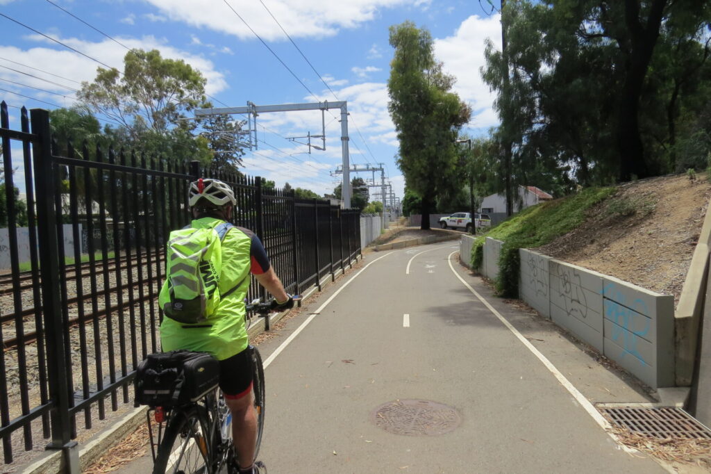
- The trail passes under the Southern Expressway, then beneath the Main South Rd bridge and climbs to busy Old South Rd where you cross at the lights. The path follows Old South Rd to the right for a short distance before re-joining the railway alignment.
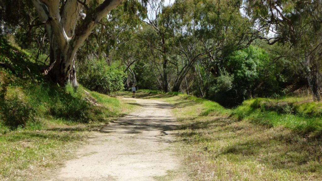
Old Reynella to McLaren Vale (20km)
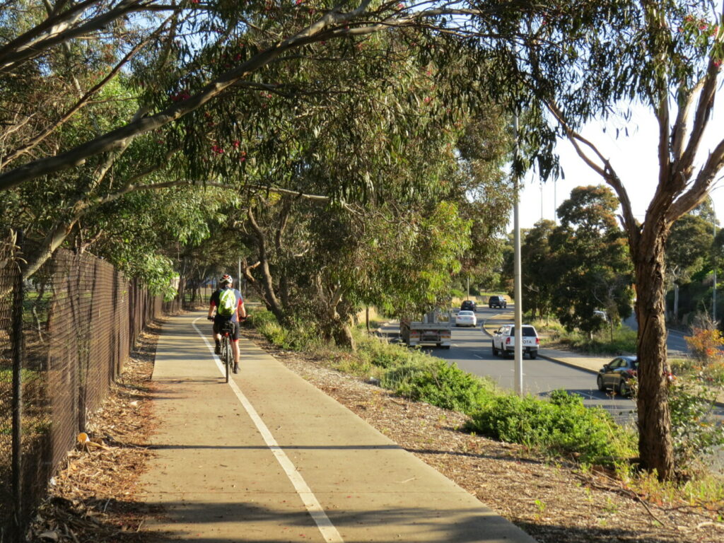
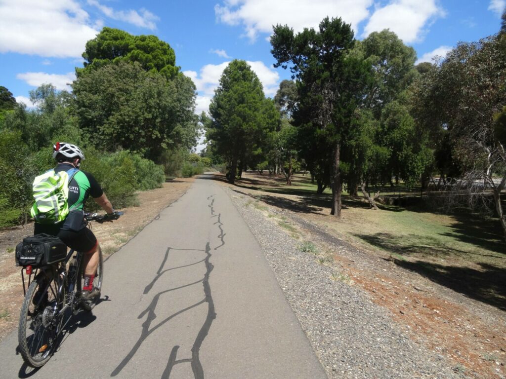
- From here the trail runs in a wide, well-vegetated reserve through the suburbs, linking conservation reserves and parks. Major road crossings have traffic islands or lights
- After Hackham, the scenery becomes more rural as the trail descends to Noarlunga Downs
- There the trail crosses the Onkaparinga River on a restored bridge (watch for the sewer vent pipe in the middle of the approach) and, after another 600 m, it reaches Railway Rd
- The trail runs next to the electrified railway, passing the newish stations of Seaford and Seaford Meadows
- The trail climbs to the Seaford Rise estate before turning east into Pedler Creek valley. From here it becomes a rural landscape of rolling hills
- At the end of the valley the trail joins a path beside Victor Harbor Rd for 250 m before passing beneath it to emerge beside Main Rd, McLaren Vale. Take care; the underpass decking has blind corners and can be slippery when wet
- The visitor information centre is well worth a stop for its great display about the region
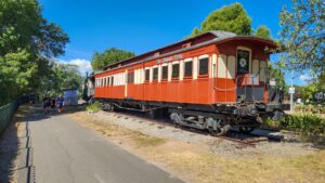
- The trail crosses Main Rd onto Caffrey St for 300 m, then turns left. Cross Main Rd as you reach the Almond Train, old railway carriages that have been converted into a gift shop and diner
- There are many shops, restaurants and bakeries in McLaren Vale
- Toilets at Memorial Reserve, 270 m south of the Almond Train on opposite side of road
- Many options for dining and Willunga
- An extensive range of accommodation in both towns, with many bike friendly options
McLaren Vale to Willunga (8km)
- The trail continues on an uninterrupted, gentle climb to Willunga bearing the name Shiraz Trail. There are many wild olive trees beside the trail and you are surrounded by vineyards
- Willunga has a well-preserved railway station and the township is a few hundred metres away
- Visit the Old Willunga Courthouse and Police Station Museum, rose gardens, nurseries and the Willunga Wirra Arboretum
- Many options for dining in Willunga
CONNECTING PATHS
- The Flat to Vale Trail is short, at 4km, but the scenery will leave a lasting impression. It follows a shared path from McLaren Vale along Pedler Creek, with tall eucalypts on one side and rambling vineyards on the other. Just before reaching the McLaren Flat township, the trail follows Chalk Hill Rd, a quiet back lane ideal for cycling and walking. The trail is sealed and flat so it’s suitable for cyclists of all ages. Once in McLaren Flat you can use the footpath to ride into town and to the general store/bakery in the middle of Main St. The PG Dawson Reserve and toilets are conveniently located nearby. The trail starts from the Shiraz section of the Coast to Vines Rail Trail at the site of the McLaren Vale Railway Station on Railway Tce and ends in McLaren Flat. The best return route is back the way you came.
- The Coast to Vines and Shiraz rail trails form more than half of the 28km Southern Vales Loop Trail. The shared-use path section from Seaford Rise to Aldinga follows the alignment of Main South Rd. There is a small section on the very quiet Old South Rd, followed by a busy section through Aldinga, where it is best to walk your bike along the footpath. The shared-use path starts again on the southern side of Port Rd and the trail crosses over Main South Rd. Once over that, the trail follows the quiet but sealed Flour Mill Rd and Free Lane before turning left onto Aldinga Rd. This section follows a shared-use path on the northern side of Aldinga Rd that is separated from the traffic by a raised median strip. The shared-use path finishes at Jay Drive so, if it’s busy, use the footpath for 400 m. The Willunga Jubilee Rose Garden will be on the left, enter the car park and follow the path adjacent to the toilets until you meet the Shiraz Rail Trail at Willunga Railway Station. The Shiraz Trail connects with the Coast to Vines Trail at McLaren Vale
- Patrick Jonker Bikeway is a 20km sealed, shared-use path that follows the Southern Expressway from Darlington to Noarlunga. The bikeway offers plenty of climbs as you head south, and connects with the Coast to Vines Rail Trail at the Panalatinga Rd exit from the expressway and also at the southern end of the expressway, just north of the Onkaparinga River Bridge. The northern end also intersects with the Sturt River Linear Trail just north of the trail’s crossing point at Marion Rd. Cycle Instead (maps.sa.gov.au) provides a good overview of Adelaide’s cycling network, including the Patrick Yonkers Bikeway, Sturt River Linear Park Trail and Coast to Vines.
![Example of the signage here at the Marino Rocks trailhead [2024]](jpg/s10-050-marino-rocks-station-2024-03-31_170227-300x169.jpg)
Example of the signage here at the Marino Rocks trailhead [2024]
![Great views of ocean and city from Marino Rocks but see the gradient [2020]](jpg/s10-055-marino-rocks-view-of-adelaide-from-the-trail-0811-2020-08-300x169.jpg)
Great views of ocean and city from Marino Rocks but see the gradient [2020]
![A flatter stretch between Marino Rocks and Hallett Cove [2024]](jpg/s10-055-marino-rocks-to-hallet-cove-2024-03-31_095723-300x169.jpg)
A flatter stretch between Marino Rocks and Hallett Cove [2024]
![After passing Hallett Cove, the rail trail turns inland to wine country [2024]](jpg/s10-105-hallet-cove-to-old-reynella-2024-03-31_100516-300x169.jpg)
After passing Hallett Cove, the rail trail turns inland to wine country [2024]
![Between Hallett Cove and Old Reynella a lot of trail is off the alignment [2024]](jpg/s10-105-hallet-cove-to-old-reynella-2024-03-31_101858-300x169.jpg)
Between Hallett Cove and Old Reynella a lot of trail is off the alignment [2024]
![After crossing over the Southern Expressway, you go under Reynella Bypass Rd [2024]](jpg/s10-110-trott-park-southern-expressway-2024-03-31_103322-300x169.jpg)
After crossing over the Southern Expressway, you go under Reynella Bypass Rd [2024]
![Panalatinga Creek has a low-level bridge where a larger one stood [2024]](jpg/s10-110-panalatinga-creek-bridge-2024-03-31_104907-300x169.jpg)
Panalatinga Creek has a low-level bridge where a larger one stood [2024]
![Lots of shady conifers planted in the Old Reynella area [2024]](jpg/s10-150-old-reynella-2024-03-31_105538-300x169.jpg)
Lots of shady conifers planted in the Old Reynella area [2024]
![Significant cutting at Morphett Vale [2024]](jpg/s10-200-morphett-vale-2024-03-31_110854-300x169.jpg)
Significant cutting at Morphett Vale [2024]
![Lots of signage and rest stops, here at the former station of Yetto [2024]](jpg/s10-210-yetto-2024-03-31_111705-300x169.jpg)
Lots of signage and rest stops, here at the former station of Yetto [2024]
![Trail underpass for the Southern Expressway, Noarlunga [2024]](jpg/s10-255-hackham-to-old-noarlunga-2024-03-southern-expressway-_dsf5700-300x169.jpg)
Trail underpass for the Southern Expressway, Noarlunga [2024]
![Descending to the Onkaparinga River at Noarlunga [2024]](jpg/s10-255-hackham-to-old-noarlunga-2024-03-31_114314-300x169.jpg)
Descending to the Onkaparinga River at Noarlunga [2024]
![The major bridge over the Onkaparinga River with awkward vent pipe [2024]](jpg/s10-300-onkaparinga-river-bridge-2024-03-_dsf5701-300x169.jpg)
The major bridge over the Onkaparinga River with awkward vent pipe [2024]
![Trail shifted for line extension from Seaford Rise to Seaford [2024]](jpg/s10-355-seaford-rise-station-2024-03-_dsf5736-300x169.jpg)
Trail shifted for line extension from Seaford Rise to Seaford [2024]
![Riding up to Seaford from McLaren Vale. The fun is over [2024]](jpg/s10-355-seaford-rise-to-mcclaren-vale-2024-03-_dsf5724_crop-300x169.jpg)
Riding up to Seaford from McLaren Vale. The fun is over [2024]
![Rugged terrain around the re-decked Pedlers Creek bridge [2025]](jpg/s10-355-seaford-rise-to-mcclaren-vale-pedler-creek-bridge-2025-03-300x169.jpg)
Rugged terrain around the re-decked Pedlers Creek bridge [2025]
![Impressive Visitor Information Centre in McLaren Vale [2024]](jpg/s10-400-mclaren-vale-info-centre-2024-03-31_152027-300x169.jpg)
Impressive Visitor Information Centre in McLaren Vale [2024]
![Entrance to trail at McLaren Vale after a diversion into town [2024]](jpg/s10-400-mclaren-vale-2024-03-31_143034-300x169.jpg)
Entrance to trail at McLaren Vale after a diversion into town [2024]
The Almond Cafe closed in April, 2024, but the Japanese cafe in the carriage behind was open
![The Pikkara rest area between McLaren Vale and Willunga [2014]](jpg/s10-410-pikkara-shelter-2014-05-p1040017-300x225.jpg)
The Pikkara rest area between McLaren Vale and Willunga [2014]
![Vines between McLaren Vale and Willunga ready for picking [2014]](jpg/s10-411-mclaren-vale-to-willunga-2014-05-p1040021-300x169.jpg)
Vines between McLaren Vale and Willunga ready for picking [2014]
![Autumn scenery between McLaren Vale and Willunga [2014]](jpg/s10-410-mclaren-vale-2010-03-2255-300x169.jpg)
Autumn scenery between McLaren Vale and Willunga [2014]
![Willunga Railway Station marks the southern trailhead [2014]](jpg/s10-450-willunga-station-2014-05-300x225.jpg)
Willunga Railway Station marks the southern trailhead [2014]
 Only a short distance from the city of Adelaide, this bike wine tour combines easy cycling with winery visits and tastings, lunch and the gorgeous vineyard and coastal scenery of this region
Metro Adelaide runs regular train services to Marino Rocks and they take bikes subject to space.
Electric bike hire at McLaren Vale and Fleurieu Coast Visitor Information Centre
Do you know of a bike hire or transportation service on this rail trail that should appear here? If so, let us know at admin@railtrails.org.au.
Information and Links
Information and links
For further information, or to report any problems, please see contacts below:
Bike Hire: Click here for places you can hire a bike along the trail.
City of Onkaparinga (08) 8384 066 or www.onkaparingacity.com
City of Marion (08) 8375 6600 or www.marion.sa.gov.au
See here for another map of the rail trail.
For more general information click here
South Australian Government Link www.southaustraliatrails.com
McLaren Vale and Fleurieu Visitor Information Centre 1800 628 410 or www.mclarenvale.info
Contact Rail Trails Australia
To contact us about this rail trail, email sa@railtrails.org.au
Background Information
Traditional owners
We acknowledge the Kaurna people, the traditional custodians of the land and waterways on which the rail trail is built.
Development and future of the rail trail
Construction is underway on the duplication of Main South Rd between Aldinga and Sellicks Beach. The Onkaparinga Council is planning to construct a shared use path from Main South Rd to Aldinga and another from Aldinga to Sellicks Beach.
An 800 m boardwalk along the coastal cliff between Port Noarlunga and Christies Beach has been constructed but will not be opened at the Christies Beach end until mid 2025. To ensure that users of the Coast to Vines trail can access this iconic boardwalk we are working on a trail that leaves the Coast to Vines Trail at the Pedler Creek Trail and then follows the Coast Park Trail (which includes the boardwalk), Beach Road shared use path, Golden Wattle Way shared use path and Christies Creek trail shared use path. The Christies Creek shared use trail will link back to the Coast to Vines. This loop trail will provide a scenic diversion along the Coast to Vines Trail. We hope to have this trail documented as a side trail by mid 2025, in time for the opening of the Christies Beach end of the boardwalk.
Rail line history
As in other thriving rural regions, residents lobbied hard for the all-important rail link to Adelaide. However, the railway branching off at Hallett Cove was not opened until 1915, relatively late in the railway era. It carried wood, fruit, wine, almonds and building materials for just over 50 years until 1969. It carried passengers until 1957. The line was dismantled in 1972 but most of the corridor remained in public hands, allowing the development of this great rail trail. The rail trail is managed by the cities of Marion and Onkaparinga, both of which are committed to further improving its quality.
Pedler Creek Bridge Reopens on the Coast to Vines Rail Trail
Posted: 05/04/25
Pedler Creek Bridge has now reopened after the renewal of the decking and balustrade by ...
More...Coast to Vines Partial Closure
Posted: 04/02/25
The uneven surface and subsidence of the bridge ...
More...Southern Vales Loop Joins Coast to Vines
Posted: 16/12/24
The shared-use path adjacent to Main South Rd approaching ...
More...Coast to Vines underpass artwork
Posted: 21/11/24
Western approach showing net fishers The duplication of ...
More...Tour Down Under takes place soon in South Australia
Posted: 19/12/23
South Australia's iconic Tour Down Under international road cycling event is on again in January 2024 ...
More...Coast to Vines set to become the centre of the Southern Vales loop
Posted: 24/05/23
The duplication of Main South Road from Seaford to Sellicks Beach has commenced and will ...
More...Flat to Vale Side Trail – a small trail that leaves a big impression
Posted: 01/05/23
The Coast to Vines Rail Trail in South Australia now has a new side trail ...
More...Coast to Vines Rail Trail – signage upgrade
Posted: 19/03/22
The Coast to Vines Rail Trail extends from coastal Adelaide to urban areas south of ...
More...Onkaparinga River Bridge Closure and Coast to Vines Rail Trail detour during construction works
Posted: 26/05/21
The City of Onkaparinga is reconstructing the shared use bridge section of the Coast to ...
More...Coast to Vines Rail Trail Detour (SA)
Posted: 25/09/11
Map of detour during Seaford Rail Extension project construction. ...
More...Temporary changes to the Coast to Vines Rail Trail (SA)
Posted: 22/03/10
Map of Detour between Lynton Terrace and Seaford Road[/...
More...Nearby Trails
Marino Rocks Greenway rail trail
Adelaide CBD
16 km


Mike Turtur Bikeway railside trail
Adelaide CBD
9 km
Coast Park Path Rail Trail
12km north-west of Adelaide CBD
25 km
Westside Bikeway rail trail
2 km west of Adelaide CBD
9 km
Mount Barker Rail Trail
Adelaide Hills, 33km south-east of CBD
5 km
O-Bahn Bikeway trail
Adelaide CBD
16 km
Outer Harbor Greenway railside trail
Adelaide CBD
23 km
Semaphore Rail Trail
16 km north-west of Adelaide CBD
4.2 km
Stockade Rail Trail
11 km north of Adelaide CBD
2.6 km
Gawler Greenway railside trail
Adelaide CBD
14 km
Parafield railside trail
15 km north of Adelaide CBD
3 km
Amy Gillett Bikeway rail trail
Adelaide Hills, 49 km east of CBD
23 km

Nurragi Conservation Reserve rail trail
Fleurieu Peninsula, 70 km south-east of Adelaide
13 km
Encounter Bikeway railside trail
Fleurieu Peninsula, 85 km south of Adelaide
28 km
Penfield railside trail
20 km north of Adelaide CBD
7 km
Smithfield Magazine Rail Trail
33 km north of Adelaide CBD
3.5 km
Barossa Rail Trail
Barossa Valley, 50 km north-east of Adelaide
43 km
Kapunda Rail Trail
78 km north of Adelaide
1 km
Nearby Trails
Marino Rocks Greenway rail trail
Adelaide CBD
16 km
Mike Turtur Bikeway railside trail
Adelaide CBD
9 km
Coast Park Path Rail Trail
12km north-west of Adelaide CBD
25 km
Westside Bikeway rail trail
2 km west of Adelaide CBD
9 km
Mount Barker Rail Trail
Adelaide Hills, 33km south-east of CBD
5 km
O-Bahn Bikeway trail
Adelaide CBD
16 km
Outer Harbor Greenway railside trail
Adelaide CBD
23 km
Semaphore Rail Trail
16 km north-west of Adelaide CBD
4.2 km
Stockade Rail Trail
11 km north of Adelaide CBD
2.6 km
Gawler Greenway railside trail
Adelaide CBD
14 km
Parafield railside trail
15 km north of Adelaide CBD
3 km
Amy Gillett Bikeway rail trail
Adelaide Hills, 49 km east of CBD
23 km
Nurragi Conservation Reserve rail trail
Fleurieu Peninsula, 70 km south-east of Adelaide
13 km
Encounter Bikeway railside trail
Fleurieu Peninsula, 85 km south of Adelaide
28 km
Penfield railside trail
20 km north of Adelaide CBD
7 km
Smithfield Magazine Rail Trail
33 km north of Adelaide CBD
3.5 km
Barossa Rail Trail
Barossa Valley, 50 km north-east of Adelaide
43 km
Kapunda Rail Trail
78 km north of Adelaide
1 km
9 reviews of “Coast to Vines Rail Trail”
Forgot to mention check out the post next to the pub car park at the foot of the Willunga hill. Richie port smashed the 3km hill in I think 6 and a half minutes KOM (for Strava people) kudos to him very impressive and wasn’t game to even try.🤣.
Rode from Moana beach to Willunga yesterday and what’s not to love, Willunga is a lovely town to grab a bite with some lovely buildings 34 km round trip and easy smooth ride. Ride Moana to Kingston today 55km round trip (a few u turns included), also an easy ride and great to see the trail being used by a lot more people. Sure there’s a few bumps from tree roots but it’s a great ride. Shame businesses haven’t caught onto the passing trade, nothing obvious at Kingston station but get to see the old carriages being used as a sushi train midway, best of luck to them. I have to say it’s a ride that has everything, ocean views, vineyards and a fun interesting corridor, I loved it and guessing by the amount of traffic the locals do too, prams, dog walkers, joggers and cyclists. No grumpy farmers,👍🏻 Love love love.
14/70 Just in time to check out the freshly-line-marked Pedler Creek Bridge. It's a bit higher than before, but nice and level. Lunch at Willunga before the slog along Aldinga Rd. Aldinga itself is not bike friendly and the route to the Patrick Jonkers Veloway, via Old Coach Rd and Old Main South Rd, was not clear and not up to standard. Must have run out of money on Main South Rd widening
I ride this trail often but usually from Willunga to Old Reynella in various parts. I think that the southern part is the best and shows off the wine region. Well maintained and sealed but some northern parts are really around residential or industrial areas.
Coast to Vines is one of SA's classic rail trails. With a new path now open following South Rd to Aldinga and then across to Willunga, more options are available to see more of the Southern Vales. The link path to McLaren Flat is also a great, safe ride, perfect for children and novice riders. There are numerous options for linking with the train to/from Adelaide with a number of stations to choose from. Highly recommended!
Great trail. Unfortunately some signs are missing or faded. Especially in Hallett Cove and Panalatinga road, which caused us to take a huge detour.
Rode the Coast to Vines over the Victorian Queens Birthday weekend June 2018.
A Great ride overall, starting at Marino Rocks through to Willunga finish point. You must stop at Shingleback Winery just as you come off the freeway on your left hand side of the trail.
We left our vehicle at Marino Rocks as suggested by Micky A’s review first part of the ride is uphill and some downhill riding Hallet Cove. From Hallet Cove to McLaren Vale is fairly easy riding plenty to see a few major road crossings as well. Signage overall is ok,
Once you get to McLaren to Willunga is a steady uphill ride about 9km which after some wine tasting was a little more difficult.
Willunga has a main street shops and a great little bBakery, loved the Potato Pie, yumo..
The only down side if possible is the lack of Public transport from Willunga back to Seaford Rise, buses will not allow riders with bikes. Its about a 16km trip back to Seaford Rise from Willunga which is mostly downhill with a few uphill sections better on the trip back.
Have some gold coins in your pocket for the train trip back from Seaford Rise to Marino Rocks about 20 minute trio back as with Micky A’s review saves about 1.5 hours total time.
We rode about (40km) in total to get from Marino Rocks to Willungs about 2.15 hours with a stop at McLaren Vale Winery.
About 16km – 1 hour back from Willunga to Seaford Rise Station so in total about a 56km day trip.
Well worth it for the sights and overall experience of the ride.
Not so good Things:
* Singage could be better, particularly at road point crossings.
* No Public Bike transport from Willunga to Seaford Rise Station.
Great things:
Variety of the ride
Fully sealed Rail Trail – Bitumen
Trail is quite wide for bikes and pedestrians
Easy to Moderate riding
Toilets and amenities were excellent with plenty of water stations.
Would recommend for families as well.
Compared to some of the rail trails in Victoria, Adelaide rocks.
Well worth the effort.
I have ridden this bike trail on more than a dozen occasions and I find it fun and interesting each time.
One of the best parts of the ride is you can cut your ride short if you don’t feel like doing the whole return trip by catching a train at Seaford Rise to Marino Rocks where the trails starts/finishes.
The easiest way I think is starting at Marino Rocks and riding to McLaren Vale / Willunga as there are more steady downhill segments.
There is a great bakery at McLaren Vale, the trail goes right past and there are plenty of wineries you can pop in and have a tasting at places like Shingleback and Serafino wineries.
Hint:
If you want to miss some of the trail – leave your car at Marino Rocks Railway Station, ride to McLaren Vale or Willunga and on the way back catch the train at Seaford Rise ( the trail goes straight past it on the way down) back to Hallett Cove and ride the last bit to Marino Rocks or get off the train at Marino Rocks. This cuts about an hour off the ride and eliminates the steady uphill part between Seaford and Reynella.
It’s really a nice ride capturing a bit of everything from start to finish.
For the most part, terribly signposted – riders shouldn’t have to guess as to where the trail goes next, especially when it’s crossing at railway stations or major roads!