 Location:
 Length:
 Surface:
 Start / End:
 Suitable for:
The Penfield Rail Trail is an interesting dive into Adelaide's WW2 munitions industry.

- Goes past an historic WWII munitions factory with extensive rail and tramway network
- Links Salisbury Railway Station with the northern industrial and defence precincts
- Passes alongside RAAF Edinburgh
- Semi-rural alternative to busier urban routes between Salisbury and Elizabeth
Nearby Attractions
- Historic remains of Penfield Railway Line
- RAAF Base Edinburgh
- Penfield Park Railway, Edinburgh
- National Military Vehicle Museum
Last updated: 7 May 2025
This flat trail links Salisbury Station with Adelaide’s northern industrial and defence precincts via the railway corridor, where possible, and by adjacent paths and roads where the railway corridor is not available. The trail gives cyclists and walkers an opportunity to view the remains of a once busy and important railway line. Some of the railway corridor is still on defence land and not accessible. Penfield Model Engineers Society has extensive landscaped grounds and railway networks in Penfield Park at the eastern end of Woomera Av (1.5 km from this trail). There are no facilities, shops or cafes along this trail and no signage; it must be self-navigated.
There are three short sections:
Salisbury to Penfield 1 (3.2 km): This section has a smooth hot-mix asphalt surface with some paving.
Penfield 1 to Penfield 3 (2.9 km): Covers the main area of the ordinance stores that served various armament factories.
Penfield 3 to Edinburgh North (1.2 km): This section is a sealed shared path to the west of the Penfield Line “balloon loop”.
Section Guides
Salisbury to Penfield 1 (3.2 km)
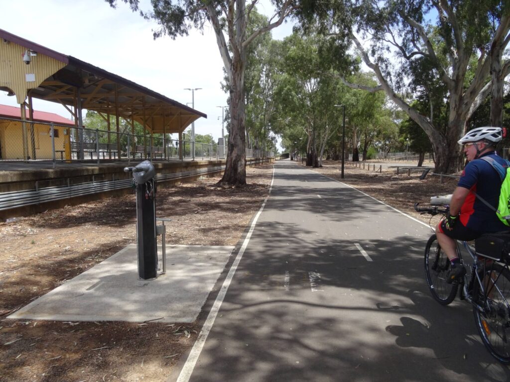
- This trail starts at Salisbury Station, which is on the Gawler Line. The town has two sizeable shopping centres with associated sizeable carparks and good facilities.
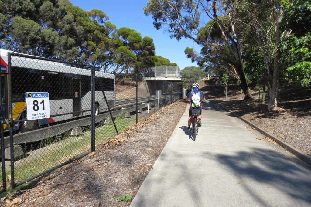
- From the station, find the shared path along its western side. Head north, cross Salisbury Hwy (A9) on the shared bridge and continue north. Approaching the Little Para River, cross the Little Para River Trail and continue north. At the next fork, veer right to squeeze between Salisbury High School and the diverging Main North Line on a shared path that joins Langford Tce. In this section, a pedestrian subway goes right under the Main North Line and this leads to a pedestrian bridge over the Gawler Line. From this bridge, the spur of the Penfield Line is visible diverging from the Gawler one and ending abruptly at the edge of an industrial estate. This spur has been straightened and electrified for use as a railcar siding.
- Continue northwest along Langford Tce with the Main North Line on the right.
- As you pass Compton St you are near the Hilra Station site on the far side of the Main North Line, in what is now an industrial estate. No evidence remains.
- Right turns are not allowed at the northern end of Langford Tce, so cyclists must use the ramp on the right and proceed on the footpath along Bagster Rd, crossing the Main North Line through the chicanes before crossing Bagster Rd to reach closed-to-traffic First Av.
- Here the Penfield Line corridor sits between the Main North one and First Av. At the end of the First Av trail, take the shared path to the left to stay close to the Main North Line, crossing the Penfield Line corridor again in the process.
- The shared path stops at West Av. Penfield 1 Station was just to the northeast of this point but no remains are visible. The security checkpoint at the entrance to the old Weapons Research Establishment lies to the east. Some buildings are still in use but access to this area is no longer restricted.
- At the north-western end of First Av, remains of the Penfield Line are visible on the right. The two tracks curved to the north while a single line went straight ahead to the bulk stores, of which some sawtooth-roof buildings still stand. Ballast and a number of concrete culverts remain near the junction.
Penfield 1 to Penfield 3 (2.9 km)
- This section is initially on the road or footpath, then a good quality shared path resumes to the west of the Penfield Line corridor.
- Proceed north along West Av, which is usually quiet in this section. The eastern footpath is a good option for children or adults who do not wish to ride on the road. Take care at the junction with Woomera Av.
- Before the Purling Av roundabout, cross to the eastern footpath to minimise road crossings. North of Purling Av, the trail is a good quality path well away from the road.
- Approaching Taranaki Rd roundabout, Penfield 3 Station remains are visible on the right.
- At the eastern end of Woomera Av (1.5 km from West Av) is the Penfield Model Engineers Society’s property, with extensive landscaped grounds and miniature railway networks
- The first road crossing north of the Purling Rd roundabout is for the Defence Science and Technology Group (DSTG) main entrance, which can be busy at peak hours
- The Penfield Line crossed Fifth Ave to the west of the DSTG entrance gates and Penfield 2 Station was just south of the entrance road. No evidence remains.
- The base has an AP3C Orion aircraft and Leopard tank on display near the gates
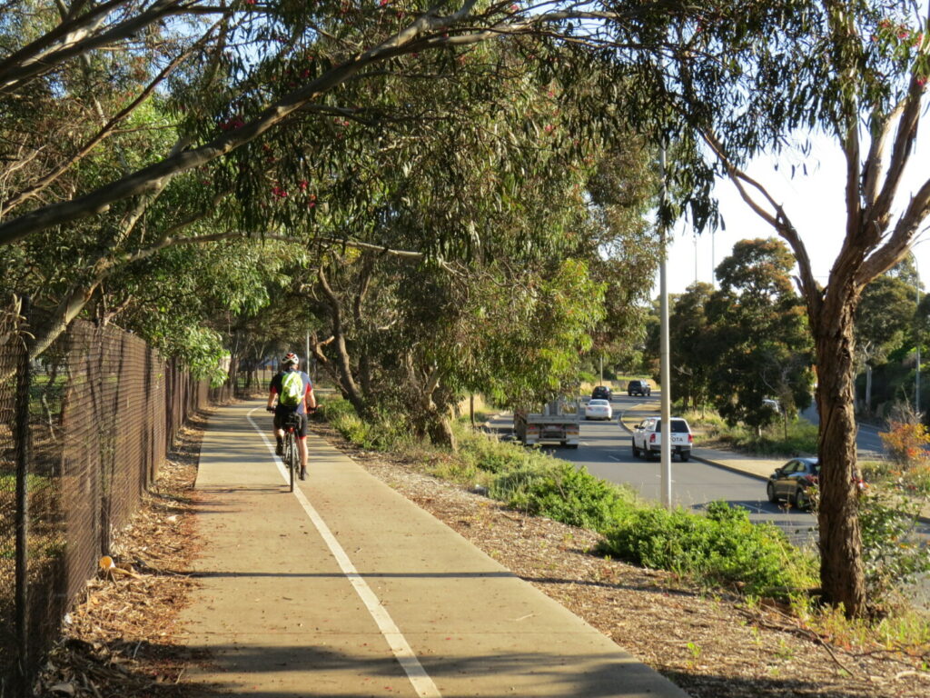
- North of the DSTG entrance, the Penfield railway corridor can be discerned from remaining ballast, culverts and tree lines
- Close to the RAAF Edinburgh fence are several sawtooth-roof red brick warehouses that have loading platforms on their eastern sides. They were served by a spur line that crossed West Av north of Taranaki Rd
- The platform and shelter of Penfield 3 Station remain near Taranaki Rd, but is overgrown
Penfield 3 to Edinburgh North (1.2 km)
- This section is on a good quality sealed path to the west of the Penfield Line “balloon loop”. An alternate route is to travel via Taranaki Rd past Penfield 3 Station and turn left into East Av which, for much of its length, is closed to traffic but open to cyclists and pedestrians.
- The location of the balloon loop can be discerned at various times of the year, depending on crops and grazing
- Both routes end at Bellchambers Rd, Edinburgh North.
- Turn right on Bellchambers Rd to travel to Elizabeth Station and the Gawler Line.
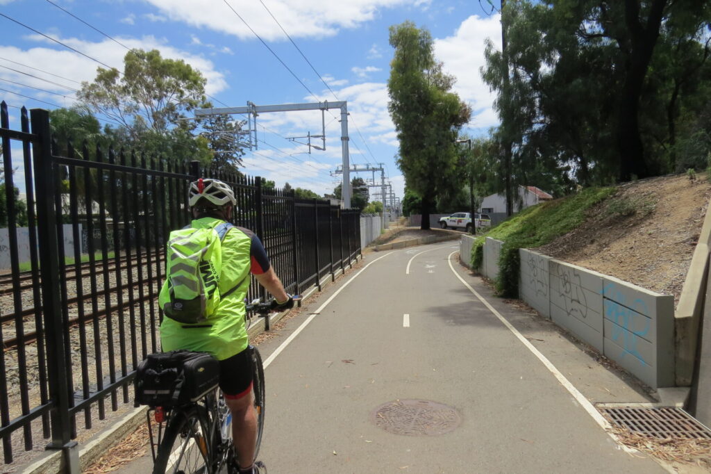
![The spur of the Penfield Line has been straightened and is used for stabling [2025]](jpg/s11-050-the-remaining-spur-of-the-penfield-line-has-been-straightened-and-used-for-stabling-2025-img_5777-300x225.jpg)
The spur of the Penfield Line has been straightened and is used for stabling [2025]
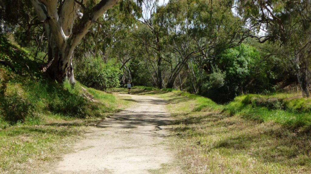
![There's a squeeze between Salisbury High School and the line [2020]](jpg/s03-055-007-penfield-rt-high-school-path-2020-10-300x225.jpg)
There's a squeeze between Salisbury High School and the line [2020]
![Penfield Trail link to the Gawler Greenway [2020]](jpg/s03-055-004-penfield-rt-gawler-greenway-2020-10-300x214.jpg)
Penfield Trail link to the Gawler Greenway [2020]
![Approach to Salisbury Hwy bridge [2020]](jpg/s03-055-002-penfield-rt-salisbury-hwy-bridge-2020-10-300x225.jpg)
Approach to Salisbury Hwy bridge [2020]
![The remains of Penfield 3 Station [2020]](jpg/s03-155-027-penfield-rt-penfield-3-station-2020-10-300x225.jpg)
The remains of Penfield 3 Station [2020]
![Trail uses a section of First Ave [2020]](jpg/s03-105-012-penfield-rt-first-ave-2020-10-300x237.jpg)
Trail uses a section of First Ave [2020]
![Open section of trail along the defence property [2020]](jpg/s11-112-penfield-rt-nth-of-dst-entrance-2020-10-300x225.jpg)
Open section of trail along the defence property [2020]
- Adelaide Metro trains take bikes, with restrictions. Salisbury Line timetable (Monday to Friday) here
Do you know of a bike hire or transportation service on this rail trail that should appear here? If so, let us know at admin@railtrails.org.au.
Information and Links
For further information:
To report any issues or problems contact City of Salisbury
Contact Rail Trails Australia
To contact us about this rail trail, email sa@railtrails.org.au
Background Information
Traditional owners
We acknowledge the Kaurna people, the traditional custodians of the land and waterways on which the rail trail sits.
Rail line history
The Penfield branch line started just north of Salisbury Station on the Gawler Line, then ran northwest and north through defence land in what is now Edinburgh. Opened in 1941 to serve various armament factories, it stopped at Hilra, Penfield 1, Penfield 2 and Penfield 3 stations and had ouble-track for its whole length. It even had a balloon loop at its northern end for locomotives to turn around (see our map)
As it was built for industrial use, sidings branched off both the Up and Down tracks at many locations. The longest went into what is now RAAF Base Edinburgh. During the war years, this branch line was used by passenger trains carrying workers to the munitions factories in the area as well as freight trains carrying raw materials in and armaments out. Passenger trains were necessary because Salisbury was a semi-rural community and most of the workforce had to be brought in from other districts.
The No 2 Explosives and Filling factory sprawled over 11.65 square kilometres of plain in the Penfield area in mid-1942. It employed 6500 people working a six-day week around the clock in three shifts. It was served by 25 passenger trains a day; 19 were from Adelaide, the other six from Gawler, Hamley Bridge, Tanunda, Angaston and Kapunda via a specially built connecting curve from the Main North Line to the Penfield branch line. A more limited peak-hour passenger service continued after the war, serving staff at the government Weapons Research Establishment (later DSTO).
The balloon loop closed in June, 1983, following the derailment of a train of railcars. Services continued to Penfield 3 on the Down track and returned on the Up track using a crossover just south of Penfield 3. The Up track beyond Hilra closed in April, 1984, along with most of the sidings. The remaining sidings were closed in 1986, and single track went for the length of the branch by the end of the 1980s. The remaining peak-hour trains were withdrawn in January, 1991, due to low patronage and the need to upgrade the track. The track was dismantled in the same year but several hundred metres from Salisbury Station were kept so that terminating trains from Adelaide could reverse direction. The spur remains, but the next section to Hilra Station has been replaced by a road.
Gawler rail line reopens
Posted: 10/06/22
After almost two years of closure, the Gawler Rail Electrification Project is nearing completion and ...
More...Nearby Trails
Parafield railside trail
15 km north of Adelaide CBD
3 km


Smithfield Magazine Rail Trail
33 km north of Adelaide CBD
3.5 km
Gawler Greenway railside trail
Adelaide CBD
14 km
Stockade Rail Trail
11 km north of Adelaide CBD
2.6 km
O-Bahn Bikeway trail
Adelaide CBD
16 km
Outer Harbor Greenway railside trail
Adelaide CBD
23 km
Semaphore Rail Trail
16 km north-west of Adelaide CBD
4.2 km
Westside Bikeway rail trail
2 km west of Adelaide CBD
9 km
Mike Turtur Bikeway railside trail
Adelaide CBD
9 km
Coast Park Path Rail Trail
12km north-west of Adelaide CBD
25 km
Barossa Rail Trail
Barossa Valley, 50 km north-east of Adelaide
43 km
Marino Rocks Greenway rail trail
Adelaide CBD
16 km
Amy Gillett Bikeway rail trail
Adelaide Hills, 49 km east of CBD
23 km

Mount Barker Rail Trail
Adelaide Hills, 33km south-east of CBD
5 km
Coast to Vines Rail Trail
20 km south of Adelaide CBD
37 km
Kapunda Rail Trail
78 km north of Adelaide
1 km
Eudunda Rail Trail
112 km north of Adelaide
1 km
Nurragi Conservation Reserve rail trail
Fleurieu Peninsula, 70 km south-east of Adelaide
13 km
Riesling and Rattler Trails
Clare Valley, 130 km north of Adelaide
53 km
Encounter Bikeway railside trail
Fleurieu Peninsula, 85 km south of Adelaide
28 km
Shamus Liptrot Rail Trail
Adelaide Plains, 100 km north of Adelaide
11 km

Copper Rail Trail
Adelaide Plains, 100 km north of Adelaide
39 km
Wool Rail Trail
130 kms north of Adealide
2.2 km
Nearby Trails
Parafield railside trail
15 km north of Adelaide CBD
3 km
Smithfield Magazine Rail Trail
33 km north of Adelaide CBD
3.5 km
Gawler Greenway railside trail
Adelaide CBD
14 km
Stockade Rail Trail
11 km north of Adelaide CBD
2.6 km
O-Bahn Bikeway trail
Adelaide CBD
16 km
Outer Harbor Greenway railside trail
Adelaide CBD
23 km
Semaphore Rail Trail
16 km north-west of Adelaide CBD
4.2 km
Westside Bikeway rail trail
2 km west of Adelaide CBD
9 km
Mike Turtur Bikeway railside trail
Adelaide CBD
9 km
Coast Park Path Rail Trail
12km north-west of Adelaide CBD
25 km
Barossa Rail Trail
Barossa Valley, 50 km north-east of Adelaide
43 km
Marino Rocks Greenway rail trail
Adelaide CBD
16 km
Amy Gillett Bikeway rail trail
Adelaide Hills, 49 km east of CBD
23 km
Mount Barker Rail Trail
Adelaide Hills, 33km south-east of CBD
5 km
Coast to Vines Rail Trail
20 km south of Adelaide CBD
37 km
Kapunda Rail Trail
78 km north of Adelaide
1 km
Eudunda Rail Trail
112 km north of Adelaide
1 km
Nurragi Conservation Reserve rail trail
Fleurieu Peninsula, 70 km south-east of Adelaide
13 km
Riesling and Rattler Trails
Clare Valley, 130 km north of Adelaide
53 km
Encounter Bikeway railside trail
Fleurieu Peninsula, 85 km south of Adelaide
28 km
Shamus Liptrot Rail Trail
Adelaide Plains, 100 km north of Adelaide
11 km
Copper Rail Trail
Adelaide Plains, 100 km north of Adelaide
39 km
Wool Rail Trail
130 kms north of Adealide
2.2 km
2 reviews of “Penfield railside trail”
23/70 Another branch off the Gawler Line that would benefit from a linking trail to Salisbury. Interesting to see the Penfield Model Engineers set-up and the RAAF Base Edinburgh being upgraded. Lots of empty space out here.
A pleasant ride through the historic defence precinct and a safe way to transit from Salisbury to the more northerly suburbs. From its northern end it is only a few kilometres to the Smithfield Magazine Rail Trail and its associated side-trails. We rode Smithfield Magazine, Penfield, Parafield and Stockade Rail Trails all in one day. A great ride through easy flat country.