 Location:
 Length:
 Surface:
 Start / End:
 Suitable for:
- It is a hidden gem in Sydney’s western suburbs and would provide a 2km link with surrounding green spaces and pathways, including the popular Cooks River shared path between Botany Bay, Strathfield and Homebush.
- It would be accessible from Lidcombe Station, via Bachell Ave, at the southern end, and from Edwin Flack Ave at the northern end, just across from the Sydney Olympic Park athletics warm-up arena.
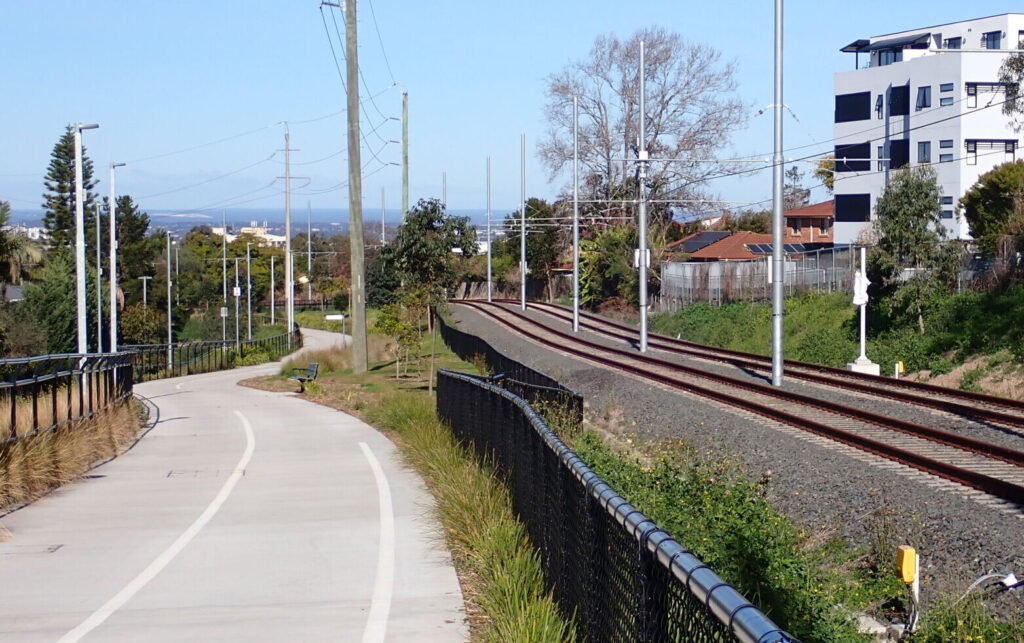
- The existing link between the Cooks River shared path and Olympic Park is on-road for most of the way. The Pippita Rail Trail would provide a quieter off-road path near the historic Rookwood Cemetery
Nearby Attractions
- Sydney Olympic Park is the sporting hub of greater Sydney, having hosted the 2000 Sydney Olympic Games
- The Sydney Olympic Park precinct connects many walking and cycling trails along the Parramatta River
- Lidcombe offers culinary and cultural experiences
- This short trail would connect the transport hub at Lidcombe with the greater western network of off-road trails.
Last updated: 18 December 2025
The trail is relatively short at 3 km, but when completed will provide a natural linkage with surrounding green spaces and pathways.
It will be accessible from Bachell Avenue at the southern end, and from Edwin Flack Avenue in the northern end, on the edge of Sydney Olympic Park.
Lidcombe has many shops and restaurants, and Sydney Olympic Park has restaurants, cafes and hotels. It also has a regular suburban train service on the T1 line.
Sydney Olympic Park has historical sites and good tourist, cycling and walking amenities. The Parramatta River is at the north end of the area. There are off-road cycle paths to Parramatta, Liverpool and Prospect Reservoir, and safe cycling paths from Parramatta through Westmead to the 42 km M7 cycleway.
Important note: This rail trail is not yet open. The alignment is owned by Transport NSW and most of it passes through private property. Trespassing on the alignment is prohibited.
Section Guides
This trail is not yet open.
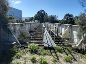
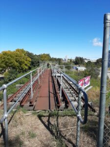
This forgotten trail is to be transformed into a viable Rail Trail
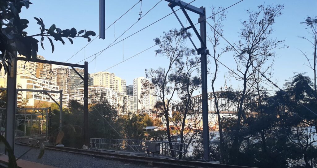
Disused Pippita railway line, facing south near Parramatta Road
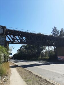
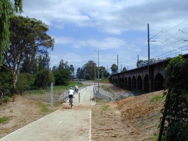
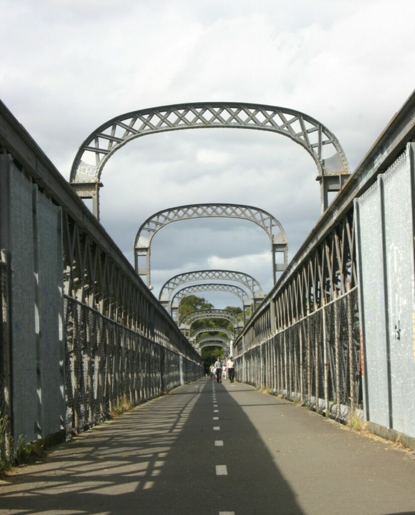
Disused rail bridge over Parramatta Road
Do you know of a bike hire or transportation service on this rail trail that should appear here? If so, let us know at admin@railtrails.org.au.
Information and Links
Cumberland Council released a detailed design for the trail on 15 February, 2024. Details are available in the council’s media release.
Funding for developing this rail trail was announced by NSW Minister for Infrastructure, Cities and Active Transport Rob Stokes in August, 2022. To see our news item about this, click here.
To see a 7News video about the announcement, click here.
Find further information about the history of Pippita here
For more background on the Pippita Rail Trail proposal and how it links Lidcombe to Sydney Olympic Park:
Contact Rail Trails Australia
To contact us about this rail trail, email nsw@railtrails.org.au
Background Information
Traditional owners
We acknowledge the Dharug people, the traditional custodians of the land and waterways on which the rail trail will be built.
Development and future of the rail trail
The trail will begin at the northern side of Lidcombe station, running off Bachell Ave. It will be to the east of existing warehouses in both Bachell Ave and Birnie St. The alignment ends at Edwin Flack Ave in Olympic Park.
The rail trail will be easily accessible from either Lidcombe or Olympic Park train stations.
Rail line history
The Pippita rail trail will use the former goods railway line alignment that existed before Sydney Olympic Park was constructed. A spur line from Lidcombe to a meatworks at Pippita was closed in 1995.
There are disused bridges over Parramatta Road and the M4 motorway, just to the west of the current suburban rail line, that will be re-used as part of the rail trail.
Pippita Rail Trail detailed design released
Posted: 17/02/24
Cumberland Council has released the proposed design for the Pippita Rail Trail, a 2.4 kilometre walking ...
More...Pippita Rail Trail gets development funding
Posted: 11/08/22
NSW Minister for Infrastructure, Cities and Active Transport Rob Stokes has announced funding of $770,000 for ...
More...Rapid progress on the Pippita Trail (Lidcombe to Sydney Olympic Park)
Posted: 25/09/20
The potential of the Pippita Trail has been identified and rapid initial progress has been ...
More...Nearby Trails
Meadowbank Railway Bridge
15 km west of Sydney
0.5 km


Rosehill to Carlingford rail trail
Western Sydney, 23km west of CBD
5 km
Parramatta to Liverpool rail trail
Western Sydney, 25km west of CBD
16 km
Cooks to Cove Greenway
Sydney
6 km
Goods Line
2km from Sydney GPO
1 km
Lavender Bay “High Line”
Milsons Point to Waverton

Como Bridge
20 km south of Sydney
2 km
Lapstone Zig Zag rail trail
Lower Blue Mountains, 60 km west of Sydney
1.5 km
Mt Kembla Memorial Pathway rail trail
Illawarra region, 100km south of Sydney
2 km
Box Vale Tk rail trail
Southern Highlands, 110km south-west of Sydney
4 km
Wolgan Valley Rail Trail
Wolgan Valley, 190km west of Sydney
11 km
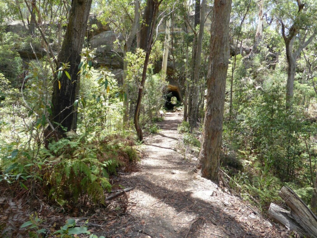
Awaba – Wangi Wangi Rail Trail
130 km north of Sydney
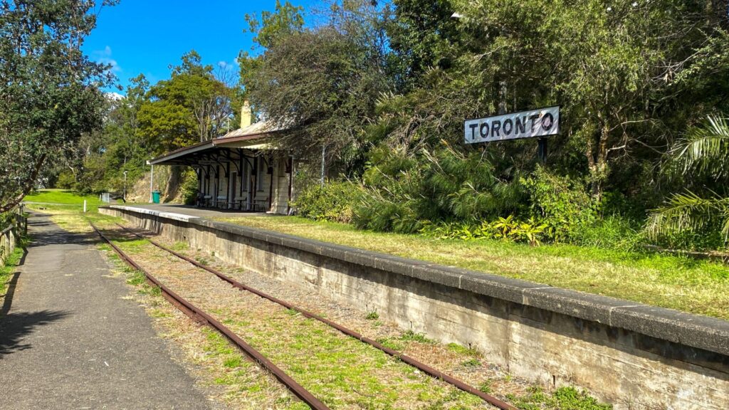
Fassifern to Toronto Greenway rail trail
Lower Hunter, 26km south-west of Newcastle CBD
4 km
Pioneer Rail Trail
Central Tablelands, 180km west of Sydney
6 km
Fernleigh Track rail trail
Lower Hunter, 5km south of Newcastle CBD
16 km
Richmond Vale Rail Trail
160 km north of Sydney, 12 km northwest of Newcastle
Wallsend tramway rail trail
Lower Hunter, 13km west of Newcastle CBD
9 km
Nearby Trails
Meadowbank Railway Bridge
15 km west of Sydney
0.5 km
Rosehill to Carlingford rail trail
Western Sydney, 23km west of CBD
5 km
Parramatta to Liverpool rail trail
Western Sydney, 25km west of CBD
16 km
Cooks to Cove Greenway
Sydney
6 km
Goods Line
2km from Sydney GPO
1 km
Lavender Bay “High Line”
Milsons Point to Waverton
Como Bridge
20 km south of Sydney
2 km
Lapstone Zig Zag rail trail
Lower Blue Mountains, 60 km west of Sydney
1.5 km
Mt Kembla Memorial Pathway rail trail
Illawarra region, 100km south of Sydney
2 km
Box Vale Tk rail trail
Southern Highlands, 110km south-west of Sydney
4 km
Wolgan Valley Rail Trail
Wolgan Valley, 190km west of Sydney
11 km
Awaba – Wangi Wangi Rail Trail
130 km north of Sydney
Fassifern to Toronto Greenway rail trail
Lower Hunter, 26km south-west of Newcastle CBD
4 km
Pioneer Rail Trail
Central Tablelands, 180km west of Sydney
6 km
Fernleigh Track rail trail
Lower Hunter, 5km south of Newcastle CBD
16 km
Richmond Vale Rail Trail
160 km north of Sydney, 12 km northwest of Newcastle
Wallsend tramway rail trail
Lower Hunter, 13km west of Newcastle CBD
9 km