 Location:
 Length:
 Surface:
 Start / End:
 Suitable for:
A massive engineering project to get trains into the Blue Mountains, the 1.5 km Knapsack Zig Zag was used for less than 30 years before part of it spent time as a road. It's found its true calling as a great little rail trail.
- To check out the impressive sandstone viaduct over Knapsack Gully, the largest in Australia when construction started in 1863
- The Lapstone Zig Zag was the first full zig zag on any main line in the world
- To enjoy the all-abilities path from Knapsack Street to the Top Points viewing platform.
Nearby Attractions
- Lennox Bridge on the Macquarie Pass
- Blue Mountains World Heritage Area
- Sydney Harbour and CBD
- Great Lismore Zig Zag.
Last updated: 15 July 2025
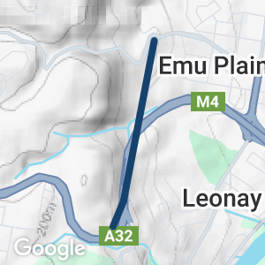
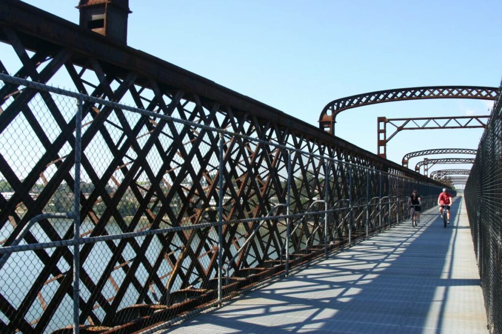
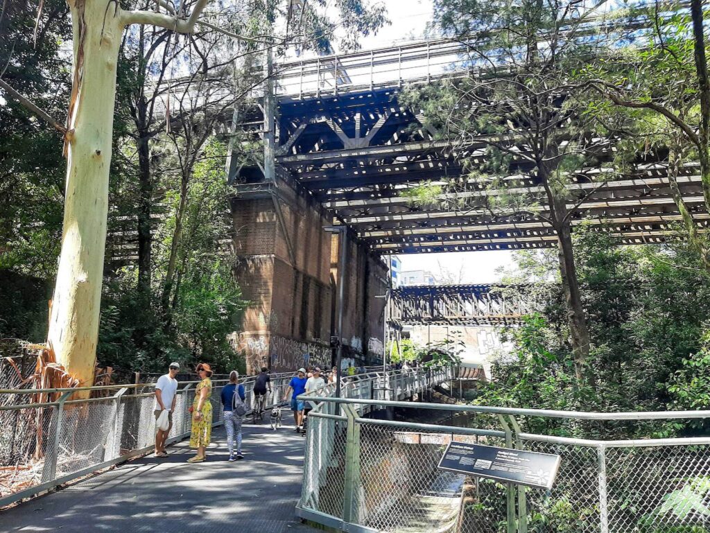
The Lapstone Zig Zag is in the Lower Blue Mountains suburb of Lapstone. The 1867 Knapsack Viaduct that forms part of it is signposted from the Emu Plains exit of the Great Western Hwy (M4). From the car park at the junction of the old highway (which used the viaduct for a while) and Mitchells Pass, a concrete path rises gently as it follows the zig zag to the viaduct and across it. From here, dirt paths (suitable for walking only) descend below the stone arches and up to Elizabeth Lookout
The highway took the alignment of the rest of the bottom leg of the zig zag, but it is possible to walk from the viaduct along the footpath next to the M4 to reach stairs to the middle “leg” of this engineering marvel. This neglected uphill section is still dirt and ballast.
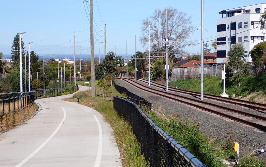
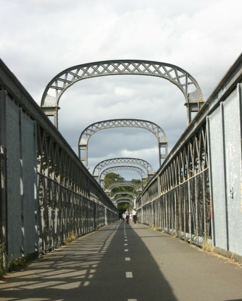
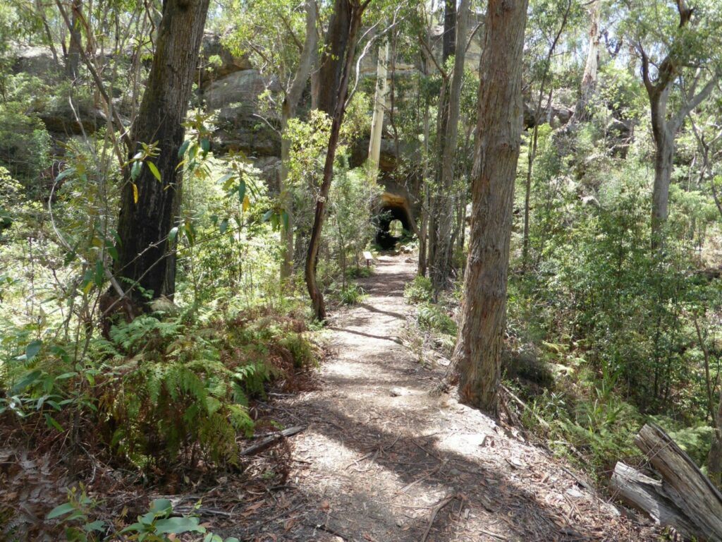
The top section is more easily reached from a recently built trailhead at the eastern end of Knapsack St, which will take you down through some of the major cuttings on smooth asphalt and past the Lucasville Station site to the upgraded Top Points Lookout.
The 634 m Glenbrook Tunnel, which bypassed the awkward zig zag after only 25 years, is located mainly south of the curving Great Western Hwy. A second railway viaduct built to the east as part of that re-routing project is still in use in conjunction with a wider, two-track Glenbrook Tunnel. The first one was closed after only 21 years but may be recommissioned for cyclists and pedestrians. The upgraded track to the eastern portal of the old tunnel is further along Governors Drive, next to a water reservoir.
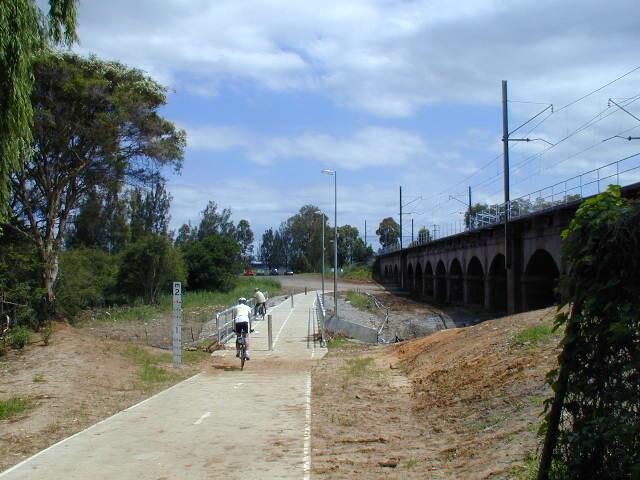
![The bottom leg of the Lapstone Zig Zag later served as a road [2024]](jpg/n10-050-lapstone-lower-leg-2024-03-17_150030-300x169.jpg)
The bottom leg of the Lapstone Zig Zag later served as a road [2024]
![The Knapsack Viaduct is a popular attraction for tourists [2024]](jpg/n10-100-john-whitton-bridge-2024-03-17_150633-300x169.jpg)
The Knapsack Viaduct is a popular attraction for tourists [2024]
![New wayfinding signage is much easier to follow [2025]](jpg/n10-050-colourful-wayfinding-signage-on-the-trail-2025-img_6224-225x300.jpg)
New wayfinding signage is much easier to follow [2025]
![One of the deep zig zag cuttings near Knapsack Street [2025]](jpg/n10-050-one-of-the-deep-cuttings-at-the-top-of-the-zig-zag-near-knapsack-st-2025-img_6223-300x225.jpg)
One of the deep zig zag cuttings near Knapsack Street [2025]
![The Knapsack Street trailhead has been landscaped [2025]](jpg/n10-050-fresh-planting-at-the-knapsack-st-trailhead-2025-img_6227-225x300.jpg)
The Knapsack Street trailhead has been landscaped [2025]
![Glenbrook Tunnel's eastern portal after a tidy up of the access track [2025]](jpg/n10-150-glenbrook-tunnel-eastern-portal-2025-img_6214-225x300.jpg)
Glenbrook Tunnel's eastern portal after a tidy up of the access track [2025]
Do you know of a bike hire or transportation service on this rail trail that should appear here? If so, let us know at admin@railtrails.org.au.
Information and Links
For more information:
- https://en.wikipedia.org/wiki/Lapstone_Zig_Zag
- https://en.wikipedia.org/wiki/Glenbrook_Tunnel_(1892)
- http://www.visitsydneyaustralia.com.au/glenbrook-railway.html
To advertise your rail trail support business on this page, please click here.
To contact us about this trail, Email or click here: ns*@************rg.au
Contact Rail Trails Australia
To contact us about this rail trail, email nsw@railtrails.org.au
Background Information
Traditional owners
We acknowledge the Dharug people, the traditional custodians of the land and waterways on which the rail trail is built.
Development and future of the rail trail
Much of the abandoned railway corridor can be reached via the rail trail.
Railway line history
This section of the Main Western Line was completed in 1865 and opened for traffic two years later. The structure was repeated on the western side of the Blue Mountains with what is now the arguably more famous Great Lithgow Zig Zag between Clarence and Lithgow.
The Lapstone Zig Zag and Lucasville Station were officially closed after just 27 years, having been bypassed by the first Glenbrook Tunnel.
Around 1910 the lower section, including the viaduct, got a second chance as part of the Great Western Hwy, which was the main road up Lapstone Hill until the M4 Mwy replaced it in 1993. The M4 also uses part of the lower section. A second Glenbrook Tunnel, with double tracks and a gentler grade, bypassed the first one at that time.
Nearby Trails
Parramatta to Liverpool rail trail
Western Sydney, 25km west of CBD
16 km


Rosehill to Carlingford rail trail
Western Sydney, 23km west of CBD
5 km
Pippita Rail Trail
19km west of Sydney, near Sydney Olympic Park

Meadowbank Railway Bridge
15 km west of Sydney
0.5 km
Como Bridge
20 km south of Sydney
2 km
Cooks to Cove Greenway
Sydney
6 km
Lavender Bay “High Line”
Milsons Point to Waverton
Goods Line
2km from Sydney GPO
1 km
Wolgan Valley Rail Trail
Wolgan Valley, 190km west of Sydney
11 km
Pioneer Rail Trail
Central Tablelands, 180km west of Sydney
6 km
Mt Kembla Memorial Pathway rail trail
Illawarra region, 100km south of Sydney
2 km
Box Vale Tk rail trail
Southern Highlands, 110km south-west of Sydney
4 km
Awaba – Wangi Wangi Rail Trail
130 km north of Sydney
Nearby Trails
Parramatta to Liverpool rail trail
Western Sydney, 25km west of CBD
16 km
Rosehill to Carlingford rail trail
Western Sydney, 23km west of CBD
5 km
Pippita Rail Trail
19km west of Sydney, near Sydney Olympic Park
Meadowbank Railway Bridge
15 km west of Sydney
0.5 km
Como Bridge
20 km south of Sydney
2 km
Cooks to Cove Greenway
Sydney
6 km
Lavender Bay “High Line”
Milsons Point to Waverton
Goods Line
2km from Sydney GPO
1 km
Wolgan Valley Rail Trail
Wolgan Valley, 190km west of Sydney
11 km
Pioneer Rail Trail
Central Tablelands, 180km west of Sydney
6 km
Mt Kembla Memorial Pathway rail trail
Illawarra region, 100km south of Sydney
2 km
Box Vale Tk rail trail
Southern Highlands, 110km south-west of Sydney
4 km
Awaba – Wangi Wangi Rail Trail
130 km north of Sydney
3 reviews of “Lapstone Zig Zag rail trail”
39/70 The new smooth asphalt path from Knapsack St and associated parking area is a big improvement for people of all abilities. There's new signage as well. Hopefully the middle leg down to the Great Western Hwy (M4) will get a similar treatment so that you don't have to go down steps or bushwalking
Explored this trail again over the new year weekend. It is justifiably popular with locals (great for short walks and cycling for littlies), and probably under appreciated by the thousands of tourists who travel past it unawares to the more famous parts of the Blue Mountains. Well worth a visit.
I walked this trail this morning (28/3/16) and it is a very popular with locals – riders, walkers and their dogs. It’s an easy walk up to the viaduct and then stairs up to the rail zig zag section. I found it really interesting, because it gave great views over the west Sydney region, good insight into the geology of the edge of the Blue Mountains, and great bush. I really recommend this trail, though the zig zag section is more for walking than riding, because of the difficulty in getting to it from the carparks.