 Location:
 Length:
 Surface:
 Start / End:
 Suitable for:
The 16km Parramatta to Liverpool rail trail links Sydney’s second and third biggest population centres beside the busy railway line with a paved, shared path through a variety of landscapes.

- This path is mostly shared with low-volume foot traffic, with some short on-road sections
- You can access it at many intermediate points, including all railway stations between Parramatta and Liverpool (T2 Leppington and T5 Cumberland Lines)
- Parramatta has many connecting walking and cycling paths (mostly off-street) that provide links to Olympic Park via the Parramatta River.
Nearby Attractions
- Old Government House
- Parramatta Park
- Elizabeth Farm
- Powerhouse Museum branch under construction in Parramatta CBD
- Cabramatta’s famous Vietnamese restaurants
- Prospect Reservoir, to the south of the Guildford Railway Station
- Parramatta Light Rail shared path
Last updated: 19 October 2025
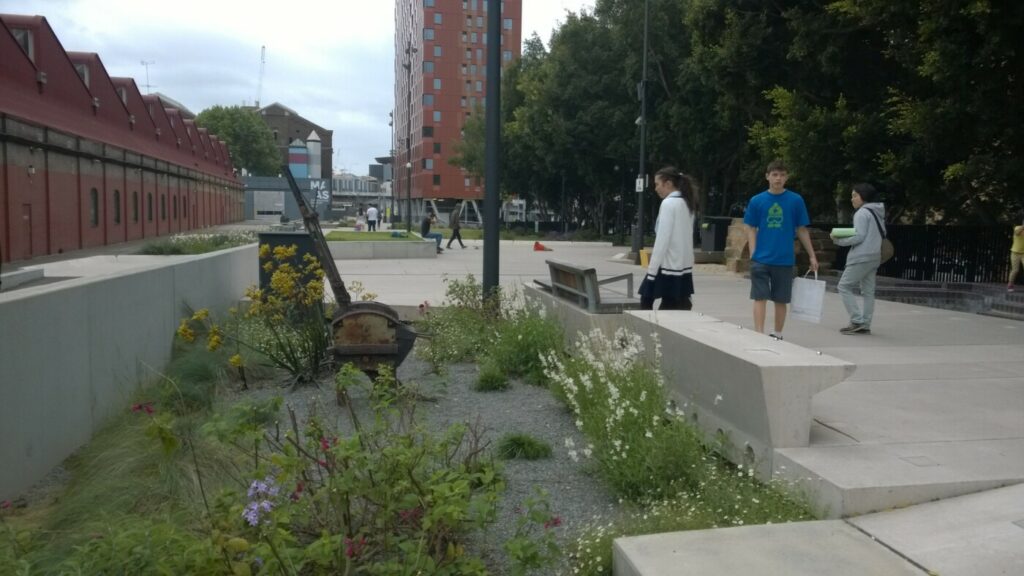
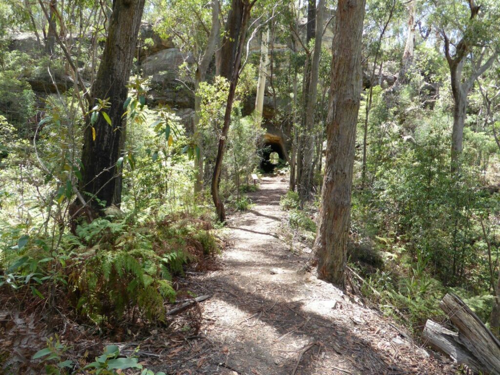
This trail between Paramatta and Liverpool runs through a variety of landscapes, including sections of urban bushland, industrial areas and creek crossings with old brick railway bridges. The trail is most easily accessed from Harris Park or Merrylands at the northern end, or at any of the stations from Merrylands to Liverpool.
Care needs to be taken near railway stations due to the high numbers of pedestrians using trains and shops. Be very vigilant at road crossings, particularly busy Pevensey St between Canley Vale and Cabramatta. Dismount and walk.
Section Guides
Parramatta to Liverpool (16km)
- Access: The start of the trail is at Parramatta Station off Darcy St, but it is more easily reached from the next ones, Harris Park or Merrylands
- Shorter rides or walks can be undertaken from other stations
- The path beneath the Western Mwy (M4) can be difficult to find. Signage is limited and care should be taken to consult the website map (see FURTHER INFORMATION)
- The trail runs through residential areas from there to Guildford
- From Guildford, the surroundings become more industrial as the trail passes through factory areas around Yennora
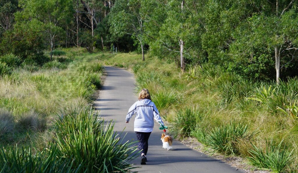
- From Fairfield to Warwick Farm there is a mix of suburban areas and bushland
- At Warwick Farm, the trail runs towards Liverpool Hospital and becomes an on-road path for the final stretch into Liverpool.
- It ends on the corner of Scott and Bigge St
- Liverpool is a major city with all facilities
Cabramatta Creek between Cabramatta and Warrick Farm
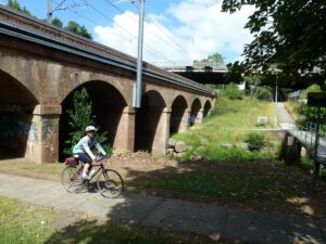
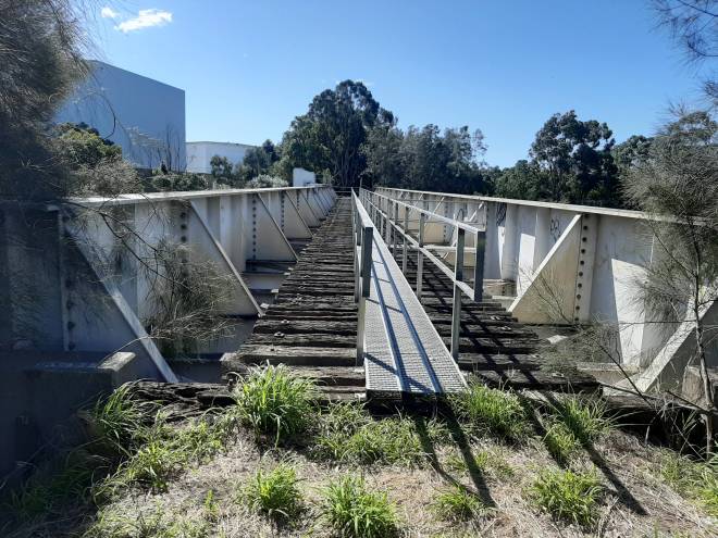
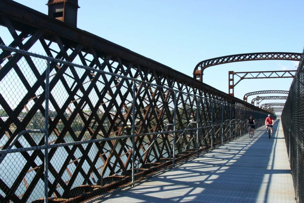
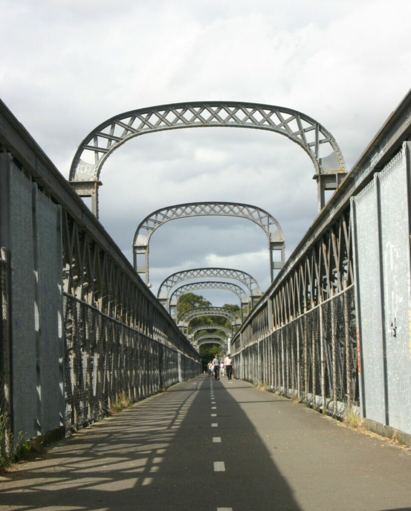
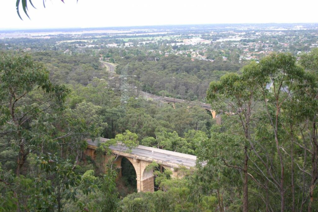
Beautiful railway viaduct at Prospect Creek (2015)
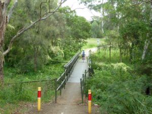
Crossing Orphan School Creek near Canley Vale (Apr 2015)
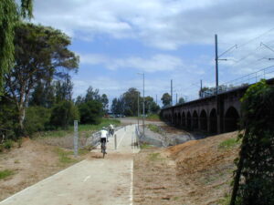
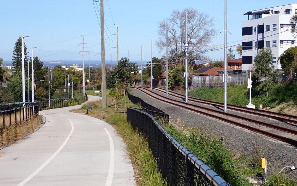
Cycleway along Railway Tce near Merrylands (Apr 2015)
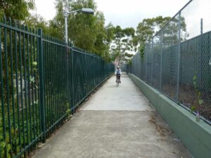
Cycleway adjacent to Harris Park Railway Station (Apr 2015)
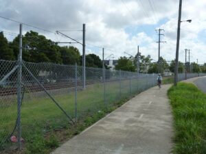
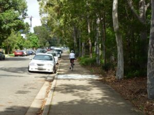
Cycleway between Merrylands and Guildford (Apr 2015)
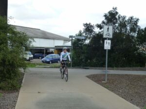
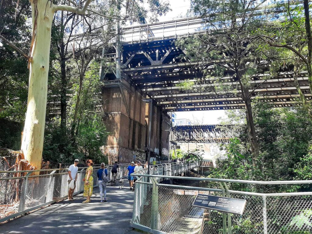
Cycleway junction under the M4 freeway (Apr 2015)
Do you know of a bike hire or transportation service on this rail trail that should appear here? If so, let us know at admin@railtrails.org.au.
Information and Links
For further information click on the link below:
Contact Rail Trails Australia
To contact us about this rail trail, email nsw@railtrails.org.au
Background Information
Traditional Owners
We acknowledge the Dharug people, the traditional custodians of the land and waterways on which the rail trail is built
Railway History
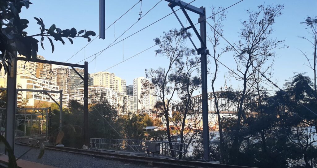
The trail was opened in December 2000 and remains one of few railside paths in Sydney. It follows the very busy Parramatta to Liverpool Line through residential and industrial landscapes, providing an urban snapshot of western Sydney.
Nearby Trails
Pippita Rail Trail
19km west of Sydney, near Sydney Olympic Park

Rosehill to Carlingford rail trail
Western Sydney, 23km west of CBD
5 km


Meadowbank Railway Bridge
15 km west of Sydney
0.5 km
Cooks to Cove Greenway
Sydney
6 km
Como Bridge
20 km south of Sydney
2 km
Goods Line
2km from Sydney GPO
1 km
Lavender Bay “High Line”
Milsons Point to Waverton
Lapstone Zig Zag rail trail
Lower Blue Mountains, 60 km west of Sydney
1.5 km
Mt Kembla Memorial Pathway rail trail
Illawarra region, 100km south of Sydney
2 km
Box Vale Tk rail trail
Southern Highlands, 110km south-west of Sydney
4 km
Wolgan Valley Rail Trail
Wolgan Valley, 190km west of Sydney
11 km
Pioneer Rail Trail
Central Tablelands, 180km west of Sydney
6 km
Awaba – Wangi Wangi Rail Trail
130 km north of Sydney
Fassifern to Toronto Greenway rail trail
Lower Hunter, 26km south-west of Newcastle CBD
4 km
Fernleigh Track rail trail
Lower Hunter, 5km south of Newcastle CBD
16 km
Nearby Trails
Pippita Rail Trail
19km west of Sydney, near Sydney Olympic Park
Rosehill to Carlingford rail trail
Western Sydney, 23km west of CBD
5 km
Meadowbank Railway Bridge
15 km west of Sydney
0.5 km
Cooks to Cove Greenway
Sydney
6 km
Como Bridge
20 km south of Sydney
2 km
Goods Line
2km from Sydney GPO
1 km
Lavender Bay “High Line”
Milsons Point to Waverton
Lapstone Zig Zag rail trail
Lower Blue Mountains, 60 km west of Sydney
1.5 km
Mt Kembla Memorial Pathway rail trail
Illawarra region, 100km south of Sydney
2 km
Box Vale Tk rail trail
Southern Highlands, 110km south-west of Sydney
4 km
Wolgan Valley Rail Trail
Wolgan Valley, 190km west of Sydney
11 km
Pioneer Rail Trail
Central Tablelands, 180km west of Sydney
6 km
Awaba – Wangi Wangi Rail Trail
130 km north of Sydney
Fassifern to Toronto Greenway rail trail
Lower Hunter, 26km south-west of Newcastle CBD
4 km
Fernleigh Track rail trail
Lower Hunter, 5km south of Newcastle CBD
16 km
3 reviews of “Parramatta to Liverpool rail trail”
A good urban trail. Have not cycled completely only from Liverpool to Fairfield. It beats using the road!
I rode this trail yesterday from Parramatta to Liverpool. I agree with the comments by cascho – the trail is in generally good condition although signage is lacking in some parts. Also some of the paths through the station areas have changed since I was last on the trail. Still a good trail overall, with a few really nice sections. Signage to turn right after Warwick Farm is missing. The road overpass at Cabramatta is also a bit tricky to negotiate.
I rode this trail this morning (25/3/16) with my brother. It was a quiet morning for the trail, which was great because it passes through some busy pedestrian areas associated with the nearby train stations. The quality of the trail is good, and the surface can handle most bikes no problem. Signage can be a problem in some areas, especially going under the M4 and around Warwick Farm, but the trail can be easily followed. There is just one major hill at Guildford – which gives great views in all directions. The trail gives great insight into the surrounding suburbs and their different vibes. I found it a good rail trail.