 Location:
 Length:
 Surface:
 Start / End:
 Suitable for:
The NSW National Parks and Wildlife Service have done an amazing job in bringing this rail trail back to life. Once at the car park at the start of the walk there are information signs and toilets, with interpretive panels along the way explaining the railway, the locomotives and the shale oil refinery. This has been a $4.3 million project to provide access to the 387m tunnel which is now home to thousands of sparkling glow worms and to complete the track to the valley floor. The tunnel is totally dark, except for the glow worms, so you will need to have a head torch with a red light option, otherwise you won’t see the glow worms.

A spectacular walk following the route of a former standard-gauge private railway that served kerosene shale mines and a refinery. The railway ran through two tunnels, the second of which (closer to Newnes) now has a large population of glow worms. The total distance from Newnes Junction to Newnes is 50km.
Between Newnes Junction and the first tunnel the former railway is now mostly a gravel road. Shortly after the first tunnel, the road ends at a carpark and from here it is walking only through the glow worm tunnel down to the valley floor.
There are two options to travel to the Glow Worm Tunnel Car Park and rail trail from the south – from Lithgow or from Clarence Station site. Both options are around 35km and are close to an hour’s drive on mostly gravel roads.
Warning: You will probably encounter many 4WD and trail bikes on these gravel roads.
Nearby Attractions
- Lithgow Zig Zag
- Glow Worm Tunnel
- Spectacular views of Wolgan Valley
Last updated: 19 December 2025
Access points
- Lithgow
- Clarence Railway Station
- Newnes
- Glow Worm Car Park
The easiest access on graded gravel roads is via Lithgow on State Mine Gully Road until it becomes the Glow Worm Tunnel Road at the junction with the Old Bells Line of Road.
The other way to access the trail is via Clarence Railway Station, using the Old Bells Line of Road till you reach the Glow Worm Tunnel Road.
The Glow Worm Tunnel Road then follows the alignment of the former railway, with lovely curves and cuttings along the way as you pass through the State Forest. There are two tunnels along the alignment – one on the road to drive through, and the other, the longer Glow Worm tunnel on the walking track proper.
While it is possible to cycle this section, the road carries quite an amount of traffic, and once at the trail head carpark it is not possible to ride through the second tunnel.
Once at the trailhead there are two options, either a walk through the tunnel for as far as you want to go along the rail trail and return the same way, or walk along a circular track from the trailhead and the short Pagoda Track to the Old Coach Road, and then via the rail trail back to the start. The return walk through the Glow Worm Tunnel to the Wolgan Valley Lookout is around 6km, and the circular walk 9km.
There is currently no road access to the Wolgan Valley, so the rail trail is the only way to get there. You can extend the walk along the final 8km of the trail and stay at the Newnes Hotel Cabins and return the same way the following day or so.
Newnes
There is a large camping area surrounded by spectacular rock walls and some cabins at Newnes. However the road to the Wolgan Valley has had a large landslip and it currently impossible to access the valley this way. There are many hotels in Lithgow or in the western Blue Mountains towns and surrounds.
It is worth continuing a short distance past Newnes town site to the ruins of the shale oil mining operation. The trail ends at the base of these ruins: interpretive signs have been set up to give visitors an appreciation of what was once an enormous enterprise in a very remote location.
The former railway is now part of Wollemi National Park managed by the NSW National Parks and Wildlife Service. Refer to the NWPS at the link below for more information
Section Guides
Clarence Station to Glow Worm Tunnel Rd (9 km)
From the Clarence Station site on Chifley Rd, Clarence, the unsealed Old Bells Line of Road travels to the right (northeast) around the station buildings.
Clarence Station is also the Zig-Zag Railway’s top station. Several buildings and some rolling stock can be viewed at the site. It is around 9 km from Clarence Station to the junction with State Mine Gully Rd/ Glow Worm Tunnel Road. Turn right at the junction to go to the Glow Worm Tunnel; the left turn goes to Lithgow as per the description below.
Lithgow to Glow Worm Tunnel Rd (6 km)
If riding or driving from Lithgow railway station, head out from the north side of the station, turn right and travel through Lithgow’s suburbs on Atkinson St and State Mine Gully Rd to the interesting State Mine Heritage Park and Railway. Continue north on State Mine Gully Rd. The road will become gravel and after a short but very steep climb intersects Old Bells Line of Road and becomes Glow Worm Tunnel Rd. As at July 2020 this steep section of road was in poor condition and best accessed by 4WD, especially heading north to the tunnels in wet weather.
Glow Worm Tunnel Rd to Glow Worm Tunnel Car Park (27 km)
The intersection of State Mine Rd and Old Bells Line of Road is on a plateau at the top of the hill. From there it is 27km and 40 minutes on gravel road to the Glow Worm Tunnel Car Park. Continue north on the main gravel road through State forest for about 8 km to a crossroads and Bungleboori Picnic Area. Continue straight through the crossroads; the main gravel road continues north-northeast.
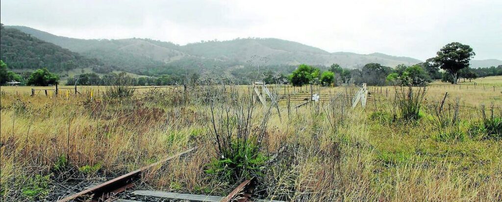
At around 15km past the crossroads and Bungleboori Picnic Area, is Deane’s Siding, where there are some rusty pieces of old railway engines. Much of Glow Worm Tunnel Rd is on or close to the old railway alignment, but it is here where the rail trail proper begins. The road is still a gravel road but it is now obvious that it is running along the former railway. Deane’s Siding also marks the beginning of a long downhill section – bliss on a bike!
After around 8km you will reach Newnes No 1 Tunnel: beware of motor vehicles. Just past the tunnel the trail curves around and descends dramatically; the scenery here is spectacular. Continue downward to a car park for the Glow Worm Tunnel.
Glow Worm Tunnel Car Park to (and through) Glow Worm Tunnel (1.3 km)
From here all car access is banned and the National Parks and Wildlife Service does not allow bicycles. The trail is narrow and climbs around bridge washouts in places. This short section is the most popular part of the trail and there are dozens of people here on weekends. The NPWS have put a lot of work into this trail with many interpretive signs, toilet etc
The Glow Worm Tunnel is just over a kilometre from the carpark. Not surprisingly, it is very dark and you may need a torch. The tunnel floor has recently been renovated with a smooth gravel surface, and drainage has been improved, DO NOT shine torches at the glow worms or touch them! When you are in the middle of the tunnel, turn off your torch and take in the great show from the glow worms.
At the other end of the tunnel is a moist, Jurassic Park world of ferns, palm trees and deep gullies. Remains of a railway bridge over a stream are visible. Continue through the deep cutting (much of the way is thick with vegetation and water) for about 250 m to the other side of the escarpment and magnificent views of Wolgan Valley. Most people return to the carpark via the same route from here, or from the end of the Tunnel, a round trip around 3km.
Glow Worm Tunnel to Newnes (11 km)
The rail trail continues along the edge of the escarpment; to your right is sheer rock face; to your left, continuing views of the valley. The odd sleeper is still visible but much of the railway heritage is gone. This is probably the best section to cycle; however, a number of bridges have been washed out (a problem experienced by the rail line during operation), necessitating some steep climbs around washouts. Bushfires in 2019 and 2020 burnt out many of the steps in the washouts and recent storms have caused tree falls and rock slides, so this section is likely to be slow and best on foot rather than ridden.
Eventually the rail trail comes to a crossroads with tracks to the left and right. Continue straight ahead to follow the Rail Trail to Newnes. The steep (downward) track to the left ends at Wolgan River (crossing is easy via a weir) and then reaches the main (good-quality dirt) road to Newnes. Turn right on this main road to go to Newnes (an easy 5 km on flat terrain), turn left to return (at one stage via a very steep hill) to Lithgow (about 40 km, partly dirt but bitumen from the start of the steep hill onward). The track to the right is the Old Coach Road, which returns to the trail between the Glow Worm Tunnel and the carpark and makes for a 7.5 km, four-hour loop walk.
![The road from Deane to Tunnel 1 is really for cars (and kangaroos) [2009]](jpg/n15-150-tunnel-1-to-deane-2009-01-6645-300x200.jpg)
The road from Deane to Tunnel 1 is really for cars (and kangaroos) [2009]
![Tunnel 1 is now part of the access road [2009]](jpg/n15-200-tunnel-1-2009-01-6641-300x200.jpg)
Tunnel 1 is now part of the access road [2009]
![The trailhead for the glow worm tunnel (Tunnel 2) with detailed signage [David Wardle 2025]](jpg/n15-205-tunnel-2-trail-head-2025-04-08_094004-300x169.jpg)
The trailhead for the glow worm tunnel (Tunnel 2) with detailed signage [David Wardle 2025]
![Detail of part of the sign [David Wardle 2025]](jpg/n15-205-tunnel-2-trail-head-2025-04-08_094022_crop-300x251.jpg)
Detail of part of the sign [David Wardle 2025]
![Steps carved in the rocks from the car park down to Tunnel 2 (Glow Worm tunnel) [2009]](jpg/n15-210-tunnel-2-to-trail-car-park-2009-01-6623_31-200x300.jpg)
Steps carved in the rocks from the car park down to Tunnel 2 (Glow Worm tunnel) [2009]
![The trail approaching the Glow Worm tunnel [David Wardle 2025]](jpg/n15-250-tunnel-2-upper-end-2025-04-08_130933-169x300.jpg)
The trail approaching the Glow Worm tunnel [David Wardle 2025]
![The entrance to the Glow Worm tunnel [David Wardle 2025]](jpg/n15-250-tunnel-2-upper-end-2025-04-08_134001-169x300.jpg)
The entrance to the Glow Worm tunnel [David Wardle 2025]
![The entrance to the glow worm tunnel [David Wardle 2025]](jpg/n15-250-tunnel-2-upper-end-2025-04-08_133800-169x300.jpg)
The entrance to the glow worm tunnel [David Wardle 2025]

In the lush rainforest at the Newnes end of the Glow Worm tunnel. (2009)

New walking bridge to replace rail bridge
![Looking over the Wolgan Valley just below the Glow Worm tunnel [2009]](jpg/n15-260-constance-to-tunnel-2-2009-01-6565-300x200.jpg)
Looking over the Wolgan Valley just below the Glow Worm tunnel [2009]
![A spectacular sandstone cutting walking down from the Glow Worm tunnel to the valley floor [2017]](jpg/n15-260-constance-to-tunnel-2-2017-07-225x300.jpg)
A spectacular sandstone cutting walking down from the Glow Worm tunnel to the valley floor [2017]
![Typical scenery down to the valley floor and junction with Newnes Rd and Old Coach Rd [2009]](jpg/n15-260-constance-to-tunnel-2-2009-01-6538-300x200.jpg)
Typical scenery down to the valley floor and junction with Newnes Rd and Old Coach Rd [2009]
![Looking out over the valley getting nearer to the bottom [David Wardle 2025]](jpg/n15-260-tunnel-2-to-constance-2025-04-08_122629-300x169.jpg)
Looking out over the valley getting nearer to the bottom [David Wardle 2025]
![Part of the Old Coach Rd loop [David Wardle 2025]](jpg/n15-280-old-coach-rd-loop-2025-04-08_112606-300x169.jpg)
Part of the Old Coach Rd loop [David Wardle 2025]

At the Newnes Station site with the escarpment towering all around (2009)
![The old hotel at Newnes [2017]](jpg/20170713_102442-e1629531885990-300x122.jpg)
The old hotel at Newnes [2017]
![Part of the old processing works at Newnes [2009]](jpg/n15-300-newnes-works-2009-01-6526-300x200.jpg)
Part of the old processing works at Newnes [2009]
![The old coke ovens at Newnes [2017]](jpg/n15-300-newnes-works-2017-07-old-coke-ovens-300x225.jpg)
The old coke ovens at Newnes [2017]
Do you know of a bike hire or transportation service on this rail trail that should appear here? If so, let us know at admin@railtrails.org.au.
Information and Links
NSW National Parks and Wildlife Service – Wollemi National Park
Glow Worm Tunnel Walking Track
For further information on the history of the railway and the restoration work on the
tunnel and the rail trail visit: Restoration work 2025
More Details of the Glow Worm Tunnels and the Trail
History of the Wolgan Valley Railway
Newnes Cabins Newnes Cabins
Contact Rail Trails Australia
To contact us about this rail trail, email nsw@railtrails.org.au
Background Information
Traditional Owners
We acknowledge the Dharug and Wiradjuri people, the traditional custodians of the land and waterways on which the rail trail is built.
Railway history
Following the discovery of kerosene shale at Newnes, attention turned to how the processed products could be economically transported to markets. As the Wolgan Valley is hemmed in by sandstone cliffs, this was not easy.
Engineer Henry Deane not only did it, but surprised skeptics by using standard gauge, making wagons compatible with the main line to Sydney.
The line was opened in Dec 1907, and was used for only 24 years before it closed in 1932. The railway branched off the main western line at Newnes Junction, between Bell Station and the disused Clarence Station, ascended to 1200 m before dropping down to Newnes (altitude 530 m) in the rugged Wolgan River Valley, all in 50 km.
The railway route descends through Penrose (now Tunnel) Gorge, passing through two tunnels and sharing a 6 m wide chasm with the creek, before emerging into the Wolgan Valley.
Nearby Trails
Pioneer Rail Trail
Central Tablelands, 180km west of Sydney
6 km


Lapstone Zig Zag rail trail
Lower Blue Mountains, 60 km west of Sydney
1.5 km
Parramatta to Liverpool rail trail
Western Sydney, 25km west of CBD
16 km
Rosehill to Carlingford rail trail
Western Sydney, 23km west of CBD
5 km
Gulgong to Rylstone Rail Trail
Mudgee Region

Meadowbank Railway Bridge
15 km west of Sydney
0.5 km
Pippita Rail Trail
19km west of Sydney, near Sydney Olympic Park
Cooks to Cove Greenway
Sydney
6 km
Lavender Bay “High Line”
Milsons Point to Waverton
Como Bridge
20 km south of Sydney
2 km
Goods Line
2km from Sydney GPO
1 km
Nearby Trails
Pioneer Rail Trail
Central Tablelands, 180km west of Sydney
6 km
Lapstone Zig Zag rail trail
Lower Blue Mountains, 60 km west of Sydney
1.5 km
Parramatta to Liverpool rail trail
Western Sydney, 25km west of CBD
16 km
Rosehill to Carlingford rail trail
Western Sydney, 23km west of CBD
5 km
Gulgong to Rylstone Rail Trail
Mudgee Region
Meadowbank Railway Bridge
15 km west of Sydney
0.5 km
Pippita Rail Trail
19km west of Sydney, near Sydney Olympic Park
Cooks to Cove Greenway
Sydney
6 km
Lavender Bay “High Line”
Milsons Point to Waverton
Como Bridge
20 km south of Sydney
2 km
Goods Line
2km from Sydney GPO
1 km
2 reviews of “Wolgan Valley Rail Trail”
In 2007 I rode a loop, turning off Glow Worm Tunnel Track (at 33.24271S – 150.22720E) onto Pagoda Track which leads to Old Coach Road – stunning rock formations with some of the most beautiful bush and bird life I can remember. Before joining Wolgan Road, Old Coach Road crosses GlowWorm Tunnel Track – riding west up the old railway line completes the Loop. While some of the riding on the GlowWorm Tunnel Track was good, two broken bridges meant we had to haul our bikes down into gullies and up the other side.
Compared to the Old Coach Road I found the Glow Worm Tunnel an anti-climax.
I explored this trail yesterday (31/3/16) and firstly I found it the hardest trail to get reach. The trail is interesting but hard for anyone but walkers, an experience mountain bike rider should be able to handle it, but I had to walk my bike a lot. The tunnels are great, but bring a proper torch, as a mobile won’t be good enough. The glow worms are worth it.