 Location:
 Length:
 Surface:
 Start / End:
 Suitable for:
The Rosehill to Carlingford rail trail is a high-standard shared path stretching for 5km in the western suburbs of Sydney.

- The trail follows the northern section of the now-closed Clyde to Carlingford suburban line.
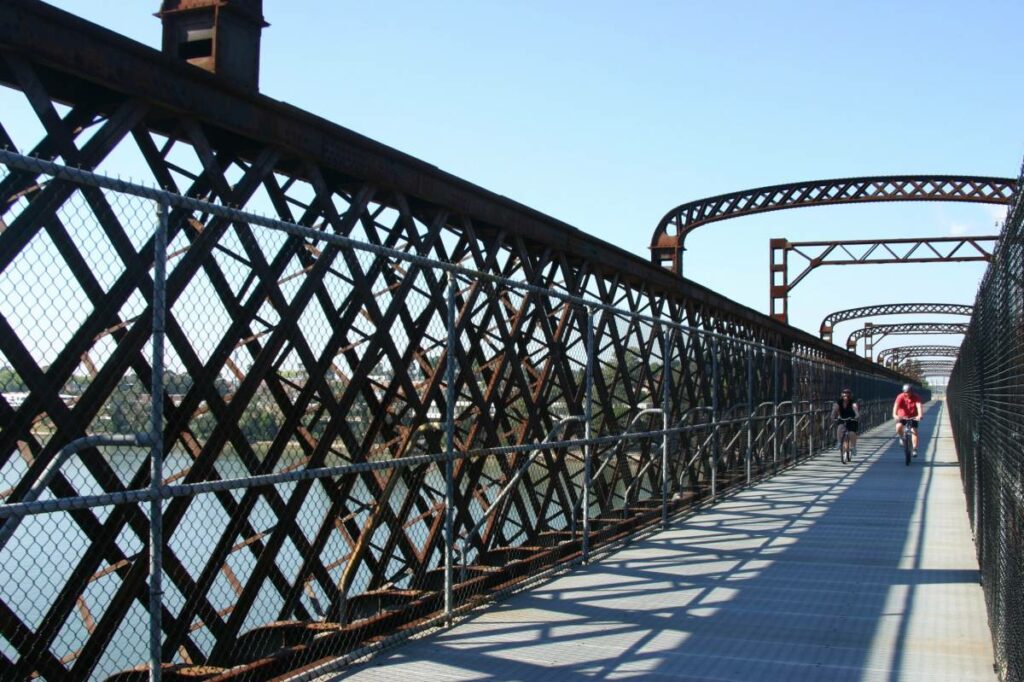
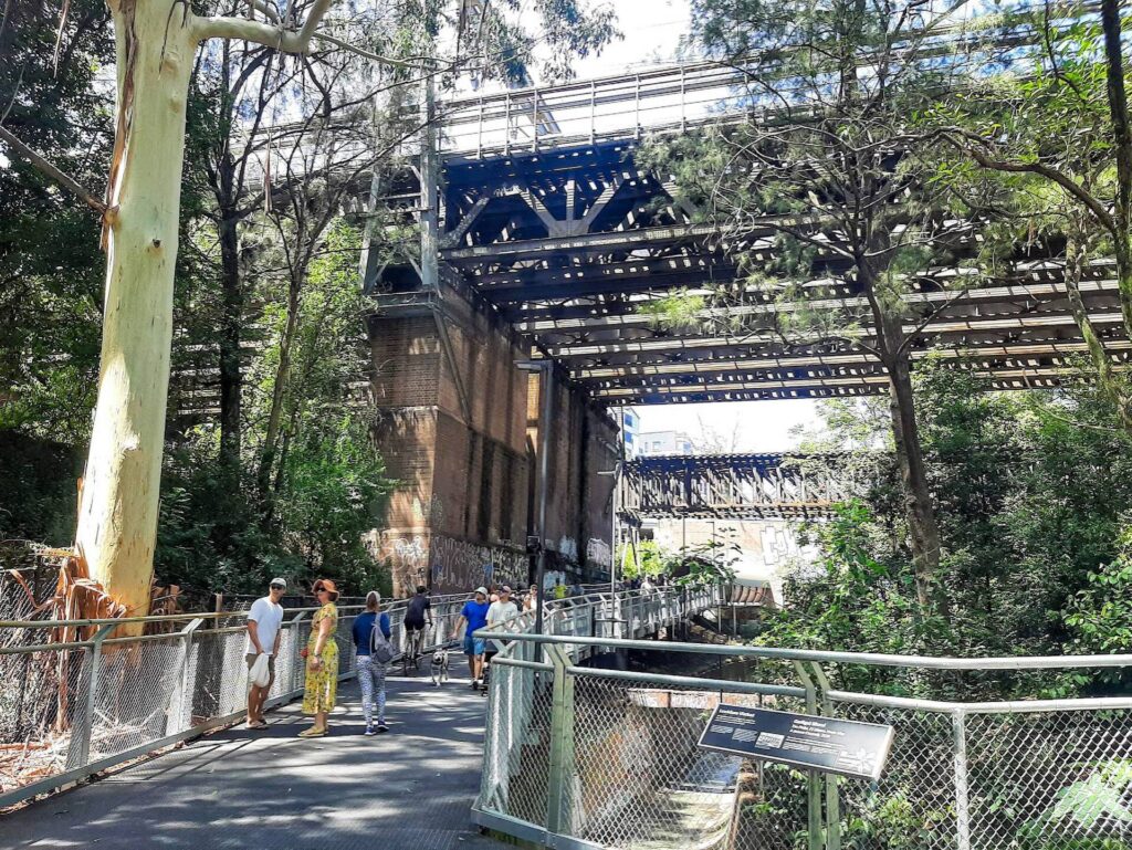
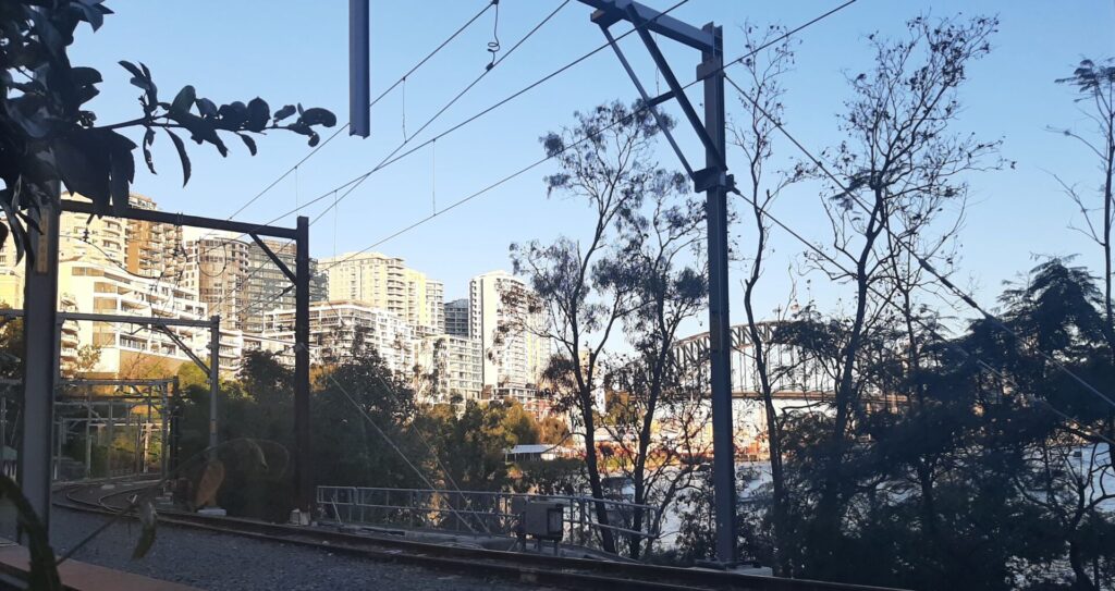
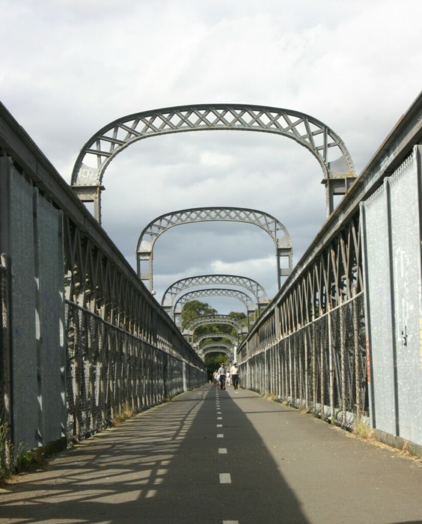
- It is concrete and suitable for all types of users. It is near the vibrant centre of Parramatta, and is easily accessible from Parramatta River trails and local streets. There are two large bridges on the trail, one over the Parramatta River and the other over James Ruse Drive.
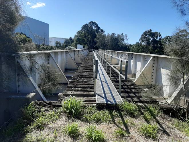
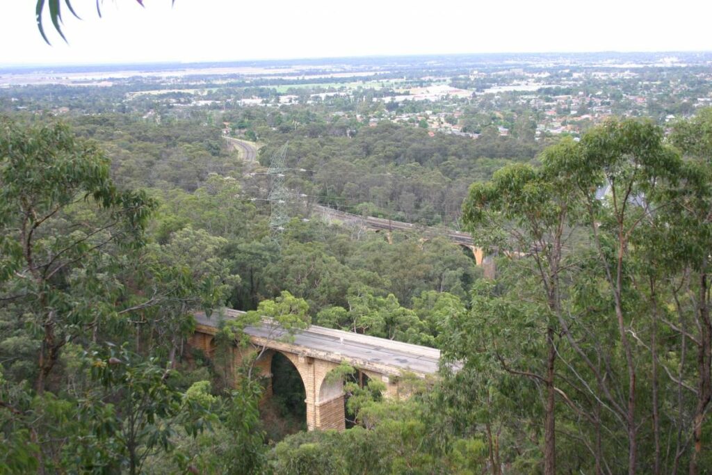
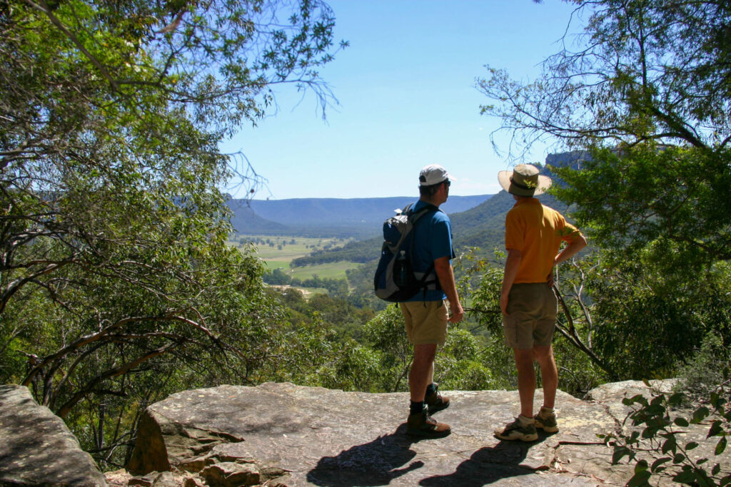
- From the Carlingford end of the trail there are great views to the south
- The trail follows L4 light rail route that links Westmead and Carlingford via Parramatta.
Nearby Attractions
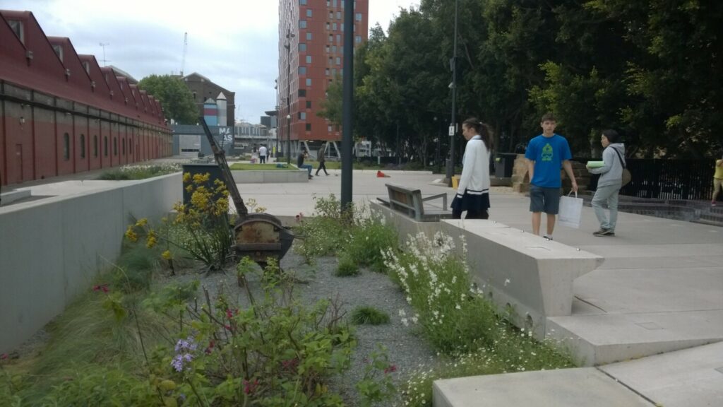
- Parramatta has a scenic location on the Parramatta River. There are many historic sites
- The Dundas Station building has been preserved
- There are interpretive signs at other locations.
Last updated: 7 February 2026
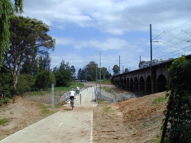
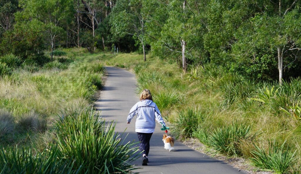
This rail trail is suitable for all types of bicycles and wheeled vehicles, as well as walkers and runners. Dogs on leashes are allowed. The trail goes north-east from the Parramatta River bridge, and is generally a moderate uphill grade to Carlingford.
Section Guides
Rosehill to Carlingford (5km)
- Access: The best starting point in Parramatta is the Tramway Ave light rail stop to the east of the Parramatta CBD. From Clyde railway station, follow James Ruse Drive north to Rosehill Racecourse.
- There are many street access points along the trail north of the Parramatta River
- There are water fountains at each light rail stop and cafes and shops along the trail. Toilet facilities are available at Parramatta and Rydalmere ferry wharf.
- There are public toilets at Carlingford, although not yet open at the light rail stop so take the stairs from the light rail stop up to the bus stop. The toilets are to the left in the car park.
- trail is 5km long, from Rosehill Gardens light rail stop north to Carlingford.
- From Rosehill Gardens, the active pathway also runs west over James Ruse Drive to the Tramway Ave light rail stop.

Parramatta River Bridge, Carlingford railside trail

Great views to the south from the Carlingford end of the railside trail.

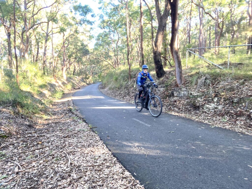
Carlingford railside trail

Interpretive sign on the trail

looking south again from the top of the hill near Carlingford

Dundas station precinct - the trail is behind the station

Carlingford precinct

James Ruse Drive bridge

Tramway Avenue light rail stop

Historic Dundas station

Telopea station showing the trail on the left

L4 light rail vehicles have bicycle racks
Public Transport
Recommended access is by Sydney Trains, to either Parramatta or Clyde stations.
Parramatta is the easier of the two: exit to the north from the station and find George St. From there follow the light-rail route to Tramway Ave.
From Clyde or Granville railway stations, travel north on Alfred St for about 1.5 km until it meets the light rail route at Tramway Ave.
Bicycles are permitted on Sydney Trains in the city’s suburban area. Restrictions apply on regional trains.
Do you know of a bike hire or transportation service on this rail trail that should appear here? If so, let us know at admin@railtrails.org.au.
Information and Links
To report rubbish, damage or hazards on this trail, please call the 24-hour community information line at Parramatta Council on 1800 139 389 or email pa*****************@***************ov.au
For Parramatta Light Rail shared path updates, click here
Contact Rail Trails Australia
To contact us about this rail trail, email nsw@railtrails.org.au
Background Information
The suburban railway line that ran from Clyde, on the Main Western Line, to Carlingford was closed in January 2020, in preparation for the conversion of the section from Rosehill for light-rail use. By that time, the Carlingford Line was operating as a branch line only.
The railside trail is located within Parramatta Council boundaries.
Sydney’s latest railside trail is open
Posted: 09/07/23
Sydney has a new railside trail, situated in the centre of the western suburbs. The ...
More...Nearby Trails
Meadowbank Railway Bridge
15 km west of Sydney
0.5 km


Pippita Rail Trail
19km west of Sydney, near Sydney Olympic Park

Parramatta to Liverpool rail trail
Western Sydney, 25km west of CBD
16 km
Cooks to Cove Greenway
Sydney
6 km
Lavender Bay “High Line”
Milsons Point to Waverton
Goods Line
2km from Sydney GPO
1 km
Como Bridge
20 km south of Sydney
2 km
Lapstone Zig Zag rail trail
Lower Blue Mountains, 60 km west of Sydney
1.5 km
Mt Kembla Memorial Pathway rail trail
Illawarra region, 100km south of Sydney
2 km
Box Vale Tk rail trail
Southern Highlands, 110km south-west of Sydney
4 km
Wolgan Valley Rail Trail
Wolgan Valley, 190km west of Sydney
11 km
Awaba – Wangi Wangi Rail Trail
130 km north of Sydney
Fassifern to Toronto Greenway rail trail
Lower Hunter, 26km south-west of Newcastle CBD
4 km
Fernleigh Track rail trail
Lower Hunter, 5km south of Newcastle CBD
16 km
Pioneer Rail Trail
Central Tablelands, 180km west of Sydney
6 km
Richmond Vale Rail Trail
160 km north of Sydney, 12 km northwest of Newcastle
Wallsend tramway rail trail
Lower Hunter, 13km west of Newcastle CBD
9 km
Nearby Trails
Meadowbank Railway Bridge
15 km west of Sydney
0.5 km
Pippita Rail Trail
19km west of Sydney, near Sydney Olympic Park
Parramatta to Liverpool rail trail
Western Sydney, 25km west of CBD
16 km
Cooks to Cove Greenway
Sydney
6 km
Lavender Bay “High Line”
Milsons Point to Waverton
Goods Line
2km from Sydney GPO
1 km
Como Bridge
20 km south of Sydney
2 km
Lapstone Zig Zag rail trail
Lower Blue Mountains, 60 km west of Sydney
1.5 km
Mt Kembla Memorial Pathway rail trail
Illawarra region, 100km south of Sydney
2 km
Box Vale Tk rail trail
Southern Highlands, 110km south-west of Sydney
4 km
Wolgan Valley Rail Trail
Wolgan Valley, 190km west of Sydney
11 km
Awaba – Wangi Wangi Rail Trail
130 km north of Sydney
Fassifern to Toronto Greenway rail trail
Lower Hunter, 26km south-west of Newcastle CBD
4 km
Fernleigh Track rail trail
Lower Hunter, 5km south of Newcastle CBD
16 km
Pioneer Rail Trail
Central Tablelands, 180km west of Sydney
6 km
Richmond Vale Rail Trail
160 km north of Sydney, 12 km northwest of Newcastle
Wallsend tramway rail trail
Lower Hunter, 13km west of Newcastle CBD
9 km
4 reviews of “Rosehill to Carlingford rail trail”
I cycled on the trail on 5 February 2026, making for an enjoyable morning. Important to note that the light rail vehicles on the L4 line to Carlingford have bicycle racks fitted, which provides options for use across the whole L4 line. The L4 light rail vehicles also operate on battery power across 2 sections of the line – together with the green sections of the rail corridor where grass is used instead of roadway or stone ballast make the L4 well worth a visit.
The trail was in good condition today when I was there. Plenty of fun riding south down the hill, and easy riding into Parramatta along the river.
A wide, generous, enjoyable trail!
Will be a huge asset to local community particularly in conjunction with the Albert, diagonal-beam, cyclist/pedestrian bridge over the Parramatta River, which opened this week (31 October 2023) to which this rail trail connects at the southern end.
This trail has only recently opened – it is relatively short at 5km but is high quality throughout. There is plenty of trail width for cyclists and walkers, and good to see water fountains provided at each light rail station.
There are nice district views from the northern end, and plenty of coffee shops along the way. I rode the trail on 2 July 2023, good to see plenty of others enjoying this new pathway.