 Location:
 Length:
 Surface:
 Start / End:
 Suitable for:
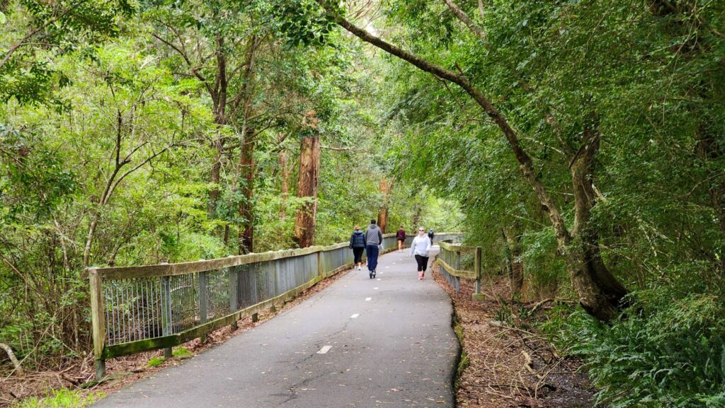
A pleasant ride or walk on some preserved tramway routes around Newcastle that are blissfully flat, the 9km Wallsend Tramway rail trail from Glendale to Lambton is a nice way to spend a day.

- This is a high-quality shared path featuring a variety of landscapes from suburban vistas to dense bushland
- It joins other shared paths that give largely traffic-free access to Newcastle’s university, city and suburbs
- The rail trail has gentle climbs and descents
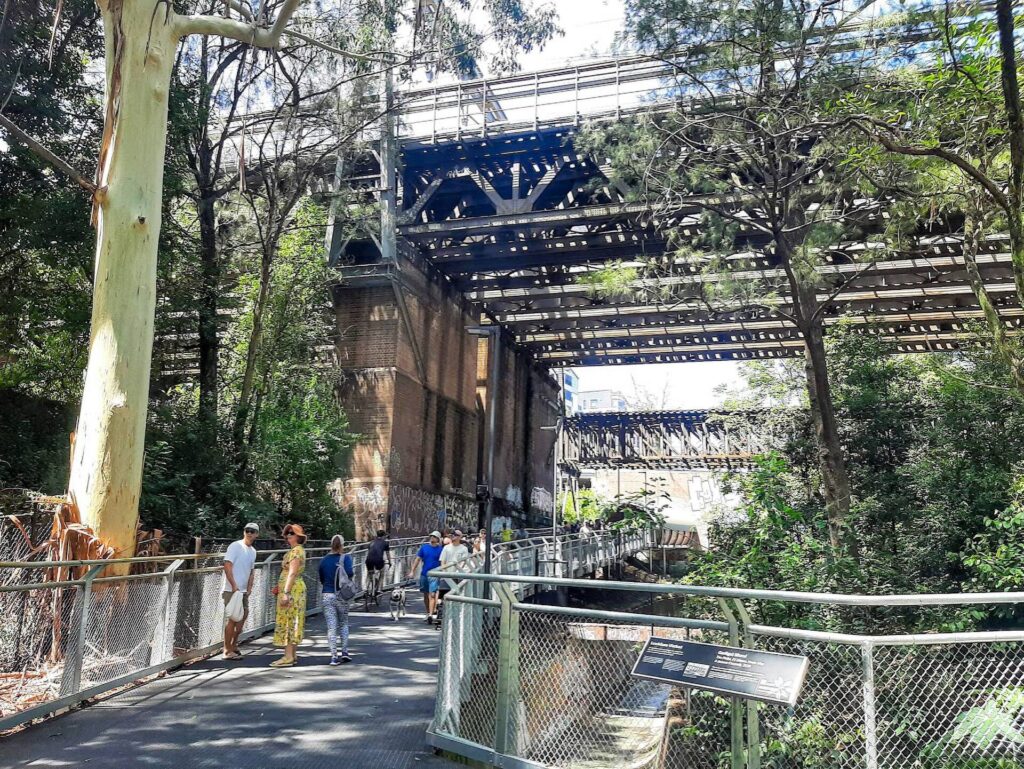
- There’s railway memorabilia at the Wallsend Station site, where the goods shed remains in use.
Nearby Attractions
- Newcastle waterfront
- Brickworks Park, Wallsend
- Fort Scratchley
- Lake Macquarie
- Fernleigh Track
- Fassifern to Toronto Greenway
Last updated: 5 January 2026
The middle section of this route is subject to closures due to major construction work for the Newcastle Inner City Bypass motorway that will include a bridge and underpass for the rail trail leading to Jesmond Park. Be prepared for detours.
The scene of frenetic tramway building in its early days, Newcastle had both steam and electric trams at one stage. The first route from the city to Wallsend was build in 1887 and extended to West Wallsend and Speers Point in 1910. Parts of the route were saved thanks to their bush location to become a rail trail.
The limited climbing capacity of steam trams makes the route relatively easy for cyclists. The surface is predominantly asphalt and concrete.
There are three sections:
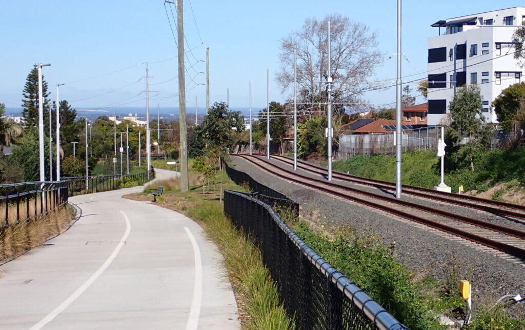
Glendale to Wallsend (4.5km): A pleasant climb from above Winding Creek, hugging the hill contours before reaching the urban area and station site.
Wallsend to Jesmond (3.5km): Lots of suburbia and major roadworks to get to Jesmond Park during 2025.
Jesmond to Lambton (2km): After cruising through Jesmond Park with pristine bushland to the south and then Rudd Park, the serenity comes to an abrupt at Howe St
Section Guides
Glendale to Wallsend (4km)
- Access: The trail, branded here as the Tramway Tk, starts from the northern end of Frederick St, Glendale, after #16 on the left. There’s parking at the TAFE campus opposite
- From a nondescript entrance, the shared path climbs on a slight gradient skirting bushland and then runs through grassland behind retirement villages
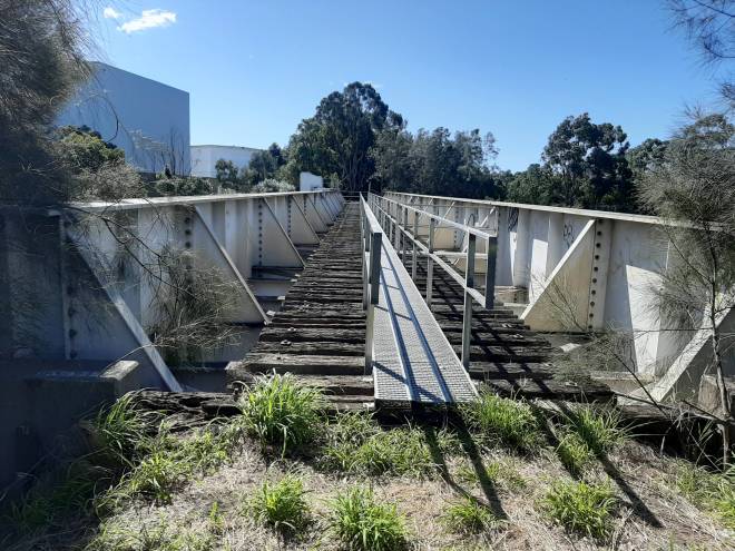
- The trail winds over gentle hills and then loops east to an underpass at Newcastle Link Rd (A15)
- You have to cross several roads and pass the Wallsend shopping centre before passing the goods shed, which is enjoying a second life.
Wallsend to Jesmond (3km)
- Access: There is parking at the station site after Nelson St, off Cowper St. Much more at the shopping centres.
- This section is basically flat and follows the route of colliery lines and a tramway
- It runs along Kemp St, crossing Newcastle Rd at traffic lights, before reclaiming the tramway corridor
- Take care crossing roads on the way to Jesmond
- At Minmi Rd, there is a diversion in place due to the widening of Cameron St as part of the Western Corridor Upgrades. This is part of the R5 cycleway.
- Cross at the traffic lights to the southern side of Cameron St and you’ll reach a replacement concrete path from Neals Park along Stapleton St built to handle the cycling commuter traffic diverted from Cameron St
- This route shaves precious seconds off our trip to Mordue Pde and the Jesmond Cycle Path along a former tram route to the CBD.
The Jesmond Cycle Path is subject to detours due to the construction of the Newcastle Inner City Bypass. Please watch for signs and obey directions.
Jesmond to Lambton (2km)
- Access: Jesmond Cycle Path runs along the eastern side of Illoura St. There are picnic tables and toilets in Jesmond Park
- After entering the park, there’s a long embankment before the tram route climbs over a cutting on Lambton Hill
- Take care crossing the uncontrolled Robinson Ave intersection, especially if heading downhill
- The shared path ends at the Howe St traffic lights but it’s worth continuing to Lambton Park for lunch. There are extensive gardens, toilets, play equipment and interpretive signs and several cafes and a hotel near there
CONNECTING PATHS
Glendale to Speers Point Park (2.5km): Connects the rail trail to Speers Point Park on a shared path close to a steam tramway route that ran along Cockle Creek. This connects with the Watagan Cycle Track
Lambton to CBD (8km): This ride can be extended from Lambton by picking up cycleways that pass through Broadmeadow parks and then Hamilton to the Newcastle CBD.

Start of the trail at Glendale, it could go south to Speers Point (2013)
![Heading up towards Wallsend on one of the embankments [2025]](jpg/n22-100-climbing-an-embankment-on-the-way-up-from-glendale-2025-img_6239-225x300.jpg)
Heading up towards Wallsend on one of the embankments [2025]
![The smooth asphalt makes life easier on the climb [2025]](jpg/n22-100-the-smooth-asphalt-makes-the-climbing-easier-2025-img_6242-300x225.jpg)
The smooth asphalt makes life easier on the climb [2025]
![Winding past the retirement villages before Wallsend [2025]](jpg/n22-100-the-trail-winds-its-way-around-retirement-villages-2025-img_6245-300x225.jpg)
Winding past the retirement villages before Wallsend [2025]
![Entering the short underpass at Newcastle LInk Rd [2025]](jpg/n22-100-tunnel-under-the-link-rd-2025-img_6249-300x225.jpg)
Entering the short underpass at Newcastle LInk Rd [2025]

Wallsend's restored goods shed with window where door used to be (2012)

Interpretive signage shows how the goods shed used to look [2012)

'Airless' coal wagon at Wallsend Station site (2012)
![Shady 'toy library' on the side of the trail near Wallsend [2025]](jpg/n22-150-toy-library-on-the-side-of-the-trail-near-wallsend-2025-img_6258-300x225.jpg)
Shady 'toy library' on the side of the trail near Wallsend [2025]

The Wallsend to Jesmond trail along Cameron St is being rebuilt (2013)
![Lambton Park is a nice place to stop after the ride [2025]](jpg/n22-200-lambton-park-on-elder-st-is-a-good-place-to-stop-2025-img_6260-300x225.jpg)
Lambton Park is a nice place to stop after the ride [2025]
The Central Coast-Newcastle Line operated by Sydney Trains stops at Cockle Creek Station which is near the shared path to Speers Point. You can use a credit card or an Opal one
Do you know of a bike hire or transportation service on this rail trail that should appear here? If so, let us know at admin@railtrails.org.au.
Information and Links
To report damage or problems contact Newcastle City Council:
For more information on walking and cycling trails in this area (including maps) click:
Tramway Track Visitor Information
City of Newcastle Walking and Cycling
Lake Macquarie Walking and Cycling
Contact Rail Trails Australia
To contact us about this rail trail, email nsw@railtrails.org.au
Background Information
Traditional Owners
We acknowledge the Awabakal people, the traditional custodians of the land and waterways on which the rail trail has been built.
Railway history
This trail follows a tram route that went from Newcastle to Wallsend from 1910 to 1930. When it opened it was part of the longest line among Newcastle’s extensive tramways, featuring steam-driven trams that ran down suburban streets and into bushland. The terminus was at West Wallsend, a coal-mining village 20 km from Newcastle. A branch line also reached Speers Point on Lake Macquarie, a popular picnic venue for Newcastle residents. The electrification of the Newcastle tram system reached Wallsend in 1926; steam trams were uneconomical and the lines beyond Wallsend closed in 1930. Place names such as Plattsburg and Young Wallsend have disappeared, along with most evidence of this line.
Shiraz to Shore – The Hunter’s Cycle Tourism Opportunity
Posted: 26/08/24
The Hunter Joint Organisation of Councils in NSW is made up of the ten local ...
More...NSW continues the momentum for developing cycling facilities
Posted: 19/06/20
Lake Macquarie and Newcastle City Councils are showing what can be done when it comes ...
More...Glendale to Wallsend Rail Trail Opening
Posted: 14/06/12
The $1.5 million Wallsend to Glendale shared pathway was officially opened on Friday 1 June 2012. The NSW ...
More...Nearby Trails
Fernleigh Track rail trail
Lower Hunter, 5km south of Newcastle CBD
16 km


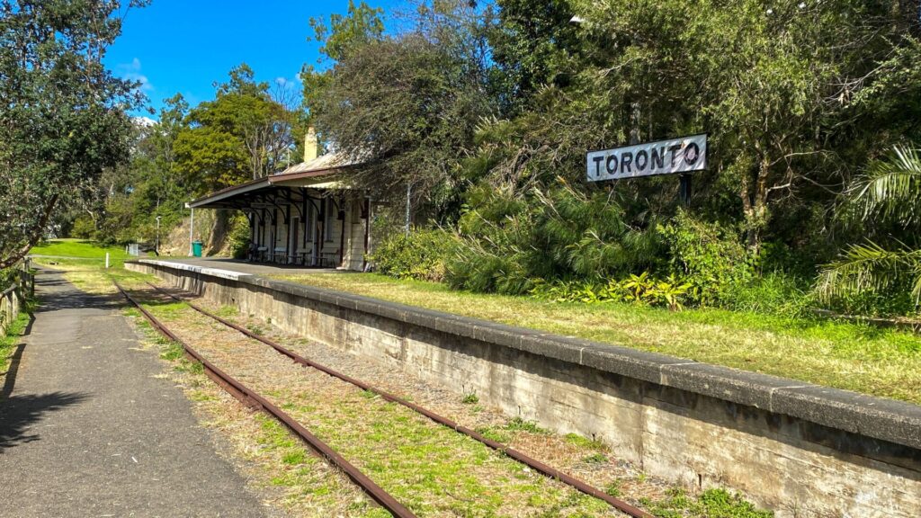
Fassifern to Toronto Greenway rail trail
Lower Hunter, 26km south-west of Newcastle CBD
4 km
Awaba – Wangi Wangi Rail Trail
130 km north of Sydney

Richmond Vale Rail Trail
160 km north of Sydney, 12 km northwest of Newcastle
Lavender Bay “High Line”
Milsons Point to Waverton
Meadowbank Railway Bridge
15 km west of Sydney
0.5 km
Rosehill to Carlingford rail trail
Western Sydney, 23km west of CBD
5 km
Goods Line
2km from Sydney GPO
1 km
Cooks to Cove Greenway
Sydney
6 km
Pippita Rail Trail
19km west of Sydney, near Sydney Olympic Park
Nearby Trails
Fernleigh Track rail trail
Lower Hunter, 5km south of Newcastle CBD
16 km
Fassifern to Toronto Greenway rail trail
Lower Hunter, 26km south-west of Newcastle CBD
4 km
Awaba – Wangi Wangi Rail Trail
130 km north of Sydney
Richmond Vale Rail Trail
160 km north of Sydney, 12 km northwest of Newcastle
Lavender Bay “High Line”
Milsons Point to Waverton
Meadowbank Railway Bridge
15 km west of Sydney
0.5 km
Rosehill to Carlingford rail trail
Western Sydney, 23km west of CBD
5 km
Goods Line
2km from Sydney GPO
1 km
Cooks to Cove Greenway
Sydney
6 km
Pippita Rail Trail
19km west of Sydney, near Sydney Olympic Park
6 reviews of “Wallsend tramway rail trail”
You feel like you’re on a train with all the asphalt connections,🤣. The bird life and sounds are the most I’ve heard in a long time, beautiful to hear.
42/70 Some nice sections, where it seems like the trail is a firebreak next to the retirement villages. Subject to detours at the moment due to Inner City Bypass project and Western Corridor upgrades.
Our local trail, great section from Wallsend to Edgeworth, nice semi rural outlook where we sometimes see Kangaroos. The section from Wallsend to Jesmond is more urban, but good all the same.
Nice ride with bushland one side all the way, and often both sides. A little more incline than anticipated for an old tramway, which was good, as its a quick ride. I wanted something longer so started at Lambton Park. Was 25km return via Jesmond cycle path, Brickworks Park, Wallsend Park & nearby Maccas, then along this old tramway track to Glendale TAFE and return. The Brickworks also definitely worth the visit with a bird hideout over the old pit now flooded, plus has BBQs & playground. I chose that way for the quiet backroads, rather than the recommended cycle lane on the very busy Newcastle Rd & Thomas St. The extended route I described crosses some busy roads, but traffic lights/pedestrian crossings are available. Start at TAFE end if driving and taking younger children (tramway section only), with close parking in quiet streets at that end.
I walked this trail on a Sunday afternoon in August 2019 and agree with March 2016 comments by cascho. Section from Glendale to Wallsend through nice bushland also passes a historic mine site. Several cyclists, walkers and joggers were also out. The section from Wallsend to Jesmond is flatter and provides links to Newcastle Uni, Wallsend and Jesmond shopping centres, Jesmond Park and beyond. It is likely a popular commuter route for some as the trail avoids a steep and busy section of Lake Road.
I rode this trail this morning (26/3/16) with my brother, as part of doing the three main rail trails around Newcastle. This is a really great trail with good sealed surface suitable for all types of bikes. Actually it’s a very busy trail, with a lot of local riders using it. The best section is between Glendale and Wallsend through the bushland and the new housing developments. While it is a climb either way, the gradient is not difficult and it’s easy to pick up a bit of speed on the downhill. I highly recommend this rail trail. Around the shopping centres there was a lot of traffic and it was hard to cross the roads, given that no drivers’ give way. So other riders please be careful.