 Location:
 Length:
 Surface:
 Start / End:
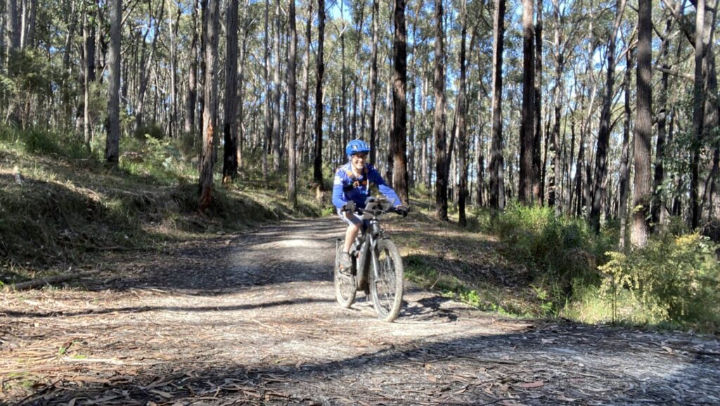
 Suitable for:
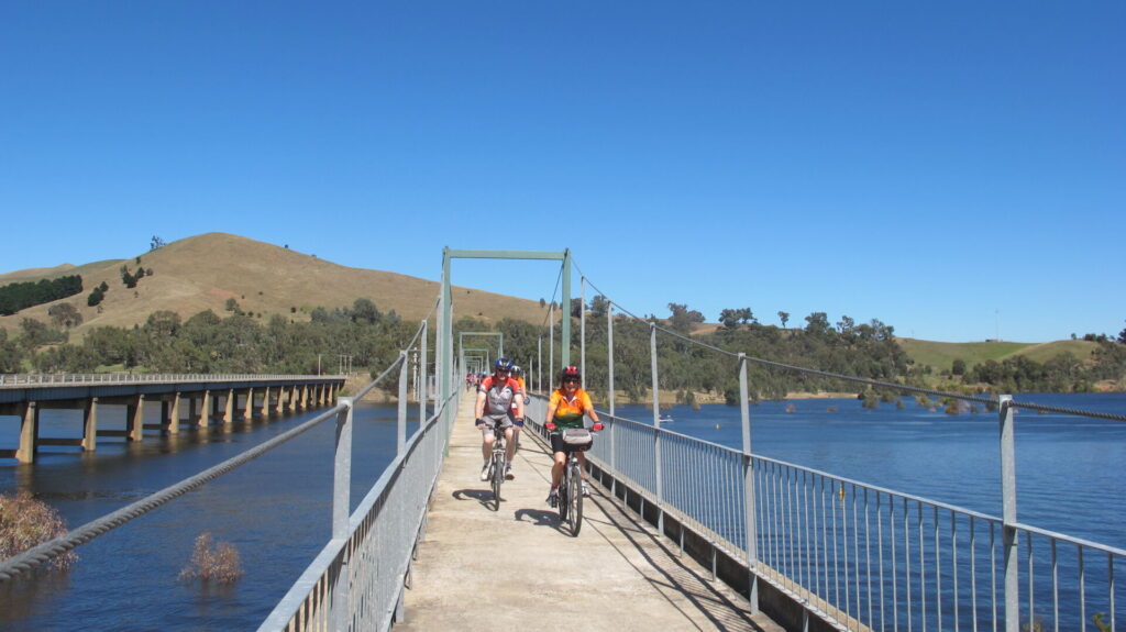
The Noojee Trestle Rail Trail is short on distance but high on interest, thanks to the heritage-listed bridge that has been rebuilt repeatedly after bushfires and is the last of seven.

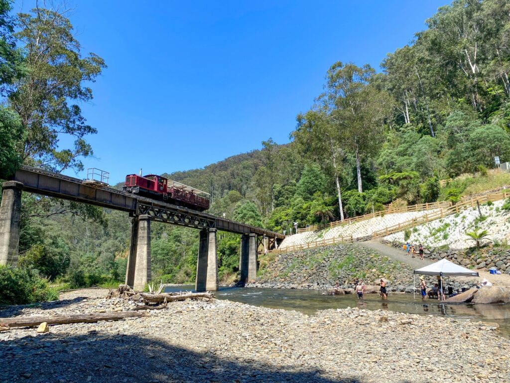
Experience Victoria’s history of timber harvesting in the mountains around Noojee. Only a 127km scenic drive from Melbourne, the area gives you a feeling of turning back time to the days of sawmills singing and steam trains struggling to get their loads over huge trestle bridges and up the steep grades. At an impressive 102m long, the curved Noojee Trestle Bridge, 2km from town, is something to remember.
Nearby Attractions
- Loch Valley Tramway Walk
- Toorongo Falls
- Natural flora and fauna like wombats, echidnas, wallabies, lyrebirds and kookaburras
- Rokeby Neerim Trail (follows part of same branch line)
- The crystal waters of the La Trobe River
- Beautiful bush camping areas
Last updated: 29 October 2025
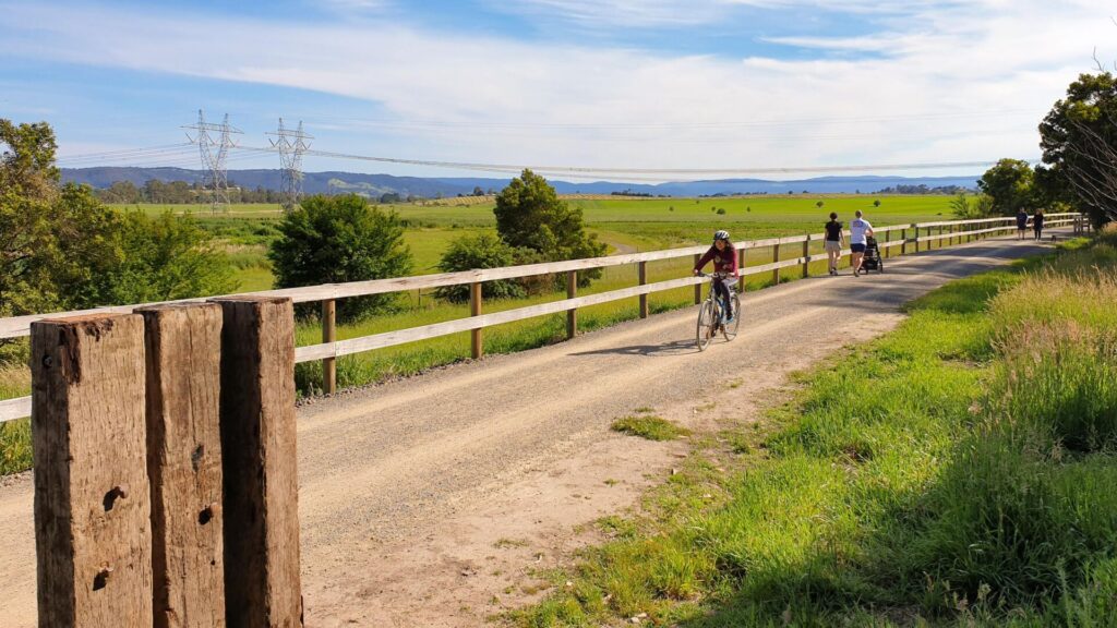
This rail trail is just a sliver of the branch line from Warragul which opened to Noojee in 1919 to get access to the timber reserves in the hills around the town. The Rokeby Neerim Trail is another part and the shire council hopes to join the two with a railside trail using quiet country roads
Section Guides
- Access: The trail starts at the trestle bridge, signed from Mt Baw Baw Tourist Rd, but access is easier from the Noojee Heritage Centre trailhead in School Rd, Noojee, which has toilets, ample parking and picnic tables.
- Noojee has a café selling some grocery items, a hotel, parks and accommodation
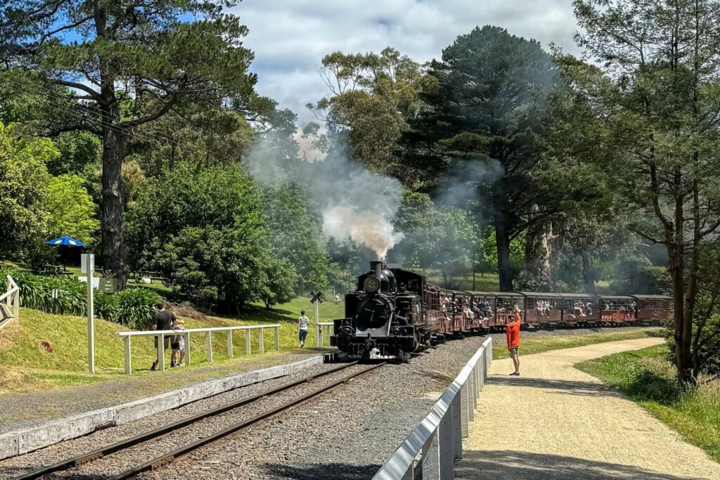
- Spend some time at the Noojee Heritage Centre, which features a J 550 steam loco, old freight wagons and extensive displays
- From this end, the trail almost immediately crosses Mt Baw Baw Tourist Rd
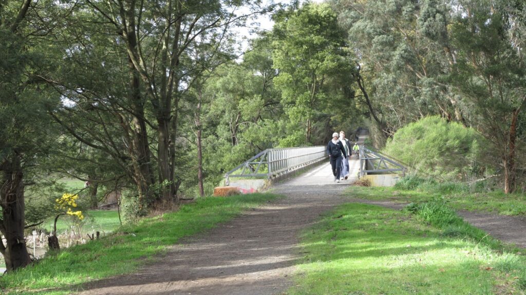
- It is level for about 600m then changes to a 1-in-45 incline from which you get views of the town
- After about 1km you reach a level area, where the Goodwoods timber siding was
- After another kilometre you arrive at the timeless Noojee Heritage Trestle Bridge, which was dubbed #7. It was burnt down in 1939 bushfires but rebuilt later that year and has been restored twice since
- There are steep steps at both ends of the bridge which lead down to the carpark. but there is a vehicle access track at the western end which families and cyclists may find easier
- The trail narrows and ends after another 1km, before the site of trestle bridge #6, which is on private land. This section is not maintained
- The trestle bridge has picnic tables.
![The magnificent Noojee Trestle bridge [2008]](jpg/v27-308-noojee-bridge-2008-07-300x225.jpg)
The magnificent Noojee Trestle bridge [2008]

No horses allowed and walking the narrow bridge deck is recommended (2023)
![The bridge was destroyed in the 1939 Black Friday bushfires but rebuilt before that year was out [2023]](jpg/v27-309-noojee-trestle-bridge-was-destroyed-in-the-1939-black-friday-bushfires-but-rebuilt-before-that-year-was-out-2023-img_1618-300x200.jpg)
The bridge was destroyed in the 1939 Black Friday bushfires but rebuilt before that year was out [2023]
![The Noojee Railway Precinct is well worth a visit, with a replica station and steam locomotive along with other heritage items [2023]](jpg/v27-359-the-noojee-historical-precinct-2023-img_1659_crop-300x169.jpg)
The Noojee Railway Precinct is well worth a visit, with a replica station and steam locomotive along with other heritage items [2023]
![Historic steam locomotive besides replica railway station created by community [2014]](jpg/v27-358-noojee-historical-precinct-2014-04-4853-300x200.jpg)
Historic steam locomotive besides replica railway station created by community [2014]
![The J Class locomotive was trucked in from Warragul for the railway precinct [2023]](jpg/v27-359-noojee_s-j-class-locomotive-was-trucked-in-from-warragul-and-originally-an-oil-burner.-2023-signs-img_1660-300x225.jpg)
The J Class locomotive was trucked in from Warragul for the railway precinct [2023]
Running the Warragul-Noojee Railway line
Do you know of a bike hire or transportation service on this rail trail that should appear here? If so, let us know at admin@railtrails.org.au.
Information and Links
The Noojee Trestle Bridge Rail Trail is managed by DEECA and the Baw Baw Shire.
Tourist services can be accessed from Visit Baw Baw here or by calling Baw Baw Shire Toll Free: 1300 BAW BAW (1300 229 229). Tel: +61 3 5624 2411.
Contact Rail Trails Australia
To contact us about this rail trail, email vic@railtrails.org.au
Background Information
Traditional owners
We acknowledge the Kurnai people, the traditional custodians of the land and waterways on which the rail trail is constructed.
Development and future of the rail trail
The Noojee and District Historical Society’s has restored the station site in Noojee including the station and surrounding tracks, but wants to recreate the goods shed, turntable and add an underground museum and cultural centre.
The official opening of the ‘Noojee Heritage Project Centre’ was in December 2011 when the society unveiled its five-stage plan to reconstruct the site.
Baw Baw Shire is planning to extend the Noojee Trestle Rail Trail to the shared path at Neerim South and on to the Rokeby Crossover Rail Trail, which was part of the same railway line.
Railway history
This trail is on part of the branch line from Warragul that opened in 1919.
The branch opened in 1890 to Rokeby and in 1892 to Neerim South. In 1915, the Forests Commission sought access to the tall timber at Noojee and the state government extended the railway to Nayook within two years. After building seven trestle bridges, the line was then opened to Noojee in 1919. The surviving bridge, which was No. 7, has a height of 21 m and length of 102 m and was the third largest.
Seven years after opening bushfires burned five of the seven, including bridge No. 7. Only 13 years later, in the 1939 Black Friday bushfires, bridge No. 7 was destroyed for a second time and rebuilt again. The costs were substantial even though they didn’t have to pay for timber! From 1939 to 1945, World War II reduced demand.
By the 1950s road transport was competing against the railway and, after a fire in 1954 at Bridge No. 2, the line was closed from Noojee to Nayook.
The rest was closed in sections between 1954 and 1958. This area suffers from bushfires and required a lot of expensive repairs on many occasions.
Nearby Trails
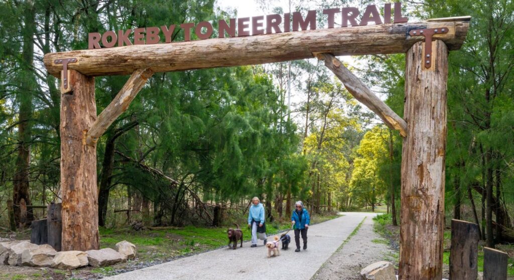
Rokeby to Neerim Railside Trail
West Gippsland, 100km from Melbourne
17 km


Powelltown Tramway Trails
Yarra Ranges, 80km east of Melbourne
39 km
Tyers Junction Rail Trail
Baw Baw Ranges, 30km north of Moe
7 km
Erica to Thomson Rail Trail
Baw Baw Ranges, 165km east of Melbourne
7.3 km
Moe – Yallourn Rail Trail
Latrobe Valley, 130km east of Melbourne
7.2 km
Eastern Dandenong Ranges Trail
Dandenongs, 50km south-east of CBD
15 km
Warburton Rail Trail/Yarra Valley Trail
Yarra Valley, 50km east of Melbourne CBD
48 km


Grand Ridge Rail Trail
Strzelecki Ranges, 160km east of Melbourne
13 km
Ringwood to Belgrave Trail
40km east of Melbourne CBD
17 km

Great Southern Rail Trail
South Gippsland, 130km south-east of Melbourne
136 km
Gippsland Plains Rail Trail
Latrobe Valley, 190km east of Melbourne
62 km
Bass Coast Rail Trail
Bass Coast, 130km south-east of Melbourne
23 km
Outer Circle Rail Trail
Eastern suburbs, 6km from Melbourne CBD
17 km
Rosstown Rail Trail
Southern suburbs, 9km from the CBD
9 km
Mornington Rail Trail
Mornington Peninsula, 60km south of CBD
4 km
Hawthorn to Kew Rail Trail
Inner suburbs, 9km east of Melbourne CBD
1 km
Inner Circle Rail Trail
Inner suburbs, 5km from the CBD
5 km
Sandridge Rail Trail
Melbourne city, 1km from GPO
4 km
Webb Dock Bridge
Docklands, 1 km south-west of Melbourne GPO
0.2 km
Great Victorian Rail Trail
90km north of Melbourne
135 km
Meadowlink Linear Park
Broadmeadows, 20km north of CBD
1.2 km
Red Hill Rail Trail
Mornington Peninsula, 90km south of CBD
6.3 km
Nearby Trails
Rokeby to Neerim Railside Trail
West Gippsland, 100km from Melbourne
17 km
Powelltown Tramway Trails
Yarra Ranges, 80km east of Melbourne
39 km
Tyers Junction Rail Trail
Baw Baw Ranges, 30km north of Moe
7 km
Erica to Thomson Rail Trail
Baw Baw Ranges, 165km east of Melbourne
7.3 km
Moe – Yallourn Rail Trail
Latrobe Valley, 130km east of Melbourne
7.2 km
Eastern Dandenong Ranges Trail
Dandenongs, 50km south-east of CBD
15 km
Warburton Rail Trail/Yarra Valley Trail
Yarra Valley, 50km east of Melbourne CBD
48 km
Grand Ridge Rail Trail
Strzelecki Ranges, 160km east of Melbourne
13 km
Ringwood to Belgrave Trail
40km east of Melbourne CBD
17 km
Great Southern Rail Trail
South Gippsland, 130km south-east of Melbourne
136 km
Gippsland Plains Rail Trail
Latrobe Valley, 190km east of Melbourne
62 km
Bass Coast Rail Trail
Bass Coast, 130km south-east of Melbourne
23 km
Outer Circle Rail Trail
Eastern suburbs, 6km from Melbourne CBD
17 km
Rosstown Rail Trail
Southern suburbs, 9km from the CBD
9 km
Mornington Rail Trail
Mornington Peninsula, 60km south of CBD
4 km
Hawthorn to Kew Rail Trail
Inner suburbs, 9km east of Melbourne CBD
1 km
Inner Circle Rail Trail
Inner suburbs, 5km from the CBD
5 km
Sandridge Rail Trail
Melbourne city, 1km from GPO
4 km
Webb Dock Bridge
Docklands, 1 km south-west of Melbourne GPO
0.2 km
Great Victorian Rail Trail
90km north of Melbourne
135 km
Meadowlink Linear Park
Broadmeadows, 20km north of CBD
1.2 km
Red Hill Rail Trail
Mornington Peninsula, 90km south of CBD
6.3 km
5 reviews of “Noojee Trestle Bridge Rail Trail”
RT70/70 Wasn't planning to treat this one as a separate rail trail from Rokeby, but it's separate on this website so it's legit for my 70 rail trails challenge. The trail has been resheeted between Noojee and the trestle but beyond that its still not maintained. Be interesting to see how they link it up from Neerim.
2/27 2nd Jan 2019. 2nd Rail Trail completed in my quest to ride every RT in Victoria this year. This is short and close to home so an esay one to knock off. A really nice area at the start with an old engine on display. The Noojee Trestle Bridge is beautiful and very picturesque. I went as far possible past the Bridge until a tree across path blocked my way, although I think I was only a few hundred metres from the end before turning around and going back to the start. You can follow me on FB Warwick Duncan – The 2nd Chance Man or Insta @warwick_rides
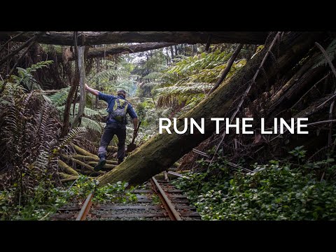
https://www.youtube.com/watch?v=XX-b3RnjRGM
Only called in for a visit on our way back from Warburton but a fantastic walk around and across the bridge. Wedding party there taking photos to add to the magic.
I rode this trail today (26th December 2014). It is a short well maintained trail – with two great tourist sites at either end – the Noojee station and the Trestle bridge. The track is well maintained and hybrid bikes will be fine. Honestly, it is too short for riding – and would be better suited for walking, given I rode the distance in less than 15 mins. Very impressed with the Noojee area.