 Location:
 Length:
 Surface:
 Start / End:
 Suitable for:
Just a 1.2km wander for people in Melbourne's northern suburbs, the Meadowlink Linear Park rail trail has been nicely done.

- The City of Hume has transformed this former railway reserve into a 4ha open space and called it Meadowlink Linear Park
- Visitors can read about the former Broadmeadows Military Camp, set up in 1914, which this line served
- The establishment of the trail has sparked a wave of development along both sides of the railway corridor, including a training base for state rugby
- Broadmeadows Railway Station is minutes away
Nearby Attractions
- Jack Roper Reserve is a great spot to take the kids, with picnic shelters and play equipment
- A number of other shared paths are within easy reach if you use the Merlynston Creek Trail
- Broadmeadows Valley Park
- Seabrook Reserve has extensive play equipment, picnic areas, a half court, exercise stations and toilets
Last updated: 19 December 2025
The trail runs from Railway Cres, Broadmeadows (access just north of #70 and south of King William St) to Merlynston Creek. From that often-dry waterway, the Merlynston Creek Trail leads to the Will Will Rook Pioneer Cemetery on Camp Rd and, further south, through Jack Roper Reserve to a popular shared path beside the Western Ring Rd. The council has built a concrete shared-user path for Meadowlink and added 400 shade trees, 500 plants, seating and, to improve public safety, solar lighting. The state government contributed over $2 million. More recently, play equipment, exercise stations and toilets were installed in Seabrook Reserve.
For public transport options go to ‘GET AROUND’ below and click on ‘SHOW MORE’ if necessary
![The start of the trail has the 'shadow' of the rail line in the landscaping [2023]](jpg/v04-050-meadowlink-western-end-signage-2023-225x300.jpg)
The start of the trail has the 'shadow' of the rail line in the landscaping [2023]
![Developers are taking advantage of the rail trail in their 'backyard' [2023]](jpg/v04-050-meadowlink-new-apartments-on-left-2023-300x225.jpg)
Developers are taking advantage of the rail trail in their 'backyard' [2023]
![A pedestrian refuge makes crossing Blair St a little safer than it was [2023]](jpg/v04-100-blair-st-crossing-2023-300x225.jpg)
A pedestrian refuge makes crossing Blair St a little safer than it was [2023]
![Solar lighting comes on early on overcast days [2023]](jpg/v04-100-solar-lights-switched-on-in-cutting-2023-225x300.jpg)
Solar lighting comes on early on overcast days [2023]
![Views of ever-growing Melbourne city along the railway corridor [2022]](jpg/2011605557883-300x225.jpg)
Views of ever-growing Melbourne city along the railway corridor [2022]
![New play equipment, toilets and picnic tables in Seabrook Reserve [2023]](jpg/v04-150-new-play-equipment-and-toilets-in-seabrook-reserve-2023-300x225.jpg)
New play equipment, toilets and picnic tables in Seabrook Reserve [2023]
![Rail bridge crossed the creek here. Path to Roper Reserve on right [2023]](jpg/v04-150-a-railway-bridge-crossed-merlynstone-creek-background.-path-to-jack-roper-reserve-on-right-2023-1-300x225.jpg)
Rail bridge crossed the creek here. Path to Roper Reserve on right [2023]
Public Transport
As mentioned in the Section Guide, this short trail is near Broadmeadows Railway Station, which is on Metro’s Craigieburn line and has frequent services. There’s a shared path from the station to the start of the rail trail. There are no bicycle restrictions on these trains but Metro prefers bikes at the back or the middle, where there is more room. PTV bicycle guidelines here.
Refer to the PTV web page for map and timetables, or the navigation program of your choice.
Do you know of a bike hire or transportation service on this rail trail that should appear here? If so, let us know at admin@railtrails.org.au.
Information and Links
For more information on this trail, contact Hume City Council at en*******@**********ov.au or telephone 9205 2200
Contact Rail Trails Australia
To contact us about this rail trail, email vic@railtrails.org.au
Background Information
Traditional Owners
We acknowledge the Woiworung people, the traditional custodians of the land and waterways on which this rail trail was built.
Railway history
This was a World War 2 siding called the “Broadstore Line” that ran for 1.6km from the main north/south line at Broadmeadows (a northern suburb of Melbourne) in an easterly direction to provide services to the Maygar Army Barracks in Cambellfield from 1942. These barracks played an important part in housing troops and army support from WW1. The line closed in 1982, with the tracks being lifted in 1991.
Nearby Trails
Inner Circle Rail Trail
Inner suburbs, 5km from the CBD
5 km


Sandridge Rail Trail
Melbourne city, 1km from GPO
4 km
Webb Dock Bridge
Docklands, 1 km south-west of Melbourne GPO
0.2 km
Hawthorn to Kew Rail Trail
Inner suburbs, 9km east of Melbourne CBD
1 km
Outer Circle Rail Trail
Eastern suburbs, 6km from Melbourne CBD
17 km
Rosstown Rail Trail
Southern suburbs, 9km from the CBD
9 km
Ringwood to Belgrave Trail
40km east of Melbourne CBD
17 km
Warburton Rail Trail/Yarra Valley Trail
Yarra Valley, 50km east of Melbourne CBD
48 km

Eastern Dandenong Ranges Trail
Dandenongs, 50km south-east of CBD
15 km
Mornington Rail Trail
Mornington Peninsula, 60km south of CBD
4 km
Woodend to Daylesford (incl Domino) Rail Trail
Goldfields, 85km north-west of Melbourne
6 km
Bellarine Rail Trail
Bellarine Peninsula, 75km south-west of Melbourne CBD
35 km
Fyansford Rail Trail
North Geelong, 5km from town centre
4.4 km
Powelltown Tramway Trails
Yarra Ranges, 80km east of Melbourne
39 km
Red Hill Rail Trail
Mornington Peninsula, 90km south of CBD
6.3 km
Great Victorian Rail Trail
90km north of Melbourne
135 km
O’Keefe Rail Trail
Goldfields region,150km north of Melbourne
49 km
Bunny Trail
110 km west of Melbourne
1.2 km
Noojee Trestle Bridge Rail Trail
West Gippsland, 100 km east of Melbourne
3 km
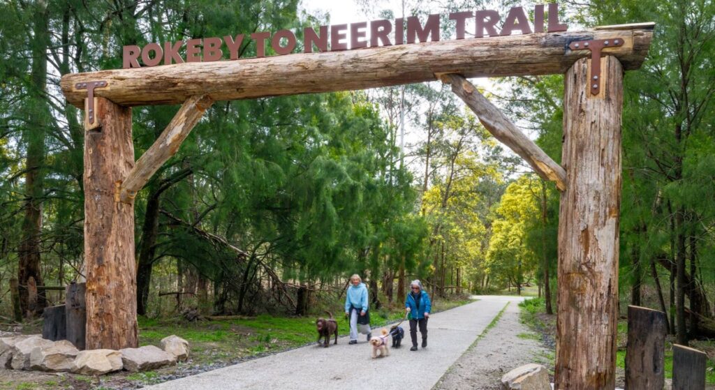
Rokeby to Neerim Railside Trail
West Gippsland, 100km from Melbourne
17 km
Castlemaine to Maldon Trail
120 km north west of Melbourne
18 km
Castlemaine-Maryborough Rail Trail
Central Victoria, 124 km from Melbourne

Bass Coast Rail Trail
Bass Coast, 130km south-east of Melbourne
23 km
Ballarat-Skipton Rail Trail
110 km north-west of Melbourne
57 km
Nearby Trails
Inner Circle Rail Trail
Inner suburbs, 5km from the CBD
5 km
Sandridge Rail Trail
Melbourne city, 1km from GPO
4 km
Webb Dock Bridge
Docklands, 1 km south-west of Melbourne GPO
0.2 km
Hawthorn to Kew Rail Trail
Inner suburbs, 9km east of Melbourne CBD
1 km
Outer Circle Rail Trail
Eastern suburbs, 6km from Melbourne CBD
17 km
Rosstown Rail Trail
Southern suburbs, 9km from the CBD
9 km
Ringwood to Belgrave Trail
40km east of Melbourne CBD
17 km
Warburton Rail Trail/Yarra Valley Trail
Yarra Valley, 50km east of Melbourne CBD
48 km
Eastern Dandenong Ranges Trail
Dandenongs, 50km south-east of CBD
15 km
Mornington Rail Trail
Mornington Peninsula, 60km south of CBD
4 km
Woodend to Daylesford (incl Domino) Rail Trail
Goldfields, 85km north-west of Melbourne
6 km
Bellarine Rail Trail
Bellarine Peninsula, 75km south-west of Melbourne CBD
35 km
Fyansford Rail Trail
North Geelong, 5km from town centre
4.4 km
Powelltown Tramway Trails
Yarra Ranges, 80km east of Melbourne
39 km
Red Hill Rail Trail
Mornington Peninsula, 90km south of CBD
6.3 km
Great Victorian Rail Trail
90km north of Melbourne
135 km
O’Keefe Rail Trail
Goldfields region,150km north of Melbourne
49 km
Bunny Trail
110 km west of Melbourne
1.2 km
Noojee Trestle Bridge Rail Trail
West Gippsland, 100 km east of Melbourne
3 km
Rokeby to Neerim Railside Trail
West Gippsland, 100km from Melbourne
17 km
Castlemaine to Maldon Trail
120 km north west of Melbourne
18 km
Castlemaine-Maryborough Rail Trail
Central Victoria, 124 km from Melbourne
Bass Coast Rail Trail
Bass Coast, 130km south-east of Melbourne
23 km
Ballarat-Skipton Rail Trail
110 km north-west of Melbourne
57 km
3 reviews of “Meadowlink Linear Park”
The path is super kid friendly, including the Blair St crossing if supervised with playgrounds fore, aft and midships. Info boards at either end and a look out over the creek. A wide concrete path leads to other cycle paths. An easy walk from the eastern carpark end there and back. There is a huge playground / BBQ / Fitness station being built at this end.
The track sections that are dotted appear to be offcuts rather than original and there is no original rail infrastructure other than possibly a small section at the creek.
If you are in the area it's worthwhile a visit.
Blair St now has a safety island where the trail crosses it and I was surprised to see cars stopping for me despite the lack of zebra stripes.
The Meadowlink Rail Trail, along the old Broadstore Line, is a good way of riding around the suburbs just south of the Metropolitan Ring Road. It is connected to the M80 Trail via the Merlynston Creek Trail through Jack Roper Reserve. Further developments would be a tremendous benefit as well, such as a cycling overpass of the Craigieburn and North East Railway Lines at Broadmeadows Station, a safer crossing of Blair St and a connection across Merlynston Creek past Maygar Barracks through to the Upfield Line.