 Location:
 Length:
 Surface:
 Start / End:
 Suitable for:
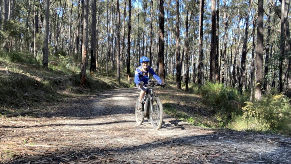
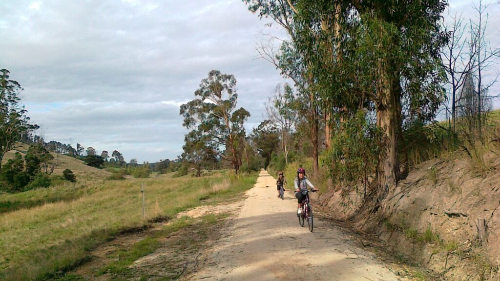
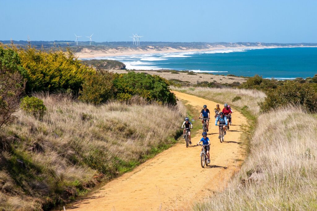
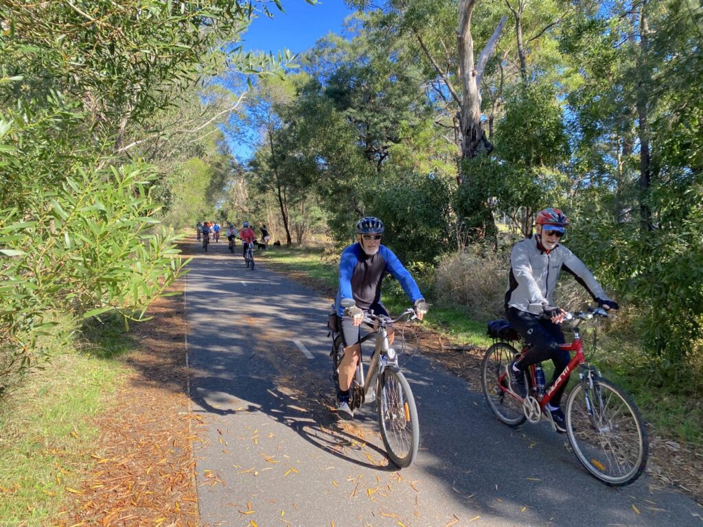
A blissful shared path to the steaming Yallourn Power Station past Lake Narracan, the Moe-Yallourn Rail Trail packs a lot into 7km.

- The trail traverses open countryside and bushy areas while packing in views of Lake Narracan, the Haunted Hills and Yallourn Power Station
- It passes the manicured Moe Botanic Gardens and crosses Narracan Creek. There are access ramps to visit both from the trail
- After crossing the creek flats, the route passes Newborough
- A loop via Halls Bay Link and Sullivans Tk to Lake Narracan is worthwhile for a picnic, a swim or as an alternative return route
- Riding or walking the trail can be combined with a drive to discover the Latrobe Valley’s history as Victoria’s powerhouse
Nearby Attractions
- Moe Botanic Gardens
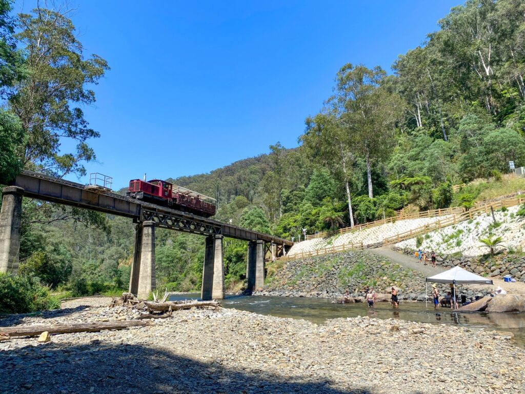
- The Yallourn Power Station, due to close in 2028
- Lake Narracan
- Yallourn Mine Lookout
- Old Brown Coal Mine Museum
- Haunted Hills MTB Park, Morwell
- Old Gippstown Heritage Park, Moe
Last updated: 12 November 2025
The trail traverses open countryside and bushy areas while packing in views of Lake Narracan, the Haunted Hills and Yallourn Power Station.
ESTA Emergency Markers are installed along the trail. In an emergency, call 000 and quote the code on the marker post nearest to you, eg MTY100
Section Guides
Moe to Yallourn (7.2km)
- Access: Bennett St, Moe is on a gravel driveway near the corner of Bennett St and Narracan Drive, C103 (Search: 1 Bennett St. Nearby Albert St also offers easier access with more on-street parking
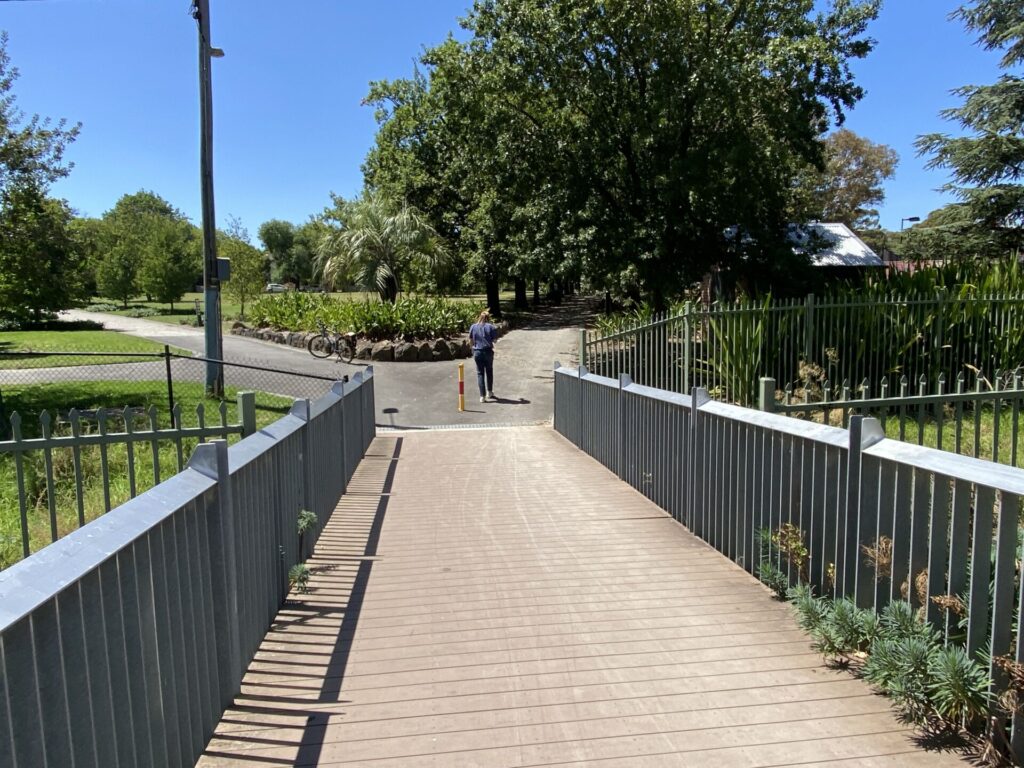
- From Bennett St the trail passes the Moe Botanic Gardens and crosses Narracan Creek
- At Old Sale Rd, you can detour to Newborough for supplies, or coffee if desperate
- Access: Old Sale Rd near Lowanna College
- Detour at Sullivans Tk to gain access to Lake Narracan, where you can skirt the lake via Southern Shore Rd and Halls Bay Loop back to the rail trail. The loop is better suited to walkers, mountain or cyclecross bikes.
- Picnics are allowed at the lake from the last Friday in October to the first Monday in May.
- Continue to Petits Tk and then pass under John Field Drive.
- The trail finishes at Graeme Edwards Memorial Garden on Eastern Rd, just outside the power station. It has an electric BBQ, bike rack, water fountain, shelter and ample parking
- Return to Moe via the rail trail, Halls Bay Loop or John Field Drive.
- If starting at this end, Graeme Edwards Memorial Garden is on Eastern Rd, off John Field Drive
![Tailhead at Bennett St, Moe, is not a great place for parking [2022]](jpg/v26-059-the-trailhead-at-bennett-st-moe-2022-10-img_1097-300x225.jpg)
Tailhead at Bennett St, Moe, is not a great place for parking [2022]
![Narracan Creek Bridge crosses above the Moe Botanic Gardens [2013]](jpg/v26-058-moe-2013-08-0867-300x169.jpg)
Narracan Creek Bridge crosses above the Moe Botanic Gardens [2013]
![Narracan Creek Bridge and surrounding gardens are a feature of the trail [2025]](jpg/v26-060-moe-narracan-creek-bridge-and-botanic-gardens-2025-img_7006-1-300x168.jpg)
Narracan Creek Bridge and surrounding gardens are a feature of the trail [2025]
![Foundations that supported overhead wires are reminder of line's electrification [2025]](jpg/v26-060-moe-to-newborough-catenary-pole-foundations-2025-img_7008-300x170.jpg)
Foundations that supported overhead wires are reminder of line's electrification [2025]
![A big community effort on the directonal signs, here at Newborough [2016]](jpg/v26-010-signs-2016-11-img_8647-300x200.jpg)
A big community effort on the directonal signs, here at Newborough [2016]
![The trail near Newborough [2013]](jpg/v26-107-newborough-to-yallourn-2013-08-0871-300x169.jpg)
The trail near Newborough [2013]
![Pacing it out on the shared path viewed from the Sullivans Tk bridge [2022]](jpg/v26-158-pacing-it-out-on-the-moe-yallour-raail-trail-at-sullivans-tk-2022-10-img_1105-300x225.jpg)
Pacing it out on the shared path viewed from the Sullivans Tk bridge [2022]
![There are three cooling towers at Yallourn but four coal-fired boilers [2022]](jpg/v26-158-there-are-three-cooling-towers-at-yallourn-w-but-four-coal-fire-boilers-2022-img_1100-225x300.jpg)
There are three cooling towers at Yallourn but four coal-fired boilers [2022]
![View from the power station area has improved since mine closed [2025]](jpg/v26-150-yallourn-view-across-the-valley-from-yallourn-power-station-2025-img_7017-1-300x169.jpg)
View from the power station area has improved since mine closed [2025]
![Halls Bay Loop follows the shore of Lake Narracan's southern arm [2022]](jpg/v26-158-the-halls-bay-link-takes-you-along-the-shore-of-lake-narracans-southern-arm-2022-10-img_1104-300x225.jpg)
Halls Bay Loop follows the shore of Lake Narracan's southern arm [2022]
Do you know of a bike hire or transportation service on this rail trail that should appear here? If so, let us know at admin@railtrails.org.au.
Information and Links
![]() For further information contact the secretary of the Moe Rail Trail Committee of Management at Latrobe City Council on Ph: 1300 367 700
For further information contact the secretary of the Moe Rail Trail Committee of Management at Latrobe City Council on Ph: 1300 367 700
Download the rail trail map and brochure here
Contact Rail Trails Australia
To contact us about this rail trail, email vic@railtrails.org.au
Background Information
Traditional Owners
We acknowledge the Boonwurrung people, the traditional custodians of the land and waterways on which the rail trail is built.
Rail Line History
The railway from Moe to Yallourn was constructed in the 1950s to replace the original branch line, which joined the main line between Moe and Morwell. The new line meant that heavy coal trains didn’t have to climb through the Haunted Hills. The new line was closed in 1986, when briquette production was moved to Morwell.
Nearby Trails
Tyers Junction Rail Trail
Baw Baw Ranges, 30km north of Moe
7 km


Erica to Thomson Rail Trail
Baw Baw Ranges, 165km east of Melbourne
7.3 km
Grand Ridge Rail Trail
Strzelecki Ranges, 160km east of Melbourne
13 km

Rokeby to Neerim Railside Trail
West Gippsland, 100km from Melbourne
17 km
Noojee Trestle Bridge Rail Trail
West Gippsland, 100 km east of Melbourne
3 km


Great Southern Rail Trail
South Gippsland, 130km south-east of Melbourne
136 km
Gippsland Plains Rail Trail
Latrobe Valley, 190km east of Melbourne
62 km
Powelltown Tramway Trails
Yarra Ranges, 80km east of Melbourne
39 km
Bass Coast Rail Trail
Bass Coast, 130km south-east of Melbourne
23 km
Eastern Dandenong Ranges Trail
Dandenongs, 50km south-east of CBD
15 km
Warburton Rail Trail/Yarra Valley Trail
Yarra Valley, 50km east of Melbourne CBD
48 km
Ringwood to Belgrave Trail
40km east of Melbourne CBD
17 km

Mornington Rail Trail
Mornington Peninsula, 60km south of CBD
4 km
Red Hill Rail Trail
Mornington Peninsula, 90km south of CBD
6.3 km
Rosstown Rail Trail
Southern suburbs, 9km from the CBD
9 km
Outer Circle Rail Trail
Eastern suburbs, 6km from Melbourne CBD
17 km
Hawthorn to Kew Rail Trail
Inner suburbs, 9km east of Melbourne CBD
1 km
Nearby Trails
Tyers Junction Rail Trail
Baw Baw Ranges, 30km north of Moe
7 km
Erica to Thomson Rail Trail
Baw Baw Ranges, 165km east of Melbourne
7.3 km
Grand Ridge Rail Trail
Strzelecki Ranges, 160km east of Melbourne
13 km
Rokeby to Neerim Railside Trail
West Gippsland, 100km from Melbourne
17 km
Noojee Trestle Bridge Rail Trail
West Gippsland, 100 km east of Melbourne
3 km
Great Southern Rail Trail
South Gippsland, 130km south-east of Melbourne
136 km
Gippsland Plains Rail Trail
Latrobe Valley, 190km east of Melbourne
62 km
Powelltown Tramway Trails
Yarra Ranges, 80km east of Melbourne
39 km
Bass Coast Rail Trail
Bass Coast, 130km south-east of Melbourne
23 km
Eastern Dandenong Ranges Trail
Dandenongs, 50km south-east of CBD
15 km
Warburton Rail Trail/Yarra Valley Trail
Yarra Valley, 50km east of Melbourne CBD
48 km
Ringwood to Belgrave Trail
40km east of Melbourne CBD
17 km
Mornington Rail Trail
Mornington Peninsula, 60km south of CBD
4 km
Red Hill Rail Trail
Mornington Peninsula, 90km south of CBD
6.3 km
Rosstown Rail Trail
Southern suburbs, 9km from the CBD
9 km
Outer Circle Rail Trail
Eastern suburbs, 6km from Melbourne CBD
17 km
Hawthorn to Kew Rail Trail
Inner suburbs, 9km east of Melbourne CBD
1 km
14 reviews of “Moe – Yallourn Rail Trail”
RT64/70 Second one for the day today. Western end has been re-profiled to improve drainage and re-sheeted. Also some new recycled plastic plank signs. Maybe this trail will be extended to the lookout when the power station closes
A nice easy ride started at Moe, some nice local children’s painted rocks line the trail at the start, fairly shaded corridor that drops you right at the foot of the power station when you turn the final corner which is cool.
Day 1 of Darren's base camp. 12 members arrived in Moe to embark on 7kmwalk from Moe to Yallourn. Weather was fine, 26c. We had to walk a kilometre to reach the Moe Yallourn Rail Trail, which is quite scenic with various trees providing good canopy for walking. The gravel path was flat and well maintained. Both sides cleared of dead branches and long grass. Through the trees there were good views of quite lush green farmlands. We came across Lake Narracan which was calm and relaxing, with views of Baw Baw range. Few birds, several cyclists. The trail ends spectacularly at the power station. No toilets.
This trail was one I really struggled to get any interest – short out and back really didn't pique my interest… that was until I rode it.
Apart from the dearth of any signage at street level at the Moe end, the trail is really well signposted and the old concrete bases for the overhead power numbered. Tracks disappear both left and right into residential areas and side roads. The track fairies have been both creative and busy and the resulting access has locals using as a fantastic corridor to walk and exercise. This trail works on so many levels.
About 75% in to the tip you come across Lake Narracan on the left and if you are heading out and back, you can use this loop to vary the return trip – it appears.
At the end of the ride, you are confronted by the cooling towers and a lovely bbq area with a water station.
I continued via road on to Yallourn North and then to a MTB park near Maryvale Mill before arriving at Traralgon via a roadside trail for the train back. About 40-45km all up and an excellent day out.
Note that the track was fully open and the landslips removed from earlier in 2024.
Rode this today 14 January 2024. First 5km from Moe was fine, but the trail was closed near Yallourn power station due to several landslips. Can detour via Sullivans Track and Lake Narracan. Adds another 2km to the route to Yallourn. Hopefully the path repaired soon.
A very easy ride, starting from Yallourn and going to Moe and then return. Good surface for all types of bikes.
A great Rail Trail for walk. It is hard to imagine an electrified passenger train service running to Yallourn. The size of Yallourn W power station still amazes me. On the way back we walked down to the picturesque waters of Narracan Lake on the Latrobe river, a very nice place for a picnic.
This was the second of 3 short trails done over a 3 day weekend (Rokeby to Neerim Sth and Grand Ridge Trail the others). Signage to the start of the trail in Moe could be more prominent. The surface was in good condition and flat all the way to the Power Station at the end – quite a striking feature to arrive at. We took the Halls (?) loop deviation on the way back which was a nice way to enjoy views of Lake Narracan and experience a few undulations – returning to the main trail along Sullivan’s Track was on a quiet road with a gentle climb.
5/27. Moe to Yallourn #railtrail completed 9/2/19. 5 trails now completed for my 2019 challenge to ride every railtrail in Victoria this year. Cold and wet conditions but we need the rain and it’s very short so I didn’t mind at all. The rain however meant that I didn’t take any of the side tracks and appreciate the scenery. Yallourn Power Station is a highlight at the end. I had to do the track there & back.
You can follow me on FB Warwick Duncan – The 2nd Chance Man or Insta @warwick_rides
Went out on the trail this morning and found it to be a pleasant walk, I only have a couple of criticisms. It’s an 8k walk and there was only one seat to rest on, and another one would be there are no sign posts saying how far you’ve gone and how far you have left. Aside from that we all had a good 16k walk and were back to Moe for lunch.
Rode the Moe – Yallourn trail on November 5th 2014. Not a great rail trail – the quality of the track as you left Moe was poor and would only recommend for mountain bikes. Riding around the base of the Power Station to the picnic ground was the best part of the whole trail and should be better signposted on the trail.
Rode the Trail today in Sunshine after several wet weeks. The trail was dry enough with only a few wet patches. Blackberries will require attention before long as they are starting to grow onto the trail. This trail is very accessible from Melbourne by train with regular services to and from Moe. Unfortunately as for many of our trails, there is very little written history of the former railway. No one else around so I had the trail to myself. I agree with bnicho 5 Jul 13, and keep going to the picnic area at the end. It is well worth the extra few hundred metres. Hard to realise the height of the cooling towers at the Power Station. Highly recommended.
A heap of work is currently underway to add road base and improve the drainage. The main problem areas are done already (although they could still use a bit of compaction). And if you get out there soon on a workday the friendly digger driver loves a chat…
At the end remember to keep going on past the stop sign and along the footpathy bit to find the beautiful park for lunch.
Just did it on unicycles from Yallourn up five kilometres and back five. The track was soaked, giant puddles were everywhere and there were at least four fallen trees. Definitely a dry day trail.