 Location:
 Length:
 Surface:
 Start / End:
 Suitable for:
A visual feast when combined with the Barwon River Trail and Geelong waterfront, the Fyansford Rail Trail follows the route of cement trains that are long gone, along with their loading silos.

- A safe and convenient way to walk and ride in the northern area of Geelong
- Brilliant views of the Moorabool River valley from the Fyansford end of the trail
- A great excuse to explore the many highlights of the Geelong region
Nearby Attractions
- Geelong Waterfront with its colourful, carved bollards
- National Wool Museum
- Buckley Falls
- Bellarine Rail Trail
- Corio Bay
- Green Spine project along Malop St
Last updated: 2 January 2026
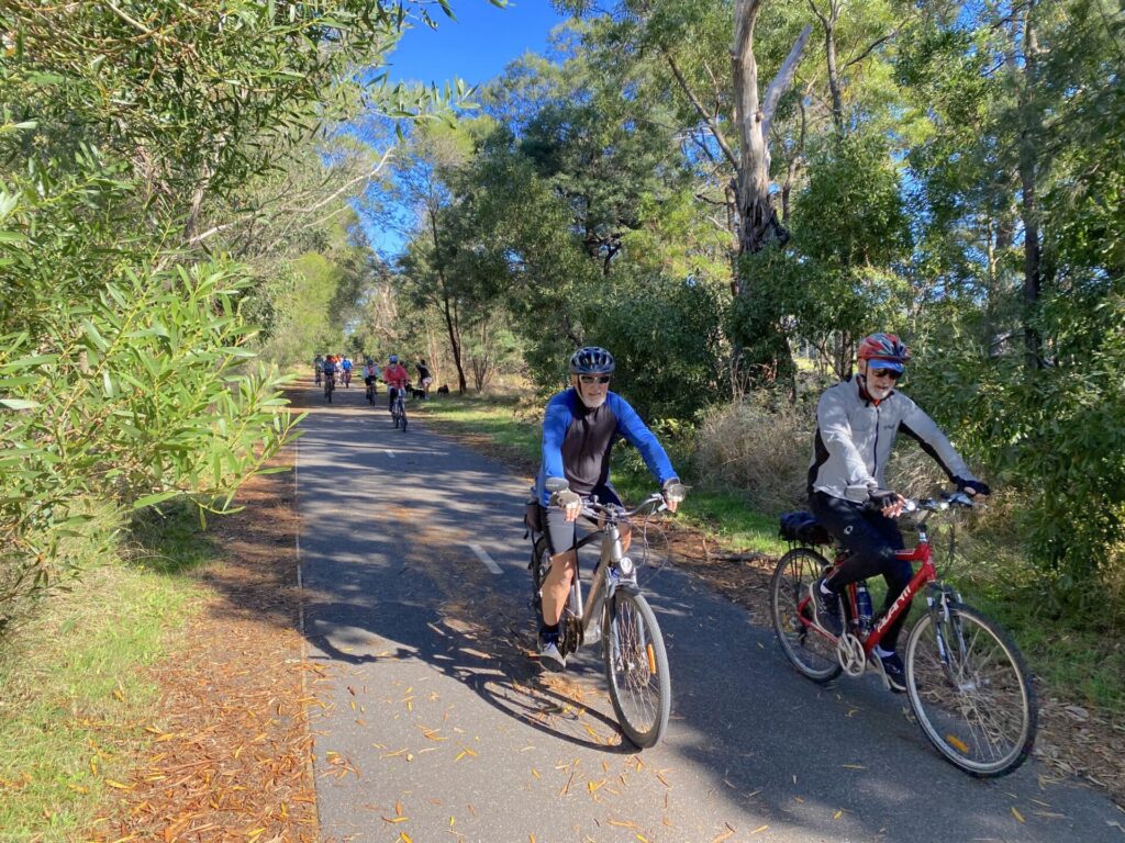
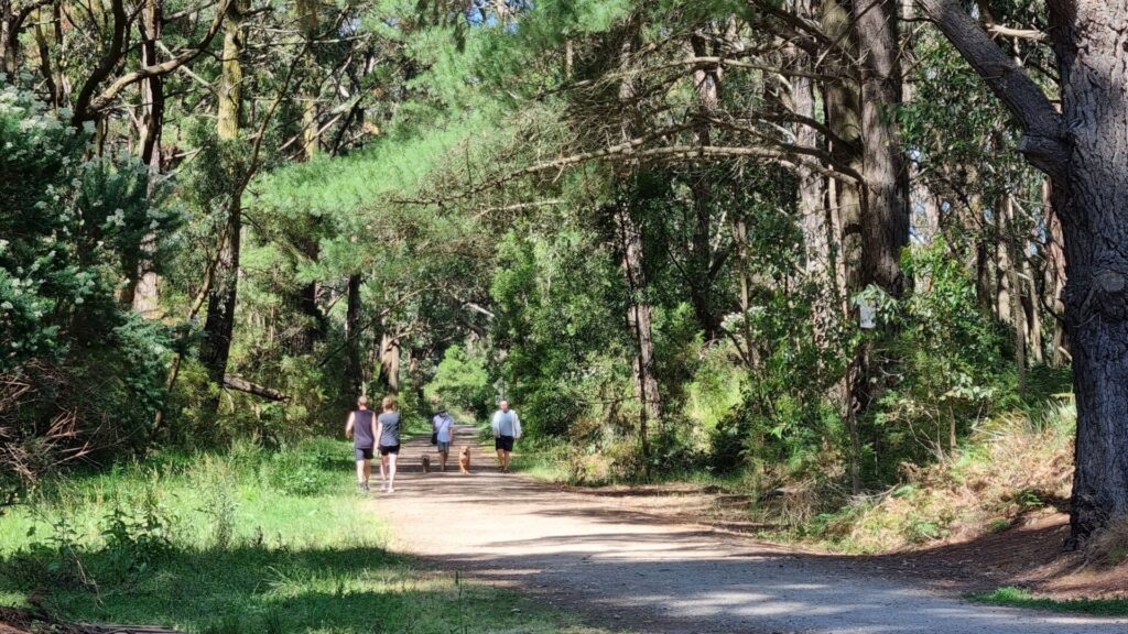
The trail appears to retain the asphalt from the early 1980s and, as a result of being build off the rain alignment near trees, is lumpy in places. It does offer a range of parkland and urban settings as it heads up to Fyansford. It’s possible to link this shared path to the Bellarine Rail Trail by following the Barwon River Trail (see ‘CONNECTING PATH’).
Section Guides
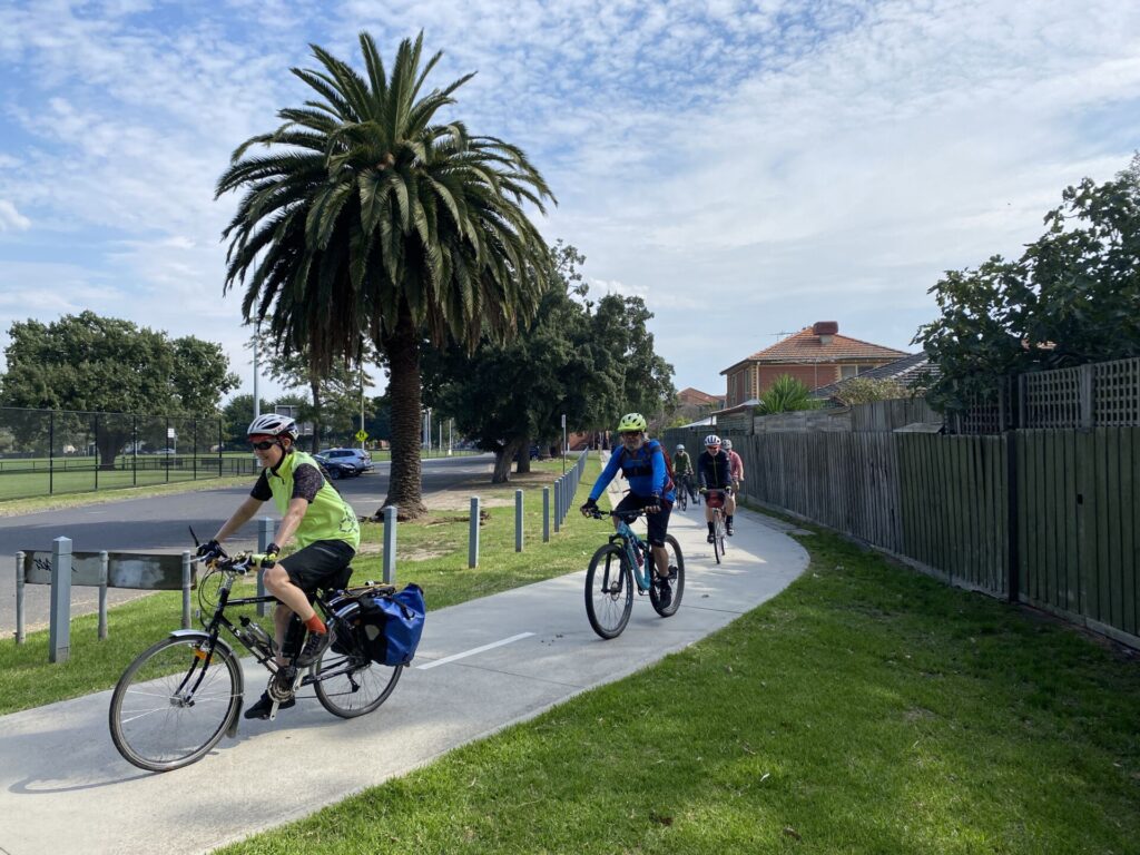
- Access: The rail trail starts from Douro St, North Geelong, opposite Roseneath St, where there is limited parking.
- Douro St is near North Geelong Station, which has a sizeable car park. From there take Victoria St west to Roseneath St, turn right and travel north until it meets Douro St, where the trailhead is part of Tom McKean Linear Park
- The asphalt path runs through various urban settings linking small and large parks. There are facilities at Hamlyn Park and Kevin Kirby Reserve, which also has a BBQ
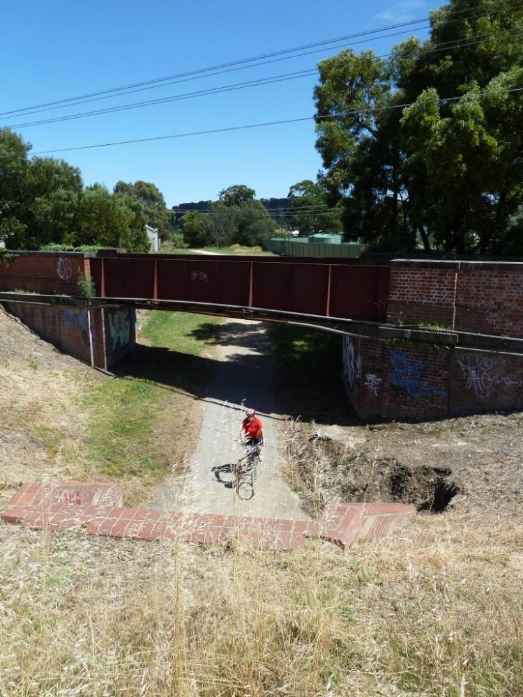
- When you reach the end of the trail at McCurdy St, Fyansford, only the despatch area and switching yard for the cement trains remains. The tall silos high on the bluff were a focal point for locals and visitors, especially after they were painted by famous street artist Rone. The artwork was visible for kilometres but the silos were demolished in 2020
- The cement works itself, below the Hyland St hill, has also been demolished
CONNECTING PATH
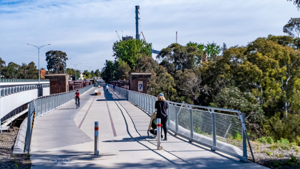
- If the Fyansford Rail Trail was just a warm-up for you, why not add 17 km by riding to the Bellarine Rail Trail? From the Fyansford switching yard on McCurdy Rd, walk down the steep path or ride down Hyland St, with care, and cross Deviation Rd to the Barwon River North Bank Trail. Head south-east, passing The Hill MTB Park on Marnock Rd to the left and an impressive array of rowing sheds after Moorabool St. You can ride ride directly to the Bellarine trailhead at South Geelong Station via the on-road bike lanes on Yarra St, or turn left after the Breakwater rail bridge and take the concrete shared path beside the railway embankment to Barwon Tce and the shared path along Breakwater Rd northwards to join the Bellarine Rail Trail just south of Carr St (see our map). There is car parking here and camping at the showgrounds you just past on your right.
![Heading off on the trail from Douro St in North Geelong [2024]](jpg/v17-050-heading-off-on-the-fyansford-railside-trail-from-douro-st-near-north-geelong-railyard-2024-1-300x225.jpg)
Heading off on the trail from Douro St in North Geelong [2024]
![The mail must get through, even if you have to use a rail trail to do it [2024]](jpg/v17-050-the-mail-must-get-through-on-the-fyansford-railside-trail-2024-1-300x169.jpg)
The mail must get through, even if you have to use a rail trail to do it [2024]
![Local schools make use of Hamlyn Park which has public toilets [2024]](jpg/v17-075-hamlyn-park-on-the-fyansford-railside-trail-2024-300x169.jpg)
Local schools make use of Hamlyn Park which has public toilets [2024]
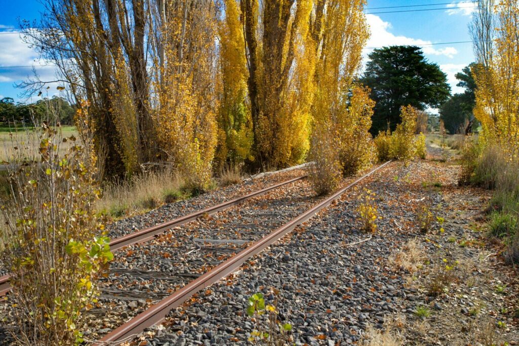
![Typical parkland scenery on the trail next to the railway alignment [2019]](jpg/v17-055-north-geelong-to-fyansford-2019-08-2019-08-31_162435-300x169.jpg)
Typical parkland scenery on the trail next to the railway alignment [2019]

Silos' artwork was a landmark, but they were demolished in 2020
![The cement silos are gone but the view has improved [2024]](jpg/v17-100-fyansford-2024-11-with-cement-silos-demolished-img_5145-300x169.jpg)
The cement silos are gone but the view has improved [2024]
![The view from Fyansford looking over the Moorabool River [2019]](jpg/v17-105-fyansford-2019-08-0547-300x169.jpg)
The view from Fyansford looking over the Moorabool River [2019]
![The Barwon River makes a great spot for an excursion [2024]](jpg/v17-110-fun-on-the-barwon-river-near-fyansford-2024-300x169.jpg)
The Barwon River makes a great spot for an excursion [2024]
Public Transport
V/Line’s Geelong services from Southern Cross Station will get you to the North Geelong Station near the start of this trail. From there take Victoria St west to Roseneath St, turn right and travel north until it meets Douro St, where the trailhead is on the left and signed as Tom McKean Linear Park.
Refer to the PTV web page for map and timetables, or the navigation app of your choice.
Do you know of a bike hire or transportation service on this rail trail that should appear here? If so, let us know at admin@railtrails.org.au.
Contact Rail Trails Australia
To contact us about this rail trail, email vic@railtrails.org.au
Background Information
The line was conceived by the Australian Portland Cement Company, which approached the state government in 1915-16 requesting a rail link from its plant on Hyland St, Fyansford, to the North Geelong yards to cope with increased production and reduce road traffic. The company bought the land for it and transferred the titles to Victoria Railways. The broad-gauge line opened in 1918, with a conveyor system carrying the cement up the hill from the APC plant to the silos and despatch area on McCurdy Rd.
A shared path and linear park were established beside the tracks in the early 1980s but use of the line itself declined as road haulage took over. The cement plant closed in 2000 and was demolished, while the silos were decorated with artwork and became a landmark until they were removed in 2020.
Coincidentally, after initially using a ropeway, in 1926 the company opened its own 3’6″-gauge (1067mm) line from the Fyansford plant to its quarries further up the Moorabool River. This was replaced with a conveyor system in 1966 and most of the locomotives went to the Bellarine Railway.
Nearby Trails
Bellarine Rail Trail
Bellarine Peninsula, 75km south-west of Melbourne CBD
35 km


Sandridge Rail Trail
Melbourne city, 1km from GPO
4 km

Webb Dock Bridge
Docklands, 1 km south-west of Melbourne GPO
0.2 km
Tiger Rail Trail
136 km south-west of Melbourne
4.4 km
Rosstown Rail Trail
Southern suburbs, 9km from the CBD
9 km
Mornington Rail Trail
Mornington Peninsula, 60km south of CBD
4 km
Inner Circle Rail Trail
Inner suburbs, 5km from the CBD
5 km
Hawthorn to Kew Rail Trail
Inner suburbs, 9km east of Melbourne CBD
1 km
Red Hill Rail Trail
Mornington Peninsula, 90km south of CBD
6.3 km

Outer Circle Rail Trail
Eastern suburbs, 6km from Melbourne CBD
17 km
Bunny Trail
110 km west of Melbourne
1.2 km
Meadowlink Linear Park
Broadmeadows, 20km north of CBD
1.2 km
Old Beechy Rail Trail
Otway Ranges, 152 km south-west of Melbourne
40 km
Ballarat-Skipton Rail Trail
110 km north-west of Melbourne
57 km
Woodend to Daylesford (incl Domino) Rail Trail
Goldfields, 85km north-west of Melbourne
6 km
Ringwood to Belgrave Trail
40km east of Melbourne CBD
17 km
Eastern Dandenong Ranges Trail
Dandenongs, 50km south-east of CBD
15 km
Warburton Rail Trail/Yarra Valley Trail
Yarra Valley, 50km east of Melbourne CBD
48 km
Bass Coast Rail Trail
Bass Coast, 130km south-east of Melbourne
23 km
Camperdown-Timboon Rail Trail
160km south-west of Melbourne
41 km
Castlemaine-Maryborough Rail Trail
Central Victoria, 124 km from Melbourne

Nearby Trails
Bellarine Rail Trail
Bellarine Peninsula, 75km south-west of Melbourne CBD
35 km
Sandridge Rail Trail
Melbourne city, 1km from GPO
4 km
Webb Dock Bridge
Docklands, 1 km south-west of Melbourne GPO
0.2 km
Tiger Rail Trail
136 km south-west of Melbourne
4.4 km
Rosstown Rail Trail
Southern suburbs, 9km from the CBD
9 km
Mornington Rail Trail
Mornington Peninsula, 60km south of CBD
4 km
Inner Circle Rail Trail
Inner suburbs, 5km from the CBD
5 km
Hawthorn to Kew Rail Trail
Inner suburbs, 9km east of Melbourne CBD
1 km
Red Hill Rail Trail
Mornington Peninsula, 90km south of CBD
6.3 km
Outer Circle Rail Trail
Eastern suburbs, 6km from Melbourne CBD
17 km
Bunny Trail
110 km west of Melbourne
1.2 km
Meadowlink Linear Park
Broadmeadows, 20km north of CBD
1.2 km
Old Beechy Rail Trail
Otway Ranges, 152 km south-west of Melbourne
40 km
Ballarat-Skipton Rail Trail
110 km north-west of Melbourne
57 km
Woodend to Daylesford (incl Domino) Rail Trail
Goldfields, 85km north-west of Melbourne
6 km
Ringwood to Belgrave Trail
40km east of Melbourne CBD
17 km
Eastern Dandenong Ranges Trail
Dandenongs, 50km south-east of CBD
15 km
Warburton Rail Trail/Yarra Valley Trail
Yarra Valley, 50km east of Melbourne CBD
48 km
Bass Coast Rail Trail
Bass Coast, 130km south-east of Melbourne
23 km
Camperdown-Timboon Rail Trail
160km south-west of Melbourne
41 km
Castlemaine-Maryborough Rail Trail
Central Victoria, 124 km from Melbourne
2 reviews of “Fyansford Rail Trail”
Although sealed, the surface is bumpy in places due to tree roots – we reverted to the road at one point. Some of the road crossings are poorly designed, but otherwise a pleasant, short ride. We did it as part of a 30km ride from Lara to South Geelong stations, taking in the Hovell Creek trail and the Barwon river trail. This route is mostly off-road and sealed, a bit rough in places but generally OK. It's very varied, going past Geelong Grammar School and through North Geelong industry, plus lovely riverbank landscapes. There is one black hole of about 1km of ugly busy roads to get across railway tracks north of North Geelong station to access the rail trail. You can ride on the concrete footpath across the road bridge but there is gravel and broken glass and you are close to very fast traffic.
Short and sweet. The sealed trail surface runs beside the old track bed. I didn't see any remains of any rail relics, apart from the obvious raised track bed. Overall it's not a bad little ride.