 Location:
 Length:
 Surface:
 Start / End:
 Suitable for:
The Rylstone to Gulgong Rail Trail is a proposed 83.5 kilometre trail in the Central West region of NSW. In November 2024, the Mid-Western Regional Council resolved to investigate leasing the rail corridor for public amenity/recreational opportunities, as per the framework adopted by the NSW government for formerly publicly-owned railways.

This Trail is a proposed Rail Trail only at this stage. It is not yet constructed or open.
The railway corridor is owned by the NSW State Government, and trespassing is prohibited.
The disused railway corridor between Rylstone and Gulgong passes through some very scenic countryside, and goes through the popular wine region of Mudgee in the Mid West of NSW.
The NSW Government has advised that Council may lease the non-operational rail corridor between Rylstone and Gulgong, via Lue and Mudgee, for the purpose of a rail trail. To ensure Council is meeting the needs of our community, it is seeking feedback on this opportunity.
Nearby Attractions
Mudgee and region wineries
Gulgong museum and historical village
Historical railway infrastructure
Last updated: 23 December 2025
The potential distance of this proposed rail trail between Gulgong and Rylstone would be 83.4kms.
Section Guides
Gulgong to Mudgee (32.5km)
Mudgee to Lue (28.5km)
Lue to Rylstone (22.4km)
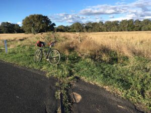
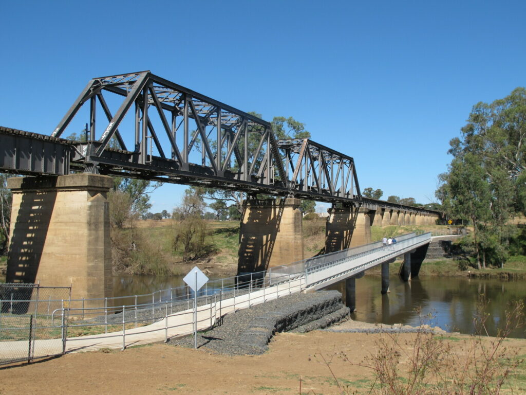
Rylestone to Gulgong Corridor at Wilbertree Rd
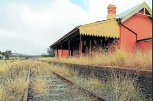
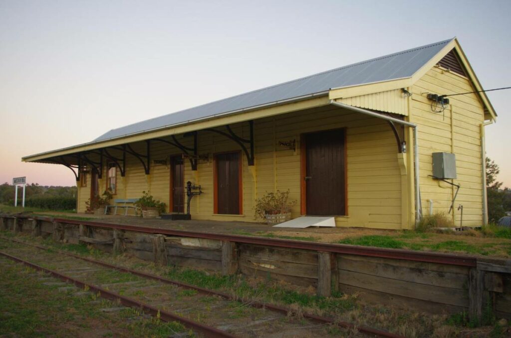
Lue Station on the proposed rail trail
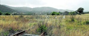
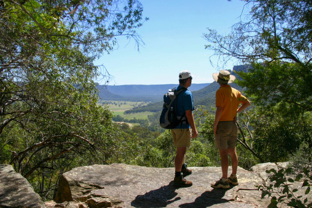
Typical scenery Lue area,
Do you know of a bike hire or transportation service on this rail trail that should appear here? If so, let us know at admin@railtrails.org.au.
Contact Rail Trails Australia
To contact us about this rail trail, email nsw@railtrails.org.au
Background Information
This Trail is a proposed Rail Trail only at this stage. It is not yet constructed or open.
The railway corridor is owned by the NSW State Government, and trespassing is prohibited.
Background Information
Traditional owners
We acknowledge the Wiradjurie people, the traditional custodians of the land and waterways on which the rail trail will be built.
Development and future of the rail trail
The NSW Government has advised that Council may lease the non-operational rail corridor between Rylstone and Gulgong, via Lue and Mudgee, for the purpose of a rail trail. To ensure Council is meeting the needs of our community, it is seeking your feedback on this opportunity.
Council is seeking community input on the future use of the non-operational rail corridor between Rylstone and Gulgong. Feedback will guide Council’s planning, advocacy, and consideration of options such as a rail trail.
This consultation responds to community priorities identified in Council’s Community Strategic Plan, which highlighted the need for further engagement on the corridor’s future. Community views will help shape Council’s decisions and inform discussions with the NSW Government.
As a result of the Council’s recent survey, this project was shown to have a good lot of community support, and as a result the Council is now seeking funding of $50,000 to do a feasibility study.
Rail line history
The Gwabegar branch runs from Wallerwawang on the Main Western Line north to the locality of Gwabegar. It was opened progressively from 1882 to 1923.
The section from Kandos to Gulgong was closed on March 2, 1992, however this was re-opened for traffic on September 2, 2000.
The section between Kandos and Rylstone remains open for occasional heritage trains, but the rest of the line between Rylstone and Gwabegar has subsequently been out of use for more than 25 years.
The lower section, from Kandos to Wallerawang sees occasional cement traffic and regular coal trains, from the collieries at Charbon and Baal Bone.
Nearby Trails
Molong to Dubbo Rail Trail
400 km north-west of Sydney

Sandy Hollow to Merriwa
100 km north west of Newcastle
Wolgan Valley Rail Trail
Wolgan Valley, 190km west of Sydney
11 km


Tracker Riley Cycleway rail trail
Dubbo, 390km north-west of Sydney
3 km


Nearby Trails
Molong to Dubbo Rail Trail
400 km north-west of Sydney
Sandy Hollow to Merriwa
100 km north west of Newcastle
Wolgan Valley Rail Trail
Wolgan Valley, 190km west of Sydney
11 km
Tracker Riley Cycleway rail trail
Dubbo, 390km north-west of Sydney
3 km