Receive Our Free Email News
Stay up to date with the latest news about Rail Trails with our free email news.
Register for news updatesNew section of Mary to Bay Rail Trail officially opened
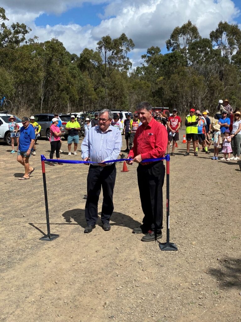
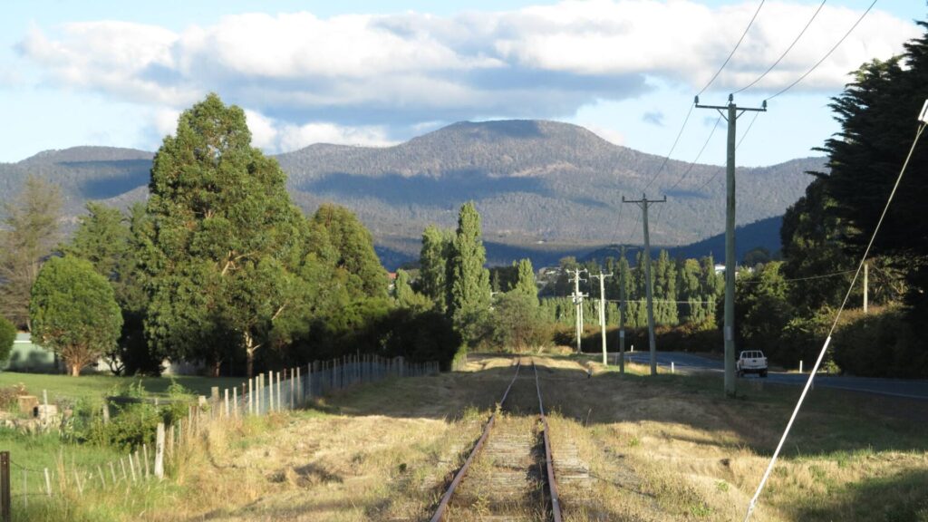
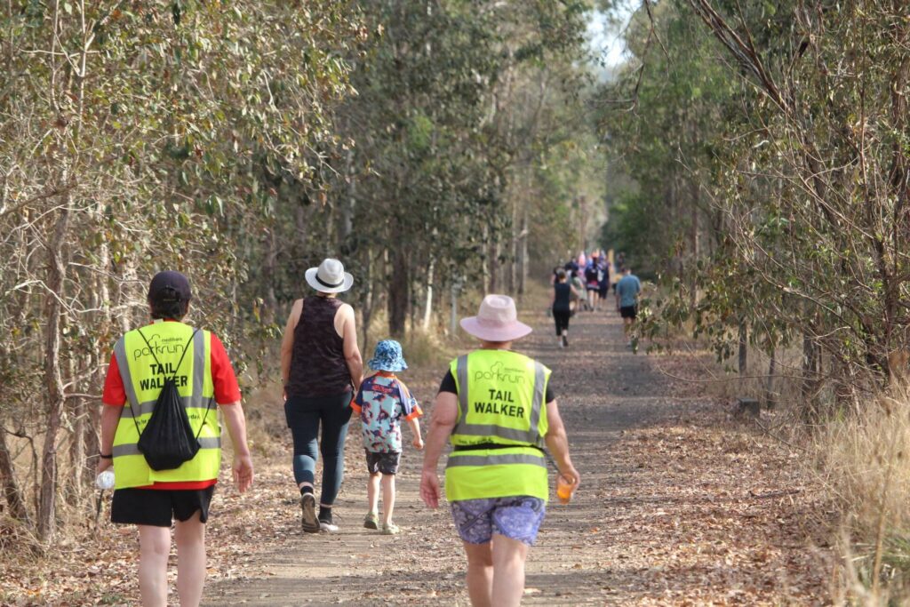
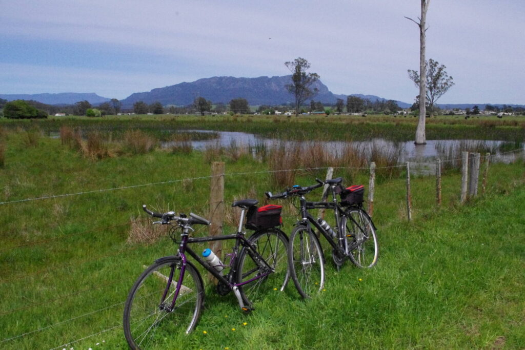
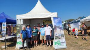
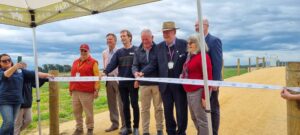
An enjoyable morning was had by nearly 350 people who attended the official opening of a new 11k section of the Mary to Bay (Fraser Coast) Rail Trail in Queensland connecting Takura and Colton near Hervey Bay.
Bike riders, walkers, bird watchers, horse riders and interested residents were all well represented. The ultimate plan is for a rail trail from Hervey Bay to Maryborough.
The extension only came about after a huge amount of work by a band of volunteers. It was pleasing to see the local MP for Maryborough, Mr Bruce Saunders, expressing his support and commitment, as did Councilor David Lewis from Fraser Coast council.
Rail Trails Australia was ably represented by Queensland representative Desley O’Grady, with NSW representatives Stephen Brown and John O’Brien also attending. To show how hardy they are in Queensland, a group of bike riders led by Desley O’Grady rode to the opening from Buliyan over 5 days, as did another group riding from Ipswich. All the hard-working volunteers were presented with a “gold railway spike” collected during the undertaking.


More News

If you live in Melbourne, Sydney, Perth, regional Victoria and NSW, Adelaide and Tasmania and are available to count bik...
Long-standing rail trail supporter Ms Rosamund Lesley Heit has been awarded the Medal of the Order of Australia (OAM) in...
Rail Trails Australia had 289,000 visits to its website in 2025, many by people looking for information on specific rail...
Byron Shire in northern NSW is working on getting approvals and funding for the transition of the 132km rail corridor th...
A 49km rail trail west from New Norfolk to mountain bike park centre Maydena is an exciting proposition from Derwent Val...
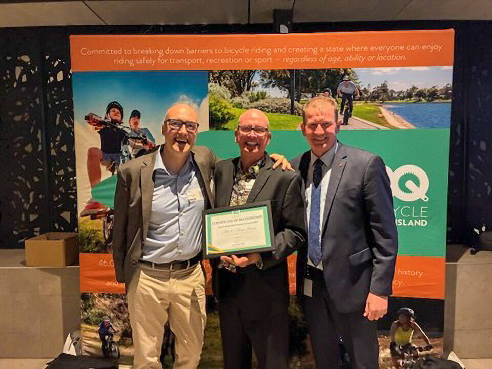
Pioneer Valley Rail Trail volunteers Mike and Margie Browne have won an Excellence in Community Project Achievement awar...
Update: as of 25 January 2026, Cycle Dindi 26 has been postponed due to damage to the Great Victorian Rail Trail (GVRT)....
Construction has begun on the next 1.5km stretch of the Yarra Valley Trail in Victoria, which will extend to the Birraru...
We know that rail trails are not exclusively enjoyed by cyclists: horse-riders, runners, walkers and mobility aid users ...
Queensland’s Somerset Regional Council and City of Moreton Bay have confirmed they have undertaken a Multi Criteri...
Hilltops Council is inviting the community to have their say on the Boorowa Galong Rail Trail Concept. The concept explo...
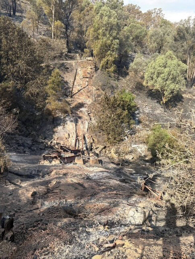
The 2026 Victorian bushfires caused widespread damage to many communities and also severely damaged 2 rail trails in nor...
Northern Tasmania’s Latrobe Council and Kentish Council have released the Latrobe-Kentish Trails Strategy to guide the...
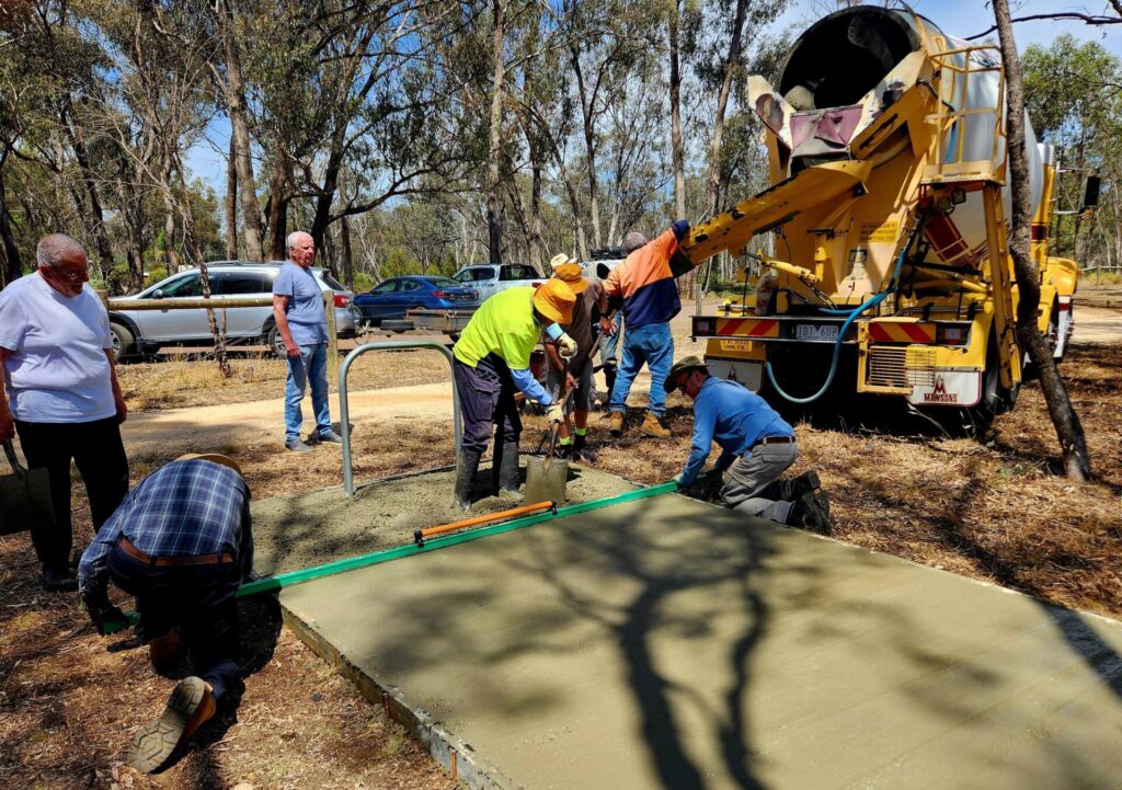
Friends of The Bendigo – Kilmore Rail Trail (FBKRT) continue to improve the O’Keefe Rail Trail, with 2 recent wo...
In December, Logan City Council (bordering Brisbane) decided to proceed with a staged development of the 11.5km section ...

As Rail Trails Australia (RTA) ramps up its efforts to assist New South Wales increase the number of rail trails in the ...
Calendar of Events
See upcoming eventsNews Archives
Receive Our Free Email News
Stay up to date with the latest news about Rail Trails with our free email news.
Register for news updatesFeatured Articles
Celebrating RTA’s Volunteers
26/05/25
More News
If you live in Melbourne, Sydney, Perth, regional Victoria and NSW, Adelaide and Tasmania and are available to count bik...
Long-standing rail trail supporter Ms Rosamund Lesley Heit has been awarded the Medal of the Order of Australia (OAM) in...
Rail Trails Australia had 289,000 visits to its website in 2025, many by people looking for information on specific rail...
Byron Shire in northern NSW is working on getting approvals and funding for the transition of the 132km rail corridor th...
A 49km rail trail west from New Norfolk to mountain bike park centre Maydena is an exciting proposition from Derwent Val...
Pioneer Valley Rail Trail volunteers Mike and Margie Browne have won an Excellence in Community Project Achievement awar...
Update: as of 25 January 2026, Cycle Dindi 26 has been postponed due to damage to the Great Victorian Rail Trail (GVRT)....
Construction has begun on the next 1.5km stretch of the Yarra Valley Trail in Victoria, which will extend to the Birraru...
We know that rail trails are not exclusively enjoyed by cyclists: horse-riders, runners, walkers and mobility aid users ...
Queensland’s Somerset Regional Council and City of Moreton Bay have confirmed they have undertaken a Multi Criteri...
Hilltops Council is inviting the community to have their say on the Boorowa Galong Rail Trail Concept. The concept explo...
The 2026 Victorian bushfires caused widespread damage to many communities and also severely damaged 2 rail trails in nor...
Northern Tasmania’s Latrobe Council and Kentish Council have released the Latrobe-Kentish Trails Strategy to guide the...
Friends of The Bendigo – Kilmore Rail Trail (FBKRT) continue to improve the O’Keefe Rail Trail, with 2 recent wo...
In December, Logan City Council (bordering Brisbane) decided to proceed with a staged development of the 11.5km section ...
As Rail Trails Australia (RTA) ramps up its efforts to assist New South Wales increase the number of rail trails in the ...
8 comments on “New section of Mary to Bay Rail Trail officially opened”
Rode 500k on my 20" folder to be there and hopefully one day it will be normal to ride between Maryborough and Hervey Bay. Plenty of maps and information on the Facebook site. It is an adventure trail for the moment.
I was expecting to see a report on the local news on Monday evening (on 7) but there was no mention of the opening of the trail. Getting it out to the public via the news would spread the word of the trail and encourage more riders to experience it I thought.
We tried but apart from a very successful media event the week before there was no interest from media despite repeated contacts.
Missed it by one day ! Will have to come back next year. Well done to all the volunteers 👍
Having ridden the Mary to Bay RT yesterday morning (Saturday 28/8), I agree with the comments made by Colin about the need for a map and by Garry for better signage to get around the Pialba shopping precinct. Having reached the end of the paved trail at Nukembah (near the main road to Maryborough, though I didn't realise that at the time) there was no signage to indicate that there were other sections of the trail that could be ridden further on, starting on Piggford Lane. The only sign was a red arrow with "Fraser Coast BUG" that didn't tell me anything useful. Later, I checked the FCBUG website & found that they were opening the new Takura section that very day. So my wife Toni & I drove out to the Takura Trailhead, but at first found it difficult to locate as the "Fraser Coast BUG" direction sign on Dundowran Rd caused us to drive down Leos Rd, missing the Takura Trailhead that we later found was only about 40m away, parallel to Leos Rd ! So there's a need for a sign to point to where the Takura section starts & the facilities there. Anyway, we're very glad to see that the opening of the new Takura section went so well. We're much better informed now about the RT route when we return to ride it on another holiday.
A map of the area would be a good idea to orientate readers of the location.
I agree with Colin, an up to date paper map, readily available, would be great.
It can also be difficult navigating through the Pialba shopping precinct; signposts around that area would also be helpful.
I was surprised that so few tourist and accommodation facilities in the area had any useful knowledge of the cycling facilities available in the bay. Strava has cycling “segments” in the routes.
Cycling facilities are one of the main influences that bring us back to Hervey Bay!
When in Facebook next look for the Mary To Bay Trail Trail Discussion page. In the "files" at the top there is a complete map which give considerable detail on a laptop screen (or even tablet) when zoomed in and there are also smaller maps cut up from this which work well on a phone. And the bigger map prints up well at A1 or even A2 if you take it to a printer There was no professional mapping planned earlier because we knew we would be opening 11 klms before long which would render any maps obsolete. We will print maps/ brochures now as soon as we can find the necessary grant funding.