 Location:
 Length:
 Surface:
 Start / End:
 Suitable for:


The Mary to Bay Rail Trail on the Fraser Coast of Queensland runs through the seaside city of Hervey Bay to Takura. When complete it will connect to the historic city of Maryborough.
- Provides a safe off-road connection between the main centres of the major regional seaside region of Hervey Bay.
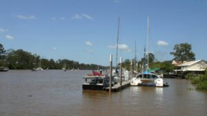
- Provides access to the beaches and the 868 m pier at Urangan
- The shared path along the foreshore from the Urangan Pier makes a scenic loop trail back to Pialba.
- Along the urban section there are an increasing number of cafes and restaurants opening to keep users fueled up and keen.
- Rural section traverses a unique “wallum” ecosystem with a range of vegetation and bird life. Horse riding is only allowed in this section.
Nearby Attractions
The Fraser Coast has many wonderful attractions and activities including:
- Portside Precinct, Maryborough which includes Customs House, Bond Store and the Military and Colonial Museum
- Story Bank , a tribute to Mary Poppins in a restored bank building, the home of PL Travers.
- ‘Mary Ann’, a replica steam train, through Maryborough’s heritage-listed Queens Park Thursdays and last Sunday of the month.
- The Cistern Chapel in the Maryborough Town Hall and the Information Centre.
- Botanic Gardens and Orchid House in Urangan
- Urangan Pier
- Tour K’gari, (formerly known as Fraser Island)
- Whale watching cruise from Urangan Marina, July – September.
- Take A Stroll Along The Esplanade.
Last updated: 20 January 2026
This rail trail has three distinct sections:
- Urangan to Nikenbah (13km): An urban trail with high quality surface providing a safe off-road connection between the main centres of Hervey Bay, including Urangan Pier, Piabla and Nikenbah.
- Nikenhah to Colton (13 km): A rural section with gravel surface starting at Piggford Lane (off the Maryborough-Hervey Bay Rd), and continues towards Maryborough through bushland, currently finishing at Churchill Mine Rd trail head. Horse riding is only allowed in this section.
- Maryborough (3km): Unsealed urban section.
Note As shown on the map, there is a gap between the first two sections as there is no official crossing of the busy Maryborough-Hervey Bay Rd.
Section Guides
Urangan to Pialba (7.5 km)
- Wide sealed trail surface connects the main centres of the coastal city of Hervey Bay.
- Access: Urangan Pier – street parking nearby, Pialba – area currently under development, park at the Hervey Bay Regional Gallery.
- Many shops and restaurants near to the trail and public toilets and water points.
Pialba to Nikenbah (former station) (5.9 km)
- Wide sealed trail surface connects the main centre to southerly suburbs.
- Access: Nikenbah station shelter on Chapel Rd (search for Nikenbah station picnic area) – Park on side of road (wide verges)
- Many shops and restaurants for the first few kilometres but only a cafe at Nikenbah.
Piggford Lane, Nikenbah to Takura Trail Head (5.6 km)
- Wide smooth gravel trail surface through bushland with shade and birdlife, bordering a conservation area.
- Access: Due to having no formal crossing of the busy Maryborough – Hervey Bay Rd, this section currently starts at 41 Piggford Lane (park on side of road). Walligan Station Picnic area is off Dundowran Road.
- At Stockyard Creek a very scenic lagoon used for watering steam trains for many decades can be found a couple of hundred metres downstream (to the left) of the rail trail.
- There are two new gravel crossings of Stockyard Creek and Black Swamp Creek, just before Takura.
- Access: Takura trail head is the former station site on Torbanlea Pialba Rd, near Leos Rd (Search Takura trail head). There is room for parking here.
- The only facilities in this section are a shelter at the Walligan station site and a shelter and picnic table at Takura station site.
Takura Trail Head to Churchill Mine Rd Trail Head (7.2 km)
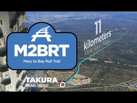
- A further 11 km of Trail from Takura has been developed by Fraser Coast Bicycle User Group volunteers but is only open to Churchill Mines Rd. This passes through wallum heath (banksias, melaleuca, grass trees) with signage and all-weather bypasses around heritage bridges.
- Access: Churchill Mine Rd Trail Head (can be searched) provides a pleasant rest area and parking, adjacent the Susan River trestle bridge and headwaters.
- The trail surface is rough in places so walkers, horse riders and mountain bike riders will enjoy this lengthy section, taking in the natural environment, flora and fauna.
- There are no facilities in this section apart from the rest area so bring water.
Maryborough (3 km)
The first section from Maryborough towards Hervey Bay.
- From Walker St (across from cemetery beside Zemek Bridge overpass) to Quarry Rd.
- High quality unsealed surface.
![The impressive 868m Urangan Pier and beach at the end of the rail trail, which also connects with coastal pathyways [2025].](jpg/q30-450-urangan-pier-2025-06-10_081731-300x247.jpg)
The impressive 868m Urangan Pier and beach at the end of the rail trail, which also connects with coastal pathyways [2025].
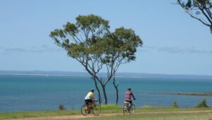
The rail trail connects with the scenic Hervey Bay foreshore trail (2007)
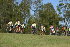
The high standard of the Hervey Bay section makes the trail accessible to all members of the community (2007)
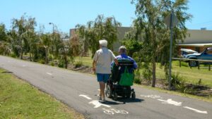
The high standard of construction in town makes the trail accessible to all members of the community (2007)
![Whale mural at Pialba, it does rain there, [2022]](jpg/q30-357-pialba-20220225-300x225.jpg)
Whale mural at Pialba, it does rain there, [2022]
![The original Pialba station is still there [2012]](jpg/q30-350-pialba-2012-01-0859-300x168.jpg)
The original Pialba station is still there [2012]
![Whale artwork at Pialba [2025]](jpg/q30-350-pialba-sculpture-2025-06-10_090443-300x300.jpg)
Whale artwork at Pialba [2025]
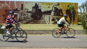
Mural on the trail at Pialba (2007)
![The Mary to Bay Rail Trail is now taking place in signage as well [Garry Long 2023]](jpg/q30-350-pialba-hunter-st-sign-20230530_102905-300x198.jpg)
The Mary to Bay Rail Trail is now taking place in signage as well [Garry Long 2023]
![The trail along Urraween Rd, Urraween [Garry Long 2023]](jpg/q30-310-urraween-rd-urraween-2023-05-30_104006-300x181.jpg)
The trail along Urraween Rd, Urraween [Garry Long 2023]
![The rail trail at Uraween [2012]](jpg/q30-310-urraween-2012-01-0868-300x168.jpg)
The rail trail at Uraween [2012]
![An underpass has been constructed to take the rail trail under a new road between Nikenbah and Urraween [2025]](jpg/q30-310-nikenbah-to-urraween-christensens-rd-new-overpass-2025-06-10_093847-300x169.jpg)
An underpass has been constructed to take the rail trail under a new road between Nikenbah and Urraween [2025]
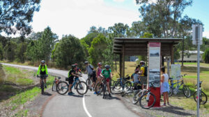
The former Nikenbah station site (2018)
![Coffee shop along the rail trail Nikenbah [2025]](jpg/q30-300-nikenbah-2025-06-10_114344-300x169.jpg)
Coffee shop along the rail trail Nikenbah [2025]
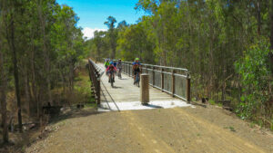
The longest restored bridge between Walligan station and Piggford Rd (2018)
![The lagoon near Stockyard Creek that was used to water the steam engines [2007]](jpg/q30-255-walligan-to-colton-2007-09-2802-300x200.jpg)
The lagoon near Stockyard Creek that was used to water the steam engines [2007]
![The former Walligan station site [2025]](jpg/q30-250-walligan-station-2025-06-10_102732-300x169.jpg)
The former Walligan station site [2025]
![The Stockyard Creek crossing between Takura and Walligan is for dry weather only [2025]](jpg/q30-210-stockyard-creek-2025-06-10_103631-300x300.jpg)
The Stockyard Creek crossing between Takura and Walligan is for dry weather only [2025]
![Horse riders enjoying the new path at Takura [2023]](jpg/q30-200-takura-2023-08-horse-300x169.jpg)
Horse riders enjoying the new path at Takura [2023]
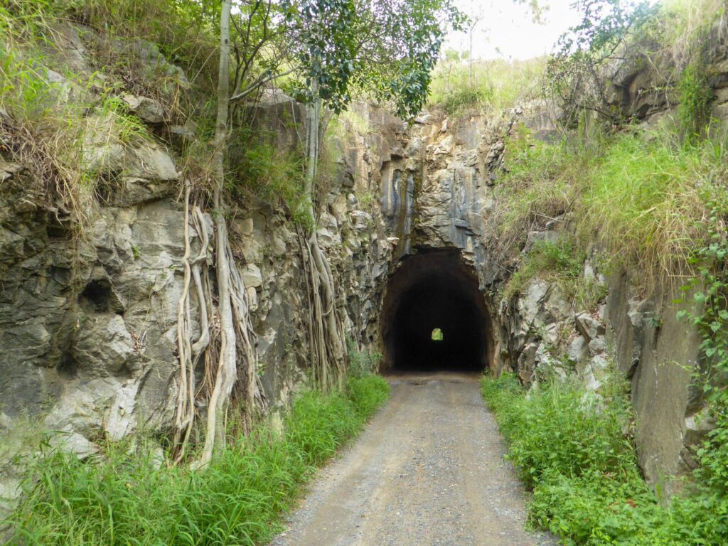
![The longest old timber railway bridge between Colton and Takura with the low level bypass on the right [2023]](jpg/q30-150-colton-to-takura-heritage-bridge-2-300x225.jpg)
The longest old timber railway bridge between Colton and Takura with the low level bypass on the right [2023]
![Riding one of the bridge bypasses between Colton and Takura [2023]](jpg/q30-150-colton-to-takura-316078725_5988322137845725_30728211661004585_n-300x225.jpg)
Riding one of the bridge bypasses between Colton and Takura [2023]
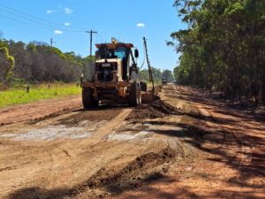
Construction on the rail trail at West Maryborough began in May 2023
The Mary River is a major feature of historic Maryborough, the future destination of the rail trail.
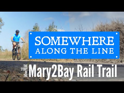
Background to development of the bushland section of the rail trail by the local volunteer group.
Promotional video of the bushland section of the rail trail.
Do you know of a bike hire or transportation service on this rail trail that should appear here? If so, let us know at admin@railtrails.org.au.
Information and Links
The rail trail is managed by the Fraser Coast Regional Council http://www.frasercoast.qld.gov.au
and Fraser Coast Bicycle User Group (Takura to 3.8kms past Churchill Mine Road).
See Facebook’s Mary to Bay Rail Trail Discussion Group Here: https://www.facebook.com/groups/979547312549490
Fraser Coast BUG Here: https://fcbug.org.au/mary-to-bay-rail-trail-home/
Contact Rail Trails Australia
To contact us about this rail trail, email qld@railtrails.org.au
Background Information
Traditional Owners
We acknowledge the Badtjala people, the traditional custodians of the land and waterways on which the rail trail is situated.
Development and future of the rail trail
The trail is mostly managed by the Fraser Coast Regional Council, who extended the trail to the Urangan Pier, which links it up with the foreshore shared path along the Bay water front. They completed the rail trail to Nikenbah in 2017 and then on to Stockyard Creek in 2018. The Fraser Coast Bicycle Users Group (FCBUG) Rail Trail are developing the 11km section from Takura almost to Colton, opening the first section in 2023 and continuing to work on the quality of the rest.
The situation to determine a suitable crossing of the busy Hervey Bay to Maryborough Rd to join the rural and urban sections is unknown.
Council constructed the first section from Maryborough in 2023 to Quarry Rd. Planning continues to connect the sections between Churchill Mine Road Trail Head and Quarry Road, as well as Walker Street Trail Head and Maryborough CBD.
Rail Line History
This line branched off the North Coast Main Line at Colton, just north of Maryborough. It reached Pialba in 1896 and was extended to Urangan in 1913. The line carried out a lot of pineapples from local farms and goods from the Urangan Pier and brought in a lot of picnic trains to the beach from Maryborough. The last section of the line closed in 1993.
Queensland Council Moves on Mary to Bay Rail Trail
Posted: 24/10/25
Fraser Coast Regional Council is now transitioning from planning to on-ground delivery of Mary to ...
More...New section of Mary to Bay Rail Trail officially opened
Posted: 26/08/23
An enjoyable morning was had by nearly 350 people who attended the official opening of a ...
More...Rural section of Mary to Bay Rail Trail progressing well
Posted: 19/03/23
Rail Trails Australia Central Queensland rep Desley O'Grady made a flying visit to Hervey Bay ...
More...Mary to the Bay Rail Community Consulation Sessions
Posted: 29/01/19
Fraser Coast Regional Council are holding two Community Consulation Drop In Sessions about the planned ...
More...The 3.2km Hervey Bay Rail Trail Extension Opens
Posted: 22/05/17
The 3.2Km extention of the Rail Trail from Urraween Road to Chapel Road has now ...
More...Mary to the Bay Rail Trail extension opens (QLD)
Posted: 10/06/16
Photo. Mark Linnett, 2016 The Fraser Coast Regional Council ...
More...Nearby Trails
Bundaberg to Gin Gin Rail Trail
Bundaberg region, 365 km north-west of Brisbane
4.4 km


Boolboonda Tunnel Heritage Trail
Bundaberg region, 400 km north-west of Brisbane
3 km
Nearby Trails
Bundaberg to Gin Gin Rail Trail
Bundaberg region, 365 km north-west of Brisbane
4.4 km
Boolboonda Tunnel Heritage Trail
Bundaberg region, 400 km north-west of Brisbane
3 km
9 reviews of “Mary to Bay Rail Trail”
50/70 Only 20 left in my quest to ride 70 rail trails in my 70th year. This was a nice one for a wet day with all that smooth hot-mix asphalt. I started at Aalborg Rd South in Nikenbah and rode to Urangan for lunch and then back. Rode as far as Takara Station site in the other direction, on what was predominantly deco limestone with a single rut emerging down the middle. One of the hand-built, low-level crossings is very rocky.
As the description states; this ride consists of various surfaces with parts to the Western end best suited for wide tyres. Trail is not completed however I was able to push on to Aldershot by crossing through some fences taking care not to damage them. I then popped out onto the Bruce Hwy and shortly after located the Maryborough end of the trail which felt like a highway.
Last week, We traveled the 20 or so Km from Urangan Pier. Good bitumen surface to Nikenbak, short distance mowed grass to Piggford Lane, then very good dirt surface about next 6 or 8 Km to the unmade creek crossing where we stopped.
Sign@ge could be improved, especially around Unwarra (?) Road. In other places Fraser Coast Bicycle Users Group has provided handy signage.
Next visit we may tackle the entire run to Maryborough.
Overall, where we travelled, it is better than BVRT!
Great to see improvements continue for the Mary to Bay Rail Trail, with additional wayfinding signs in the Urangan and Pialba areas. Still not clear indication at King St Urangan for the Pier St connection. Trail map on sign at Hunter St Pialba unfortunately bypasses the whale sculpture, Regional Gallery area and railway remnants. The Depot Cafe at Nikenbar, accessed via trail gate, is a must for coffee etc. Sealed trail still ends with no trail crossing at Maryborough Hervey Bay Rd. Restart trail at Piggford Ln towards Maryborough for gravel sections open. See also Facebook 'Mary2Bay Rail Trail Discussion'page for current community involvement and updates.
This certainly is a well built and designed rail trail. It is well used by locals and when I was there the electric scooters certainly outnumbered the cyclists. It has a very good coat of bitumen which I would say has very low maintenance and the local council keep the lawns and infrastructure well maintained. It has all the bells and whistles that you could expect from an urban cycling path.
Hervey Bay is worth visiting, but for my liking the place is really just becoming another city landscape. The beach areas and the pier are worthy of a visit and as I only rode the sealed area I can’t say much about the section. This is more remote and would be good to visit as this is more to my liking and more rural landscape is at the Maryborough end of the trail. I think this would appeal more to the adventure cyclists. I understand behind the scenes there is a group of dedicated locals working towards improving this section.
We are back in Hervey Bay and it isn't raining. Rode the complete trail from the Jetty to the end of the dirt section off Piggford Road. It is 3.5km from Piggford Rd to the end of the dirt section. Very smooth surface with two new bridges. At the end of the trail is a missing bridge, which would have been quite long. You could push down to the low level crossing and continue further down towards Maryborough, however 4 wheel drivers have been down and churned up the area into a huge deep rutted mud bath. No way of getting through on a bike unless you like getting muddy. Very inconsiderate, especially since there are signs up saying no vehicles beyond this point.
Read my previous review for the rest of the trail.
Wow this is a very top class rail trail. Hot mix all the way from the jetty to Maryborough-Hervey Bay Rd. Too wet for us to go any further unfortunately. The surface is wide and smooth, and neat and tidy lawn and gardens on each side all the way. Felt like we could have rode on this all day, but it would not stop raining. Hervey Bay residents are so lucky to have this trail running through the middle of the city. 🛴🚲❤
Trail from Urangan to Nikenbah is fully sealed.
Nikenbah to Pigford Lane not clear but bypassing along the main road is possible.
Pigford to Walligan rest area is packed gravel and clear.
Walligan to Torbanlea Road has two removed bridges which maybe impassible when wet, surface is loose ballast but not hard to ride some over growth and small trees down.
Beyond that I have not ventured.
Road from Maryborough RWS to Urangan Pier via mainline and then the rail trail this morning – 58ks and 4 hours later arrived in the Bay. Great ride, challenging in places, especially through the forestry when you enter the trail head off the mainline north of Aldershot. Much work to be done on the trail at that end, but what an asset it will be. Recommend the ride for those wanting adventure as well as the rail trail experience. Steve Kingaroy.