 Location:
 Length:
 Surface:
 Start / End:
 Suitable for:
The Brassall Bikeway started out as a narrow-gauge railway but now it's a pleasant 3.5km rail trail with lots of history

- It’s a high standard rail trail in the major centre of Ipswich
- It follows the route of the first railway line in Queensland
- It goes past the site of the railways’ coke mine
Nearby Attractions
- Ipswich is a major regional city, with easy access from Brisbane by train
- Brisbane Valley Rail Trail
- The Workshops Railway Museum
- Gold Coast tourist offerings
- Smith St bike route to Ipswich.
Last updated: 16 June 2025
- The trail starts on Grace St, Wulkuraka, east of the Brisbane Valley Rail Trail trailhead
- The path generally follows the route of a narrow-gauge railway line towards Brassall.
- At Vogel Rd it goes onto the railway formation and heads north-east towards the Brassall Shopping Centre in Workshops St.
- It then travels behind the centre and crosses Haig St
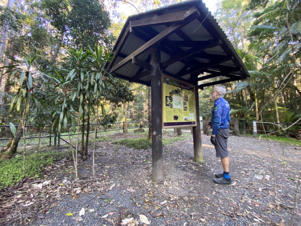
- Mihi Junction is reached soon after. There are picnic tables there under cover.
- Soon after the picnic area, an 80 m steel bridge spans Mihi Creek. This section of the trail is in bushland.
- After a short distance, you will come to the next picnic area at Klondyke Junction. Here you will see the remains of the coke mine that supplied Queensland Railways
- The trail is supposed to continue along Bremer River at some stage to the Ipswich CBD (see our map)
- For now, there’s a fancy S-bend to W.M. Hughes St, which takes you to The Workshops Railway Museum on North St.
- There are on-road bike lanes to the North Ipswich shopping centre and then Bradfield Bridge over the Bremer to the heart of the Ipswich CBD
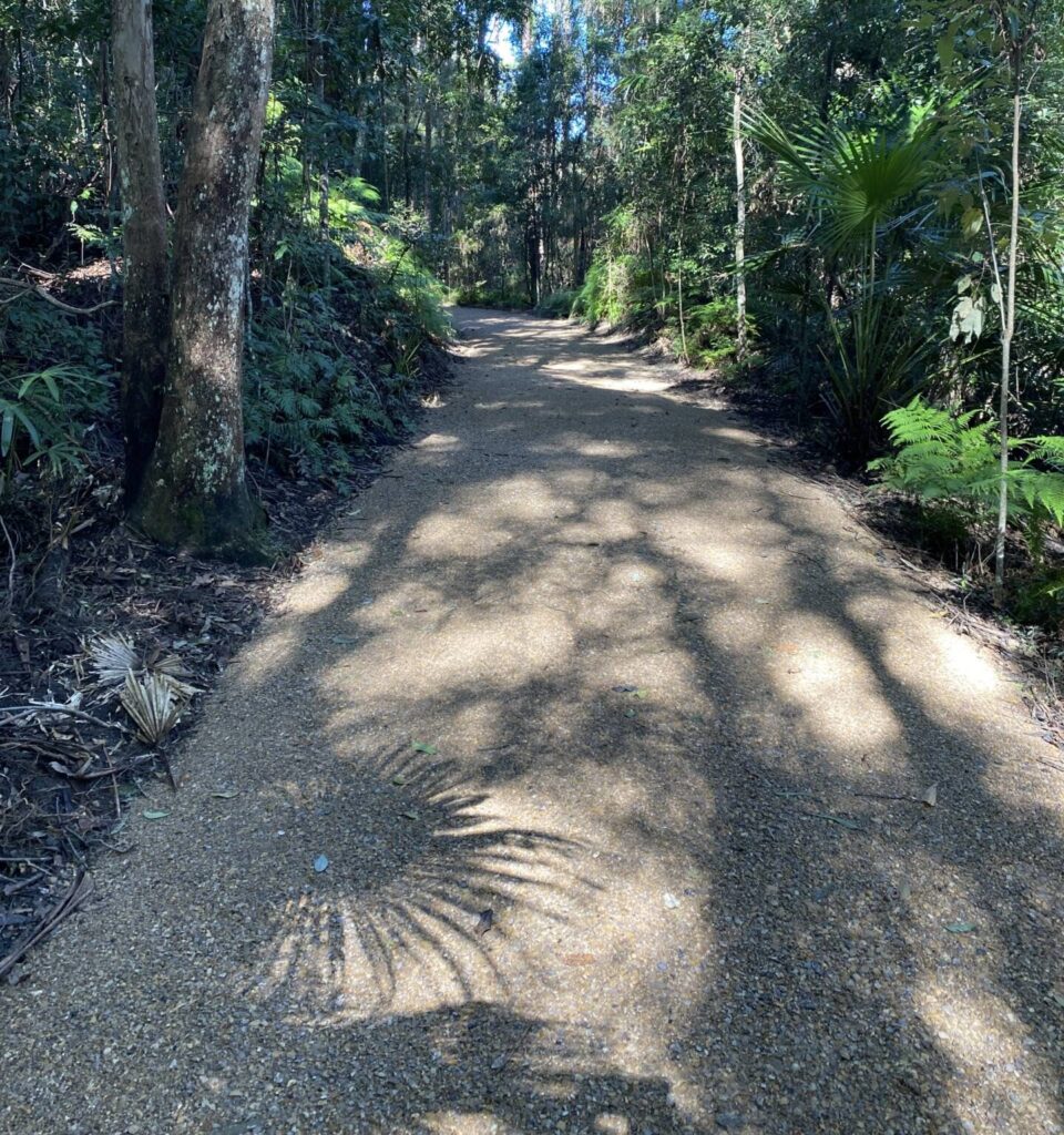
- A lot of the rail trail has lighting, 24-hour camera surveillance and a 3.5 m wide concrete surface.
![Start of the path on Grace St. The BVRT trailhead is down the road [2022]](jpg/q02-061-wulkuraka-station-to-trail-head-2022-06-13_104932-300x169.jpg)
Start of the path on Grace St. The BVRT trailhead is down the road [2022]
![Riders enjoying the rail trail in all its 3.5m wide concrete glory [2015]](jpg/q01-055-new-section-brassall-rail-trail-2015-2015-10-300x225.jpg)
Riders enjoying the rail trail in all its 3.5m wide concrete glory [2015]
![The trail approaching the Brassall Shopping Centre [2010]](jpg/q01-106-brassall-2010-06-2520-300x169.jpg)
The trail approaching the Brassall Shopping Centre [2010]

Railway-themed sculpture beside the trail (2010)

Mihi Junction picnic area offers shelter from the storm [2010)
![Mihi Creek Bridge ready to take on all-comers [2012]](jpg/q01-107-mihi-2012-01-1027-300x168.jpg)
Mihi Creek Bridge ready to take on all-comers [2012]
![Klondyke picnic area and the non-railway endorsed S-bends [2010]](jpg/q01-156-klondyke-2010-07-2505_crop-300x170.jpg)
Klondyke picnic area and the non-railway endorsed S-bends [2010]
![The Workshops Railway Museum in North St marks end of the trail [2010]](jpg/q01-156-nth-ipswich-2010-07-2512-300x169.jpg)
The Workshops Railway Museum in North St marks end of the trail [2010]
![The Bradfield Bridge looking towards Ipswich [2022]](jpg/q01-205-bradfield-bridge-2022-06-13_102309-300x169.jpg)
The Bradfield Bridge looking towards Ipswich [2022]
From Wulkuraka Railway Station, a shared path along Grace St will take you to the start of the Brassall Bikeway, where it curves seamlessly into the bush. The BVRT trailhead is just to the west if you’re looking for car parking, toilets, picnic shelters and all the trimmings.
Do you know of a bike hire or transportation service on this rail trail that should appear here? If so, let us know at admin@railtrails.org.au.
Information and Links
The trail is managed by the Ipswich City Council
Please report any issues to the council.
For more information on the history of coal mining and coke production in Ipswich, see: https://www.ipswich.qld.gov.au/__data/assets/pdf_file/0019/9811/mining.pdf
Contact Rail Trails Australia
To contact us about this rail trail, email qld@railtrails.org.au
Background Information
Traditional Owners
We acknowledge the Yuggera people, the traditional custodians of the land and waterways on which the rail trail is situated.
Railway History
This trail is on the route of the first railway line in Queensland, from Ipswich to Wulkuraka, which closed in 1868. The line from Ipswich to Brisbane did not open until 1875.
The trail was built in 2008 and opened in 2009, with a proposed extension along the railway corridor, which hugs the Bremer River, towards the centre of Ipswich.
Wulkuraka to Brassall opens (Brisbane Valley Rail Trail)
Posted: 06/09/16
The next stage of the Brisbane Valley Rail Trail opened on August 20, 2016, in Ipswich This ...
More...Brassall Trail Extensions opened
Posted: 15/07/13
Stage two of the Brassall Rail Trail has opened toward Wulkuraka Railway Station. This section ...
More...Nearby Trails
Ferny Grove Rail Trail
Samford Valley, 16km north-west of Brisbane
11 km


Bethania to Beaudesert Rail Trail
City of Logan, 40 km from Brisbane
3.5 km

Fassifern Valley Rail Trail
Scenic Rim, 90km south-east of Brisbane
2.6 km
Brisbane Valley Rail Trail
Ipswich, 46km south-west of Brisbane
161 km
Canungra Tramway Tunnel
Canungra, south of Brisbane, 80km from Brisbane
1 km
Caboolture – Wamuran & Loop Rail Trail
Moreton Bay, 47 km north of Brisbane
10.5 km
South Coast Rail Trail and Ernest Junction Tunnel
60 km from Brisbane
0.75 km
Westbrook to Wyreema Rail Trail
Toowoomba

Dularcha National Park Rail Trail
Landsborough, 77 km north of Brisbane
3 km
Buderim Heritage Tramway Trail
Sunshine Coast, 100 km north of Brisbane
2 km
Muntapa Tunnel
15km south of Cooyar, north of Toowoomba, 210km from Brisbane
0.6 km
Nearby Trails
Ferny Grove Rail Trail
Samford Valley, 16km north-west of Brisbane
11 km
Bethania to Beaudesert Rail Trail
City of Logan, 40 km from Brisbane
3.5 km
Fassifern Valley Rail Trail
Scenic Rim, 90km south-east of Brisbane
2.6 km
Brisbane Valley Rail Trail
Ipswich, 46km south-west of Brisbane
161 km
Canungra Tramway Tunnel
Canungra, south of Brisbane, 80km from Brisbane
1 km
Caboolture – Wamuran & Loop Rail Trail
Moreton Bay, 47 km north of Brisbane
10.5 km
South Coast Rail Trail and Ernest Junction Tunnel
60 km from Brisbane
0.75 km
Westbrook to Wyreema Rail Trail
Toowoomba
Dularcha National Park Rail Trail
Landsborough, 77 km north of Brisbane
3 km
Buderim Heritage Tramway Trail
Sunshine Coast, 100 km north of Brisbane
2 km
Muntapa Tunnel
15km south of Cooyar, north of Toowoomba, 210km from Brisbane
0.6 km
3 reviews of “Brassall Bikeway rail trail”
Hello,
I rode the Brassall Bikeway Rail trail on the 5th of February, 2026.
Great path and signage on the pathway.
I decided to make a loop of it and did the following;
Parked at Wulkuraka Station (in Dixon St)
Rode up to join the path at Grace St (parking there also)
Followed the pathway up to the Rail Museum and then rode back to the shopping centre in Lowry St
Unfortunately, I could not find the river path displayed in Google Maps and the section around the shopping centre was blocked off.
Then crossed the Bremer River Rail Bridge to cross the river but the pedestrian bridge ends in a car park.
Eventually found my way out of the Car Park
Unfortunately, the Riverside Park Parkway was also closed.
Rode up Ellenborough St, Darling St East, Syntax St, Herbert St, Tallon St to the Sadliers Crossing Railway Bridge.
There is an old pedestrian way on the Southern Side (with stairs at both ends) but not difficult.
Then back to Wulkuraka Station.
Total loop was 14km's.
Cheers,
Marty
45/70 The Brassall Bikeway branding on the Brisbane Valley Rail Trail west to Diamantina Boulevard is rather confusing for a southerner, considering this narrow-gauge railway line only went from Wulkuraka to Ipswich, but thanks for the 3.5 m wide concrete in that direction anyway. Loved the metal re-creation of a collision between a bogie and a sculptor
This is a great little rail trail! For anyone that is interested in industrial history there is another ‘rail trail’ of sorts nearby that follows the old Tivoli Rail Line. There used to be a colliery on the other side of the Warrego Highway at Tivoli and a railway used to go through the suburbs from North Ipswich. It is marked on a 1960’s street directory I have and the route can be seen on Google Earth.
It roughly goes from the Rail Museum on North Street and goes up the lane opposite the carpark. It then crosses Pine Mountain Road, goes over Wyndham Street, then Liverpool Street, goes parallel to Frost Street, crosses Hill Street, Albert Street, Simmons Road ,Kay Street and onwards to Francis Street. It’s not an official ‘rail trail’ but the council has used the easement for a bike path and may appeal to history buffs