 Location:
 Length:
 Surface:
 Start / End:
 Suitable for:
The 89km Kilkivan-Kingaroy Rail Trail tracks through two Local Government Authorities: Gympie Regional Council and South Burnett Regional Council. The Gympie section from Kilkivan to Murgon is an unsealed adventure trail providing a challenging route for experienced and well-prepared trail users. The South Burnett section from Murgon to Kingaroy is all sealed and family friendly, suitable for a wide diversity of trial users.

- Scenic rural countryside which varies from the grazing lands in the eastern section, to the rich agricultural fields of the South Burnett in the southwest
- Railway history and heritage
- Food and accommodation options at many towns along the trail
- Free camping at railway station sites
Nearby Attractions
- Moffatdale Wineries
- 55 Million Years Ago Museum, Murgon
- Bjelke-Petersen Dam
- Kingaroy Heritage Museum
- Mt Wooroolin Lookout
- South Burnett Rail Trail Loop Rides
- Gordonbrook Dam
- Gordonbrook Dam Mountain Bike Park
- Wondai Mountain Bike Park
Last updated: 4 January 2026
The trail traverses undulating farm and bushland, with several towns and villages along the way and many points of interest. There is ample car parking at the station sites in each town.
Drinking water and toilets are only available at towns listed in the description. Most of the trail has mobile phone reception, as do all towns. Dogs on leads are permitted on all sections.
Kilkivan is a big town with shops, a cafe, hotel, B&B, petrol station and hotel/motel. There is a visitor information centre and free camping behind the kindergarten
The main sections of the trail are:
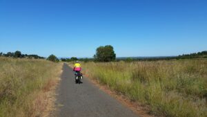
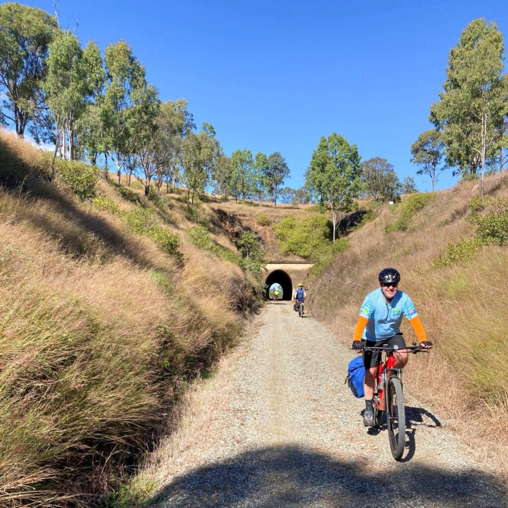
- Kilkivan to Murgon (45km): This section is very basic and best viewed as a true “adventure trail”. There are 50 gates to open and shut. Gullies are rough and some of the trail still has the original railway ballast rock as its surface. The trail receives minimal maintenance and is often impassable after rain. It is suitable only for experienced cyclists on mountain bikes
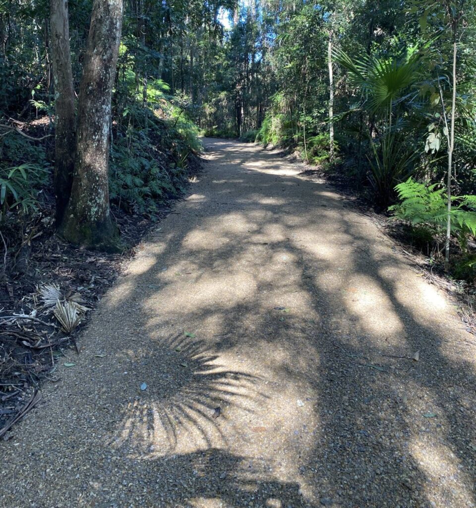
- Murgon to Kingaroy (44km): Known locally as the South Burnett Rail Trail, this section has a chip seal asphalt surface and is maintained to a high standard. There are no gates but there are chicanes at some road intersections. It’s suitable for all cyclists and family friendly. There is 400m of unsealed path from the Bunya Hwy car parking area to the official trailhead at the Kingaroy Station site on Haly St.
Section Guides
Kilkivan to Goomeri (27.7km)
- Access: The trail starts at the former Kilkivan Station at the intersection of Hwy 49 and Cave St
- From the station, the trail is gravel and dirt that is mostly in a variable state
- There are many gully crossings, some rough, near old railway bridges that require care
- There is no drinking water on this section
- Many gates to open and close
- Goomeri is a small town but has toilets, drinking water and a good variety of shops, including a bakery, hotel, cafes, motels, petrol station and Visitor Information Centre Camping at showgrounds
Goomeri to Murgon (17.2km)
- Access: The trail crosses the Burnett Hwy (A3) adjacent to the Goomeri Library (Search: ’35 Moore St’). There is off-road parking near Goomeri Station
- Heading south from the station, the unsealed trail surface is variable. Much of it is good, firm gravel but there is exposed railway ballast in places and sandy sections that can be challenging to ride
- There are more steep gully crossings which may have water in them and some gates to open and close
- Murgon is a diverse town with a very active Mens Shed operating at the former railway yard
- There is a railway museum and dairy museum (restricted opening times) and the impressive 55,000 Years Ago Museum (open every day) near the station site beside the trail.
- Murgon has a bakery and cafes (not open Saturday afternoons or Sundays), Services Club, hotel, motels, petrol station, Visitor Information Centre and camping is available on the outskirts of town.
Murgon to Wondai (13.9km)
- Access: At Murgon the trail crosses the Bunya Highway (#49) beside the Murgon Post Office and Murgon Services Club
- From here the trail is sealed with asphalt through to Kingaroy. There are even several bridges that have been restored and low-level crossings which regularly get submerged after heavy rain events
- Wondai is the major village on this section and has many facilities with popular free camping beside the trail, adjacent to the Wondai Visitor Information Centre and Regional Art Gallery on Haly St
- A Park Run happens every Saturday morning on the trail from Wondai towards Tingoora.
Wondai to Kingaroy (30km)
- Access: There is car parking adjacent to the Wondai Regional Art Gallery and railway station (Search: ’38 Haly St, Wondai)
- Heading south 1km there is a signposted entry to the Wondai Mountain Bike Trails in McEuen State Forest.
- At Tingoora, toilets and drinking water are located opposite the Tingoora Hotel.
- Wooroolin has toilets, a hotel, cafe and free camping beside the trail
- Memerambi has toilets
- Crawford has emergency drinking water at the state school in Siefert St
- Approaching Kingaroy, the sealed trail comes to an abrupt halt at the busy Bunya Hwy. There are no barriers at the approach to this road. Exercise caution crossing at this point. The nearest pedestrian crossing is further south.
- The trailhead is 400m away across the grassed former railyard
- Kingaroy is a major regional centre
- The Kingaroy trailhead is located at the former Kingaroy Railway Station at the intersection of King and Haly streets.
CONNECTING PATHS
The South Burnett Mountain Bike Club, in conjunction with the South Burnett Rail Trail Users Association, has established clear signposted cycling routes that loop out from the rail trail into the surrounding countryside. These loop rides extend the experience of rail trail users by including quiet country road routes that highlight the rich agricultural diversity and scenic panoramas of the South Burnett.
East Memerambi Loop (EML, 10km): Mixture of asphalt and gravel country roads, panoramic views of the countryside and 149 m elevation gain.
Gordonbrook Dam Route (GDR, 14km): Mixture of asphalt and gravel country roads leading to the scenic Gordonbrook Dam with 99 m elevation gain. A basic amenity block is available at the dam. An out-and-back route with singletrack mountain bike trails at the dam.
Wooroolin West Loop (WWL, 13km): Mixture of asphalt and gravel country roads, scenic views and an attractive long forested avenue of native trees with an interlocking canopy over the road. 85m elevation gain
East Wooroolin Loop (EWL, 15km): Easy gradients with 194m elevation gain from Wooroolin pub leading to a panoramic lookout over the South Burnett. Mixture of asphalt, gravel road and dirt road.
West Tingoora Loop (WTL, 18km): 194m elevation gain, easy gradient to a high vantage point, on an all-asphalt road.
East Tingoora Loop (ETL, 11km): Mixture of asphalt and gravel roads with one short, steep climb and a longer easier gradient climb providing a scenic view. Elevation gain 158 m
Moffatdale Winery Route (12km): About 11km from Goomeri, heading towards Murgan on the rail trail, a signposted route starts near the intersection of Moondooner Rd and the Bunya Hwy. A sign directs trail users to the adjacent intersection and on to the route up to Moffatdale Ridge and the various cellar-door wineries and restaurants. The route follows quiet asphalt back roads through the Moffatdale Valley.
Link Trail (55 km): You can get to the Brisbane Valley Rail Trail from Kingaroy by following a series of back roads and gravel tracks. See FURTHER INFORMATION
East Nanango Circuit (NAN1, 32km): A loop ride through Nanango’s history from the railway siding and back again. Nanango was the end of the railway line from Theebine
Greenwood Creek Circuit (NAN2, 22km): Another ride to the east of Nanango more suitable to gravel, hybrid and mountain bikes.
![A bit of railway heritage remains at the start of the trail in Kilkivan [2018]](jpg/q15-207-kilkivan-2018-09-0037-300x169.jpg)
A bit of railway heritage remains at the start of the trail in Kilkivan [2018]
![Pretty in pink just across the road from the Kilkivan Railway Station [2018]](jpg/q15-207-kilkivan-2018-07-p1040970-kilkivan-township--300x225.jpg)
Pretty in pink just across the road from the Kilkivan Railway Station [2018]
![The constrained low-level bridge across Wide Bay Ck near Kilkivan [2021]](jpg/q15-210-wide-bay-creek-bridge-construction-2021-09-8878-243x300.jpg)
The constrained low-level bridge across Wide Bay Ck near Kilkivan [2021]
![All the bridges between Kilkivan and Murgon have low-level bypasses [2018]](jpg/q15-207-p1040938-between-goomeri-and-kilkivan-july-2018-300x225.jpg)
All the bridges between Kilkivan and Murgon have low-level bypasses [2018]
![Heading south from Goomeri towards Kilkivan on freshly mowed trail [2018]](jpg/q15-207-p1040941-between-goomeri-and-kilkivan-july-2018-300x225.jpg)
Heading south from Goomeri towards Kilkivan on freshly mowed trail [2018]
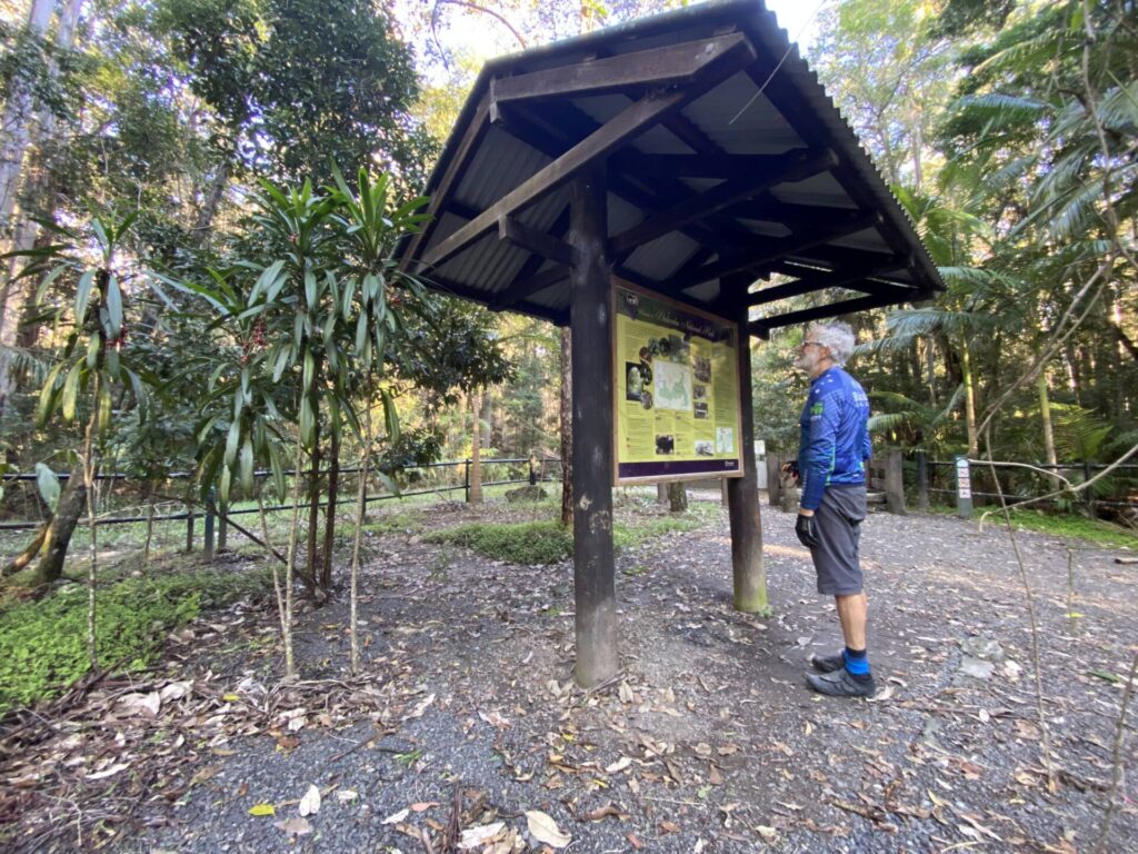
![Interpretive signage is photo opp at former sidings [Karen Davidson 2020]](jpg/q15-209-kilkivan-to-goomeri-2020-06-27-6-20-11-25-51-am-kinbombi-sign-300x225.jpg)
Interpretive signage is photo opp at former sidings [Karen Davidson 2020]
![Get fitted out in style in this classic Goomeri store while having a stopover [2018]](jpg/q15-257-goomeri-2018-07-p1040920-300x225.jpg)
Get fitted out in style in this classic Goomeri store while having a stopover [2018]
![Don't forget to eat well, with several places to chose from in Goomeri [2018]](jpg/q15-257-goomeri-2018-07-p1040921-fantastic-bakery-300x225.jpg)
Don't forget to eat well, with several places to chose from in Goomeri [2018]
![Goomeri Station retains the building and platform but not much else [2018]](jpg/q15-257-goomeri-2018-07-p1040925-300x225.jpg)
Goomeri Station retains the building and platform but not much else [2018]
![Upgraded low-level river crossing makes life easier approaching Murgon [2025]](jpg/q15-320-repaired-low-level-crossing-north-of-murgon-2025-img_6434-300x225.jpg)
Upgraded low-level river crossing makes life easier approaching Murgon [2025]
![Murgon Station is now home of the local Men's Shed and railway museum [2018]](jpg/q15-311-murgon-2018-09-0006-300x169.jpg)
Murgon Station is now home of the local Men's Shed and railway museum [2018]
![Heading out of Murgon towards Wondai for some exercise [2018]](jpg/q15-311-murgon-2018-09-0005-300x169.jpg)
Heading out of Murgon towards Wondai for some exercise [2018]
![Old mph boards between Murgon and Wondai; it wasn't a high-speed line! [2018]](jpg/q15-311-murgon-to-wondai-2018-07-p1040902-kkrt-with-old-speed-signs-and-safety-marker-300x225.jpg)
Old mph boards between Murgon and Wondai; it wasn't a high-speed line! [2018]
![The Barambah Creek low-level crossing near Murgon [2017]](jpg/q15-309-barambah-ck-murgon-2017-10-300x225.jpg)
The Barambah Creek low-level crossing near Murgon [2017]
![The old Wondai Butter Factory provides an example of days gone by [2018]](jpg/q15-357-wondai-2018-07-p1040845-old-wondai-butter-factory-300x225.jpg)
The old Wondai Butter Factory provides an example of days gone by [2018]
![Wondai's newer railway station. The area is popular with caravanners [2018]](jpg/q15-357-wondai-2018-09-0014-300x169.jpg)
Wondai's newer railway station. The area is popular with caravanners [2018]
![Heading south from Tingoora on a glorious day riding into the sun [2025]](jpg/q15-410-south-of-tingoora-on-a-glorious-day-riding-into-the-sun-2025-img_6421-300x169.jpg)
Heading south from Tingoora on a glorious day riding into the sun [2025]
![This Tingoora bridge is longest on trail [South Burnett Regional Council 2017]](jpg/q15-408-tingoora-2017-1505438579526-300x225.jpg)
This Tingoora bridge is longest on trail [South Burnett Regional Council 2017]
![Trying out the trail furniture near Tingoora [R Jackson, 2018]](jpg/q15-409-tingoora-2018-03-31_104950-crop-300x169.jpg)
Trying out the trail furniture near Tingoora [R Jackson, 2018]
![Like many stations in Qld, Wooroolin is a popular stopover for travellers [2018]](jpg/q15-459-wooroolin-2018-09-0024-300x169.jpg)
Like many stations in Qld, Wooroolin is a popular stopover for travellers [2018]
![A grand feature of Wooroolin, where hydration is rated highly [2018]](jpg/q15-459-wooroolin-2018-09-0026-300x169.jpg)
A grand feature of Wooroolin, where hydration is rated highly [2018]
Cruising the wide open spaces between Woorolin and Kingaroy (M Kranenburg 2018)
![The underwhelming end of the trail proper at Kingaroy is also carpark entrance [2025]](jpg/q15-500-the-underwhelming-and-dangerous-end-of-the-trail-at-kingaroy-is-also-the-entrance-to-the-carpark-2025-img_4510-300x225.jpg)
The underwhelming end of the trail proper at Kingaroy is also carpark entrance [2025]
![Impressive station area in Kingaroy is isolated from trail by grass area [2025]](jpg/q15-500-magnificent-trailhead-in-kingaroy-becomes-grass-quickly.-station-on-right-was-turned-sideways-2025-img_6378-300x225.jpg)
Impressive station area in Kingaroy is isolated from trail by grass area [2025]
Trail towards Nanango has gap in asphalt where level crossing was 60 years ago [2025]
Do you know of a bike hire or transportation service on this rail trail that should appear here? If so, let us know at admin@railtrails.org.au.
 The Cottage is a charming getaway nestled in the Tingoora Valley. Surrounded by farmland, The Cottage offers the perfect place to unwind. Only 2 km from the South Burnett Rail Trail at Wooroolin, The Cottage provides easy access to scenic the Rail Trail, cycling trails, local cafés, and rural pubs.
Information and Links
You can download a map here for the 55 km Link Trail route south from Kingaroy to the Brisbane Valley Rail Trail at Yarraman.
If that route is too short for you, the Downs Burnett Cycle Trail is a 440 km signposted trail that runs out from Kingaroy using quiet country roads, both sealed and gravel, to link many small towns on the Northern Darling Downs and South Burnett to Yarraman. Full route descriptions and downloadable GPS maps are available on the above link.
Please contact the relevant council to report issues with the trail.
- The Kilkivan to Murgon section is managed by Gympie Regional Council.
- The Murgon to Kingaroy South Burnett Rail Trail is managed by South Burnett Regional Council.
Download a brochure of the South Burnett section here
South Burnett Rail Trail Users Association – on Facebook
For information on the geology along the rail trail, click here.
The South Burnett section has its own website. The Facebook page for it is here. Best contact is Jason Wyeth on 0455 896 74
Contact Rail Trails Australia
To contact us about this rail trail, email qld@railtrails.org.au
Background Information
Traditional Owners
We acknowledge the Waka Waka people, the traditional custodians of the land and waterways on which the rail trail is built.
Development and future of the rail trail
The rail trail was developed by Gympie Regional Council and South Burnett Regional Council and was opened in September 2017 by Jeff Seeney, Deputy Premier and Minister for State Development, Infrastructure and Planning.
The Theebine to Kingaroy corridor is 131 km long. There are no immediate plans to extend the trail towards Theebine but it already connects with the Brisbane Valley Rail Trail and the Bicentennial National Trail via a link track. Developing the corridor to Theebine would deliver a continuous recreation trail more than 350 km long and connect Ipswich to the Sunshine Coast.
Railway history
The early 1900s was a significant time for rail development in Queensland. The section to Kingaroy was officially opened in 1904, and the extension to Nanango in 1911.
The Theebine to Nanango Line was one of the first branch lines in Queensland. It was used for passenger transport and for agriculture and commercial freight, including the Kingaroy Peanut Marketing Board and Murgon abattoir.
The Kingaroy to Nanango section closed in July 1964, while Theebine to Kingaroy closed in 2010. Kingaroy did not exist before the railway being built but has become a major centre in the South Burnett region because of it. Having served its purpose, the line is now all but abandoned.
C17 Class Loco 763 Unveiled at Murgon Trail Hub
Posted: 07/09/25
South Burnett Mayor Kath Duff recently unveiled a plaque acknowledging those who contributed to the ...
More...Stakeholders meet to discuss further development of Kingaroy to Kilkivan Rail Trail
Posted: 02/08/24
On August 1, Bicycle Queensland met with the major stakeholders for the Kingaroy to Kilkivan Rail ...
More...Restored locomotive is new attraction to Kilkivan Kingaroy Rail Trail
Posted: 05/10/23
The Murgon Men's Shed has recently unveiled a restored locomotive at its display area beside ...
More...Rail Trail Relay Biggest Yet!
Posted: 03/05/23
The third South Burnett Express Rail Trail Relay, run from Kingaroy to Wondai (on the ...
More...New bridge at water crossing on Kilkivan to Kingaroy
Posted: 16/10/21
Gympie Regional Council has advised that the low level bridge over a perennial water crossing ...
More...South Burnett Rail Trail User Association AGM
Posted: 18/01/20
Come along to the first South Burnett Rail Trail Users Association (SBRTUA) AGM on the 10 ...
More...South Burnett Regional Council abandons Bike Hire Idea
Posted: 28/10/19
At last week’s council meeting, councillors heard a six-week trial of free bicycle hire ...
More...Gympie Council to spend $230K on rail trail resurfacing
Posted: 15/10/19
Heading south from Goomeri towards Kilkivan on freshly mowed ...
More...Community Consultation Session – Murgon to Proston Rail Trail (Qld) Feasibility Study
Posted: 28/09/19
Following on from the success of the Murgon to Kingaroy Rail Trail, South Burnett Regional ...
More...Join celebrations of The Link Cycle Path opening in Nanango (QLD)
Posted: 15/08/19
The Link Cycle Path connects the South Burnett/Kilkivan-Kingaroy Rail Trail to the Brisbane Valley ...
More...Murgon Rail Trail Festival Sunday 21st July 2019
Posted: 17/07/19
The Murgon Rail Trail Festival is on again in 2019 bigger and better than than last ...
More...Want to ride the KKRT? Don’t have a bike? Hire bikes are coming
Posted: 23/03/19
People who would like to cycle the South Burnett Rail Trail but don’t own ...
More...South Burnett Rail Trail Users Association Meeting (SBRTUA)
Posted: 29/01/19
Come along and chat about what we, as an association can do to “value add” ...
More...MURGON RAIL TRAIL FESTIVAL & MARATHON ( South Burnett Rail Trail)
Posted: 17/09/18
Come and enjoy the MURGON RAIL TRAIL FESTIVAL & MARATHON Events include, RAIL TRAIL FUN ...
More...Wondai Country Festival (on the South Burnett Rail Trail) 23-24 June 2018
Posted: 18/06/18
The Wondai Country Festival will commence at 7am on 23 June with the Wondai Country Market ...
More...Grand Opening of the South Burnett Rail Trail Sunday October 1st 2017
Posted: 23/09/17
Big celebrations are being held along the entire 44km of the South Burnett Rail Trail. ...
More...Construction resumes on the Kingaroy to Kilkivan Rail Trail
Posted: 25/04/17
The South Burnett Regional Council has resumed work on stage one of the Kingaroy to ...
More...Work starts on the Kingaroy- Kilkivan Rail Trail (SE Qld)
Posted: 06/02/16
Construction has commenced on the rail trail with eight rail bridges to be re-installed for ...
More...Queensland Government funds Newest Rail Trail
Posted: 01/08/14
The Queensland Government has provided $2 million from the "Royalties for Regions " for the South Burnett ...
More...Nearby Trails
Mary Valley Rail Trail
Mary Valley region, 158 km north of Brisbane (via Caboolture)
5 km


Muntapa Tunnel
15km south of Cooyar, north of Toowoomba, 210km from Brisbane
0.6 km
Brisbane Valley Rail Trail
Ipswich, 46km south-west of Brisbane
161 km
Buderim Heritage Tramway Trail
Sunshine Coast, 100 km north of Brisbane
2 km
Dularcha National Park Rail Trail
Landsborough, 77 km north of Brisbane
3 km
Nearby Trails
Mary Valley Rail Trail
Mary Valley region, 158 km north of Brisbane (via Caboolture)
5 km
Muntapa Tunnel
15km south of Cooyar, north of Toowoomba, 210km from Brisbane
0.6 km
Brisbane Valley Rail Trail
Ipswich, 46km south-west of Brisbane
161 km
Buderim Heritage Tramway Trail
Sunshine Coast, 100 km north of Brisbane
2 km
Dularcha National Park Rail Trail
Landsborough, 77 km north of Brisbane
3 km
27 reviews of “Kilkivan – Kingaroy Rail Trail”
My husband and I completed the trail from Murgon to Wooroolin in September. The trail was pleasant but not overly scenic compared to other trails. Can't be helped but there was an extremely aggressuve magpie swooping and hitting my helmet for around 1km in Wondai (recommend detouring through the mountain bike park). Lunch at the Dusty Daisy Cafe in Wooloorin and camping at the Wondai Showgrounds were great.
57/70 Great to see all the flood repair work done by the South Burnett Regional Council. Once you hit Gympie territory beyond Murgon, the damage is all still there, and it wasn't much good beforehand. Fancy new causeway entering Goomeri but trail users still have to cross a rickety bridge and navigate a narrow path next to the library to get to the dilapidated station. I didn't bother riding the rest of the way to Kilkivan, for the second year in a row
Kilkivan to Goomeri section is open and in prime condition. Lovely riding through a mix of farmland and lightly forested areas. Goomeri Bakery an excellent incentive!
A shoutout to my favourite…The ABC for its 1 October 2024 'Backroads' episode, specifically based on this trail. Having travelled from Victoria by public transport to ride the trail in late May, it was wonderful to see it in such a favourable light…and to further highlight the Gympie Regional Councils lipservice given to the trails maintenance by starting the program with horse riding…the only mode of transport along this section of the trail that's comfortable for riding.
Congratulations ABC for changing the premise of the program by making the show about the towns along the trail and not just a single town as is usually the case.
Great rail trail coverage on ABC TV Backroads just then – so positive
We recently rode 2 sections of this Trail. Quite different experiences depending on which town you start and finish. Wondai to Kingaroy is a sealed bitumen surface and lovely to ride with many small towns along the way making 30 odd kilometres go quickly. Now the Goomeri to Wondai section is quite different. Quite a tough ride about the same distance but hard going on an ordinary hybrid bike.
Agreed! Gympie Regional Council which maintains this rough section of the trail apparently sees no economic benefit in cyclists staying within their LGA and consequently spending their $$ there on meals and hotels.
I thought that Murgon to Wondai was surfaced with one steepish climb out of a creek crossing. Lunch at the Murgon club helped alleviate some of the pain!
The first half of this Rail Trail, from Kilkivan to Wondai, was very rough and difficult to ride. The surface was either fine gravel, ballast, sandy, covered with grass, or muddy when wet. The creek crossings were difficult with eroded track up/down as well as unstable rocks over the water, no culverts and definitely no bridges here. In other states this would not even be considered a working rail trail! Not surprisingly we hardly saw anyone else riding it and we would not ride it again.
The second half, from Wandai to KIngaroy, is completely different, it is asphalt and easy to ride with bridges instead of the usual gullies. This made it a lot more usable and enjoyable plus there were a lot more riders on this trail.
Agree completely
Excellent trail. We did the Murgon to Kingaroy sealed section on touring bikes. Would love to see more trails sealed like this. Was nice that the trail departs from the road in a number of places so you are out in the bush without traffic noise.
No sign of the dog as per Carolyn B’s review below, though there were a few others less challenging. Cycling Kilkivan to Wondai in late May, I took the train to Queensland from Victoria which is a minefield in itself and caught the train to Gympie.
I travelled 60km the first day through Widgee and recharged myself and the bike there for an hour before eventually joining the Wide Bay Hwy to Kilkivan where I stayed over at the pub. Averaging 10 km/h the Trail is rough to very rough and is a testament to my Leitner folding 20” e-bike that it held together laden down with 90kg me and two panniers. As there is rail ballast everywhere along the trail, I couldn’t really enjoy the scenery as I was trying my hardest not to hit any of the ballast or rocks that litter the trail.
Crossing the creek was an adventure as the electric motor is in the crank and it just cleared the water. The grass was well over a meter high as well and well encroaching on the single line of the trail. I have since written to Gympie Regional Council about their obligations compared to the much better version in the Kingaroy Regional Council where they seem to actually want to encourage people to use the Trail.
I gave up the trail at Murgon and rode that section to Wondai on the highway, though I’m advised the trail improves from Murgon.
Off to Kingaroy today on the sealed section and will stay over there before getting an assisted ride from Murgon to Kilkivan in a few days, then to Gympie and home.
Following on from above…Actually I gave up the trail at Goomeri.
Due to the slow progress between Kilkivan and Goomeri…over 3 hours, I was becoming concerned that in the short light days of almost Winter, I’d run out of daylight. As it turned out, I was able to easily average 15 Km/h on the highway and finally arrived at Wondai around 4PM.
Leaving Wondai, the trail is a dream and it is a dream compared to the Gympie Regional Council lack of commitment to their part of the trail.
On the return, I was swooped on arrival at Wondai…early Maggie’s at the end of May.
I rode on to Murgon on the excellent trail and pre-booked the shuttle to take me to Kilkivan. Today is the final and big day of 23 Km along the Wide Bay Hwy, then turn and head east to Widgee and ultimately the Gympie North station before the departure of the 13:20 train.
I cycled Kilkivan to Goomeri on Sunday 5 November on a gravel bike. It is quite rough for that type of bike but doable. Key feedback is to watch out for a dog between the 14 and 15km markers. It was persistent and had quite a bit of speed such that it chased me for some time and was too close for comfort to my leg. I have reported it. Take care
We rode Murgon to Kingaroy return. A decent length of trail for a day trip as its sealed. Easy to get supplies in the towns along the way and lots of toilets and water points.
Once we got to Kingaroy it ends on a main road with no signage or info. We made our way into town for lunch along what looked like the rail continuation path though undeveloped. Would love to see the town erect some signage of the best route into town and information at this point.
This is a fantastic trail suitable for all including the typical grey nomad with all their aches and pains. We parked the van at Wondai and on day 1 we cycled north to Murgon and back and on day 2 we cycled to Mooroolin and back. I was riding a folding bike and hubby rides a mountain bike. We have batteries that we turn on when feeling lazy or with a head wind, but try not to use them because we want the exercise. The track is well maintained and the route is interesting. This track has inspired us to put rail trails on our holiday destinations.
I completed this Trail on the 29th June, 2023, starting at Kilkivan and riding to Kingaroy.
The above information is very accurate and you must visit the Goomeri Bakery.
I booked "Out There Cycling" for a pickup from Kingaroy and a drop off at Kilkivan. They were on time and great.
The first half of this trail (from Kilkivan to Murgon) is a similar surface to the Brisbane Valley Rail Trail through paddocks etc with a fair few easy gates.
The 2nd half (from Murgon to Kingaroy) has a sealed surface.
Remember that starting at Kilkivan and riding to Kingaroy is a gradual climb to Wooroolin.
Overall, a great ride but pick your time of year and the temperatures.
Have fun
Thank you Marty for your 3 star review, glad to hear that you had a great ride from Kilkivan to Kingaroy. As we had only recently taken over the Out There Cycling business it is fantastic to hear that we are doing a great job!
Tried to ride KKRT last May 2022, unfortunately it was around the time of all the rain and flooding. The trail was "closed' due to council unable to access to maintain. We did ride a short section and the surface was blue metal and if you did not have decent tyres a bit of a drag. We ended up doing lots of backroads from Kilkivan to Murgon. The section Murgon to Kingaroy fully paved and quite easy.
Starting from Kilkivan, gravel trail, but ok for mountain bike. Disappointed the old bridges were blocked off in that council area. Very good bitumen trail from Murgon.
Quite an interesting ride. We stayed in Murgon at the Motor City Inn – which was very good – and then rode north to Goomeri on the first day and south to Kingaroy on the second day. The section to Kingaroy was excellent: the surface was a type of bitumen/gravel, all the way which made for fairly easy going. The section between Kingaroy and Wondai was the best as it rolled through fairly ‘remote’ countryside and made for a relaxed and pretty setting. If you’re only going one way I would recommend Kingaroy to Murgon – going north as there is about twice as much descent as ascent. All gullies were bridged and the only two that weren’t had a concrete / well curated surface. Road crossings were clearly marked with signs used as chicanes ensuring no collisions with cars. The trail north between Murgon and Goomeri was completely different with a range of different surfaces that could only be described as ‘rough’. There was grass, gravel/railway ballast with sand ‘traps’ of varying sizes – one section was just railway ballast: very shaky indeed. Nearing Goomeri there was a type of curated red gravel which as quite good. There were no bridges across watercourses; I played it safe by walking and there were no mishaps. While a mountain bike would have made the going easier I did it on a touring/adventure bike with 42mm wide tyres. Don’t be put off, just take it easy
Regardless of hit and miss reviews we had read, our party of seven set out from Kingaroy on Saturday morning with enthusiasm… or maybe we were pedalling fast to out pace the magpies!?
We split our ride over two days: Day one easy going with the bitumen trail the entire way, providing a fun warm up with little effort. With beer and bakery stops along the way, we rolled into Murgon late afternoon to locate our camp. Plenty of photo stops were included throughout the day, taking in local historic features and quaint country structures, a spur of the moment detour at Wooroolin rewarded us with a waterside bird hide and delightful bird sightings.
Day two was were the real fun was at! Distinctly different to the paved track and tidy bridges on the first leg, the section from Murgon to Kilkivan was a real mixed bag. Different surfaces and textures, dirt and gravel interspersed with sandpits and patches of the original blue metal railway bed made the riding much more interesting.
For lunch we gorged ourselves on the delicious food found at a Goomeri cafe, and chatted to some friendly and hospitable locals.
The ever changing scenery was delightful, despite being tinder dry. The bridge crossings from day one were replaced with deep but graded ravines requiring careful navigation to make it up the other side. A wet creek crossing made for a comical and refreshing interlude toward the end. This section was the highlight of the ride!
The only frustration on day two the number of stock gates to be negotiated which slowed us down considerably, regardless this did not sway our spirit. KKRT is a fun ride! I’d do it again.
We stayed at Murgon for 3 nights and rode from there to Kingaroy and back on day one, and Kilkivan and back on day two. The trail between Murgon and Kingaroy is great, with a good wide sealed surface all the way. A few missing bridges along the way, but a good sealed ramp and causeway didn’t cause any problems at these points. Large chicanes have been installed at the road crossings, but you can negotiate these by slowing down, no need to get off your bike. Plenty of small villages at regular intervals to keep you fuelled up and points of interest along the way. The wetlands at Wooroolin are a bonus, as well as a train carriage stuck out in the middle of the paddock near Memerambi.
The next day we rode to Kilkivan and back. This part of the trail is not very well developed, with a rather rough surface most of the time. However it was the creek crossings with the missing bridges that were the real concern. The second large crossing out of Murgon was so steep that my wife slipped and fell while trying to push her bike up a very steep and slippery incline. Some sections of the trail are covered in the original chunky blue metal ballast. Very dangerous and hard going. The deep creek crossing about 6km out of Kilkivan is just unacceptable. and a real disgrace to the owners and managers of this trail. It is possible to climb a fence onto private property and use a shallow crossing point about 100 metres upstream. You also have to be very careful at the many badly designed and placed spring loaded gates at the missing bridges and road crossings. They have often been installed next to a very steep and slippery part of the trail, and great care needs to be taken to ensure that you don’t go over the edge while trying to get your bike and yourself through to the other side. It is a real pity because this section of trail has some wonderful scenery, particularly north of Goomeri. Goomeri is a great little town with a wonderful bakery and hotel. The old railway station precinct has been well looked after, and has some great interpretive signage.
We have ridden on most of the rail trails in Victoria and SA, and this would easily be the roughest we have encountered.
Our original intention was to ride back to Murgon on the rail trail, but we decided it was much safer to take a chance with the traffic on the highway.
I rate the Murgon to Kingaroy section with five stars, but the other section only gets one.
We rode from Gomeri to Cinnabar siding yesterday, we planned to go to Kilkivan but didn’t. want to get wet at the crossing a little further on. The trail was mostly ok with mowing done and spring gates, care needed with some steep gullies, walking up advised. Trail was very rough and stony for the first 2.5 k from Gomeri. Grading and rolling maintenance would be good. One could by-pass the water by going left into Cinnabar Rd, take the hwy to Thomas Rd., where the trail is. I estimate hwy riding would be about 4k. Kilkivan- Tansey hwy. Mountain bike only recommended.
We have just ridden Kilkivan to Goomeri return and there has obviously been some maintenance since April. The gates are sprung loaded so while it is a little annoying because of the number it is easy to navigate them. The trail has been mowed and grass was not an issue. Wide Bay Creek was an adventure and involved carrying our bikes through mid thigh water, Some of the surface is a little rough. I would recommend riding a mountain bike as the suspension and bigger tyres will make the experience more enjoyable. The local Council is proposing to improve the surface and creek crossings. If you have a mountain bike and are looking for a different ride I have no hesitation in recommending that you give this a go.
Just a warning to those folks who have decided to ride from Kilkivan to Murgon section of the KKRT
This section is terrible and should never have been opened until it had the funds to do it properly,it it over grown with long grass [keep snakes in mind ] then there is a creek to wade through carrying bike with water up to the thighs ,then there is the many gates to open and close ,this can be over looked as I realise stock is involved. If your bike is not fitted with good mountain bike tyres there is a fair chance you will get a puncture on some rough rocks. My suggestion is to start the KKRT from Kingaroy as it is sealed and a delight to ride [well done South Burnett council ]
Just want to let you know the this trail is now open from Kingaroy to Murgon and is a fantastic and well used section. Beautiful views and a wonderful bitumen surface. Come and visit us in the wonderful South Burnett.