 Location:
 Length:
 Surface:
 Start / End:
 Suitable for:
A relatively short walk or ride at 8km, the Dookie Rail Trail traverses a classic Australian wheat farming landscape.

- It’s a short, flat trail with a chip-seal surface
- It’s centred around the small town of Dookie, which is nestled between Mt Major and Mt Saddleback
- It provides good views of farmland
- It’s suitable for most people, with lots of interpretive signs
Nearby Attractions
- Shepparton is a major centre with all facilities and an extensive shared path network
- Nearby University of Melbourne agricultural college
- Mt Major walking track and MTB park
- Tallis Wine cellar door
- Correa Rock walk
- Waranga Rail Trail
Last updated: 3 January 2026
The start of the trail is in Dookie West but the main town along it is Dookie, which remains a wheat centre. where the CWA Gardens have toilets and play equipment. There is ample parking opposite the hotel.
The sections of the trail are:
- Dookie West to Dookie (3km): Runs from the direction of Shepparton starting at Conway Rd
- Dookie to Yabba South (5km): Heads north past two examples of Dookie’s portable silo art
Section Guides
Dookie West to Dookie (3km)
- Access: The trail starts on the eastern side of Conway Rd, 900m south of New Dookie Rd (C364) and 2km from Cosgove. There is some on-road parking here but larger vehicles are better off in Dookie
- The chip-seal trail runs towards Dookie next to overgrown railway tracks, which apparently have future prospects
- There’s a rest area almost immediately which would be more useful if the trail started closer to Shepparton
Dookie to Yabba South (5km)
- Access: The Dookie trail hub is in the CWA Gardens, overshadowed by the old concrete wheat silos. There is ample parking opposite the Gladstone Hotel.
- Dookie has a general store and fenced play area with toilets and picnic shelter
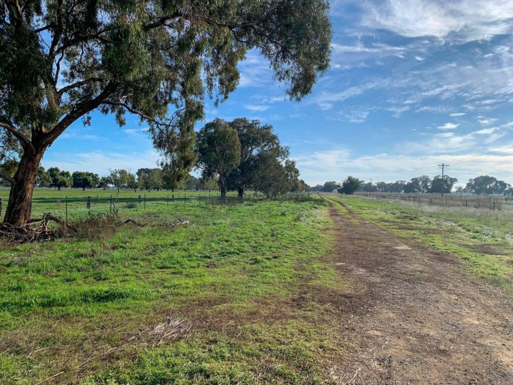
- The trail runs west, past a water fountain, decorated dead tree and exercise equipment, before heading north through open farmland, with rolling hills in the distance. Mt Major is on the right and Mt Saddleback on the left
- There’s an interpretive sign about the elaborate church you’ll see at the base of Mt Saddleback
- Volunteer groups have installed so many interpretive signs that it’s easier to walk
- There are also kilometre posts, historical markers and a shelter halfway to Yabba South
- Revegetation efforts are paying off, and there is a birdwatcher’s logbook to record sightings
- The trail runs alongside Dookie Rd before ending 500m short of Treacy Rd, marking the start of the connecting trail below
CONNECTING PATH
Dookie Loop (15km): The more adventurous among you who may be looking for an alternate way back from Yabba South can continue along Dookie Rd for 500m, turn right on Treacy Rd, left on Panter, right on McCormack, right on Gawne, left on Wrens Quarry and west on McDonald Rd to get back to the rail trail for the run back to town. Most of these roads are gravel or dirt, which is so rusty red you’ll be looking for corrosion warning signs. Follow our plot line (click on LARGER MAP) or photograph the map on the information board opposite the pub as there are limited directional signs and some may be pointing the wrong way …
![Heading west towards Dookie from Conway Rd, Cosgrove [2025]](jpg/v49-140-conway-rd-cosgrove-2025-02-heading-north-towards-dookie-from-the-current-end-of-the-trail-at-2025-img_5504-300x169.jpg)
Heading west towards Dookie from Conway Rd, Cosgrove [2025]
![This rest area appears soon after leaving Conway Rd [Peter McManus 2021]](jpg/v49-107-conway-rd-seat-2021-08-img_0063-300x216.jpg)
This rest area appears soon after leaving Conway Rd [Peter McManus 2021]
![Cycling towards Shepparton past the newer steel silos near Dookie [Peter McManus 2020]](jpg/v49-171-dookie-graincorp-terminal-2020-12-img_2908-300x238.jpg)
Cycling towards Shepparton past the newer steel silos near Dookie [Peter McManus 2020]
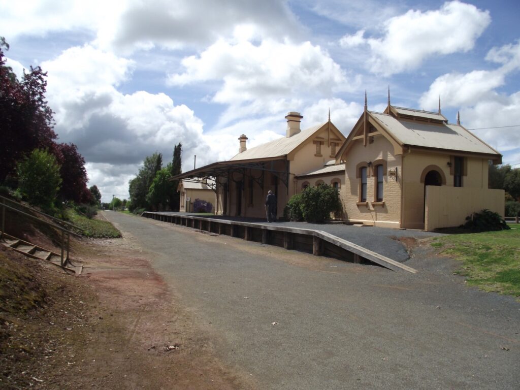
![Strolling through the former railway station area of Dookie [2017]](jpg/v49-150-dookie-2017-01-heading-out-of-dookie-past-the-parking-area-_6371-300x169.jpg)
Strolling through the former railway station area of Dookie [2017]
![Try the exercise equipment to warm up before you head north [2019]](jpg/v49-163-dookie-2019-03-24_151040-300x169.jpg)
Try the exercise equipment to warm up before you head north [2019]
![All ages enjoying the trail thanks to its compact size [Leiticia Harmer 2011]](jpg/v49-160-dookie-2010-04-9423-300x200.jpg)
All ages enjoying the trail thanks to its compact size [Leiticia Harmer 2011]
![Cycling at dusk between the wheat fields [Serena Hunt 2014]](jpg/v49-161-dookie-at-sunset-dookierail-300x169.jpg)
Cycling at dusk between the wheat fields [Serena Hunt 2014]
![Railway mile post (left) on the straight run to Yabba South [2019]](jpg/v49-163-dookie-signs-2019-03-6909-300x169.jpg)
Railway mile post (left) on the straight run to Yabba South [2019]
![Primary school students enjoy trail on an excursion [Lorraine Cairns 2010]](jpg/v49-158-dookie-2010-05-p1060341-300x225.jpg)
Primary school students enjoy trail on an excursion [Lorraine Cairns 2010]
![Numerous interpretive signs give information on the region [2019]](jpg/v49-163-dookie-signs-2019-03-6920-300x292.jpg)
Numerous interpretive signs give information on the region [2019]
![Shelter 2.5km from Dookie if you need a break [Peter McManus 2017]](jpg/v49-168-shelter-2017-01-_3375-300x225.jpg)
Shelter 2.5km from Dookie if you need a break [Peter McManus 2017]
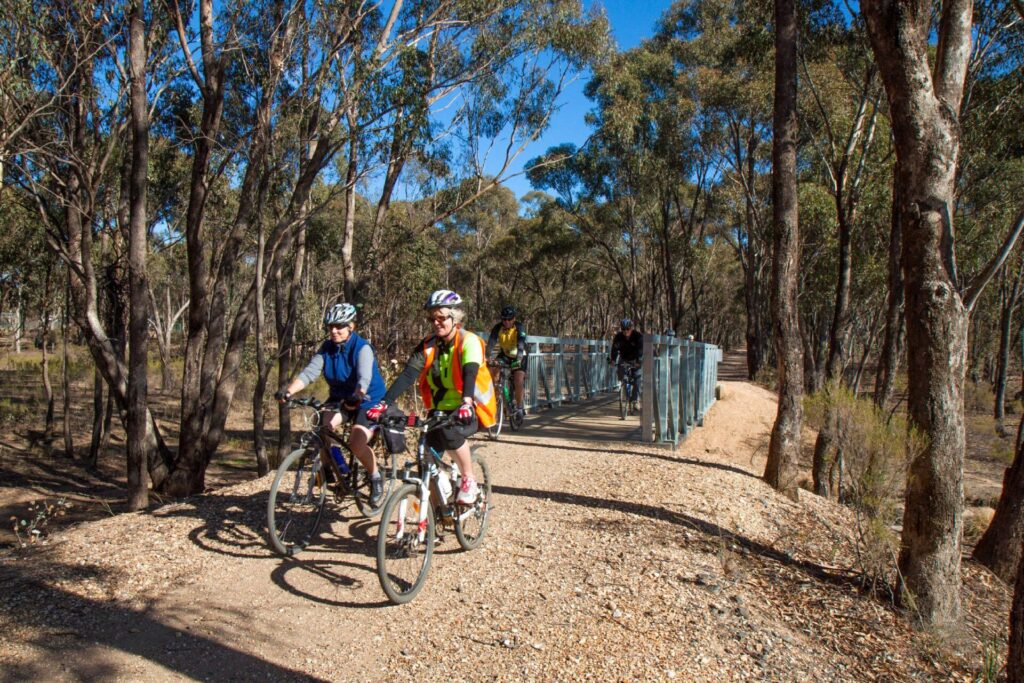
![Bridge near the northern end of the rail trail at Yabba [2025]](jpg/v49-200-bridge-near-end-20251021-300x169.jpg)
Bridge near the northern end of the rail trail at Yabba [2025]
Do you know of a bike hire or transportation service on this rail trail that should appear here? If so, let us know at admin@railtrails.org.au.
Information and Links
Contact Rail Trails Australia
To contact us about this rail trail, email vic@railtrails.org.au
Background Information
Traditional owners
We acknowledge the Yorta Yorta people, the traditional custodians of the land and waterways on which the rail trail is built.
Development and future of the rail trail
Dookie residents formed the Friends of Dookie Rail Trail group to encourage the City of Greater Shepparton to lease this section of the rail corridor, and the trail was completed in 2010. The remainder of the former branch line follows a quiet road north to Katamatite; there are no plans to build this section. Stage 2 of the trail, heading 7 km southwest to Cosgrove alongside the inactive railway line, was half completed in 2020 and discussions are underway to extend it toward Shepparton.
Rail line history
The branch line from Dookie north to Katamatite was built as a tramway by Yarrawonga Shire in 1890 and taken over by Victorian Railways in 1892. It closed in 1986 and the rails were removed shortly afterward. The line from Shepparton to Dookie is still offici
+ally open for grain trains but has not been used for many years.
Paul Baker returns to Northern Victoria and rides three trails in one day
Posted: 18/06/23
We recently featured Paul Baker riding the O’Keefe Rail Trail which was his 29th ...
More...Central Victorian Rail Trails feature in Paul Baker’s latest rides
Posted: 06/06/23
Paul Baker, an enthusiastic rider who is aiming to ride every rail trail in Victoria ...
More...Dookie Rail Trail Official Launch
Posted: 14/10/11
Peter McManus, DRT Coordinator, at the Lemnos/Cosgrove Rd ...
More...Dookie Trail is now open (VIC) (update)
Posted: 25/04/10
Dookie students out enjoying their new rail trail. Photo ...
More...Nearby Trails
Waranga (Rushworth) Rail Trail
Northern Victoria, 180km north of Melbourne
19 km


Stanhope to Girgarre Rail Trail
Campaspe region, 200km north of Melbourne
5 km


Murray to Mountains Rail Trail
250km north-east of Melbourne
137 km

Great Victorian Rail Trail
90km north of Melbourne
135 km
Lockington to Kotta Rail Trail
198 km north of Melbourne

O’Keefe Rail Trail
Goldfields region,150km north of Melbourne
49 km
Culcairn – Corowa Rail Trail
Murray region, 520km south-west of Sydney
2 km
Nearby Trails
Waranga (Rushworth) Rail Trail
Northern Victoria, 180km north of Melbourne
19 km
Stanhope to Girgarre Rail Trail
Campaspe region, 200km north of Melbourne
5 km
Murray to Mountains Rail Trail
250km north-east of Melbourne
137 km
Great Victorian Rail Trail
90km north of Melbourne
135 km
Lockington to Kotta Rail Trail
198 km north of Melbourne
O’Keefe Rail Trail
Goldfields region,150km north of Melbourne
49 km
Culcairn – Corowa Rail Trail
Murray region, 520km south-west of Sydney
2 km
11 reviews of “Dookie Rail Trail”
This is a lovely little trail, which has been sealed for most of the way. It is in good shape, and has some good interpretive signage. We rode out from Shepparton to do this rail trail, but it may be a bit too far for some. It would be fantastic to extend it all the way back to Shepparton, as I am sure it would get a lot more use then.
We rode out from Shepparton to ride this trail. Although short it is well maintained,and has lots of interpretive signs giving local information. Would be great to see it extended.
2/70 Wow, big difference in this one, despite the lack of support from Shepparton and V/Line. There are so many interpretive signs now, it's tempting to walk rather than ride. Distance posts, picnic shelter halfway heading north and a seat and bike loops near the southern end, so no more than 3km either way without a spot to rest. Lots of planting to provide shade and bird habitat. The Friends group has done a great job but council can't even finish the last 3km to Cosgrove! I did the eastern loop trail on the way back on quiet dirt and gravel roads for a 26km total.
This is another nice little trail in a small village. We checked out the north section, which runs between a shady avenue of trees most of the way. It would be good to see it continue further to make it a longer ride.
The short section towards Shepparton is a rail-side trail. The tracks are still in situ, as there is a chance of re-opening the line. Dookie is a nice little town with a very large antique store and coffee shop.
A lovely little trail. We parked in town and did the north section which has lots of signs and markers covering the settlement of the area as well as some art work in the paddock. In town there are a couple of painted small silos and a lovely green grass park to look around. Heading out to the west the gravel path travels beside the railway track which is complete and in good condition.
Thanks Dookie, you have really got into the spirit of rail trails and made it more interesting.
I rode this trail yesterday and it was for the most part in good condition. Much of it is paved and the rest is covered in good quality fine topping. This is quite unusual. There is good signage and a defined entry point.
I have ridden around 8 trails this week and this is by far the best.
It’s four years since we rode this rail trail and wow, it has improved! The trees have all grown and more have been planted. As well as all the interesting things referred to in our last comment (21/4/2015) this trail now has a pamphlet box at the start, a fitness centre (outdoor gym), bronze plaques at two historical sites (a whistle post & a mile marker) as well as the new, magnificent, historical, information signs. (The first of these signs is at the old station site, near the gardens, on the embankment.) Along the trail there is a receptacle, with a book and pen, to encourage riders to record their wildlife sightings. There’s more to see in the gardens at the start of the trail. There’s an old distance marker there and a working town clock (still chimes) and the four corner posts of its tower are made from railway tracks. The Friends of the rail trail, Dookie Lions’ Club, Dookie Men’s Shed and many others have worked together to make this trail, although only 5km, one of the best. This is definitely a five-star rail trail!
April, 2015 by Wenkle
The Dookie Rail Trail is only 5.5 kms. long – so far – but so picturesque and interesting! We have ridden it several times and the surrounding hills and country side change with the seasons – and often look like a patchwork quilt. This Trail is especially good for beginners and families, as it’s not too hard for young children and it’s not too far between things to look out for. The Trail starts in Dookie, at a lovely park with amenities, playground, bbqs and picnic facilities. The Trail is flanked with native trees, goes through a cutting and over 2 bidges, has distance posts (at 1 km. intervals) and many seats. It now also boasts a shelter, built in an old railways theme, as are the distance posts. There are plans to extend this Trail to Cosgrove and also for historical, flora & fauna signage. When the much anticipated Cosgrove section is constructed, no doubt the many Dookie Rail Trail enthusiasts will make riding in the opposite direction as interesting as this first section. We thoroughly recommend this Rail Trail to everyone to either ride or walk!
Rode the Dookie trail late Saturday 13th December 2014, best time to ride this trail as the setting sun adds great colour to the surrounding farmland – especially given everything is so yellow and dry because of summer. Very short trail – and just ends with no highlight. I would recommend taking one of the road options back, to get a good feel for the country side.
Passing through the area I decided to check out this short Rail Trail. A neat little trail with plenty of views of the surrounding hills and wheat fields. Possibly not the trail that you would travel especially to do, but worth the effort if you are in the Shepparton area and combine it with other rides and trails of the district. The trail finishes around Yabba South, and it would be good if it could continue to Katamatite. I think that people would then travel the trail just to find out what the names of Dookie, Katamatite, Youanmite and Yabba are all about. They all sound very interesting. History is required at Dookie to show users what the Railway was all about in the district. Please continue the work, it should pay off.
Gary
My hubby and I just did the Gorgeous Dookie Rail Trail,
The early morning air was fresh and smelled of the recently harvested wheat, a real treat for the senses.
The trail itself was both very relaxing and interesting it felt like we were just meandering through the past as we had freshly harvested fields on both sides, the ones disappearing over the hills looked particularly lovely and beckoned us to see where they ended.
At the end of the trail we followed a suggested circuit route and found ourselves experiencing a real sense of adventure, passing tucked in farm houses and friendly farmers. The down hill section at the end was great fun, though there was a few cars (very courteous)
Our morning ended back under the big old peppercorn tree at the start of the ride. We will come again when the Antique store and the hotel are open.. Al and Jules