 Location:
 Length:
 Surface:
 Start / End:
 Suitable for:
Potential 76km rail trail between Corowa on the Murray River in southern NSW, and Culcairn. This trail also has the potential to extend another 26km from Culcairn to Holbrook. This would mean a trail of 102km in total length.
This trail would link up with existing rail trails in northern Victoria at Wahgunyah, to create multi-destination cycling experiences.
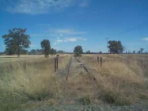
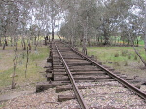
The trail would follow a long-disused railway line. Remnants of the line and bridges are still visible, and the historic town of Walla Walla has food and accommodation available.
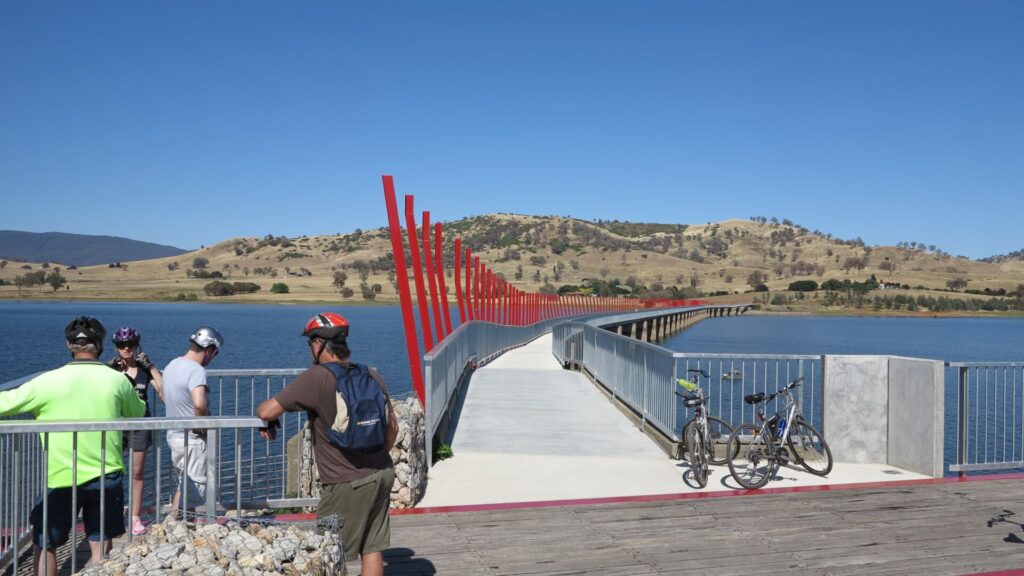
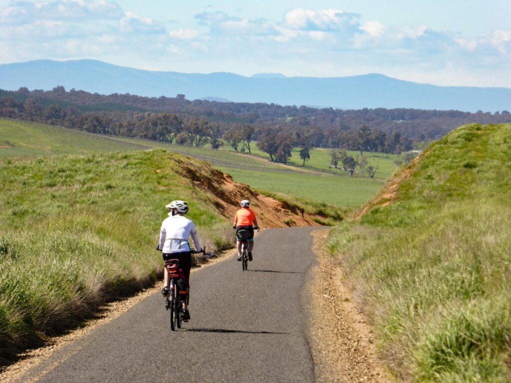
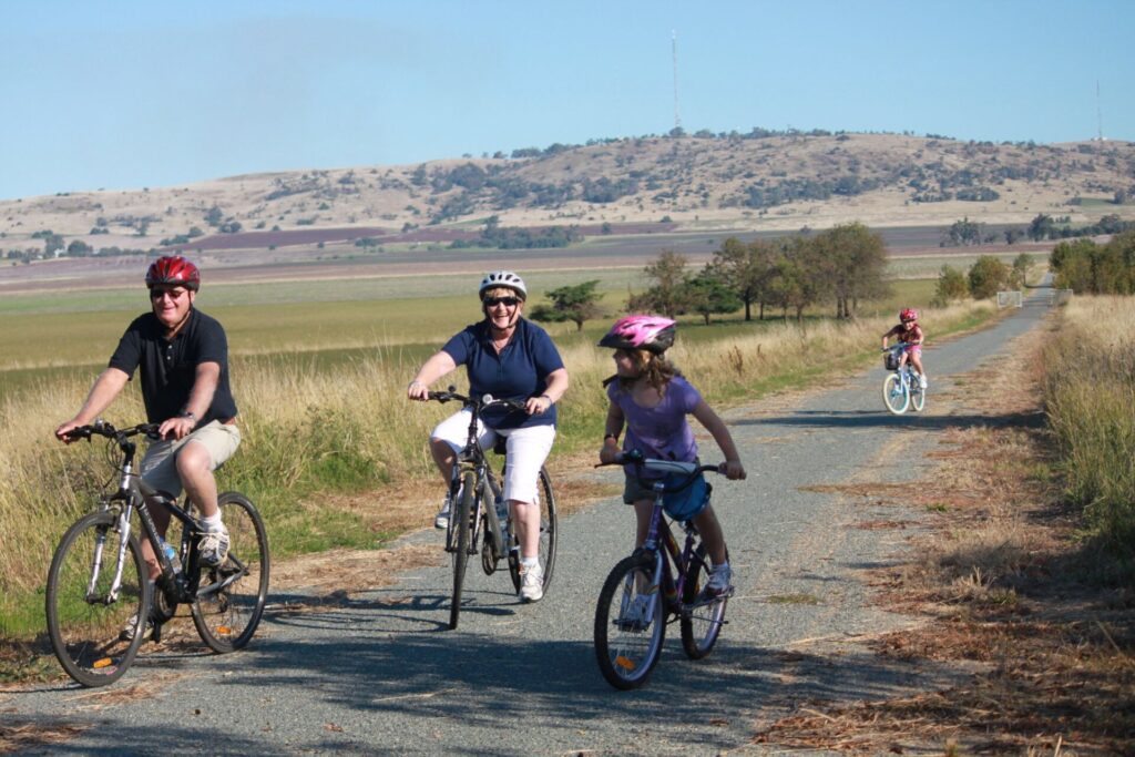
The local authority in Corowa (Federation Council) has paved 2km of the trail, from Corowa Station to Bullecourt Rd. This section is open for use.
Nearby Attractions
Only a short section of this trail is open. It is one of 17 potential rail trails in NSW.
- Picturesque rural town of Culcairn, on the main Sydney-Melbourne Line
- Historic towns of Walla Walla and Burrumbuttock
- Corowa is a major tourist centre on the Murray River
- Historic town of Holbrook on the Hume Highway
- The large submarine in the middle of Holbrook
- Murray to Mountains Rail Trail at Wahgunyah
- High Country Rail Trail at Wodonga
Last updated: 11 January 2026
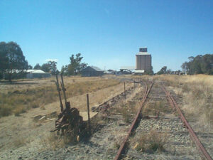
This 76km railway corridor branched off the main southern line at Culcairn before running south-west to Corowa through agricultural areas and light-timbered country. The final 2km from Bullecourt Rd to the Corowa Station site near the Murray River is paved and open for use.
The railway corridor north of Bullecourt Rd is owned and managed by Transport NSW and much of it passes through private property. Trespassing on the corridor is prohibited.
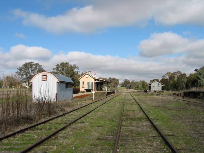
The towns of Walla Walla, Brocklesby, Burrumbuttock and Balldale were on the route.
There is another 26km railway corridor branching from Culcairn towards Holbrook. This would mean a potential rail trail of just over 102km.
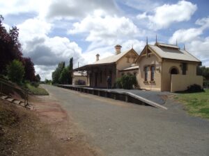
Corowa Railway Station (2014)
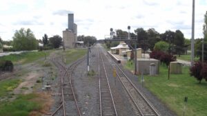
Culcairn looking north (2014)
Culcairn Station - main southern line
Culcairn (2014)
Approaching Walla Walla
Along the way...
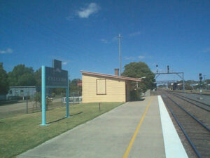
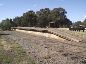
![Burrumbuttock Station [2014]](jpg/3461605549242-300x225.jpg)
Burrumbuttock Station [2014]
Balldale Railway (2014)
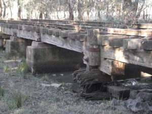
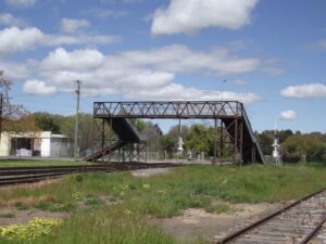
Brocklesby Trestle (2014)
Timber trestle bridge 2014
Do you know of a bike hire or transportation service on this rail trail that should appear here? If so, let us know at admin@railtrails.org.au.
Information and Links
Information about the branch line:
https://en.wikipedia.org/wiki/Corowa_railway_line
The rail trail has been proposed by local groups but remains in the early stages of development.
Contact Rail Trails Australia
To contact us about this rail trail, email nsw@railtrails.org.au
Background Information
Traditional Owners
We acknowledge the Wiradjuri people, the traditional custodians of the land and waterways on which the rail trail will be built.
Railway History
The line was opened on 3 October,1892, and its main purpose was the transport of wheat. Passenger services ceased in 1975, a time when a widespread closure of country line passenger services occurred. The section from Corowa to Brocklesby was decommissioned in January, 1989; a year after the last train ran on that section. The railway from Brocklesby to Culcairn was decommissioned in December, 1991.
New Committee Formed for NSW Rail Trail
Posted: 13/06/25
The station master’s house in Culcairn has been ...
More...Nearby Trails
High Country Rail Trail
300km north-east of Melbourne
81 km


Murray to Mountains Rail Trail
250km north-east of Melbourne
137 km
Wagga Wagga to Ladysmith (Riverina Highlands) Rail Trail
460 km south-west of Sydney

Riverina Highlands (Tumbarumba) Rail Trail
Riverina Highlands, 470km south of Sydney
21 km
Dookie Rail Trail
Greater Shepparton, 220km north-east of Melbourne
8 km
Nearby Trails
High Country Rail Trail
300km north-east of Melbourne
81 km
Murray to Mountains Rail Trail
250km north-east of Melbourne
137 km
Wagga Wagga to Ladysmith (Riverina Highlands) Rail Trail
460 km south-west of Sydney
Riverina Highlands (Tumbarumba) Rail Trail
Riverina Highlands, 470km south of Sydney
21 km
Dookie Rail Trail
Greater Shepparton, 220km north-east of Melbourne
8 km
6 reviews of “Culcairn – Corowa Rail Trail”
Hello,
I rode the Culcairn – Corowa Rail Trail (the 2km Corowa Section) yesterday (18/07/25).
I followed the advice of “Ewen H” post’s on the 23/12/23, and combined it with the Wahgunyah to Rutherglen Rail Trail and Murry River Loop. Thank you very much for your post and advice.
I started/finished at the Heritage Motor Inn – Corowa (thanks Geoff for accommodating me), rode to Rutherglen with a town loop and then back to Wahgunyah and onto the Murray River Section and then anti clockwise back to Corowa Station for a total of 29.7km ride.
Great Trails and the surfaces were all pretty good.
Cheers,
Marty
35/70 Halfway to my target of 70 rail trails in my 70th year. This one's just a sad reminder of how little has been done in NSW and how much can be done with little money. I was wondering how to link it with the rail trail to Wahgunyah but Ewen Hill (below) has already done that for me.
At just 2 km, this is more for access into town rather than requiring a visit… unless you combine it with the one across the border.
This trail shows what can be done to provide central park facilities with the history of the railway. Most of the rails are still there and the park has been leveled to the top of the rails whilst the turntable area remains in situ.
For a decent ride, start at Bullecourt Rd (the north-eastern end of the rail trail) and cycle through the park and down to the single-lane bridge that crosses the Murray. Take the first left turn into a cul-de-sac to get onto a shared path to the start of the 9 km trail from Wahgunyah to Rutherglen and back. Come back over the ford just after the end of the rail trail at Wahgunyah and ride up the Murray River on the Victorian side until you reach Federation Way, then it's back to where you started and about 27 km all up. Enjoy
Visited and only walked a section in Corowa,I will say however there is a great shared path between Corowa and Mulwala
I have just been working in the Culcairn area for several days. I think the Culcairn to Holbrook section would be an excellent starting point of development for this trail. Just 27km makes it short enough for those of lower fitness, and long enough for regular riders to make the trip to visit. The valley that the rail line snakes through is thoroughly beautiful.
This would be a great railway to turn into a rail trail – I for one would ride it regularly if it was converted to a rail trail. If the Culcairn – Holbrook line was also converted to a rail trail then 3 major highways would be linked by it: Hume Hwy, Olympic Hwy and Riverina Hwy, as well as the rail service to through Culcairn.