 Location:
 Length:
 Surface:
 Start / End:
 Suitable for:
You can't say you've experienced every type of rail trail in Victoria until you've been on the 5km Girgarre – Stanhope one.

- To experience Victoria’s rich dairy country
- A visit to Girgarre is a chance to see a small town with a big heart
- To see the Girgarre Farmers Produce and Craft Market
Nearby Attractions
- The Gargarro Botanic Garden, a unique display of indigenous plants from the Campaspe area, with nice café
- Montevideo Maru tragedy mural in Stanhope
- With up to 120 stalls, the Girgarre Farmers Produce and Craft Market provides visitors and locals with the chance to sample the finest produce from the Goulburn Valley region on the second Sunday of the month
- Girgarre’s famous fresh orange juice, pressed at the market, is a must-try!
- Girgarre’s famous annual Moosic Muster music festival
- Campaspe Artists Studio Trail
- Waranga Basin
- Waranga (Rushworth) Rail Trail
Last updated: 19 January 2026
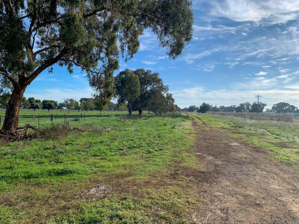
The trail is light, sandy gravel and is a bit narrow in places. It is straight and flat as it traverses prime dairy country.
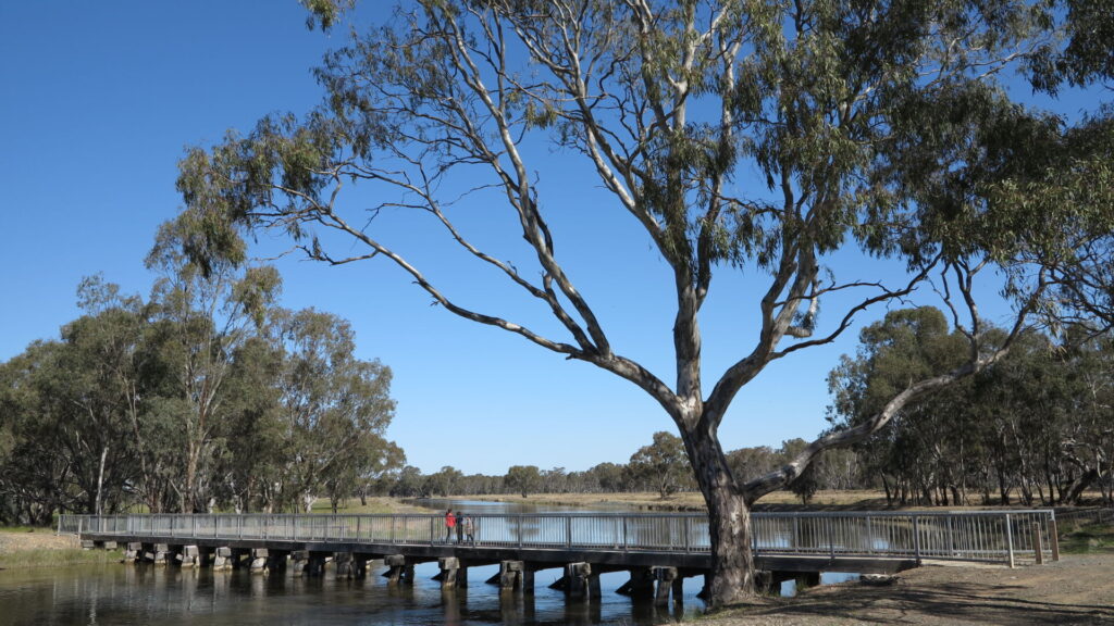
It starts at the northern end of Stanhope at Stanhope Park, where there are toilets, and ends at the station site in the centre of Girgarre
Stanhope is a small regional town with basic services while Girgarre is smaller, with limited facilities for visitors.
Section Guides
Stanhope to Girgarre (5km)
- Access: The trailhead is on Blamey St, off Brudenell St (C348), on the northern outskirts of Stanhope. There is some off-street parking.
- There’s an architect-designed facilities block in Station Park, that is hard to miss, with an area for caravan parking and one of those famous fibreglass cows, on Brudenell St. The shops are almost directly opposite on Birdwood Ave.
- A grain elevator remains out the back but this area of the railway corridor is in private hands
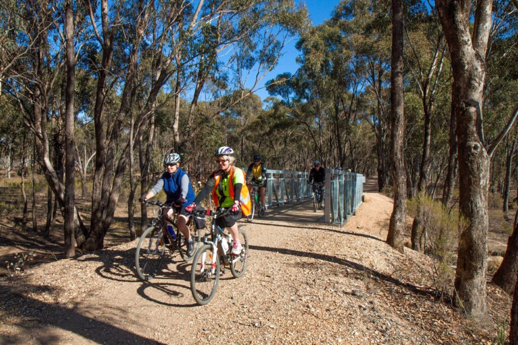
- Heading north you come to the first narrow bridge over an irrigation channel and you’ve then got a straight run
- Planting by the local Landcare group is starting to provide some shade
- Approaching Girgarre, there are a couple of diversions to a gravel road to get over irrigation channels where the rail bridges were removed.
- Anthills have also been carefully placed to slow you down
- At Winter Rd, turn left for a well-earned coffee at the Gargarro Botanic Garden, where some of that irrigation water is going
- Continue straight ahead into Progress Park, the site of the old station where you can play tubular bells as you walk around
- A cheese factory is humming away on the other side of the road.
![Early light in Station Park, Stanhope, near the trailhead [2025]](jpg/v48-250-early-light-in-stanhopes-station-park-2025-img_6013-300x169.jpg)
Early light in Station Park, Stanhope, near the trailhead [2025]
![Stanhope Montevideo Maru tragedy mural [2025]](jpg/v48-250-stanhope-montevideo-maru-tragedy-mural-2025-10-24-300x169.jpg)
Stanhope Montevideo Maru tragedy mural [2025]
![Good trail surface riding out of Stanhope [2025]](jpg/v48-255-stanhop-to-girgarre-2025-10-24_good-surface-out-of-stanhope-300x169.jpg)
Good trail surface riding out of Stanhope [2025]
![The Landcare plantings are really starting to take over [2025]](jpg/v48-270-the-landcare-plantings-are-starting-to-take-over-2025-img_6014-300x145.jpg)
The Landcare plantings are really starting to take over [2025]
![One of the small bridges on the rail trail over irrigation channels [2022]](jpg/v48-257-stanhope-to-girgarre-bridge-between-mason-and-morrissey-road-2022-06-300x225.jpg)
One of the small bridges on the rail trail over irrigation channels [2022]
![Riding between Stanhope and Girgarre ducking the regrowth [2021]](jpg/v48-256-stanhope-to-girgarre-2021-11-img-8651-300x225.jpg)
Riding between Stanhope and Girgarre ducking the regrowth [2021]
![The trail ends with a loop path in Progress Park [Sandra McDonald 2017]](jpg/v48-304-girgarre-2017-11-rail-trail-4-300x169.jpg)
The trail ends with a loop path in Progress Park [Sandra McDonald 2017]
![The beginnings of the native botanic garden at Girgarre [2023]](jpg/v48-300-girgarre-gargarro-botanic-gardens-2023-06-300x225.jpg)
The beginnings of the native botanic garden at Girgarre [2023]
![The recreated station site near the Girgarre trailhead [2025]](jpg/v48-300-girgarre-2025-10-24_girgarre-station-2012-site-300x225.jpg)
The recreated station site near the Girgarre trailhead [2025]
![Gargarro Cafe, not the sort you expect to find in a small regional town [2025]](jpg/v48-300-girgarre-gargarro-cafe-2025-10-24-300x225.jpg)
Gargarro Cafe, not the sort you expect to find in a small regional town [2025]
Dysons operates buses on this route for V/Line from East Murchison Railway Station. Bicycle carrying restrictions apply
Do you know of a bike hire or transportation service on this rail trail that should appear here? If so, let us know at admin@railtrails.org.au.
Information and Links
The trail is a community-driven one, in partnership with Landcare. For issues with the shared path, contact the Girgarre Development Group, which represents all the different community organisations in the district, here
Greater Shepparton City Council and Shire of Campaspe. Refer to their websites below to report issues.
Contact Rail Trails Australia
To contact us about this rail trail, email vic@railtrails.org.au
Background Information
Traditional owners
We acknowledge the Ngurrai-illam-Wurrung people, the traditional custodians of the land and waterways on which the rail trail is built.
Development and future of the rail trail
The local rail trail committee constructed a 2 km section in 2015 and completed it to Stanhope in 2022. Their long-term plan is to extend the shared path all the way to Rushworth, where it will join the Waranga Rail Trail
Rail line history
The branch line from Rushworth to Girgarre opened in 1917 and closed beyond Stanhope in 1975. The rest shut in 1987.
Girgarre Stanhope Rail Trail Tree Planting Day
Posted: 13/08/23
Girgarre Stanhope Land Protection group had a perfect day for a tree planting working bee ...
More...Paul Baker returns to Northern Victoria and rides three trails in one day
Posted: 18/06/23
We recently featured Paul Baker riding the O’Keefe Rail Trail which was his 29th ...
More...Central Victorian Rail Trails feature in Paul Baker’s latest rides
Posted: 06/06/23
Paul Baker, an enthusiastic rider who is aiming to ride every rail trail in Victoria ...
More...Girgarre to Stanhope Rail Trail nearing completion
Posted: 30/01/22
One of the bridges under construction, showing the trail ...
More...Nearby Trails
Waranga (Rushworth) Rail Trail
Northern Victoria, 180km north of Melbourne
19 km


Lockington to Kotta Rail Trail
198 km north of Melbourne

O’Keefe Rail Trail
Goldfields region,150km north of Melbourne
49 km
Dookie Rail Trail
Greater Shepparton, 220km north-east of Melbourne
8 km


Great Victorian Rail Trail
90km north of Melbourne
135 km
Castlemaine to Maldon Trail
120 km north west of Melbourne
18 km
Castlemaine-Maryborough Rail Trail
Central Victoria, 124 km from Melbourne
Woodend to Daylesford (incl Domino) Rail Trail
Goldfields, 85km north-west of Melbourne
6 km
Nearby Trails
Waranga (Rushworth) Rail Trail
Northern Victoria, 180km north of Melbourne
19 km
Lockington to Kotta Rail Trail
198 km north of Melbourne
O’Keefe Rail Trail
Goldfields region,150km north of Melbourne
49 km
Dookie Rail Trail
Greater Shepparton, 220km north-east of Melbourne
8 km
Great Victorian Rail Trail
90km north of Melbourne
135 km
Castlemaine to Maldon Trail
120 km north west of Melbourne
18 km
Castlemaine-Maryborough Rail Trail
Central Victoria, 124 km from Melbourne
Woodend to Daylesford (incl Domino) Rail Trail
Goldfields, 85km north-west of Melbourne
6 km
6 reviews of “Stanhope to Girgarre Rail Trail”
Another short rail trail that does not seem to be very well used. We rode on the highway up from Rushworth to do this trail. It is only short at 5km, but links the two nice little villages of Stanhope and Girgarre. The 1st half of the trail out of Stanhope is very good, with lots of tree plantings and smooth surface. The 2nd half needs a bit of TLC, with a rougher surface and overgrown bushes. Missing bridges over three irrigation canals means slight diversions. Both towns are very interesting and Girgarre has a great coffee shop at the beautiful botanical Gardens.
RT32 Rode this one yesterday as a warm-up to the Waranga Rail Trail opening. The Landcare planting is almost blocking the trail in places and needs to be cut back
What a surprise it is to arrive into the Girgarre station area with the assortment of artworks, station and trolley shed and congratulations to all who dreamt this area up. This 5.8 flat rail trail goes between trees and grass lands with an odd grassland ride for the first 200 meters in Stanhope and could ideally be extended 20km further to Rushworth however it would be a great ride for kids in the current format. I'm giving it 4 for just the effort involved at Girgarre alone.
A short but interesting little track. In the park at Grigarre there are musical 'instruments' made out of farming items and a mini train platform. It is worth a ride around the park just for that. At the Town Hall there is camping with toilets and showers, just leave a donation.
The distance makers on the trail are identified by the number of spikes on a rail plate. There are some tight turns off and onto the trail as it detours to the gravel road to go over the canals.
The track ends suddenly at the edge of Stanhope then sort of picks up a bit in the grass reserve into town where the final marker is.
Rode the northern part of this trail from Girgarre to the site of a new bridge under construction south of Mason Road. This is one of tow bridges that are being built to finalise the the southern part of this rail trail. This is a pleasant rail trail with treed shady sections and open farmland sections. Care is needed when turning bends on loose gravel to detour the straight route in order to cross irrigation channels.
when the southern section is completed the rail trail will provide a safe and enjoyable route for bike riders, walkers, joggers, horse riders etc to travel between Girgarre and Stanhope.
I rode this track yesterday along with the Rushworth track. This track is in good condition although there is some very loose gravel on the sharp corners where the track crosses a couple of canals. If this track can be completed down to Stanhope it will be an excellent ride. At present it is too short cycling but a nice walk.