 Location:
 Length:
 Surface:
 Start / End:
 Suitable for:
The Coonawarra Rail Trail passes through a 15 km by 2 km strip of terra rossa soil that produces some of the world’s finest cabernet sauvignon. Bring a backpack.

- Penola has a rich variety of early colonial buildings, including the Mary MacKillop Penola Centre
- Many wineries are located within 20 km of the Coonawarra township along the rail trail, some dating from 1890
Nearby Attractions
- The 200 km Aussie Camino walking trail that connects Penola to Portland (Vic) in recognition of Saint Mary MacKillop and Father Julian Tenison Woods
- Naracoorte Caves (SA’s only UNESCO World Heritage site)
- The Ramsar wetland sites of Bool and Hack Lagoons
- Sheep’s Back Museum, Naracoorte
- Mt Gambier Rail Trail
Last updated: 11 May 2025
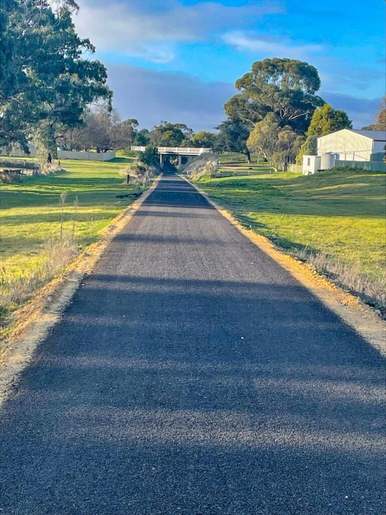
This chip-sealed trail begins in Penola and follows the Wolseley to Mt Gambier railway corridor to Glenroy, near Father Woods Park. This is home to seven sculptures depicting the lives of Father Julian Tenison Woods and Saint Mary of the Cross MacKillop.
Limited bike and e-bike hire is available in the area. There are good accommodation and dining options in the Coonawarra region.
Section Guides
Penola to Coonawarra Siding (10.5 km)
- The trail starts near the Riddoch St railway crossing in the southwest corner of Penola. There is a vehicle turning area and on-street parking
- It can also be accessed at the Robe Rd and Jessie St rail crossings.
- The station building is now a well-maintained private residence on the right.
- After passing through the old railyards and station precinct, the trail crosses Riddoch Hwy on the northern edge of town.
- The section from Penola to Coonawarra is dead straight, passing through a mix of vineyards and grazing properties.
- There are no steep or dangerous sections, but take care at road crossings.
Coonawarra Siding to Glenroy (8.5 km)
- Heading north from Coonawarra Siding, where there is ample parking, the trail is again almost dead straight through to its present end at Glenroy-Bool Lagoon Rd, passing vineyards and grazing country.
CONNECTING PATHS
Coonawarra Siding to Coonawarra (1.3 km): At Coonawarra Siding, turn right onto Memorial Drive to the small village of Coonawarra. This is an easy ride on a sealed roadside path. There are several food options, including the Coonawarra Store, as well as a number of wineries close by. There is a shady park with toilets and a playground near the end of the path.
Glenroy to Father Woods Park (7 km): At the trail’s end, turn right on sealed Glenroy-Bool Lagoon Rd and follow it for 3.3 km to Riddoch Hwy. Turn left onto the highway and proceed 4 km north to Father Woods Park. Exercise great caution on the highway due to traffic volumes and speeds. Not recommended for children or inexperienced riders.
![Historic cottages hidden away in Petticoat Lane, Penola [2022]](jpg/s16-355-historic-cottages-in-petticoat-lane-penola-2022-10-300x225.jpg)
Historic cottages hidden away in Petticoat Lane, Penola [2022]
![Impressive reminders of Mary MacKillops legacy in Penola [2022]](jpg/s16-350-impressive-reminders-of-mary-mackillops-legacy-in-penola-2022-img_1400-300x225.jpg)
Impressive reminders of Mary MacKillops legacy in Penola [2022]
![The ornate railway station is now a private residence [2022]](jpg/s16-350-lavish-art-deco-railway-station-in-clarke-st-penola-is-now-privately-owned-2022-2img_1404-300x225.jpg)
The ornate railway station is now a private residence [2022]
![Riding through the Penola railyard area [2022]](jpg/s16-355-penola-2022-10-300x189.jpg)
Riding through the Penola railyard area [2022]
![Road crossing in Penola still has the railway crossing lights [2022]](jpg/s16-355-001b-trail-near-end-riddoch-st-penola-nov-22-300x169.jpg)
Road crossing in Penola still has the railway crossing lights [2022]
![The rail trail takes a detour around the former Coonawarra Siding [2022]](jpg/s16-305-11-coonawarra-siding-trail-diversion-sep-22-300x225.jpg)
The rail trail takes a detour around the former Coonawarra Siding [2022]
![Coonawarra Siding just had a passenger shelter and telephone box [2022]](jpg/s16-305-13-coonawarra-siding-sep-22-300x225.jpg)
Coonawarra Siding just had a passenger shelter and telephone box [2022]
![Typical scenery in autumn with the surrounding vines changing colour [2024]](jpg/s16-305-coonawarra-to-penola-2024-04-vineyards-3294-300x169.jpg)
Typical scenery in autumn with the surrounding vines changing colour [2024]
![Typical scenery heading towards Glenroy and Father Woods Park [2022]](jpg/s16-255-08-south-from-mcbain-rd-sep-22-300x225.jpg)
Typical scenery heading towards Glenroy and Father Woods Park [2022]
![Rails visible through the asphalt are not fun to ride on in the wet [2022]](jpg/s16-305-rails-visible-through-the-asphalt-are-fun-to-ride-on-in-the-dry-near-penola.-sleepers-underneath-are-steel-2022-img_1410_crop-300x170.jpg)
Rails visible through the asphalt are not fun to ride on in the wet [2022]
E-bike Hire information Coonawarra Discovery
Bike Hire information Must at Coonawarra
Do you know of a bike hire or transportation service on this rail trail that should appear here? If so, let us know at admin@railtrails.org.au.
Information and Links
The rail trail is managed by the Wattle Range Council
Coonawarra Tourist Information click HERE
Penola Tourist Information click HERE
Penola and Coonawarra Brochure and Map click HERE
Coonawarra Wineries Walking Trail brochure click HERE
Coonawarra Store click HERE
Camino Walking Trail The Aussie Camino
Bus from Adelaide Stateliner
Contact Rail Trails Australia
To contact us about this rail trail, email sa@railtrails.org.au
Background Information
Traditional owners
We acknowledge the Pinejunga people, the traditional custodians of the land and waterways on which the rail trail is built.
Development and future of the rail trail
The Coonawarra Rail Trail was constructed in 2021 and 2022, opening in November of the latter year. It is 50 km from the Mt Gambier Rail Trail, which runs in the same railway corridor.
It is intended to eventually connect it with a proposed Naracoorte Caves trail, creating a 50 km shared path between Penola and Naracoorte and providing a mix of wine tourism and bush trekking along back roads, around wetlands and through conservation parks.
Rail line history
The Mount Gambier Line was originally part of South Australian Railways (SAR) narrow-gauge network, but was later converted to broad gauge. Opened in stages from 1881, it reached Coonawarra and Mount Gambier in 1887, completing the connection from Wolseley on the Adelaide-Melbourne Line.
Passenger services to Adelaide ended in December 1990, and the line officially closed in April, 1995. Some of it was used by the Limestone Coast Railway tourist service, but that closed in June, 2006.
Coonawarra Rail Trail in South Australia now Open
Posted: 05/11/22
November Update The rail trail opened with a well attended family event at Coonawarra on ...
More...The Coonawarra Rail Trail is taking shape
Posted: 25/02/22
The Wattle Range Council is making good progress with the construction of the Coonawarra Rail ...
More...Full steam ahead for the Coonawarra Rail Trail
Posted: 26/01/22
Construction on the 20km rail trail through the Coonawarra Wine Region in South Australia commenced ...
More...Nearby Trails
Mount Gambier Rail Trail
Limestone Coast, 435km south-east of Adelaide
10.5 km


Branxholme to Casterton Rail Trail
Southwest Victoria, 360 km from Melbourne

Dartmoor Rail Trail
Western Victoria, 365 km from Melbourne
1.3 km
Hamilton-Coleraine Rail Trail
286 km west of Melbourne
28 km
Nearby Trails
Mount Gambier Rail Trail
Limestone Coast, 435km south-east of Adelaide
10.5 km
Branxholme to Casterton Rail Trail
Southwest Victoria, 360 km from Melbourne
Dartmoor Rail Trail
Western Victoria, 365 km from Melbourne
1.3 km
Hamilton-Coleraine Rail Trail
286 km west of Melbourne
28 km
11 reviews of “Coonawarra Rail Trail”
16 degrees 16knot NE wind. Maybe one day this trail will take you to Naracoorte which would be great. Flat easy ride.
Great can detour off onto quiet road to access wineries. Most roads very quiet and speaking with locals very respectful of riders on the road.
We seen a fox, bird of prey, sheep, blue tongue lizard and magpies who are protecting their babies, mild swooping no contact.
Vines dormant if that’s the correct terminology. Be extra beautiful when in leaf and and vibrant oranges.
Thanks Holiick great dessert wine.
I rode this trail in March 2025 on a electrified mountain bike and my wife on her electrified recumbent trike. It has a new black fine gravel surface (consistent but not ultra smooth) and is flat and straight. Great views of vineyards either side as you pass many cellar door areas (mostly off the trail a bit). Seats and reset stops were rather lacking. A pleasant if unspectacular ride in a low key area.
10/70 Coming up for 2.5 years old, the Coonawarra Rail Trail chip seal surface is holding up well. Compared with its southern neighbour at Mt Gambier, it’s all a bit unloved. No interpretive signs and it’s starting to need a road sweeper. The Patrick of Coonawarra winery has made trail users feel welcome so don’t forget your panniers or backpack for the odd bottle. The rest are banking on road traffic
Yes, it is dead straight. It was quite cool today and very windy when we rode from Penola. Made the ride back a little slower.
Small town of Penola is great with services at the southern end, but there is nothing at the northern end.
Passed through many vineyards but no signage or off ramps. Good surface and very straight.
The 19km long Coonawarra Rail Trail travels north of Penola, mostly in a very straight line, while passing vine yards. For most of the time the paved surface still has the rails visible, along with most other rail infrastructure, which adds to its charm.
However there is no signage or information boards along the trail. While the trail just randomly ends, among vine yards, with the abandoned rail line continuing north.
It feels like it's just a bike path which could be anywhere, rather than a rail trail which I presume has some history to this area.
Also in Spring, there are a few magpies to watch out for.
Hopefully one day it can be extended so it actually goes somewhere.
Very flat & absolutely straight! Great bitumen surface. A pleasant ride past the vineyards but a bit boring after a while. Well away from the highway so very quiet.
No cellar doors along the trail. – you need to get across to the main road to find these.
Can be pretty windy & trail is quite exposed.
Really wonderful scenery, riding through vineyards and paddocks, and very interesting to see people at work tending the vines. The trail is well sealed albeit a bit bumpy at the Penola end once you have crossed the Riddoch highway. We took the side trail off to Coonawarra and enjoyed some great food and wine. Just check the wind before you go we had a great tail wind on the way out but oh goodness it was a shocker on the way back!!
Lovely ride with the wife and Dog. The section between Coonawarra and the end is fantastic and smooth. The section between Penola and Coonawarra is a little bumpy and the rails are sticking through the surface, I think the surface has sunk a little and the rails are exposed and the sleepers cause a bumpy ride at times
Perfect trail through vineyards and farmland. Easily accessible. Hopefully the trail will be extended towards Naracoorte or Mount Gambier in the future.
We rode on October 22 long weekend. What at great trail (even with a few magpies :). A massive shout out to those involved in its construction – well sealed, fenced and signposted. 10m of climbing end to end and yes, dead straight.
Will be back next time to include some of the amazing wineries there!
Best wineries in Australia right next to a cycle path. What could possibly go wrong? Cant wait!